Wednesday, February 29, 2012
WESTERN HEMISPHERE INDIGENOUS PEOPLES PLEISTOCENE DATA BASE 200,000 - 11,050 YBP
Link via Norman Muller: click here
Unsorted pics from the last few weekends
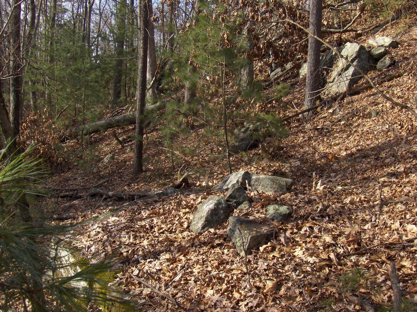
Gates Pond Boulder
 Another view near Gibbs Mtn Marlborough
 Some trail markers from Westborough Community Trust trail markers:
 and an interesting structure from those same woods:
 I think this was three small upright slabs, forming a 3-sided box. But the one on the lower right fell over. Behind this little box was a rock with quartz:


Robert Geake Tips His Hat to Rockpiles

Cairn in Parker woodland, Coventry. Photo by author, Robert Geake
"In some areas such as Coventry, these sites have long been protected under the Audubon auspices, and while I am not aware of any official study of the cairns in this location, evidence shows that the area was long used by the Narragansett and Nipmuc people up to the period preceding the Revolutionary War. Cairns of differing age and condition lie throughout the region, the most famous and most photographed being one section of neatly constructed rock piles that are likely the most recent in the area, perhaps dating from that period of the 18th century.
I would suggest that those of you with an interest in Native American places of memory, of ceremony, look into a blog called “rockpiles”, a site founded by Peter Waksman, and with contributors Tim McSweeney, photographer Larry Harrop, who has chronicled a considerable number of these places, and taken and taken some fine pictures of the sites in Coventry, as well as photographer Norman Muller and researcher Jim Porter. This site is very informative and covers an extensive area of New England and beyond where some of these ceremonial and sacred sites can be found..."
http://rifootprints.com/2012/02/29/rediscovering-native-american-places-of-memory/
Monday, February 27, 2012
Small Stark Point
This "point" is from Concord, MA and made of beige quartzite:
 Unfortunately I never dreamed that the small flake I was picking up would turn out to be an arrowhead so I missed getting a picture of it in situ. But this is the kind of environment I found it in:

 Unfortunately I never dreamed that the small flake I was picking up would turn out to be an arrowhead so I missed getting a picture of it in situ. But this is the kind of environment I found it in:
Saturday, February 25, 2012
Ozark Rock Piles
A reader writes to Tim MacSweeney:
Back here in the Missouri Ozarks, I have uncovered a bunch (27 to date) of similar structures which I have begun to describe in a blog, http://bmf-news.blogspot.com/
[Permanent link added to the right.]
Back here in the Missouri Ozarks, I have uncovered a bunch (27 to date) of similar structures which I have begun to describe in a blog, http://bmf-news.blogspot.com/
[Permanent link added to the right.]
Thursday, February 23, 2012
Following intuition - seeking out standard topographic settings when exploring (part 3)
(Referring to parts 1 and 2 here and here)
 I was out in the chill, exploring on the downwind side of Gates Pond in Berlin, MA. Starting next to the eastern edge of the lake about where the letter "s" is in "Gates", I planned to cut diagonally up across the end of one of the smaller hills, explore the ravine between it and the next, larger, hill, then diagonal up and across that hill, do the same kind of exploring in the ravine beyond it.
Heading off uphill, you know there is probably good stuff around:
 Off I went over hill, dell, hill, and next dell, finding myself on the northern side of the ravine there (see blue outline), looking southwest and I am proud of myself: I stopped from a high vantage point and looked out into the valley (which I am calling a "ravine") and spent several minutes looking around carefully and trying to decide in what direction I should go. A big stone wall comes down the other side of the valley and there is a short stretch of wall in the level bottom. And I look back and forth and decide I should head southwest along the slope - trying not to lose elevation. Within less than ten steps I spot rock piles. So I picked the right direction. Part of the choice was knowing that sometimes there are sites along the lower edge of the highest outcrops - well above the floor of the valley. Here are some:
 And here are some views of short stretches of wall at the bottom of the valley, seen from these rock piles. One piece of wall cuts across the valley floor:
 Another piece of wall goes along the middle of the valley and degenerates into tumbled larger rocks (to the right=southwest)
 Going a few feet further along the slope (I am heading southwest on the northern side of the valley), some more rock piles:
 Another view of the piece of wall in the middle of the valley, it is joined by a degenerate piece of wall made of larger rocks and leading down from this spot
 Here the walls up on the side of the valley become more substantial. I think these are Indian walls and that this is an entrance to the site:
 [I am spending more and more time thinking seriously about the idea of pathways designed to flow through the rock pile site. It is an idea that seems to be sticking around.]
Continuing a few feet further along the slope: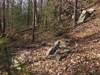 Note the small pile built into the outcrop to the upper right. [You could start the argument against field clearing rock pile sites with this example. The rocks are broken ledge rock from the adjacent outcrop. No fields anywhere nearby.] Another view, over the rock pile and down:
 Note the split in the upper rock.
Another few feet along and the site comes to an end, as the outcrop it was following comes to an end. The stone wall (which I think I remember as having come diagonally up the slope) ends here, with a gateway to a small level spot.
 Note the smidgen of rock pile to the right. I was thinking these walls might serve to funnel deer over to this spot but, no, I don't think this is a kill site. Look at the outcrop in the background; how someone levered two large slabs of rock outward, so they hang over the space.
This last of three examples of rock pile sites, shows the value of exploring along outcrop edges in this kind of valley/ravine setting. Perhaps this is the same kind of site encountered on the hill shoulder north of Gibbs Mountain (part 1), but with the heavy presence of stone walls, it has a different feel. I can guess about astronomy and water as reasons for those first two site examples but I have no opinion about this third site. A little bit unique to this part of the county, sites along high outcrops occur in Berlin and Upton.
 I was out in the chill, exploring on the downwind side of Gates Pond in Berlin, MA. Starting next to the eastern edge of the lake about where the letter "s" is in "Gates", I planned to cut diagonally up across the end of one of the smaller hills, explore the ravine between it and the next, larger, hill, then diagonal up and across that hill, do the same kind of exploring in the ravine beyond it.
Heading off uphill, you know there is probably good stuff around:
 Off I went over hill, dell, hill, and next dell, finding myself on the northern side of the ravine there (see blue outline), looking southwest and I am proud of myself: I stopped from a high vantage point and looked out into the valley (which I am calling a "ravine") and spent several minutes looking around carefully and trying to decide in what direction I should go. A big stone wall comes down the other side of the valley and there is a short stretch of wall in the level bottom. And I look back and forth and decide I should head southwest along the slope - trying not to lose elevation. Within less than ten steps I spot rock piles. So I picked the right direction. Part of the choice was knowing that sometimes there are sites along the lower edge of the highest outcrops - well above the floor of the valley. Here are some:
 And here are some views of short stretches of wall at the bottom of the valley, seen from these rock piles. One piece of wall cuts across the valley floor:
 Another piece of wall goes along the middle of the valley and degenerates into tumbled larger rocks (to the right=southwest)
 Going a few feet further along the slope (I am heading southwest on the northern side of the valley), some more rock piles:
 Another view of the piece of wall in the middle of the valley, it is joined by a degenerate piece of wall made of larger rocks and leading down from this spot
 Here the walls up on the side of the valley become more substantial. I think these are Indian walls and that this is an entrance to the site:
 [I am spending more and more time thinking seriously about the idea of pathways designed to flow through the rock pile site. It is an idea that seems to be sticking around.]
Continuing a few feet further along the slope:
 Note the small pile built into the outcrop to the upper right. [You could start the argument against field clearing rock pile sites with this example. The rocks are broken ledge rock from the adjacent outcrop. No fields anywhere nearby.] Another view, over the rock pile and down:
 Note the split in the upper rock.
Another few feet along and the site comes to an end, as the outcrop it was following comes to an end. The stone wall (which I think I remember as having come diagonally up the slope) ends here, with a gateway to a small level spot.
 Note the smidgen of rock pile to the right. I was thinking these walls might serve to funnel deer over to this spot but, no, I don't think this is a kill site. Look at the outcrop in the background; how someone levered two large slabs of rock outward, so they hang over the space.
This last of three examples of rock pile sites, shows the value of exploring along outcrop edges in this kind of valley/ravine setting. Perhaps this is the same kind of site encountered on the hill shoulder north of Gibbs Mountain (part 1), but with the heavy presence of stone walls, it has a different feel. I can guess about astronomy and water as reasons for those first two site examples but I have no opinion about this third site. A little bit unique to this part of the county, sites along high outcrops occur in Berlin and Upton.
Following intuition - seeking out standard topographic settings when exploring (part 2)
(Continuing from here), as I am walking along the side of a hill at the edge of a swampy wetland, I passed a gully with water entering the swamp and said to myself: "it is good to always explore gullies"). A few steps into the bushes reveals the rock piles:


 I would expect somewhat randomly placed rock piles around a spring like this. But actually, judging from the line of structures diagonaling off uphill in the next pictures, I guess I would have to call this site a "marker pile" pile site.


 I would expect somewhat randomly placed rock piles around a spring like this. But actually, judging from the line of structures diagonaling off uphill in the next pictures, I guess I would have to call this site a "marker pile" pile site.
Following intuition - seeking out standard topographic settings when exploring (part 1)
It is getting late in the week and I still have three sites to describe from last weekend: two near Gibbs Mountain ( middle and right-hand outlines on the map here) and a third from a ravine to the south of Gates Pond in Berlin (MA) . Perhaps I can describe them together. In the case of all of these sites, I found them opportunistically because I happened to pass certain topographic settings that I knew are often worth examining. These are:
- shoulders of hills, especially westward facing
- gullies where new water comes out
- the flanks of ravines near their entrance
(Another topographic setting worth exploring is a saddle between hills or above a watershed. I did not see an example of this last weekend)
Shoulder of Hills
On my way up the hill to the north of Gibbs Mountain, where the pipelines cross, I saw a shoulder facing northwest with some rock piles:


 You can see this is a level spot before the hill resumes its rise to a summit.
 Hard to escape the idea that this next one is a triangular pile. It has some interesting components:
 Here is a nice one:
 As I get to the highest part of this "level" spot the piles get slightly larger
 The view:
 How about this back wall at the site?
 On hill shoulders like this, I expect to find marker pile sites. Not sure but I think that is what we have here.
I guess I'll tell about the other two sites in later posts.
- shoulders of hills, especially westward facing
- gullies where new water comes out
- the flanks of ravines near their entrance
(Another topographic setting worth exploring is a saddle between hills or above a watershed. I did not see an example of this last weekend)
Shoulder of Hills
On my way up the hill to the north of Gibbs Mountain, where the pipelines cross, I saw a shoulder facing northwest with some rock piles:


 You can see this is a level spot before the hill resumes its rise to a summit.
 Hard to escape the idea that this next one is a triangular pile. It has some interesting components:
 Here is a nice one:
 As I get to the highest part of this "level" spot the piles get slightly larger
 The view:
 How about this back wall at the site?
 On hill shoulders like this, I expect to find marker pile sites. Not sure but I think that is what we have here.
 I guess I'll tell about the other two sites in later posts.
Tuesday, February 21, 2012
An interesting site near Gibbs Mountain
 The leftmost blue outline is on one of three rock pile sites I found on Saturday while exploring in the vicinity of Gibbs Mountain in Marlborough, MA. I posted a short video earlier (here) and want to do my best to describe this place in pictures.
The site is the northwest-facing slope of a level knoll, with stone walls coming to a corner at the back of the knoll. The slope is flat (but not level). Here is a sketch. I tried to make it a faithful rendering of the what can be seen in the panorama photos that follow:
 I am struck by a herring-bone pattern that is new to me. Do you see what I mean?

 Here is a view back down:
 Sure looks as if the soil is pushed down between the piles. Let's take a closer look at that:
 Again:
 The meaning hovers beyond reach. But there is something a little familiar about this place. With a sense of some alignment and some even spacing it is like a marker pile site. Perhaps we are catching the phenomenon at a certain point in its evolution. Or perhaps this is something else entirely. Certainly the herring-bone is unique in my experience.
Here is a view from within the site of where the walls meet behind.


Monday, February 20, 2012

Subscribe to:
Posts
(
Atom
)