The year started out with heavy snow that kept me indoors for several months. It ended with some new theories and exploration strategies that succeeded, so the year ended well. More details are available in the archive of links to the right.
January:
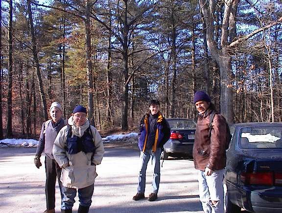
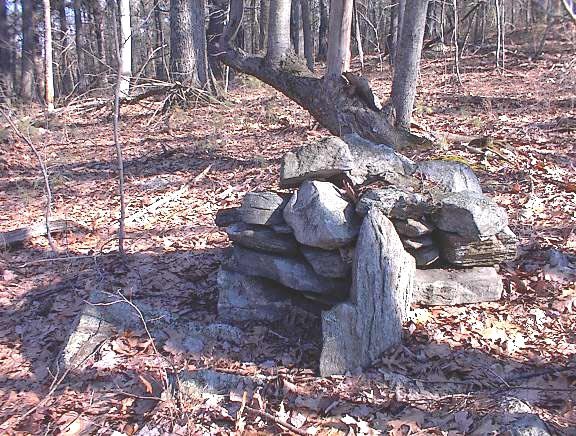
Just before the snow there were some minor sites and a field trip with Curt H. and Matt H. I found a fine marker pile site at Rocky Pond and Birch Hill in NH:
Later, after the snow melted, I found some fine 'rectangle with hollow' examples there, near the road.
Sitting snowbound at home, in January we saw:
- new sites reported from CT
- strange rocks from Brazil
- stone walls from CA
February:
As Tim MacSweeney says: "Up to our necks in snow". Sitting at home we saw:
- rock piles in Alaska
- other people's photos
- strange rocks from CT
- Hopkinton Land Trust buys 13 acres, notable for having "cairns"
- Tim sends picture of Nuclear Lake, NY
- We watch "America Unearthed" - marveling at the degradation of content into drivel, including archaeologists stepping on rock piles while looking for traces of archaeology.
March:
Finally enough snow melted, I started getting in some hikes. Mostly to the south of Concord, as there was less snow in that direction.
- Finally some "red rock" rock piles in Randolph, on south side of Ponkapoag Pond.
For several years, I had hoped to find piles made of the "Wamsutta Formation" rock.
- March 28th was the first visible rock pile of the winter.
- New pictures began to emerge from CT (thanks Tim)
- Before that we are still looking at old photos ("Petroforms") and foreign photos (rock piles of northern Sweden)
- strange rocks from NH
- multiple news items from the Nolumbeka Project
- more CA stone walls
April:
SNOW IS FINALLY GONE AND OUTDOOR ACTIVITY RESUMES
- sites along North Str, Upton and along Warren Brook
with old decripit mounds:
- re-exploring at Holden Rd Shirley, found a new 'mound' by the inland wetland:
- a lovely mound group by Miscoe Brook in northwestern Upton:
May:
- a couple of very minor sites at Wolf Swamp, Boxboro. But then, sites are hard to come by in there.
- Chris Pittman startles all of us with his magnificent arrowhead finds:
- I revisit George Krusen's "Hill of 500 Cairns", and located a few more on the east side:
- Petromorphs from Montana
- At the end of the month I locate a (for me) second (after Miscoe) significant site of the year, at Lovell Reservoir Fitchburg. With a great mound group:
Looking back, I think this may have been the "best" find of the year. But what was most significant was, in fact, the messy berms in the ravine there, which I payed little attention to.
June:
- minor sites on Merrill Hill NH
- strange rocks from Hollis NH
- new finds by the Gumpass in Pelham NH, and A TICK BITE.
July:
Mostly I am going to the beach on weekends and not exploring....this is the dead zone of summer.
- I found a little rock outline-connected-to-wall about 20 feet from the road at Minuteman State Park. No, the park is not aware of it.
- The genetic nonsense about Native American DNA rears its ugly head.
- A big load of nothing at Bordeland State Park (some messy stuff at the southern edge along a brook).
August:
- more nothing at Bordeland State Park
- more nothing at Red Brush Hill
- Norman M. sends this photo of a stone chamber:
- more nothing at Moose Hill, Sharon MA
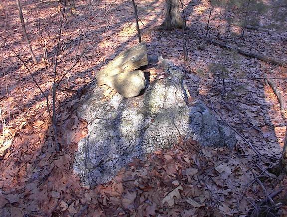
- an interesting boulder with auxiliary piles north of Silver Lake in Hollis NH
- Mamjohn Pond in Gardner MA. Fine rectangular mounds:
September:
- Egg Rock in Concord, is a famous spot but no one ever noticed the rock piles in the woods behind there.
- Tim M. visits the "Judges Woods" behind the house where I lived as a teenager:
(looks like marker piles mixed with [in the rear] mounds).
- found a rectangular mound buried in the bushes next to the Concord River - a few hundred yards from my house. Never took pictures.
October, November
- a walk in Mason NH with Carol Montgomery - turns up lots of minor features that "click" together as similar to other sites in this "northern" MA/NH area. For example, little piles with hollows:
Also, carefully build rock piles against outcrops. This is a feature that resonates with others places:
- Various threats occur:
Algonquin Pipeline expansion
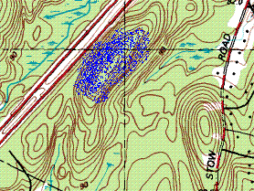
The Stow Grid (ongoing)
A (thankfully) false rumor of Parker Woodland destruction.
- Much exploration at the north end of Horse Hill Groton/Dunstable:
- The post about Horse Hill captures, or begins to capture, a couple of important theoretical ideas:
- that burial mounds will be found at the high point of the path of least resistance from the water up the hill
- that a mixture of marker piles with larger, lower, mounds is to be expected at the high point.
- that (at least in the Nashua watershed) the top of the ravine will have long berms with hollows, in place of or in addition to rectangles with hollows.
December:
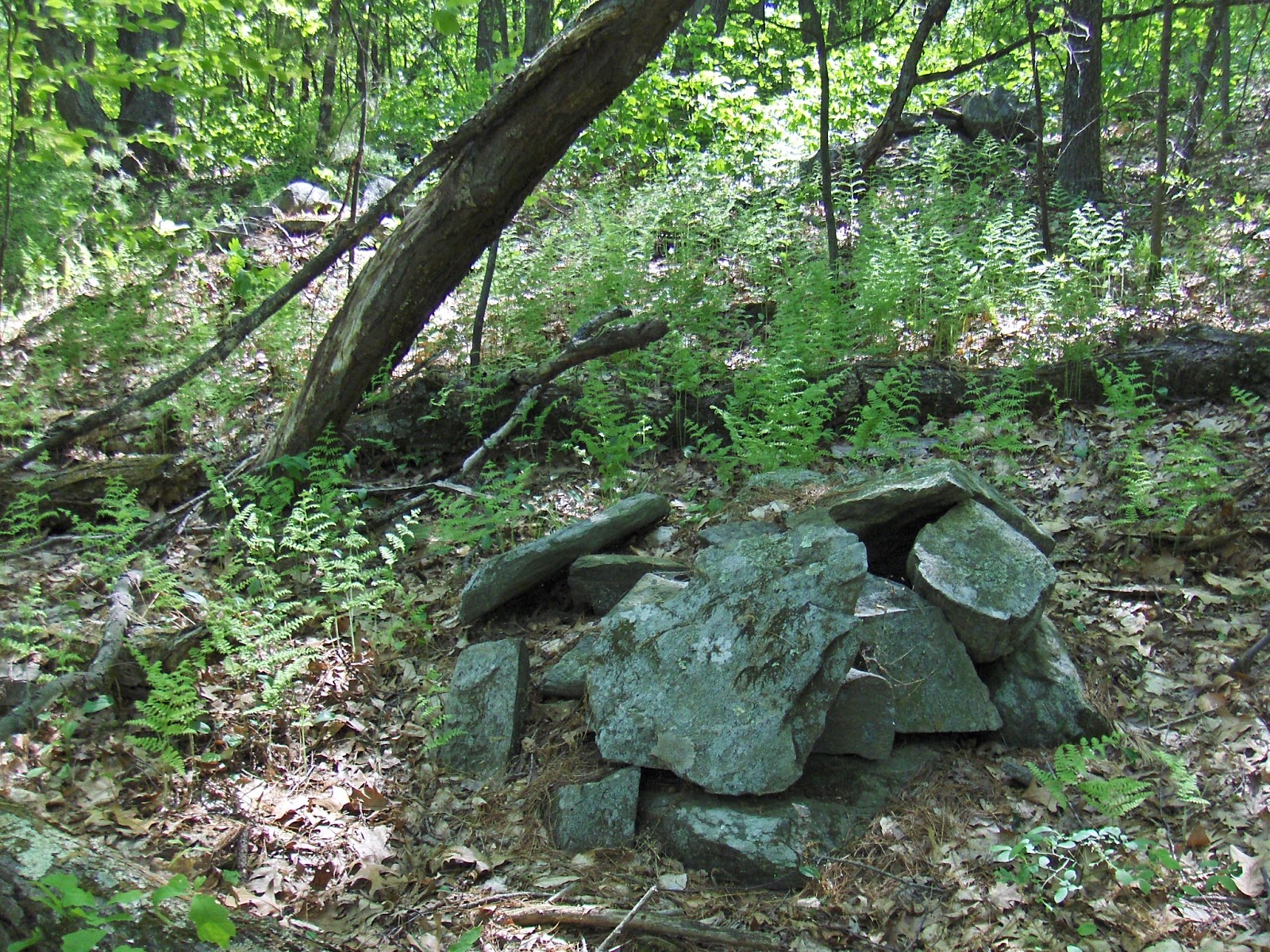
This theory, results in my beginning a refined hunting strategy: find a major waterway, and a small tributary brook. Follow the brook to its high point and look around. In the northern (Nashua River) areas, look for elongated berms with hollows, otherwise expect rectangular mounds. This burials at headwaters becomes a highly successful strategy for me, for the rest of the year. Would any of my readers care to give it a try? I am able to "squeeze juice from a rock" (or is it "milk from a bull") and find rock piles in Groton near the Throne:
- Amazingly I extract a rock pile from Ballard Hill in Lancaster MA. After all, the Nashua River passes nearby:
- I re-explore Rattlesnake Hill in Bolton. A couple of brooks lead up from a larger waterway and the same hunting strategy turns up a couple new sites on the hill.
- At Blood Hill I finally become aware of elongated mounds with hollows, found in ravines. They have a characteristic shape, location, distribution in the Nashua and Souhegan watersheds [which is only as far as I have explored]. So let me end this review with the grandest "ravine culture" mound I know - the grand "J" at Blood Hill which captures the essence of this special aspect of stone mound culture in these parts (right click and open in new tab to see magnified):
And finally, this is echoed by a pile along E. Wachusett Brook in Princeton
The sites and ideas that stand out from the rest, over the year, were:
- Ravine Culture at Blood Hill
- The pathway up the hill at Horse Hill
- The Lovell Reservoir Mound Group
- A forlorn site near the head of Miscoe Brook
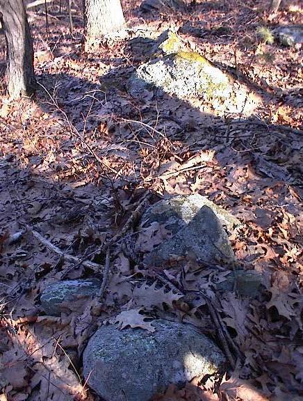
 The first thing I saw on the eastern side was a nice light feldsparstructure.
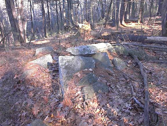
 If they are marker piles they are more like the type where the pointer rock is flat like a "fin" sticking out of the pile. By this time in our fieldtrip I was starting to get hungry and becoming less interested in yet another rock pile. But there are some different interesting things on the eastern slope. Let me tell you about (1) an aperture pile, (2) a strange short stone row with a large aperature through it, and an isolated piece of quartz perched on a ledge at the edge of the hill. [Click here] for information about the aperture pile and the quartz. Here is the curious stone row:
 The row ends to the right of the picture. At the top on the left is a larger rock - a bit like the head of a snake. What I found most interesting was the hole in the middle of the wall. See that? Yet one more thing suggesting looking at/ through/ past a construction. That seems to be the theme of the Hill of 500 Cairns.
 After this we headed down the southeastern side of the hill, passed that ledge with quartz and scrambled back out to the road. I am ashamed to say I missed this site entirely when I came to explore this hill sometime last year. So now we have a little bit of a sense of this Hill of 500 Cairns. My conclusion: this is a hill which is steep on all side and has elevated horizons in all directions. So it is a natural location for marker piles and, in my experience, is more thoroughly covered with piles than other hilltop sites nearby.