Showing posts sorted by relevance for query Fenton Rd. Sort by date Show all posts

Thursday, April 12, 2007

Fenton Rd - extending knowledge of the sites in Leominster State Forest

Last year I blogged and publicized the locations of some rock pile sites along Fenton Rd in Leominster State Forest, corresponding to locations B and C in the map fragment below [click here and look down the page a ways]. This account it about sites at A and a more extensive site on the hillside between B and C at D.

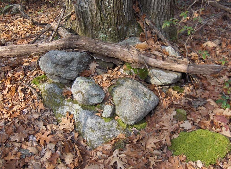
I was thinking all winter about going back out to the end of Fenton road and trying to explore more in the northerly direction. In the end, I got over to the landfill area where the woods are full of blown in plastic bags, before turning back to the eastern side of the slope and ending up exploring downhill from where I was before. I turns out that what I thought was a minor site near a foundation hole (C) is actually a quite extensive site with multiple acres of rock piles in little clusters. At times it seemed to be a marker pile site, and at other times it seemed more like an effigy site. There were some of the intimate groupings of rock-on-rocks that I associate with brookside sites. Maybe one pile in ten has some of its original structure. The rest apparently are knocked down. Water is coming out of the hill everywhere on this slope between two streams flowing east (D).To get to this site you walk in from Elm Rd on Parmenter - it is maybe 1/2 mile to the foot of Fenton and then 1/2 mile or so to the end of Fenton. Right at the beginning, you pass the outflow from Rocky Pond and then start up a little slope. I was thinking how much it was like a spot on the way up Horse Hill in Groton and was thinking that at Horse hill there are rock piles on the left - so I looked to the left and, sure enough, there was what looked like a rock pile. There were actually several piles and at a casual glance they looked to be the result of a roadside dirt disturbance. But I went over for a closer look and discovered there were several other rock piles on the slope (A) all overlooking Rock Pond to the southwest in an eminently suitable location. So that is quite a lot of rock piles sites along Fenton Rd.

Here are some of the piles I found at (A).
And here is a view to the southwest towards the pond:I felt like I had already accomplished something finding this site, which I walked right past several times without seeing before.

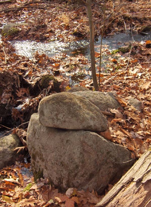
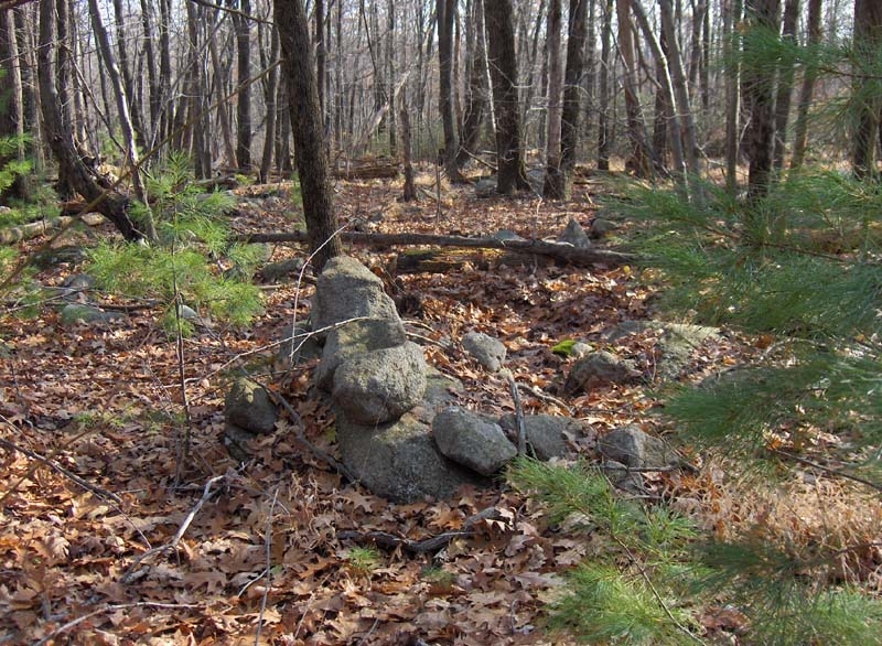
Then I continued slogging up the road and eventually passed the brook at (B) and continued along the trail that begins where the road ends. I followed that right along through several patches of dense mountain laurel, taking digressions where I could. I passed the site at (A) and took one picture and then continued along the trail till I got to a sign "DEAD END" indicating that I had come all the way through to the edge of the landfill. Everywhere you look in there there are bits of plastic bag that have blown in from the landfill; and it starts to smell a bit funky too. I had hoped to explore to the north and then circle back around to the east below (A) but actually the mountain laurel prevented exploration to the north. However when I got back around to the east I started finding rock piles at the edges of the laurels and I poked around happily for a half hour or so, taking pictures of the piles in there. Some of them look like marker piles:There were also numerous rock-on-rock groupings - suggesting either lines of sight or else a sense of containement and grouping:I cannot resist a nice rock-on-rock picture:
Lonesome colors.

In a couple of spots that seems like clusters of marker piles, I tried to locate a high point from which to view down the lines of piles. But there were numerous different clusters and a much too complicated situation for me to resolve.

I also noticed some little groupings of piles, so intimate as to suggest a concetration of effort at a single spot. Here is one group and a couple of details.
(By the way, this steep sided pile, badly damaged as it is, was the least damaged pile I saw. Given the notion of "rock pile 1/2-life", this makes this one of the older sites I have seen.)

Some of these rocks looks selected for by shape. This one, with its bird-like symmetry, suggests and effigy.I conclude it is an extended, multi-purpose site.

As I video blogged a couple of days ago, there were also the beginnings of stone walls (or "rows" for Tim M) starting in some of the gullies and heading off downhill into the impenetrable haze so typical of Leominster State Forest.I am deliberately making these sites on Fenton Rd public, so you can go to Leominster State Forest and see what I mean. It is a fascinating place. Also, although I do not think Fenton Rd is a random cross-section, look at how many sites are along just this one road. It makes me believe there is still a lot more to be found hidden in this forest of laurels

Sunday, September 25, 2011

Laurel Swimming - Leominster State Forest

Not sure what kind of rock piles I want to explore, I thought instead I would make sure I got a good walk and exercise by going off trail in Leominster State Forest. There are places over near the top of this map that I always wanted to get to. At the same time, going through mountain laurel is a hard thing to do, so I wasn't sure how far I could get. But my muscle tone has finally recovered from a slow winter and I thought it would be fun. It has been raining so the bushes are wet, the ground soaked.

Starting in from the eastern end of Parmenter Rd (a dirt forest road) I encounter a guy in cammo with a rifle. I said I did not know that it was already hunting season. He said "black bear". We chatted, he mentioned some footprints I could go look at, if I wanted to see a bear tracks (which I would love to see). I said, gee should I be wearing orange? (I am wearing the usual white button down collar oxford cloth shirt.). He said I don't look like a bear. Continuing, I left the main road onto a side road heading in the right general direction. In this forest, you should always take an existing trail if there is one. I saw one old split-wedged rock, so covered in moss you could not see the split.
And I was encouraged to see a short stretch of wall ending at a boulder. There are several like this on these slopes. But higher up, not down near the swamp. Then the trail I was following headed off uphill in the wrong direction, so I dove into the laurels.

I am not going to keep saying it but pushing through laurel is hard work. It is a full body workout and sometimes you rest your arms as opposed to resting your legs. Over the course of the walk I refined a technique of locating the edges of the bush and sweeping it sideways to clear a bit of space to walk through. Any twig thicker than 1/2 inch resists bending and you have to step over or around. At the same time as you make these sweeping motions with your arms you have to high-step to get over either the lower laurel branches or the many downed trees underfoot. I was trying to decide what to call this activity and decided I should call it
laurel swimming. [Don't they have "laurel choked hollers" down in the Carolinas? Anybody actively trying to explore in there?]

Anyway, I finally broke free of the stuff. When I got to the bottom of the valley it was a dark hemlock forest with no undergrowth and boulders underfoot. Comparatively easy going, I continued northward until I could hear the 1st brook. Looking for rock piles down and around, I crossed the brook, and saw a few meager traces of man made structures. Photos are blurred cuz of lack of light.

Leominster State Forest is a good place to go if you want to photo "gloomy":
I wonder if anyone alive has ever been in this spot?

I continued northward taking advantage of the easy footing without underbrush. Already before I left the original trail my feet were starting to get wet. When I dove into the laurels my shirt soon got soaked and then my pants and then my feet became pretty wet. But it was nice warm 74 F out and I did not mind.


Each brook crossing is a challenge. You want to get across without getting any wetter. I am working on a grading system, like grading Olympic diving, involving a combination of points for difficulty and points for excellence of execution. But with stream crossing, there is also an element of choosing an elegant solution. In one case "elegant" may involve using a stick as a cane for balance. In another case, recognizing that your feet cannot get any wetter, using a submerged rock might be an elegant solution. The main goal is to avoid getting zero points by going ass first into the middle of the brook.


Finally as I am heading north, I was pinched between the swamp and the laurels and being unwilling to start wading through actual water I cut back into the laurels. There was a lightening in the growth ahead and I pushed through to a huge split boulder. Walking through the split is always recommended and I could see from the deer droppings that this was a place they liked to hang out. And I climbed up on another boulder to have a look around and try to pick a direction with less dense laurel. Then I hear a branch snap, about twenty yards away through the bushes. My assumption is that the only thing clumsy enough to snap a branch is a human and, with bear hunters out and not wanting to trust that I still do not look like a bear, I say "Hello" in a loud voice. Then I hear some thrashing through the bushes. So I hold still a while. Is it hunter? Is it a bear? I cannot keep waiting, so I push out to the clearer space - from where the branch snapped - and there are huge hoofprints in the sphagnum moss and a rubbering horsey smell. Aah! I think: moose. I was in his nest. He had beaten a trail through the undergrowth like a bulldozer and it more or less was heading in the correct direction so I followed it. The only trouble with a moose trail is that they do not care what they are walking in and I did not want to wade through standing water. So this is still very rough going.
At one point a branch crossed the moose trail and I was sure the moose would have rubbed against the branch. Bending down to give it a sniff, I got a nose full of that rank rubbery horsey smell.

I was pretty tired and figured it was time to start thinking about extracting myself from the woods. I could hear the 2nd brook and I pushed through to it. It is usually a little easier going along a brook so at this point I headed uphill following the brook. Unfortunately this brought me into the middle of a swamp and I set off in search of higher ground. So now it is sphagnum moss underfoot, hopping between tussocks, and fighting the laurel at every step. And there are moose footprints and droppings everywhere.


After a while, I could hear the 1st brook again and I managed to get out of the swamp and back into slightly clearer rocky woodlands. There were some big white birch trees and I kept an eye out for "Chaga" mushrooms. I have a friend whose cancer is not responding to modern treatments and Chaga has some interesting medicinal properties (
see here) that might be worth a try. But I did not see any.

It has been raining heavily. The brooks were full to the brim and rushing at top speed. All the ground was soggy. My clothes were already as wet as they could be. I was thinking of a joke: my feet were so wet they actually would get drier if I stepped in the brook. I am a little tired and sweaty and hot and the brook looked so clear and inviting. I thought about taking my clothes off and taking a dip in the 74 F water. But I have a slight superstition about taking your clothes off in the woods....or some excuse, and I did not do it. I just pushed on uphill and popped out onto the northern end of Fenton Rd, which I recognized. Familiar territory, easy going.


So I am slogging back along Fenton Rd, which I know is about 1/2 mile of dull walking with walls of laurel foliage to either side. So when I saw a side road heading back towards what I figured was the right direction, I took the side road. And it is zigzagging uphill, downhill, back uphill and not really going in the direction I want, so I figured to take a short cut down to the brook, hope to find clearer walking and almost immediately I am saying to myself: You are 2 kinds of fool. First kind for leaving the familiar Fenton Rd and 2nd kind for leaving the trail and getting back into the darned laurels. For fun I tried to see how fast I could "swim" without breaking a leg. And I had to sit down under a bush and rest. I tried to photo my state of dishevelledness:
I pulled myself back onto my feet and pushed on. I was really pleased with my body getting tired overall rather than one part getting too tired to use. I still had plenty of energy and it was still a nice comfortable temperature. I am two kinds of fool but then, how else would I get to see something like this, two garter snakes mating in mid air:
I finally got back out to a dirt road and, what do ya know, it was still Fenton Rd. What the heck? I finally had to pull out a compass to make sure I was walking in the correct direction. But I got out of there and back to my car.

When I got home and was talking about my walk at dinner, I realized that I never did get to the destination I had hoped for - a peninsula that sticks out into the western side of Notown Reservoir over there. I am thinking - you really cannot get there. At least I am not man enough to do it and I sure am not going to camp and make it a 2 day expedition.

Friday, May 07, 2010

Another little rock pile with a tail

This looks out towards the southwest, over Rocky Pond in Leominster State Forest. Last time I looked at this site, the main pile seemed like such a messy pile, near enough to Fenton Rd, that I thought it was probably just bulldozer activity. But this time I had a careful look around, recalling that there were also some smaller piles nearby. As I was saying, it is these small outliers that cinch the deal for me.Taking, therefore, a closer look at the main pile we see what is actually a very typical (and now familiar) design:
On the left is a rectangular structure with a depression in the middle. Then the pile has a lower wall-like extension curving around and ending to the right of the tree. This "tail" encloses another rectangular space.

I know this might seem a laughable interpretation of what looks like just another pile of rubble but, for me, this is a pretty standard Wachusett Tradition site with a view to the southwest over water and with the small outlier piles.

Update:
Note the map fragment from here where "A" is this site overlooking Rock Pond. Also, the plan of the main pile is this:
In general for sites along Fenton Rd, see here.

Tuesday, April 10, 2007

Stone wall beginnings off Fenton Rd, Leominster State Forest

When I made these videos I thought they were examples of short stretches of stone walls. But in both cases I later saw that the wall was more extensive and led off into the impenetrable depths of the mountain laurel, downhill. Yet I doubt that these walls are particularly "agrarian", they seem to be celebrating the same water flow out from the hillside as are the rock piles, which are clustered about on the same hillside.


And this is the way it is, so far, off of Fenton Rd. There is always a little further you did not yet explore, and there is always a reason for going back. It is wonderful to be able to explore -essentially- a wilderness; like the guys going into the Honduran jungle to find Mayan pyramids. Who knew you could do the equivalent in Massachusetts?

Tuesday, November 07, 2006

Fenton Road, Leominster State Forest

Although much of Leominster State Forest is impenetrable because of the mountain laurel, I have often wished I could get to some of the more obscure parts. I noticed a thin trace of forest road leading north from Parmenter to the right of Rocky Pond and, because I had once noticed those little brooks descending the hill north of there and also because that little forest road leads over to at least one of the brooks, I thought it would be worth the effort to get out there, even though it amounted to a mile or so of slogging on those Leominster State Forest roads. So off I went on Sunday. That little forest road has the name "Fenton Road" and it runs just as indicated before stopping. After that you can continue on State Forest Paths and I did for less than a quarter of a mile before stopping and thinking I had gone far enough. By then the woods had opened up a bit on the right and it was possible to explore east and downhill from the path. There was a very indeterminate rock pile site there - close by an old foundation and with very little sense of sacredness or ceremony. Could they be something other than ceremonial? I was not able to decide but was not so thrilled with the discovery. Then I turned back and got off the path to explore down stream at the point that Fenton Rd crosses the brook (above the "R" at the end of "LEOMINSTER"). Sure enough there was a site there as I had hoped. Ironically I proposed an experiment long ago involving predicting where the rock piles were and then going to check. Well one of my predicted locations was exactly that brook and, I think, I just succeeded with the original experiment. Yes there were rock piles there.

I walked all the way up Fenton till it turned to path, followed that along for several hundred yards, and then saw a kind of rough wall made of earth and rock heading downhill to the east. The woods were open enough in that direction that I got off the path to go take a look and found rock piles (approximately in the upper blue outline). They are really non-descript. No quartz, no sense of alignment, no sense of shape.
It is nice to see them in the laurels. Perhaps they are quite distinct in a shape I do not recognize.

These piles were near this structure, a historic age foundation for I don't know what.
I poked around a bit back to the south along the same slope of hill and came on another small cluster.Still not very satisfied I must believe these are Indian piles perhaps because they are small and placed on boulders. So I went back to the trail and walked back sotuhward towards the end of Fenton Road....[continued in subsequent post].

Fenton Rd, Leominster State Forest (continued)

... So I went back to the trail and walked back sotuhward towards the end of Fenton Road and when I got to the stream crossing I got off trail to explore down along the brook. Pretty soon there was a first rock pile beside the stream with the sense that there were others beyond, and there they were. First one or two, then some small clusters. But not too many solitary rock-on-rocks. With all the sound of running water going by, that puts this site sort of into the category of "Above the Falls" in Bolton. I made videos:


And here is one nice cluster off to the side: Here is another that caught my eye, and another by the brook that I thought was nice:
Still more.As I look at these pictures I am struck by the similarity in structure of 1st, 3rd, and 4th. They all have a curved trailing away structure made of three or four stones. Also my forced comparison with "Above the Falls" causes me to look more carefully at the relation between the two piles in that last photo. Is that a "gap" between them?

Thursday, December 01, 2011

Parker Hill - Fitchburg, MA

I picked this hill in western Fitchburg for my Sunday walk. Drove up the road next to it until the pavement gave way to dirt, parked, and continued on foot up the road. Lots of dumped rubbish consisting - curiously - of lots of chairs and old TVs. It was like graveyard for couch potato accessories.

One dirt road goes up and crosses the hill east-west just below the summit - a stone wall actually crosses the summit. From there I took another smaller dirt road down the north side of the hill. I wanted to get into the flatter valley in that direction (hoping to find some traces of the "Wachusett Tradition") and wanted to get away from the dumped rubbish. This turned out to be a good move. Half way down the north side of the hill, the road passes through a gap in a stone wall and passes what looked like a donation boulder (because of the sense of random rocks falling off the sides):
I was worried, though, that it was an isolated pile and was only slightly re-assured when I saw something else on the other side (downhill) of the wall. But I was not too sure of this:
Let me parse this view. We are looking at a low, curved mound of cobbles, mostly of the size that you could carry in one hand. On the left, at each end of the curve, are two larger cobbles/boulders and you can see some symmetry of the curved mound between these larger endpoints. Looking carefully there is also a piece of quartz at the center of the curve, just to the right of the center of the photo. There is a second piece of quartz to the right of that. Here is a view towards the center of the pile, taken in a line perpendicular to the above photo:I was still a little worried that this was not a "real" site. The worry started to fade when I came to a "real" rock pile - real because it is carefully built up.
This manifests the ideal of "rock piles poking up out of the laurel". My worries that this was not a site evaporated as I entered a boulder field, with lots of rocks and small rock pile clusters.
So I combed the area, traversing the hill at the same level until I ran out of rock piles, then traversing back, a few feet lower down on the hill. Lots of examples of piles with two larger rocks in a pair:Some pretty old piles - love it when they are moss covered and hiding in the bushes this way:
Now, that first pile with quartz would make a decent example of an older Wachusett mound. But everything else I was seeing felt more like marker piles - evenly spaced, and the kinds of things I expect to see as outliers around Wachusett mounds. Or perhaps each cluster represents an individual little ceremony.The question was: are there any other of the larger mounds in here? I think I found a couple but they were too far gone to photograph well. You see, here the laurel is growing around the edges of the rock pile:Is this cool or what? I'll just show you some more pictures, hoping to convey the atmosphere of the place:Note in the distance is a pile built into the corner of a stone wall. I wonder if this came later or if the walls and piles are from the same date as the rest of this site?

It was a pretty, but somewhat forlorn, place. This is the first decent new site I have found in a while, so I was glad for that also. The location corresponds with the larger blue outline on the map fragment above.

After spending a while at this first site, I continued into the flatter area beyond north and west of the hill. There was a brook, and a large pile of rocks badly re-arranged and driven over by multiple ATV. My guess is that this is just what it looks like: a multiple chambered mound right next to the water. But who can tell? There was a little quartz in the right place:
Not that this pile is of any interest by itself. Perhaps another dot on the site map? But overall another site in Fitchburg, much like the others I have found here.

Update: I want to mention two other sites this site reminds me of: the northern slope of North Manoosnoc and downhill from Fenton Rd - both places a few miles south of here in Leominster. From my point of view this site is pretty typical of what I would expect to find in these hills. The sites are pretty common if you go looking and cover enough territory. That requires curiosity and a car. But how likely would it be for someone to spot a pattern when they only see one site? How inclined would someone be to hitch up the horse and wagon and go looking for something similar, further afield? Not very. I think getting a real sense of rock pile sites is only possible because of the having a car and having reasonably affordable gasoline.