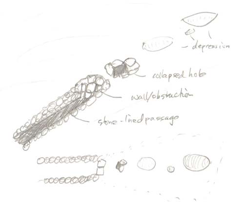
 The upper part of the picture shows the features seen from 3/4 view. To the left is the stone-lined passage which gets deeper uphill - to the right in the picture. The passage is obstructed by a wall and uphill/beyond that is a collapsed structure with a hole hinting at deeper recesses underneath. Still further uphill and in line with that, are several depressions indicating other collapsed spaces. The lower part of the picture shows a "bird's-eye" view of the surface features.
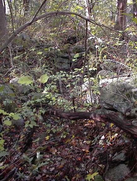
Here is a view up the stone lined passage towards the walled off entrance. The dark behind it is where the roof is collapsed.
 And here is a view down in the opposite direction from the top showing some of the depressions which suggest collapsed passage.
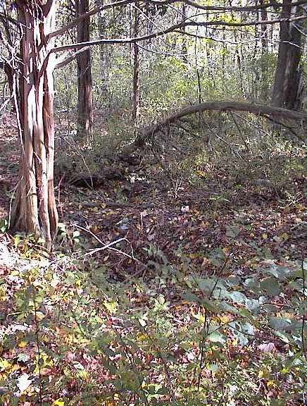
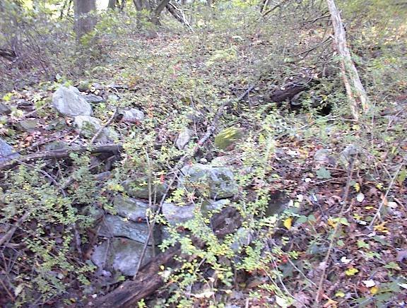
Finally here is another detail of the wall and collapse. Perhaps someone will want to check it out more thoroughly someday.
 Backside of Rt 3 is not the sort of place you expect to find something interesting.
2 comments :
I am truly sorry I did not name the street whose houses this was behind. I'm thinking maybe it could not be Burlington, so maybe Bedford of Billerica?
It was on the west side of Rt 3 - somewhere I could park and then walk in behind the houses.
Perhaps near Old Billerica Rd
Post a Comment