By Geophile
The second picture in
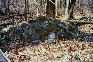
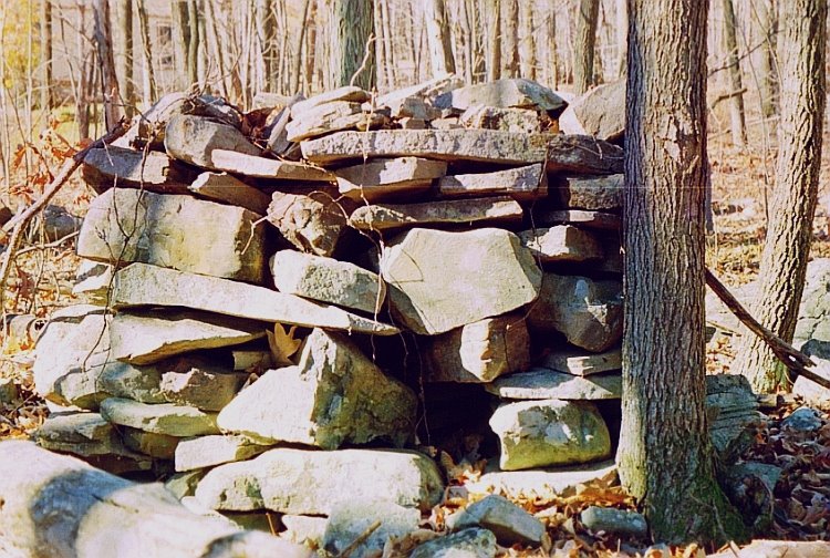
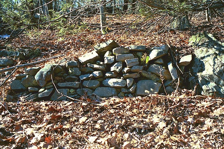
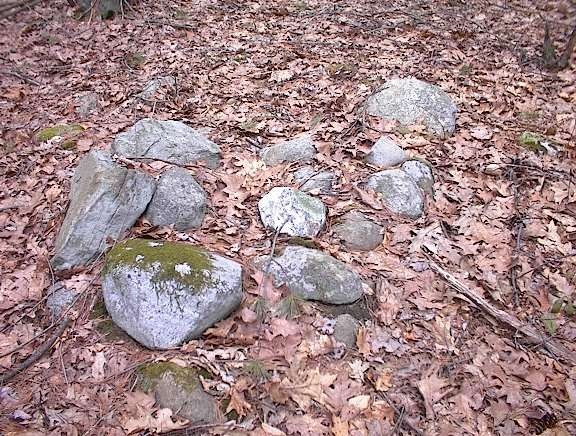
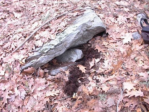
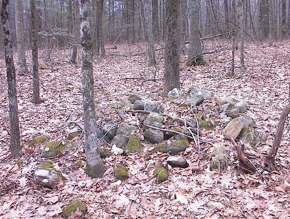
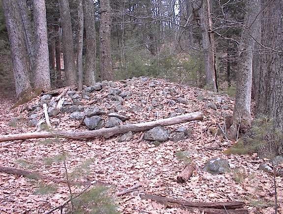
Norman's post reminded me of a form of rock pile I've seen a few places. To distinguish them in my mind, I call them fish tails, but there's no connection with fish, really. They often are built against a small berm, or else a small rise is built against them, I'm not sure. The one below was at a site in Monroe County, PA.

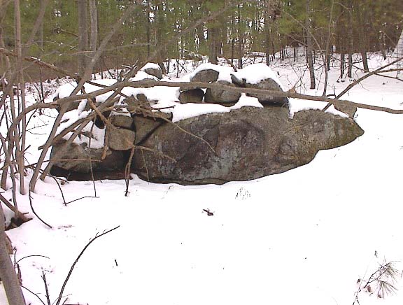
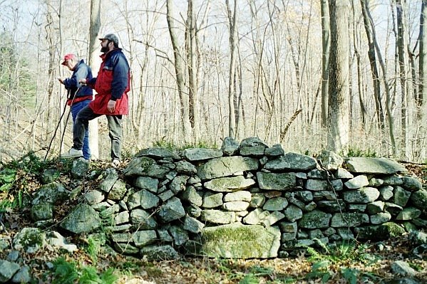
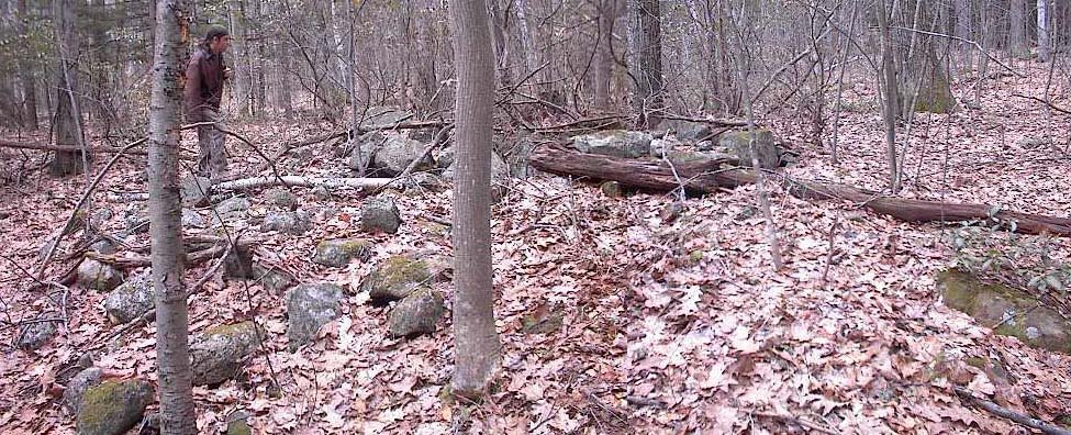
The one below isn't typical, but it's similar to the others, although it's also possible it once was part of something else. It's in Berks County, PA, not far from Oley Hills. The people in the picture are, in the foreground, Frank Maykuth, who grew up a NEARA kid and added that perspective, and the other is Don Repsher, reverend rascal and researcher extraordinaire.

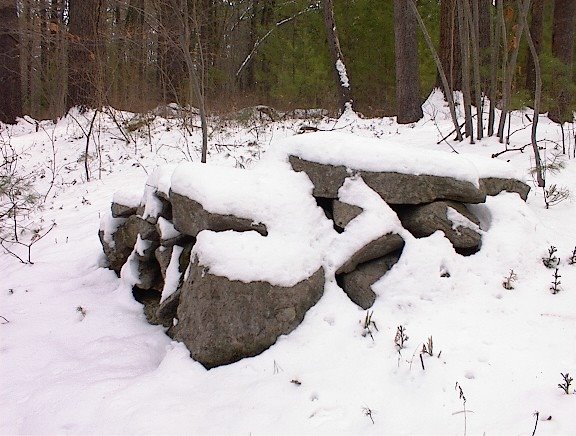
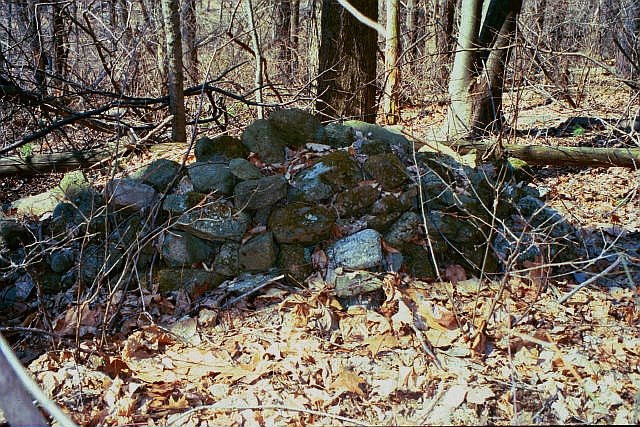
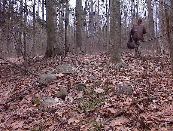
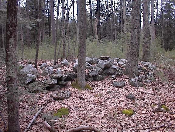
The next one is from the Hackettstown, New Jersey site. Its form, like two of the others, is what you might call the 'Anne Elk' shape if you're a Monty Python fan--small at one end, larger in the middle, and then small again at the other end. It is however, less flat as it faces you.
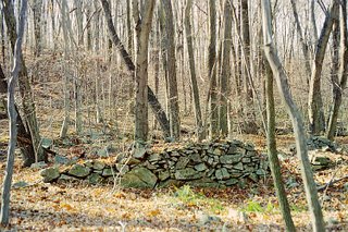
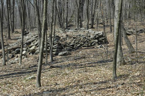
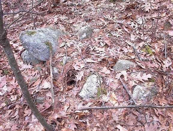
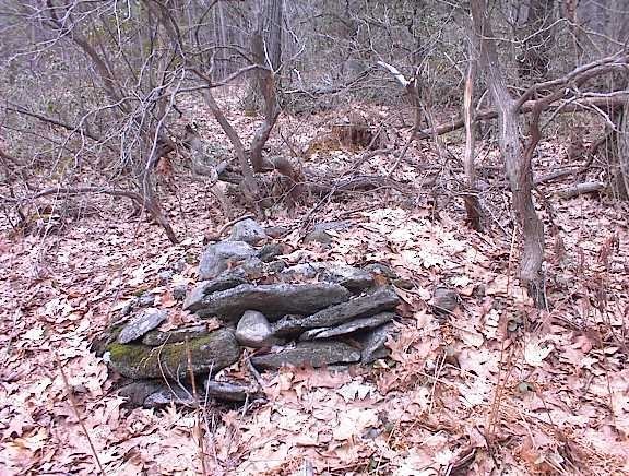
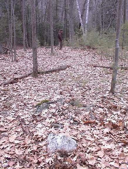
The last is from the same site as the second, not far from Oley Hills in Berks County. Like the first one above, especially, it is backed up against a small hump of earth, is flat in front, and seems never to have been part of a larger structure of any kind. This one is especially nice to look at.
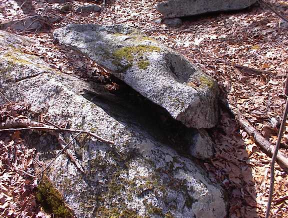
What is it?


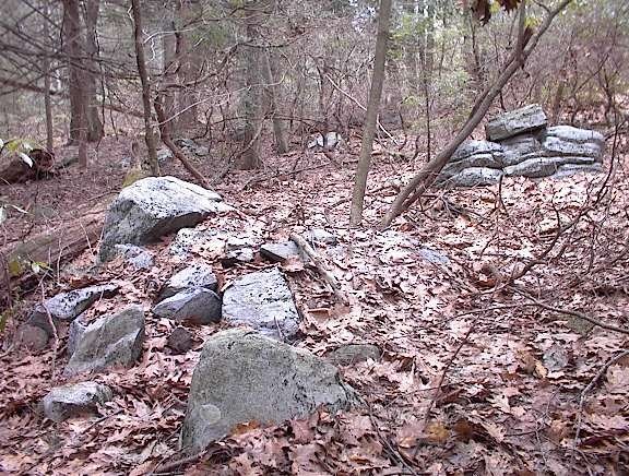
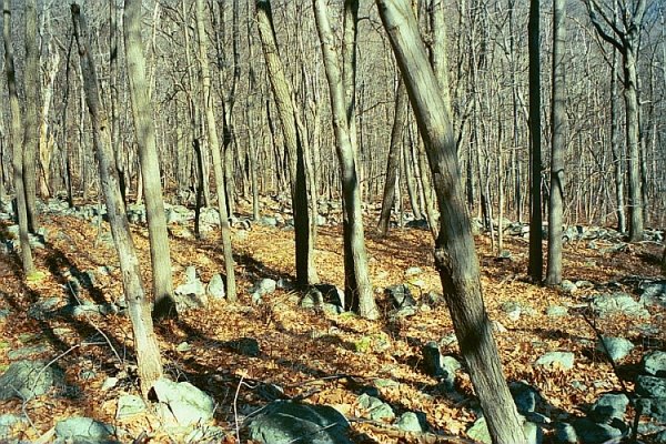
 They were from a site with a number of other distinctive features, like small pile with a space and then a larger pile:
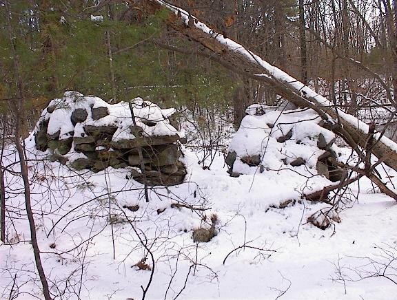 I'll say more about the site some other time.


![[Click here]](http://www.ptone.com/phcroatia4/6/Image010.jpg)