Saturday, October 31, 2009
Old stone tool from Acton
I was heading up to a high point in a cornfield in Acton, and happened to step over this on the way.
 In this next picture, the working edge is to the lower right.
  The nicely fluted scallops out of the rock are produced by percussive flaking and this is a material I do not know the name of. It certainly does not come from Acton.
I was trying to figure out how to hold it.
 Opposite from the sharp edge, the squared off butt end is clearly not functional.
  Perhaps this rock was a fragment broken off from something larger, like an axe head. But it was re-worked. Or maybe it started out this way.
By studying where the rock was smoothed out, after a while it became clear how it was held and, it could have been held quite tightly while in use on some slippery task. There was even some dried blood still on it - believe it or not, dried blood can persist for 10K years and I read a book once how re-crystallizing the hemoglobin allows determining the species of animal the blood came from. So there is more that could be learned from this rock.

Update on the effigy with quartz
In reference to articles here and here. Mike H writes:
I located some older photos from 2004. Another view of the Effigy.
 Another view of the third picture from previous post .
 A photo of a portion of the wall. [The previous article mentions this wall is semicircular with a spring in the middle - PWAX]
 Three quartz rocks located in the center of the circle.
 The property has been in the family since the 1960's. I first saw the wall in 1986. After I found the NEARA website in 2004, I decided to have a closer look at the wall with a new perspective. At first I thought I was seeing things, but I have found numerous constructions inside and outside of the circle.
Friday, October 30, 2009
A few more piles from last weekend
...and then up and over into an area I was in the previous weekend, and took a few pictures of more rock piles I missed before. So just for the pictures:
 Gotta love it:

 Gotta love it:
A little outcrop ceremony
...proceeding down stream there was a small outcrop looking over the water and a few signs the rocks were manipulated: In the background of the above:
 In the background of the above:
Ruins, Mounds, Field Clearing, or What?
Here is something a little different: Where the story left off, I had just parked and noticed a grid of rock piles and a short stretch of wall next to a farm dump and borrow pit. That was to the north of the road. But I had planned to sneak into the woods to the south, so after a few minutes poking around the grid, I went across the road and stepped into the woods just below a farm field. There were more rock piles over there but they were different, unfamiliar.
The first impression was this was an outcrop with frost-broken rocks. But the rocks were clustered into mounds. In the next picture you can make out a sort of path that passes to the right of the larger tree. That path then went through a break in the stone wall leading into an area of about 1/4 acre, enclosed by stone wall on the field side (to the right in the above) and outcrop to the left. This area was a very suitable ceremonial location: a knoll looking out over a spring with views to the south and west:
 Here is what I saw stepping into the enclosed area:
 Note the two "mounds" to the left and lower on the slope. Note also the unstructured mess of broken rock on the level area and to the right. The piles in this level area did not have much integrity as piles. It was more like a tumbled down ruin. Also this was broken ledge rock not glacial till. So maybe someone cleaned up a bunch of loose rock from the field on the other side of the stone wall there. Generally with field clearing you expect rocks of many different sizes - perhaps some piles with smaller rocks dumped on piles with larger rocks.
On the other hand, these two downslope mounds do have some integrity as piles: They are positioned right at the edge of the drop off to the spring:
 You can see these rocks are mostly the same general size and mostly are broken rock. So I have a hard time believing these are just field clearing but they are right next to a field and at the lower edge. But why across a stone wall?
 Where the story left off, I had just parked and noticed a grid of rock piles and a short stretch of wall next to a farm dump and borrow pit. That was to the north of the road. But I had planned to sneak into the woods to the south, so after a few minutes poking around the grid, I went across the road and stepped into the woods just below a farm field. There were more rock piles over there but they were different, unfamiliar.
The first impression was this was an outcrop with frost-broken rocks. But the rocks were clustered into mounds. In the next picture you can make out a sort of path that passes to the right of the larger tree.
 That path then went through a break in the stone wall leading into an area of about 1/4 acre, enclosed by stone wall on the field side (to the right in the above) and outcrop to the left. This area was a very suitable ceremonial location: a knoll looking out over a spring with views to the south and west:
 Here is what I saw stepping into the enclosed area:
 Note the two "mounds" to the left and lower on the slope. Note also the unstructured mess of broken rock on the level area and to the right. The piles in this level area did not have much integrity as piles. It was more like a tumbled down ruin. Also this was broken ledge rock not glacial till. So maybe someone cleaned up a bunch of loose rock from the field on the other side of the stone wall there. Generally with field clearing you expect rocks of many different sizes - perhaps some piles with smaller rocks dumped on piles with larger rocks.
On the other hand, these two downslope mounds do have some integrity as piles:
 They are positioned right at the edge of the drop off to the spring:
 You can see these rocks are mostly the same general size and mostly are broken rock. So I have a hard time believing these are just field clearing but they are right next to a field and at the lower edge. But why across a stone wall?
Thursday, October 29, 2009
Snake Legend

"Long years ago, when the country belonged to the Indians, a certain chief became enamored of a dusky maiden of another tribe and sought to make her his squaw, but she was not in favor of this plan, and one evening, when the chief came a wooing, she took to her heels and made straight for the summit of this cliff. She was closely pursued, and on reaching the edge of the precipice found herself almost within the grasp of the deserted lover. Escape in the direction whence she came was cut off; beneath her yawned the dreadful abyss. Breathing a prayer to the Great Spirit, she threw herself from the brink, and the next moment was a shapeless mass upon the rocks below. Hence the name " Squaw Rock."
It appears that the spirit of this maiden does not rest well, whatever may have been the cause of her death ; for, about half way up Squaw Rock, and down the river from the cliff, there is a narrow crevice, from which the said spirit appears at midnight, on the 2Oth of March and the 2Oth of September, of each year. It takes the form of a snake,—some say with four heads, some, with seven ; and the snake has upon its heads a large carbuncle, which, if anyone can secure it, will make him fabulously rich. Many a night have superstitious persons watched for the snake, hoping to capture this wealth ; but although they may have found snakes with seven rattles, no snake has thus far been secured with heads decorated with carbuncles..."
It appears that the spirit of this maiden does not rest well, whatever may have been the cause of her death ; for, about half way up Squaw Rock, and down the river from the cliff, there is a narrow crevice, from which the said spirit appears at midnight, on the 2Oth of March and the 2Oth of September, of each year. It takes the form of a snake,—some say with four heads, some, with seven ; and the snake has upon its heads a large carbuncle, which, if anyone can secure it, will make him fabulously rich. Many a night have superstitious persons watched for the snake, hoping to capture this wealth ; but although they may have found snakes with seven rattles, no snake has thus far been secured with heads decorated with carbuncles..."
by Samuel Orcutt - 1882 -
A version where a bottle of rum turns into a boulder @ Snake Legend
East side of Peach Hill - a gridded site next to a farm dump
Went back to "sip at the same cup" but from the eastern side. There was a gridded site where I parked, a curious set of ruins across the road and then minor features along the swamp - but nothing as major as on the west side of the hill. The first site, a grid, is kind of broken down and not easy to photo as a grid. My best effort:
 Some details. Here are three in a row:
 One pile. There is a bit of wall underneath the dead branches.
 Probably the most interesting thing was this short stretch of wall at the lower end of the site. This was so short, it is almost an elongated pile. It reminds me of the hill by Gilmore Rd with its grid and longer but still short stretch of wall. One view:
 From the side:
 Looking downhill you can see a hollow which is a sand/gravel borrow pit. Beyond that, some rusty farm equipment. This video gives the layout:
I should mention that this hill is not far from where I found fresh rock piles built correctly. So I believe there must be a family living in the vicinity that never lost its connection to the past.
Wednesday, October 28, 2009
Last Look at Peach Hill
A couple of other nice structures from Peach Hill. Some "gap" piles:

 A pile with a manitou-like stone in it:
(from the side)
 (from above)
 A last look at the forest understory:
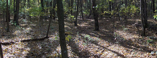

 A pile with a manitou-like stone in it:
(from the side)
 (from above)
 A last look at the forest understory:
Effigy with quartz - trying to make sense of it.
I tried to draw the rocks in the effigy with quartz (shown in an earlier post by Mike H about a Serpentine wall in the Berkshires).  I tried to draw the rocks as I see them in the picture and noticed a few things. You see how the quartz rocks are both pointed at the lower end? They are a similar shape. I also noticed the two rocks on either side of the lower piece of quartz. They both have a kind of "fold" running vertically (in the pictures). Given the symmetry of the structure, I am wondering of this fold is not a deliberate part of the design. If so, then...come on...that's not a turtle. What is it? Is it two different somethings?
 I tried to draw the rocks as I see them in the picture and noticed a few things. You see how the quartz rocks are both pointed at the lower end? They are a similar shape. I also noticed the two rocks on either side of the lower piece of quartz. They both have a kind of "fold" running vertically (in the pictures). Given the symmetry of the structure, I am wondering of this fold is not a deliberate part of the design. If so, then...come on...that's not a turtle. What is it? Is it two different somethings?
Tuesday, October 27, 2009
Serpentine wall - Northern Berkshires
Reader Mike H writes:
I was out in the Northern Berkshires in Lanesborough, MA at my In-laws this past weekend. There is a 200 yard wide stone wall enclosed semicircle at the top of a hill with the open side overlooking a steep bank. A spring originates in the middle of the circle and flows through the opening. Enclosed is a photo of a nearby serpentine wall that is 50 yards long (possible Manitou Stone to the right?). Also a photo of the Turtle? formation located at the start of the spring with quartz.
 The third photo is of another pile with a quartz boulder that has reddish quartz at the bottom.
 The fourth photo shows some pure white quartz rocks in the otherwise grey wall. Close to the site is Seecum (Sachem) Brook, also called disappearing Brook because it flows underground and disappears at points.
I was out in the Northern Berkshires in Lanesborough, MA at my In-laws this past weekend. There is a 200 yard wide stone wall enclosed semicircle at the top of a hill with the open side overlooking a steep bank. A spring originates in the middle of the circle and flows through the opening. Enclosed is a photo of a nearby serpentine wall that is 50 yards long (possible Manitou Stone to the right?).
 Also a photo of the Turtle? formation located at the start of the spring with quartz.
 The third photo is of another pile with a quartz boulder that has reddish quartz at the bottom.
 The fourth photo shows some pure white quartz rocks in the otherwise grey wall. Close to the site is Seecum (Sachem) Brook, also called disappearing Brook because it flows underground and disappears at points.
Monday, October 26, 2009
Stone Row in Delaware Water Gap
Norman Muller writes:
...images of a stone row I was shown in the Pennsylvania side of the Delaware Water Gap two years ago.

 The walls are made of local siltstone, but on top, every 15 or 20 feet, were rounded cobbles of quartzite. These were not found on the ground in the vicinity of the wall, but must have come from the Delaware River some 100 to 200 feet below. Also note the rounded and relatively thin stone leaning against the row. This is a common accent often overlooked by researchers. Just this spring I found one leaning against a probable Indian wall in Milford, PA
Sunday, October 25, 2009
Rock Pile Vandalism
I paste this here (from Matt in Stow) to illustrate an example of vandalism. Note there was no prior "publicizing" of the site and, in fact, such publicizing might have avoided what did happen:
i just wanted to drop a note, albeit a bit of a sad one. i came home after a run yesterday, and heard noises coming from the grid next door. i immediately investigated. and found two neighborhood kids with a shovel. digging up a rock pile. i confronted them sternly, and explained how wrong they were in what they were doing. dumbasses thought they were being investigative. they rebuilt the pile they were dismantling. but i'm very upset, because of which pile they vandalized. it was the one that looked like a turtle, with the free-standing arch of rocks along it's crest. the one i considered to the be the last undisturbed and complete piles. i don't know if you have good photo of it, i'm going to look through my photos- i tried to replicate the head, and i know i used the proper rock, but it's just not the same. and i know the rebuilding is not advised, but i could not let it stay as a ravaged pile. i spoke at length with the kids, and i still feel like beating my head against the wall for how stupid they were, but there was a time when i had no idea either. they were sincerely remorseful what they had done, but still. so i shared more info with them about what waa round them, and i think i instilled some respect. i'm going to look at the top of the hill this morning for more formations, based on some of what they told me. so some loss occurred, but there are now two more people who will be vigilant about protecting things out here. although it's a bit late.
so sorry, for the bad news, but not many others would be interested in hearing it.

Saturday, October 24, 2009
Native American Tribal Historic Officers speak about Ceremonial Stone Structures
Background:
Thursday night at the Acton MA public library by invitation of the "Friends of Pine Hawk" [an Acton archaeological conservancy group], several tribal historic preservation officers spoke and answered questions about rock piles and other Native American ceremonial stone structures. They were: Doug Harris, the Narragansett Tribe Ceremonial Landscape Preservation Officer. Chuckie Green: the Natural Resource Assistant Director for the Mashpee Wampanoag; and Bettina Washington: the Tribal Historic Preservation Officer for the Wampanoag Tribe of Gay Head (Acquinna). Although she was scheduled to participate, Rae Gould of the Nipmuc could not come that evening.
[Doug Harris, with FFC in background]
 Bettina Washington and Chuckie Green:
 Acton has been the leading New England town in incorporating Indian ceremonial landscape ideas into their conservation land planning. They are the first town to actively design trails that go through rock pile sites, design signs for that purpose, and attempt to educate their own citizens about the value of the stone structure resources in the Acton conservation lands. Acton's leading role is not a coincidence but is directly related to the actions of several particular individuals: Linda McElroy of Acton Land Stewardship program is on the NEARA board of directors and has been trying for years to engage the Acton Land Stewards in a discussion of the stone structures. Peter Waksman [that would be me] helped tip the scales of opinion in Acton by talking and showing photographs to the Land Steward's Committee; and he also introduced FFC [that would be Jic Davis] to the stone structures on the border between Carlisle and Acton. [Update: As I think about it, actually Linda McElroy introduced Peter W to FFC.] Then FFC spent three and a half years phoning the Narragansetts until, finally Doug Harris agreed to come look at what FFC was calling about. Peter also got to be there when Doug Harris was introduced to Linda McElroy, and these personal connections have now broadened to engage many other people. Peter took numerous walks in the woods with Doug Harris, showing him sites and discussing observations about water and topography and ceremonialism. We talked about the book Manitou [the book was repeatedly mentioned by the Indians, as important and sensitive. They also agreed it is difficult to read.]
It was somewhere around then that the Indians, including Doug Harris, were asked to give a site survey of an airport expansion plan for the town of Turner's Falls. Turner's Falls was a historic site of an Indian massacre. A town with a dark history from the Indian's point of view. Those past events are regarded as relevant to this story. The re-connecting of the Indians with their own past really began at Turner's Falls and the dark past is almost mythologically apt. It was at Turner's Falls that Doug Harris shared his understanding with the other Indian tribes, leading both to the formal acknowledgement of stone structures by the United South and Eastern Tribes [a USET Resolution 2007:037] and also to the listing of the Turner's Falls site as a National Historic Monument. I am not sure but I also think they added new concepts to the requirements for eligibility for listing as a National Historic Monument. What is so apt about the Turner's Falls location is that what was taken from the Indians there, was returned to them there. So events, past and present, at Turner's Falls were mentioned frequently during the Thursday evening discussion.
So why were the Indians there in Acton talking about such intimate matters? Acton has already been "convinced", so is there more to it than just sharing with the public? I think the Indians are still trying to understand how they could have lost this history, I think they are admiting that they did lose it. I heard the word "re-discovery" used over and over, and I was struck by how very serious they are about this subject. This is not Indians trying to set the stage of future land grabs and Casinos. No, this is much closer to their hearts.
Quotes from the evening from Doug Harris (DH), Chuckie Green (CG), and Bettina Washington (BW) (my comments and context insertions in parentheses or brackets):
DH: Tribes have been "hush hush" because of a history of site damage and of ridicule. [Stone structures] represent a relationship to Mother Earth...have to do with ceremony that brings about balance. Some with Mother Earth, others with other spirits....Stones are a tool of ceremony.
CG: Indian Science is not usually considered (talking about analysis of stone structures).
DH: Ceremonial sites come in clusters [they expressed some wonder at this recently re-discovered fact]
BW: We are re-discovering, re-connecting with these places....Places have been waiting for us to come back. What we have started [the modern protection of ancient ceremonial sites], we know goes way beyond our lifetime.
DH: We should be thankful for bad fortune as well as the good. At Turner's Falls they made a terrible mistake and clearcut the hill we were trying to protect. [They were outraged] And then we were able to see a stone wall and its relation to the site, and use the wall to see a relation between this site and a notch on the horizon 16 miles away where there were other clusters of ceremonial sites.
CG: In order to find balance, we use ceremony. We knew very little about this [the stone structures] and with Turner's Falls we found it was here. And it [knowledge of site locations] keeps growing....Found the next cluster, it just went on and on. [[I am seeing how very serious they are about this subject]]
DH: Why are we sharing? To walk together for preservation. (He said it did not matter if we disagree about who built the structures as long as we all agree to protect them.) [Here more discussion of ridicule and racism that prevented them acknowledging these sites in the past. Also, here, CG making the point that the Wampanoag language was so secret: speaking Wampanoag was punishable by death up until 1950. The language was kept so secret that it came very close to being lost. The implication is that knowledge of stone structures actually was lost, so they are exteremely thrilled to pick back up on it before it was completely gone. I am getting a feeling they are almost thanking us that this new re-discovering came about]
DH: We thank the spirits that may be present in this room. We thank the spirits of the Nashoba, the energies that helped shape this place [Acton].
DH: A stone placed on a pile is a living prayer. [Damaging a pile breaks the prayer...some discussion of what the Indians regard as insane littering of the moon by rocket debris]
Q from audience: how do you find these sites?
DH: We are told about them in the family...people in this room have found these places and report back to us...some people in this room have the sensitivity...
DH [talking about the USET resolution]: Alabama Indians came up to us at USET and said (about stone structures): "We have them too!".
DH: Ceremonial Lanscape is out of the closet.
CG: Indians from Arkansas also talking about stone structures [again with some awe and surprise:] we find the structures are all over the eastern seaboard.
DH: As far as we can tell this is something that is present throughout the continent.
DH [talking about why Acton is so central] because of the many waters that flow through...this is a special place.
Q from Audience: Should we keep these sites secret?
[Firm position taken by all Indians: better to make the places public]
DH: learn to preserve...[talking about the plan to build senior housing near the stone piles in Carlisle, and an interpetive path with benches] a park for seniors may be the best protection.
CG: Isn't it better to find a way to let people know about these sites? Vandals will be vandals.
DH [on Turner's Falls] Much of what we are seeing, we do not understand. I call my collegues together to look at something saying "is this familiar to you, is there anything in your experience that tells about this"...and each remembers a thread of the story they may have heard, and we are weaving these threads back together...
Thursday, October 22, 2009
Wednesday, October 21, 2009
A hillside covered with marker pile clusters
I was exploring a hill in XXXXX called Peach Hill with a substantial west-facing flank that looked undisturbed in the aerial photos. As usual you walk along without much hope of finding anything and then, when you see a low rock pile, you have a hard time believing it is part of a legitimate site. Later, when you find the really big piles nearby, the earlier doubts are dismissed. In this case I saw this pile  and thought maybe it was a solitary boundary pile. But I soon found a neighbor:
 and beyond that, another.
 I noticed these piles were sort of evenly spaced, and definitely in a row. So I continued with my pessimism, thinking this was just piles being staged for later stone wall building. It was only when I found another pile off of this line that I was confident this was a ceremonial site. After poking around carefully, I found 5 piles in a cluster, in this arrangement:
 [I showed this same diagram once, in reference to a hill in Westford, but this no longer turns up in my "Search this blog" searches, so I could not locate it for comparison.] Slightly uphill from this there were a couple of other piles (off to the upper left in the above diagram). These are the features: even spacing and rows forming a grid-like pattern, that lead me to calling it a "marker pile sites". No one seems to believe this but marker pile sites are by far the most common type of rock pile site. The word "marker" - perhaps poorly chosen- indicates these piles mark a position on a horizon, as seen from someplace nearby [possibly the uphill structures?]. Here is one of the uphill structures:
 Might this be the viewing location?
So I was happy to find a little west-facing cluster of piles. If there were no trees we would be looking towards Mt. Wachusett - something which is also a common feature of many marker pile sites around here: a nice view over water and towards Wachusett.
But I was dreaming of finding a bigger rock pile, and found three of them about 30 yards further downhill. Later I realized that, without underbrush, both smaller and larger piles would have been visible at the same time. Seeing larger piles further downhill is also typical of marker pile sites (for example and scroll down). This suggests that the viewing position is uphill and the increase in size of the lower piles is necessitated by their being further from a viewing position.
I believe most of my readers think I have gone off the deep end when I start talking about grids of piles, lines of piles, viewpoints and this sort of thing. It is too bad because this is what observation shows me. To me these pile placements form a sort of gird: Here are the larger piles:
 Another:
 Note the nearly vertical side (another common feature of marker piles) and note the rock propped up against the pile. My colleagues have taught me to look closely at flat triangular- or manitou-shaped stones leaning against rock piles. Have another look:
 That is not a fallen rock but a deliberate placement.
Here is that third large pile: I poked around some more in the vicinity and came up with one more substantial pile (there were a few minor rock-on-rocks I am not showing). This one was elongated and perhaps damaged:
 What with the original little cluster of 5 piles, the occasional rock-on-rock, the minor structures uphill that could have been a viewing location, the larger piles downhill, and this elongated pile to the side - what with all these specifics, it is clear this is not just a grid but a small detailed site, well worth studying more.
After this I combed the hillside back and forth until I realized there were clusters everywhere, and I got tired of looking for them before I ran out of new things to see. I'll post some more later.
Overall this cluster looked (in a very crude approximation) something like this:
 and thought maybe it was a solitary boundary pile. But I soon found a neighbor:
 and beyond that, another.
 I noticed these piles were sort of evenly spaced, and definitely in a row. So I continued with my pessimism, thinking this was just piles being staged for later stone wall building. It was only when I found another pile off of this line that I was confident this was a ceremonial site. After poking around carefully, I found 5 piles in a cluster, in this arrangement:
 [I showed this same diagram once, in reference to a hill in Westford, but this no longer turns up in my "Search this blog" searches, so I could not locate it for comparison.] Slightly uphill from this there were a couple of other piles (off to the upper left in the above diagram). These are the features: even spacing and rows forming a grid-like pattern, that lead me to calling it a "marker pile sites". No one seems to believe this but marker pile sites are by far the most common type of rock pile site. The word "marker" - perhaps poorly chosen- indicates these piles mark a position on a horizon, as seen from someplace nearby [possibly the uphill structures?]. Here is one of the uphill structures:
 Might this be the viewing location?
So I was happy to find a little west-facing cluster of piles. If there were no trees we would be looking towards Mt. Wachusett - something which is also a common feature of many marker pile sites around here: a nice view over water and towards Wachusett.
But I was dreaming of finding a bigger rock pile, and found three of them about 30 yards further downhill. Later I realized that, without underbrush, both smaller and larger piles would have been visible at the same time. Seeing larger piles further downhill is also typical of marker pile sites (for example and scroll down). This suggests that the viewing position is uphill and the increase in size of the lower piles is necessitated by their being further from a viewing position.
I believe most of my readers think I have gone off the deep end when I start talking about grids of piles, lines of piles, viewpoints and this sort of thing. It is too bad because this is what observation shows me. To me these pile placements form a sort of gird:
 Here are the larger piles:
 Another:
 Note the nearly vertical side (another common feature of marker piles) and note the rock propped up against the pile. My colleagues have taught me to look closely at flat triangular- or manitou-shaped stones leaning against rock piles. Have another look:
 That is not a fallen rock but a deliberate placement.
Here is that third large pile:
 I poked around some more in the vicinity and came up with one more substantial pile (there were a few minor rock-on-rocks I am not showing). This one was elongated and perhaps damaged:
 What with the original little cluster of 5 piles, the occasional rock-on-rock, the minor structures uphill that could have been a viewing location, the larger piles downhill, and this elongated pile to the side - what with all these specifics, it is clear this is not just a grid but a small detailed site, well worth studying more.
After this I combed the hillside back and forth until I realized there were clusters everywhere, and I got tired of looking for them before I ran out of new things to see. I'll post some more later.
Overall this cluster looked (in a very crude approximation) something like this:

Subscribe to:
Posts
(
Atom
)