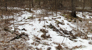
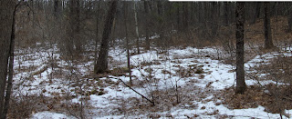
Years of hunting for rock piles and stone mounds have shown the value of looking along brooks with the expectation that when the brook "meets the sky" is where one finds things. That is not quite right. The highest point where the water flows and the land is barely a fold, is a good place to explore but so are other places further downstream with good vistas, or where there is an advantageous outcrop, or a side brook comes in. In any case, this means that following a brook uphill is a good hunting strategy.
You want to find new stone mounds in Massachusetts? Find a tributary of a good sized river, and locate its highest and smallest secondary tributaries. Follow the brook up to that high point and you will almost surely find mounds- at least after trying two or three brooks in undisturbed areas. The reason I believe this is that I find them that way so often. For an extra bonus find a place that is between two watersheds with several brooks starting and flowing in different directions.
To be sure, it would be wrong to only follow a "brook strategy". There are sites high on hills in some towns. But overall, brooks are a good start. Coming up, a case in point (SW Mt Pisgah):
Wednesday, February 28, 2018
Sunday, February 25, 2018
Monday, February 19, 2018
LiDar and Seniors and Stones
Recent posts at Waking Up On Turtle Island about a Ceremonial Stone Landscape remnant soon to disappear for a proposed Senior Assisted Living Facility near my childhood home:
(2012 LiDar and inset of where I often park at the Stop & Shop)
Thursday, February 15, 2018
Brief visit to Ponkapaug
The woods across the highway from Blue Hill have always looked interesting. Full of big dark red rocks of the -so called- Wamsutta formation (see here). I took a brief spin over there last weekend and found very little worth mentioning. But you see little hints.
With the tips of these three rocks lined up, and two of them having artificial-looking notches, could they be intended to line up?
With the tips of these three rocks lined up, and two of them having artificial-looking notches, could they be intended to line up?
They do:
A horned owl?
Is this something?
Something going on here:
Small sites on Shepley Hill Groton
I owe an explanation for sites D, E, and F on Shepley Hill. At D there were a few piles on the ridge and on the western side.
view back to previous
view back to previous
At E there were a few suggestive things next to the wetland. This short stretch of wall particularly caught my eye:
Finally at F, more low worn-out piles on a western facing slope. Probably just marker piles, but perhaps also a small "box" or two:
Friday, February 09, 2018
Next brook north of Nod Brook in Groton
I had a wonderful walk last weekend, not for the piles I found so much as for the gratification of predicting where I would find them. In general if you go up a valley and it curves around - say - to the right: when you are on the right hand side of the valley and look back down, you see the sides of the valley. But if you are on the left side of the valley and look back down, sometimes you can see out to the sky. Those are the first places I look to find rectangular mounds.
I followed such a valley up the brook that is one brook north of the Nod Brook. It curved around the northern end of Shepley Hill and came up along the hill's eastern side.
I followed such a valley up the brook that is one brook north of the Nod Brook. It curved around the northern end of Shepley Hill and came up along the hill's eastern side.
As I came around the hill and saw a kind of "knoll" at A, I had that feeling of expectation: "Ah! That is where I would expect to find rock piles". And there was nothing but empty snow under the pine trees. But then...wait there are several rocks poking up in one place, could that be a rock pile?
I look back down the valley at it. I am not sure. I look up the valley at it:
And I almost see an 'F' (with the large rock at the bottom). And then notice another rock, off there in the distance along the line of the photo. A closer look at it:
Son of gun there is a rock pile beyond it.
So I thought that the value to the world of such a small find might not be that great. But it is good to confirm the instinct to follow a valley and consider places with a good view back down.
Proceeding to the far side of the "knoll" where a different branch of the brook was coming uphill (at B), what is that?
Another cluster of rocks sticking out above the snow, all in a cluster, with few other rocks around.
I think this is a big old thing. Probably not too visible at any time of year. I don't know how to describe it but the pile is in more than one lobe. I see a channel dividing it. You can see it better here:
This nice structure was a little uphill from here:
Then when I really got to the top of the valley (at C), I saw a traditional shape - there low to the ground and left of center, highlighted by the snow:
Closeup:
A crescent that, to me, seems a degenerate version of a rectangle with a hollow. A typical shape, but reduced to a suggestion. Another view:
Nearby, a little stretch of wall (a bit like the "rock pile" at A):
There I am, walking along with mixed thoughts, a pain in the back, and a theme of climbing the valley. Here we are at the top:
I saw a few other things on the way back to my car, circling around the southern end of the hill.
Monday, February 05, 2018
Not Guatemala (NH)
You might’ve seen the stories about a "Sprawling Maya network discovered under
Guatemala jungle." You probably never heard anything about this hilltop in New Hampshire:
ARS photos (2018)
Sunday, February 04, 2018
Under the power lines on Baralock Hill, Groton
I had tried to get north of this hill via a road that turned out to be "private" and closed off. So I went around to where I spotted a conservation land entrance, which took me up the west side of Baralock hill. Just walking along: what is that?
Not the clearest "mound", could it be modern or ancient? Lots of reasons why it is ancient: Two things jump out: the consistent small sized rocks involved and this faint hollow with most of the visible quartz at its edge. Also the fine view over water:
Let's get a close up of that faint depression (where there is slightly more snow on the pile).
The only obvious quartz is around this depression, on the far and near edges:
That was pleasant and unexpected.
So I continued up the power lines and came across another old smeared out rock piled. (I joke that this is exactly what a 2 thousand year old Sythian burial looks like from Siberia. I guess they had a lot of colonial field clearing going on back then.) Here are some views of the second mound:
Reasonably rectangular (actually I think the Sythian burials are more circular)
A view back toward the first pile (under the single pole)
Even though all smeared out, you can see how this was a substantial taller structure:
Both this and the first mound have views down the hill to the south over the marsh - which is a headwater of Unkety Brook. I note that the setting of this second upper mound, is in a bit of a natural amphitheater. That might be relevant:
I would not make such a big deal of these piles but they were all I found that day. My original plan had me walking past lots of sandy paces.
Subscribe to:
Posts
(
Atom
)


