Friday, July 24, 2009
Going on Vacation through Aug. 15
Due to a company forced week-long shutdown, I am getting ready to take three entire weeks off. First time in a while that I had such a long vacation. Down on the cape there are fewer rocks piles and poorer internet connections, so blogging will be sporadic to non-existent for several weeks.
Split-wedged rocks from Texas Str. Westford
 Went out with FFC (something getting rarer and rarer) and he managed to find things even where there was nothing to see - along the conservation land trail that starts near the end of Texas Rd in southern Westford. A bunch of quarrying debris, had been tidied up with wedges put into the splits:
 I joked with FFC , that creating an opening to the underworld then leaving it un-plugged, must have been regarded by the Indians as exactly the kind of stupidity you could expect from the Anglos.
The main rock pile site at Poplar Hill - Pelham, NH
With reference to the sites I began reporting here and continued with here, let me describe the largest site on Polar Hill, shown as the large blue outline on the map. As I think about it, most rock pile sites in northern and eastern Middlesex County (north and northwest of Boston) are located on the northern slopes of hills. [I can say this with some knowledge.] By contrast the sites in western Middlesex County (west of Boston) are most common on the western slopes of hills. I have thought that the western facing sites were chosen because of their view of Mt. Wachusett. If that is correct, then these northern facing sites should be facing some prominent mountain to the north or northwest. Maybe Manadnock?
I was heading back to the car, well pleased with the site I found earlier, when I passed a slope and told myself to just have a closer look in case there was something inconspicuous. Like this: [There were Indian Pipes (shown in the foreground) all over the place last weekend.] As I looked around I saw rock piles scattered across the slope:
 Some of them were roughly in line with each other and with boulders, and the spacing between piles looked to be slightly systematic. Where earlier I had found a common spacing of about 13 paces, here the spacings was more on the order of 8 and 16 paces. Here is a closeup of the pile in the foreground of the above photo. Note the vertical "fin" and the adjacent piece of quartz:
 Note also the way the other rocks in the pile are carefully placed. This photo gives a good feel for the dappled light and the pile spacing:
 Like the earlier site, some of these piles contained a single larger rock on their perimeter (perhaps shaped like a Manitou stone, I could not tell):
 In my own theory about rock piles, the characteristics of even spacing and their placement along lines, rules out their being burials. I try to avoid reporting locations for burial sites and I do not think this is a burial site. Hence, in this theory, Manitou stones are not direct evidence of burials. They would have to be more general purpose indicators of something ceremonial.
Lots of low inconspicuous piles: But as I proceeded down the slope, the piles got bigger...
 ...and bigger, till they were 4 feet high and perched upon boulders.
 This change in height was pretty much a systematic change as I went further downhill. To me this suggests they are getting further and further from the viewer and needed to be larger to be seen. On the other hand, there were several distinct clusters of piles so these might just be different sites at different places on the hill. This pile shape is beginning to remind me of the "dumpling" shape of piles from southern Mass. and Rhode Island.
 The piles looked good in the ferns and it was refreshing to see them.
  But I began to get overloaded and ready to call it a day. One last charming group:
 Look at the three in a row on the right hand side of this picture:
 Finally a little video:
I was heading back to the car, well pleased with the site I found earlier, when I passed a slope and told myself to just have a closer look in case there was something inconspicuous. Like this:
 [There were Indian Pipes (shown in the foreground) all over the place last weekend.] As I looked around I saw rock piles scattered across the slope:
 Some of them were roughly in line with each other and with boulders, and the spacing between piles looked to be slightly systematic. Where earlier I had found a common spacing of about 13 paces, here the spacings was more on the order of 8 and 16 paces. Here is a closeup of the pile in the foreground of the above photo. Note the vertical "fin" and the adjacent piece of quartz:
 Note also the way the other rocks in the pile are carefully placed. This photo gives a good feel for the dappled light and the pile spacing:
 Like the earlier site, some of these piles contained a single larger rock on their perimeter (perhaps shaped like a Manitou stone, I could not tell):
 In my own theory about rock piles, the characteristics of even spacing and their placement along lines, rules out their being burials. I try to avoid reporting locations for burial sites and I do not think this is a burial site. Hence, in this theory, Manitou stones are not direct evidence of burials. They would have to be more general purpose indicators of something ceremonial.
Lots of low inconspicuous piles:
 But as I proceeded down the slope, the piles got bigger...
 ...and bigger, till they were 4 feet high and perched upon boulders.
 This change in height was pretty much a systematic change as I went further downhill. To me this suggests they are getting further and further from the viewer and needed to be larger to be seen. On the other hand, there were several distinct clusters of piles so these might just be different sites at different places on the hill. This pile shape is beginning to remind me of the "dumpling" shape of piles from southern Mass. and Rhode Island.
 The piles looked good in the ferns and it was refreshing to see them.
  But I began to get overloaded and ready to call it a day. One last charming group:
 Look at the three in a row on the right hand side of this picture:
 Finally a little video:
Thursday, July 23, 2009
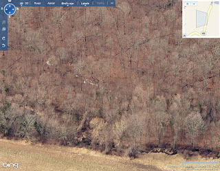
Aerial Photos at Bing.com
Tim MacSweeney writes:
I got some good views of that white quartz stone row and many others down in Woodbridge by changing the direction of the view. I thought you might like to see it: (click here)
The bird's eye view changes the image to various photos taken in perhaps early spring when there are no leaves on the trees. Maybe this might show some stone features at some locations you've been looking at...
The bird's eye view changes the image to various photos taken in perhaps early spring when there are no leaves on the trees. Maybe this might show some stone features at some locations you've been looking at...
Here is the picture:
 I'll have to poke around at Bing.
Serpentine Walls - From Norman Muller
Norman writes:
On Larry’s blog (http://larryharrop.com/blog), he has posted photos and a video of a new site in West Greenwich, RI, which contains a serpent wall that looks a lot like the one in Montville, CT, that I wrote about (see http://rock-piles.com/souterrain/). The video clip gives one a good idea of the unusual wall and its serpentine configuration. Note also the Manitou stone leaning against a stone pile, found in the general vicinity. (see http://rock-piles.com/manitou).
On Larry’s blog (http://larryharrop.com/blog), he has posted photos and a video of a new site in West Greenwich, RI, which contains a serpent wall that looks a lot like the one in Montville, CT, that I wrote about (see http://rock-piles.com/souterrain/). The video clip gives one a good idea of the unusual wall and its serpentine configuration. Note also the Manitou stone leaning against a stone pile, found in the general vicinity. (see http://rock-piles.com/manitou).
Wednesday, July 22, 2009
A word about diffusion and stone structures in New England
I was criticized for being anti diffusion. I actually believe that lots of European ideas got to America by boat. I also suspect information and people also went the other way across the Atlantic. I do not trust the genetic analysis comparing Indians with Europeans because the standard results appear to change every time archaeological orthodoxy shifts. Same seems to be true of linguistic analysis. They are interesting techniques but I don't trust the results.
That being said, I think that any Europeans that got here before Columbus rapidly became American Indians or died out. So the story of our landscape again becomes a story about how the Indians modified it. Although the European contacts do become part of that history and although it is fascinating how conventional academics ignore the obvious evidence for European diffusion, still in the end there is not that much more to it. I do believe that ideas developed independently here in America. So you still have to understand the stone structures and try to find out about who built them and why.
That being said, I think that any Europeans that got here before Columbus rapidly became American Indians or died out. So the story of our landscape again becomes a story about how the Indians modified it. Although the European contacts do become part of that history and although it is fascinating how conventional academics ignore the obvious evidence for European diffusion, still in the end there is not that much more to it. I do believe that ideas developed independently here in America. So you still have to understand the stone structures and try to find out about who built them and why.
Tuesday, July 21, 2009
At the top of a gully on Poplar Hill
Referring to the small outline to the left of the "P" in Poplar (introduced yesterday here):
 I walked west from the road and was on my way back up the gully, a natural place to look for rock piles, when I saw a first one.
 I looked around and there were more. Probably 15 or so and certain characteristics of the piles caught my attention.
The topography was more or less flat with wetness starting around the edges. Coming from downstream, I had just stepped up onto the slightly higher level area when I saw the first pile. The location reminds me of a site I saw at Regis College (scroll down)
These piles were a bit different from what I am used to. They seemed slightly rectangular. You can judge for yourself if you think these have straight sides.


 If they are not rectangular, perhaps they have two straight sides, like a "V".
Anyway, I also noticed a few with particularly larger rocks on their perimeter:

 Most of the piles were built on the ground but a couple were up on support boulders, or maybe this one was just taller than the others:
 It had a nice piece of quartz in it, unlike most of the other piles, and I take this seriously since this was the most prominent pile.
 And I was busy trying to notice what I could, perhaps thinking about the piles with single larger rocks, and noticed an example that was shaped like the classic manitou stone:
 I found another example in the next pile over:
 And there were a couple of other more questionable examples:
 (also see video at end)
Finally, the most recognizable characteristic of these piles was their even spacing. I counted out ~13 paces between several of them and ~19 paces between others. Later in the same walk I found another site that seemed to include pile spacings of about 13 paces so that is worth keeping an eye out for.
To summarize:
- Top of a gully, about 20 ground piles.
- Rectangular or V shaped (from above) piles
- Occasional quartz
- Occasional prominent stones, some shaped like manitou stones
- Some even spacing of around 13 paces
Oxford Alabama Mound destruction continues.
Here is an update from the AP.
Note the comments referring to stone mounds "found up and down the Eastern Seaboard" and to North Smithfield. Sad as these cases are, you can see the public awareness changing a little bit at a time.
Update (Norman Muller writes):
Harry Holstein, an archaeologist in Alabama, sent me a copy of the archaeological report on the stone mound prepared by the State Archaeologist in response to one prepared by the firm of Goodwyn, Mills and Cawood, a private archaeological firm. This firm found no evidence that the stone mound was of archaeological importance, and that it could be destroyed by developers for Walmart.
In a June 4, 2009 follow-up letter by Stacye Hathorn, the Alabama State Archaeologist, to Findley Frazer of Goodwyn, Mills and Cawood, she said that site 1Ca636 (the Oxford Mound) was eligible for the National Register of Historic Places because it satisfied criteria A and C, the former being an example of an historic traditional practice or event in the Native American community.
In that same letter she wrote the following: “This stone mound was clearly constructed by Native Americans and is probably associated with the Davis Farm Complex which is already considered one of Alabama’s Places in Peril. Perhaps, the limited excavations didn’t reveal an abundance of associated artifacts but we hold that the mound itself is an artifact (my emphasis). On a national scale, these sites are beginning to be recognized for their importance. Recently, the Turner Falls Site in Massachusetts was determined for inclusion in the National Register of Historic places by the Keeper. Turner Falls is similar to 1Ca636 in that it is dry stone construction with few associated artifacts. Regarding Turner Falls the National Register cited: ‘The site is central to the cosmology of the combined tribes and the traditions that have marked Native American sacred and ceremonial practices for numerous generations.’ ‘Located in the middle of the Connecticut River region of New England, this site also possesses the potential to yield important information about traditional Native American practices, beliefs and sacred rituals.’”
Monday, July 20, 2009
Poplar Hill - Pelham NH
 This picture is in the Robert S. Peabody Museum of Archeology in Andover, MA (click here for their website) and a reproduction is sitting un-ceremoniously on the way out of the cafeteria at Philips Health Care - which now occupies the same location - the "bend in the river" archeological site reported on by Barbara Luedtke. The hill on the horizon, just to the right of the central pine tree in the picture and with a distinctive profile, is called Poplar Hill. I have visited it before [click here] and see it most mornings driving in to work.
I needed to go into work over the weekend and decided to take another walk at Poplar Hill afterwards. The hill is divided into two parts by a road:
Last time I explored some of the hill to the right on the eastern side, so I thought it would be fun to explore the hill to the left on the western side. As you can see from the blue outlines, I found two new sites [and apparently changed my guess about the location of the small site on the eastern hill]. So I will report on the new sites.Update: This erratic is on top of the western hill. Quite a landmark.

Sunday, July 19, 2009

Friday, July 17, 2009

Thursday, July 16, 2009
Creative Destruction - Chelmsford Trails Maintenance
Went for a walk east of the Russell Millpond in Chelmsford Town Forest. Only rock piles I saw were in a flat area and I could not make out whether they were rock dumps from field clearing or were something else. All we noticed the trail maintenance people had used rocks from a convenient nearby rockpile to re-enforce their little water management, flow control structures:
[ DAMN! Could not insert photo here. So much for buying an additional 10 gig of space on Picasa! Now I gotta go hassle with that. Sorry for the continued delay in photo postings.]
OK, we're back: Try to figure this one out. Several other low piles were in the area:
 And an interesting structure or perhaps just a random rock dump.
 Which follows something like this pattern front to back:
[ DAMN! Could not insert photo here. So much for buying an additional 10 gig of space on Picasa! Now I gotta go hassle with that. Sorry for the continued delay in photo postings.]
OK, we're back:
 Try to figure this one out. Several other low piles were in the area:
 And an interesting structure or perhaps just a random rock dump.
 Which follows something like this pattern front to back:
Sunday, July 12, 2009
Work stopped on removal of Oxford AL mound
" UA report on Oxford stone mound released; City councilwoman: Company told workers not to remove mound :"
I cannot figure out why they keep calling it a stone mound. Nor why they say the mound has not yet been disturbed. The photo shows a mixed stone and earth mound already dug into.
I cannot figure out why they keep calling it a stone mound. Nor why they say the mound has not yet been disturbed. The photo shows a mixed stone and earth mound already dug into.
Friday, July 10, 2009

West VA rock piles / cairns / stone mounds
Norman Muller writes:

 [ IT WAS AT THIS POINT THAT I GOT A MESSAGE FROM BLOGGER THAT I COULD NO LONGER UPLOAD PHOTOS, BECAUSE I REACHED A QUOTA....NOW WHAT!?]
[I] have been in close contact with an archaeologist friend in West Virginia, who visited a site near Charleston, WV, and photographed a number of impressive cairns spread out over two terraces on a mountain slope.

 [ IT WAS AT THIS POINT THAT I GOT A MESSAGE FROM BLOGGER THAT I COULD NO LONGER UPLOAD PHOTOS, BECAUSE I REACHED A QUOTA....NOW WHAT!?]
Another small collection of rock piles on Nobscott Hill
Went back to comb the northern edges of the hill, behind the apartment complexes. Found another example of a house foundation built on the steepest part of an outcrop - a peculiar way to place a house. There is another to the east on the way up to Tippling Rock. But anyway, there was one tumble of loose rocks other than the house foundation that caught my attention. I had trouble photo-ing it under the dappled light:
 There was a bit of a ring of stones at one end of the larger tumble.
  Here is another view with the ring visible on the right.

 There was a bit of a ring of stones at one end of the larger tumble.
  Here is another view with the ring visible on the right.
Wausau County Rock Piles
Found this photo online and got permission from Todd Fonstad to reproduce it. He writes:
Just give credit to the Carl Guell slide collection at the University of Wisconsin Oshkosh. ...Unfortunately, many of his aerial photos are somewhat blurry due to air speed.
 I wanted to comment that I do not think these are all farmer's field clearing. Click to magnify and look at the curved line of small rock piles leading up to the larger one in the upper left of the photo. That looks too geometric to be the result of random rock disposal. More generally, I am fascinated with this photo and what it suggests.
Thursday, July 09, 2009
Small Rock Pile Sites along Sawmill Brook - Estabrook Woods Concord, MA
 It is rare that I get to add a new "dot" to my map of sites in Concord but I was lucky to find a couple of small rock pile sites along the brook that empties from Hutchins Pond, northeast of Punkatasset Hill in my hometown, Concord.
It was raining and overcast so the pictures, without flash, are blurry.
 And, while I am making excuses, the piles were not much to look at either. Buried in the moss, hidden in the ferns.
 Or, with trees growing up from them.
 In one place I saw a bit of quartz but the photo was too blurred to show it. Still, seeing new rock piles in Concord is a treat. I found them in two groups along what is labeled Sawmill Brook on the topo map. This didn't used to all be woods. I saw a small stone bridge, so once there were roads through here.
 I doubt anyone has been here recently.
Subscribe to:
Posts
(
Atom
)
