Wednesday, May 31, 2017
Monday, May 29, 2017
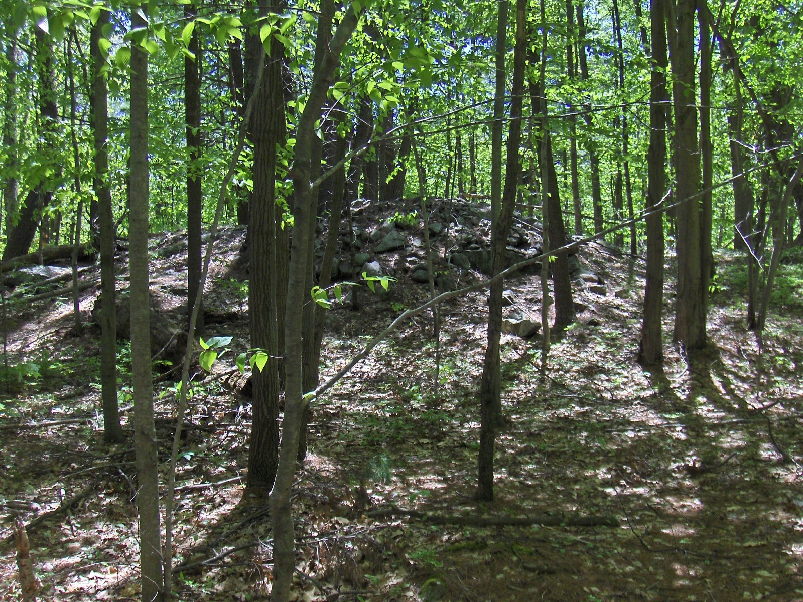
Mt Elam Leominster
There has always been too much to post from this place. For example:


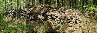

The ladies from Harvard:

 and of course much more.


Tuesday, May 23, 2017
Sunsh Nipamu (west of Kinkiyungkwallak)
"sunś nipámu (‘marker
stone’ Narragansett, Harris and Robinson 2015:140, viz. sunś,
‘stone,’ nipawu ‘stand up,’ Mohegan Nation 2004:100, 83)

"This
free-standing Sunsh Nipamu (west of Kinkiyungkwallak)
is just under 2m tall,
over 1/3m wide, with ancient lichens covering its top."
A Quantitative Assessment of Stone Relics in a Western Massachusetts Town
copyright 2017, Rolf Cachat-Schilling (2016 Massachusetts Archaeological Society)
Sunday, May 21, 2017
Failure to Publish - by Tommy Hudson
Tommy Hudson replies to the POOF article [from previous]:
In his article on "The People of One Fire" site, Mr. Thornton says "....I can tell you first hand, it is impossible to protect Native American heritage sites, if you don't know where they are." I assume he includes sites such as the Track Rock Gap stone piles, where he brought it to national attention on a TV show, and published it on the internet. It could be very difficult to protect Native American heritage sites, particularly if he knows where they are.
I will say up front, that we should be careful about making site locations public. We should verify the intentions of the people who want to know. That said, Mr. Thornton's point is not the point. Unfortunately for him, he is only chipping away at the tip of the iceberg. The main reason why no information is published, is that there is no information to publish! Those whom I call 'The High Priests of Southeastern Archaeology', and that would include Kelly, Larson, et al, dug up hundreds of sites and never reported on them. It is the Achilles Heel of the archaeological community. The information on the vast majority of sites was never published. You're lucky if there are a few notes or photographs. It's more fun to dig them up than to write about them!
As an example, go to the Alabama website that is linked through this article. Go to "Archaeological Survey in Talladega County, Alabama." You will find that Mr. Lewis H. Larson Jr. excavated 33 sites and wrote a grand total of 4 pages on all that work. This is the same Lewis Larson that did years of excavations at Etowah Mounds. In the early Sixties, my Father and I took a Greyhound bus to Cartersville, Georgia, then a taxi out to the Etowah Mounds site to witness those excavations. It's a nationally famous site. To date, I have found 3 brief articles written by Mr. Lewis H. Larson Jr. on the Etowah Mound excavations. There's a grand total of 17 pages. Huh? Is that right, you say? That's right. A good portion of the site is destroyed and most of that information is gone, but hey, we got 17 pages. Sad.
If you or I were to go to an archaeological site and dig it up, take away artifacts, never publish information on what you found, and only talk about the site amongst your peers, we would be called looters. That's right folks, and the American people paid for it.
So why doesn't the archaeological community police it's own, like other professions? The reason is called "peer fear." They would rather be known as cowards and hypocrites than to be shunned by their peers. It's really that simple. People that hold themselves out as professional and ethical archaeologists, and had vocally complained to me, in private, about the problem, sat silent when I brought the issue up in very public meetings. The verbiage "cowards and hypocrites" is appropriate.
The latest crop who hold themselves out as professional and ethical archaeologists, is still out there. Most of what is published these days, if it's published at all, is archaeological 'boiler plate', such as the ancient forest was this, and the ancient weather was that, soils, streams, blah, blah, blah. Cut and paste. Not an original thought to be had. Spare me.
Don't get me wrong, there is some very good work being done out there. Jannie (pronounced 'Yannie') Loubser comes to mind. There are archaeologists who actually put some thought and research into what they publish.
Why not withhold 10% to 20% of public money until a report is issued. A report that has been peer reviewed, and most importantly, reviewed by members of the informed public and Indians themselves?
So, while Mr. Thornton, is arguing with the system about his lack of access to site information, he failed to notice that oft mentioned "elephant in the room" that's still there. Let's look a little closer. There is no information. The issue is ''failure to publish.''
U of Alabama Archeology Map Website - and words of wisdom from "People of One Fire"
Richard Thornton writes [here] about the U of Alabama Website.
[He continues:]
Why is this so important? I can tell you first hand. It is impossible to protect Native American heritage sites, if you don’t know where they are. Look what happened in Oxford, Alabama!
To access the web site, click this URL link: Alabama Office of Archaeological Research
[He continues:]
Why is this so important? I can tell you first hand. It is impossible to protect Native American heritage sites, if you don’t know where they are. Look what happened in Oxford, Alabama!
Saturday, May 20, 2017

Thursday, May 18, 2017
A curious chronology - ceremony on a modern causeways built over older stone walls


So here we are looking at a causeway built across the area, rising above the lower ditch (on the left) and slightly above the original ground level - as visible in a bit of older stone wall.

Note that in the foreground on top of the causeway
is a ceremonial structure.

View in the other direction (you can just see another pile):


Wednesday, May 17, 2017
Another rectangular mound with hollow made from soil?
I thought these were rare [last weekend] but maybe they are just hard to see:
 There is a rock pile at the back corner but you can see a square of raised soil with a depression in the middle.

Monday, May 15, 2017

Lithic Finds


Sunday, May 14, 2017

Thursday, May 11, 2017
Phillips Hill, Hudson MA


As fine an example as you could hope to see:


There was also another lobe of land just to the east that also looked out over the pond. It seemed too well visited to spend time examining but this did catch my eye:

Then I headed sharply uphill, skirting the end of a road and found marker piles all the way up the slope and some older looking "rectangles" on the flat summit/shoulder looking out to the south.
For example on the slope:


Further up (note some of the details here: the larger rock, the cashew shaped smaller rock, the swirl of schist):


We are still climbing the hill and the trail goes right through the rock piles. [How many hikers have ever noticed? Zero?]

This is much more than I expected to squeeze out of a small bit of the landscape - so near Hudson and at the edge of an area - around Marlboro and Southboro (and all those "boros") - that is a real dead zone for finding rock piles. Let me digress to say that this dead zone may be due to the fact that the towns around Marlboro are sandy. But I wonder about a cultural divide that separates Nashoba and Upper Middlesex (my version of Thoreau's Estabrook) from the towns around Holliston, Hopkinton, and Upton (we could call them the "tons") where the ceremonial stonework could be seen as different. I am not sure if it is different enough to support the idea of a cultural divide. I am not sure the Nashua and Merrimack watersheds are different from the watersheds that drain more to the south, nor if these differences are a projection; nor if those places have enough uniformity within themselves to be characterized this way. Yet I think there is a difference.
Ah! Here we are on the southern end of the summit:


Again


Monday, May 08, 2017
Rectangular Mound with a Hollow - made from Dirt
A rectangular donut with water in the hole:
 It is rare to see something made of dirt and gravel without obvious larger stones, in a place where plenty of larger stones were available. From Danforth Falls Cons. Land in Hudson, as far south as you can get.

Sunday, May 07, 2017
Thursday, May 04, 2017
Odds and Ends from Nutting Rd Groton
Right at the end of the drive-able road, the actual hill of "Smoke Hill" had a site on its southern side. A few things from there. Perhaps a collapsed niche:
 A crossed pair, with light coming through the hole:
 Here, something was built into the outcrop:

 Here is a photo, that may be clearer. It is some kind of pathway or channel. I guess it might re-direct overflow back into the main stream:


(something with a couple of hollows)

Oh yeah, did I forget to post this video? It is pretty interesting - from the low wet area between Smoke Hill and Rocky Hill:

This was no more than a hundred yards from the bowl with gurgling cascades I reported the other day.
Subscribe to:
Posts
(
Atom
)
