Monday, May 31, 2010
Saturday, May 29, 2010
V-Shaped Piles - Revisiting the grid at Patch Hill Boxborough
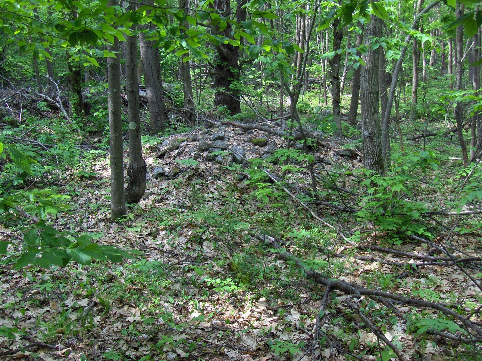
There are about thirty little rock piles on about 1/4 acre of land enclosed by stone walls. They give the impression of being in lines and evenly spaced: Some of them are nicely built up like "biscuits":
 Many of them have a "V" or triangular shape, as seen from above (including the "biscuit" above). Look carefully at the how each of these has two straight sides coming together in a corner:

 And this nice one with a piece of quartz at the tip of the "V":
 One more:
  A very deliberate shape.
I wanted to know if there was some viewing location for the "grid". Actually there seemed to be two distinct clusters of piles: one visible from a low knoll, the others visible from a messy central area: One more look, re-enforces the "grid" idea:

 Some of them are nicely built up like "biscuits":
 Many of them have a "V" or triangular shape, as seen from above (including the "biscuit" above). Look carefully at the how each of these has two straight sides coming together in a corner:

 And this nice one with a piece of quartz at the tip of the "V":
 One more:
  A very deliberate shape.
I wanted to know if there was some viewing location for the "grid". Actually there seemed to be two distinct clusters of piles: one visible from a low knoll, the others visible from a messy central area:
 One more look, re-enforces the "grid" idea:
The Mixing of Ceremonial Features with Agricultural Ones at Patch Hilll - Boxborough MA
I think one of the responsibilities we have in the rock pile community is providing a context for the frequently observed mixing of ceremonial stone structures with more mundane and perhaps more modern stone structures. The mixing is evident at Patch Hill in Boxborough where you see:
There is a wall with an added on "crib" filled with smaller rocks which we think of as a colonial field clearing practice. This "crib" is substantial and limited to the part of the wall that goes over a slight bump: Immediately behind it is a rectangular "pavement" with quartz symmetrically placed.
 The quartz is in the middle of a straight side of the pavement, facing the "crib".
 FFC poked around a bit further back and found a second "pavement".
 This one was more pentagonal. It also had quartz.
 Thank god for the sharp eyes of FFC. He spots broken glass in the pile.
 He spots a horeshoe.
 Looks like a European "Good Luck" charm. That provides a possible context for the mixing of ceremonial and agricultural.
The Patch Family were colonists who left England as religious dissenters. Might we suppose that they formed relationships with the Native Americans in an interaction that did not make it into the history books and writings of the clergymen? Or could we suppose they at least hired Indian laborers who adopted some European superstitions and played out the superstitions in some of the work they were doing? Or could we suppose that the Patch family did none of these things yet left stone structures in place that they found there; just as the bump the wall is going over might have been a mound that was left in place?
Near the corner of a different wall:
- Relationships between piles and wall
- Enclosed remaindered land sections with rock pile grid
- Piles built as bulges and corners in the stone walls
There is a wall with an added on "crib" filled with smaller rocks which we think of as a colonial field clearing practice. This "crib" is substantial and limited to the part of the wall that goes over a slight bump:
 Immediately behind it is a rectangular "pavement" with quartz symmetrically placed.
 The quartz is in the middle of a straight side of the pavement, facing the "crib".
 FFC poked around a bit further back and found a second "pavement".
 This one was more pentagonal. It also had quartz.
 Thank god for the sharp eyes of FFC. He spots broken glass in the pile.
 He spots a horeshoe.
 Looks like a European "Good Luck" charm. That provides a possible context for the mixing of ceremonial and agricultural.
The Patch Family were colonists who left England as religious dissenters. Might we suppose that they formed relationships with the Native Americans in an interaction that did not make it into the history books and writings of the clergymen? Or could we suppose they at least hired Indian laborers who adopted some European superstitions and played out the superstitions in some of the work they were doing? Or could we suppose that the Patch family did none of these things yet left stone structures in place that they found there; just as the bump the wall is going over might have been a mound that was left in place?
Near the corner of a different wall:

Friday, May 28, 2010
Peachtree Mound in NC and site complexity
Reading articles like this makes me think of rock pile sites. The hypothesis is that large complex rock pile sites may not be so different (at least conceptually) from what we read about in the article.
Interesting comment about rectangular versus circular houses. And this:
"The largest mound at the Peachtree site was oval shaped and faced due south. It was about 25-30 feet high when new. Oval shaped mounds were typical of the Lamar Culture, which was directly ancestral to the modern day Creek Indians. Mounds built by the Kusa-Creeks of this cultural period were oval, but faced west. Such is the case of the nearby mound in the Nacoochee Valley. Okonee Creek mounds were pentagonal. Tamatli-Creek and Apalachee mounds did face south, but were extremely linear. Only the Kowite–Creeks (Mountain Lion People) of the area east of Franklin, NC and south of Asheville, were known to have built oval shaped mounds facing south. During the 1700s, the Kowete or Coweta in English also had many towns in the Colony of Georgia."
And one more little goody, in reference to a published history of the Cherokee that had them not building mounds: "... The project was simply an example of extremely sloppy and ethically questionable scholarship."
Such comments resonate.
Thursday, May 27, 2010
Church Rock, Westminster, MA - round and oval mounds part 2
With reference to part 1 here, there was a nice large rock pile next to the road at "A" and another a bit deeper into the woods at "B". In each case there were smaller satellite piles.
At "A", two views:
 Here is another view with one of two or three nearby smaller piles in the foreground:
 Saw some Lady Slippers on the way to the next example at "B":
 What a treat seeing this in the background:
 Getting personal for a moment (and getting a view from slightly above by standing on the stone wall):
 As usual, I was in too much of a hurry to look around carefully. Looking at the pictures I took afterwards, there seem to have been some related stones I should have payed more attention to:
 So what is the point? Just that these piles at "A" and "B" are a different style from what I am used to. I recall seeing smaller oval piles out in western Sterling (see here), and from a reader (I forget who but it was also west of Wachusett) some larger oval ones. Also perhaps similar to these smaller domed oval piles from Ashby (also a western sort of place). Maybe there is some sense to this. We'll keep our eyes open. I have occasion to drive back out west this weekend and maybe get another walk in out there.
At "A", two views:

 Here is another view with one of two or three nearby smaller piles in the foreground:
 Saw some Lady Slippers on the way to the next example at "B":
 What a treat seeing this in the background:
 Getting personal for a moment (and getting a view from slightly above by standing on the stone wall):
 As usual, I was in too much of a hurry to look around carefully. Looking at the pictures I took afterwards, there seem to have been some related stones I should have payed more attention to:
 So what is the point? Just that these piles at "A" and "B" are a different style from what I am used to. I recall seeing smaller oval piles out in western Sterling (see here), and from a reader (I forget who but it was also west of Wachusett) some larger oval ones. Also perhaps similar to these smaller domed oval piles from Ashby (also a western sort of place). Maybe there is some sense to this. We'll keep our eyes open. I have occasion to drive back out west this weekend and maybe get another walk in out there.
Church Rock, Westminster MA - round and oval mounds, part 1
 Decided to go on a slightly longer drive into an area I haven't explored yet, a wee bit west of Mt. Wachusett in Westminster, MA. Angling out from the mountain in a solstice-y sort of direction (in this case northwest) the topo map shows some wonderful little swamps, hills, and lakes in what I have come to think of as ideal rock pile hunting topography. Sure enough there were rock piles everywhere I looked. But I never even got to the place I was aiming for, west of the water below "C" on the map. I also picked this area because the name "Church Rock" was a bit intriguing. I tried looking this up on Google but haven't found anything about the place or how it got named.
A quick overview of the exploration: I planned to park on Bolton Rd at the edge of the "State Reservation" and sneak back across West Princeton Rd onto what looked like private property. But there were some rock piles near the road already at "A",
 including small boulder supported piles around an old house foundation with at least one biggish mound. And a few feet further south on the other side of the road: a circular domed mound. So then we parked and walked in as planned (it was not posted "No Tresspassing") and, a few feet in, we came to a funny wall configuration with another circular domed mound. What with one thing and another, I figure these round domed piles to be a different manifestation from the rectangular mounds with hollows I have been finding and describing all this spring. After that we headed downhill, westward, to the water and started to try to go around the north side. But all the blown down trees from an ice storm a couple winters ago make walking in the woods almost impossible in some places. Luckily there was a series of dirt-bike/ATV trails all through there and they brought us part of the way. With the downed trees and my wife along it was just too difficult getting through the downed trees. I was about to turn back when I spotted two other rock piles at "C". Who knows what else is in there? I forgot about trying to get to Church Rock and forgot about trying to get around the lake, and we headed back out. I was well satisfied with the day.
Here is the house foundation just next to West Princeton road at "A":
 There were twenty or so low piles, mostly covered with downed trees. Already hard going even only a few yards from the car. Is it worth looking at more of them?
  They seemed to get bigger the further from the road.
 Some had quartz:
 Closer:
 Here is the scene:
 There is no way I am going to accept someone telling me field clearing produced lots of small piles like this (a detail of the nearer pile in the above):
 Or this:
 Or this:
 So I am going to tell you, there was a bigger mound in there
 and I spent a moment wondering about if it was from field clearing. Divided into two pieces, perhaps someone built a road through it? Huh? From field clearing but surrounded by these little piles? No way. But also "no way" the people living where the house foundation above would not have been intimate with these rock piles. That is where the context of Indians living in post colonial settings is so important. Maybe they were pretending to be "Scotts-Irish". Do I have to keep talking about this?
The fact that there are rock piles everywhere (out here in Westminster and more generally in Eastern MA) is really at odds with most peoples experience or lack of experience with this topic. It is stunning that these things are so common and, so invisible. It is as if you mention seeing crows everywhere to someone who says: "what is a crow" and denies ever seeing one. [Actually that is a reasonable analogy because most people are oblivious to common birds. Digressing completely: ornithology is not so different from rock pile hunting. It is mostly typology and amateurs. Except we do not have experts to dissect rock piles or study their genetics. Also bird watching has a large group of enthusiasts, publications, the Audubon Society, etc.]
That was location "A". Too bad there was no good place to park, I should have kept going downhill rather than just scratching the surface.
Other mounds a' comin'
Recall I am looking to see what other kinds of mid-to-large sized stone mounds are out there besides rectangular piles with hollows. As previews, here is a fine mound from a few miles northwest of Wachusett:
 [No hollows, circular, and mounded up pretty high]
Here is an example from Patch Hill in Boxborough:
 [Yes rectangular but no hollows. Also a deliberate use of quartz adds another characteristic.]
 [No hollows, circular, and mounded up pretty high]
Here is an example from Patch Hill in Boxborough:
 [Yes rectangular but no hollows. Also a deliberate use of quartz adds another characteristic.]
Wednesday, May 26, 2010
Clear Lake/Wiccopee Rock Piles - From Rob Buchanan
I was back in the Clear Lake/Wiccopee area on Sunday morning. My plan was to look for the elusive second Clear Lake chamber. There was a ruin marked the orienteering map which I had been to in the distant past and based on my dim memory, decided to explore.
I found the ruin but it was not clear if the original structure was a chamber. To me, the size, shape, entrance and the way that earth was piled on the side walls suggest that the ruin might have been a chamber.

About 200m N of the ruin there were two cairns marked on the map so I decided to look at them before heading back. The two cairns were actually part of a group of rock piles. I continued W from these cairns and came across more and more cairns. By the time I decided to leave I had found about 12 - 15 cairns in a 400m x 100m area situated in a saddle between a low hill to the SE and a high ridge/hill to the NW. The cairns showed a surprising variety in size and construction.


There were also a number of interesting stone walls in the area. The walls ran across the saddle and did not form any grids or enclosures.


There are three more cairns marked on the orienteering map (up the slope of the high ridge) so that I feel that there could be many more cairns in the area as it appears that only the most significant cairns were mapped.
Although the woods and bugs are thick, and it’s a hike to get there I think I'll go back to do some more exploring.
Tuesday, May 25, 2010
"Field Cairns: A Study of 18th and 19th Century Field Clearing Techniques -- A Homogeneous Study and Analysis." by Dan Leary
Reprinted, with permission, from the NEARA Journal, Vol XXII, No. 3&4 (around 1980 or 1981). Thanks to Norman for finding the article and scanning it. Clicking on individual images should make them readable.


Subscribe to:
Posts
(
Atom
)
