Friday, May 31, 2019
Wednesday, May 29, 2019
Linear feature with a "dimple"
Next to Rt 16 on Uxbridge/Douglas border, south of the road there is a brook with a linear stone feature next to it.
 At the near end, a rock covered with rust. [As if it had been wrapped in leather.]
 A dimple in the mid-section:


Strange walls around there:

Sunday, May 26, 2019
From a treasure hunter
Quoted with permission from an email (my emphasis added):
No artifacts found , not looking for them , I would think they are deep in the ground . We did not know this was 100% indian until a few weeks ago. I only go after treasures not Indian sites. Its just this site is so big and has a lot going on with it and no one knows about it. This week I will talk to the right people to make sure they know about it then I am done. Can't make money from investigating Indians so I am back to looking for Civil War... WE keep busy with TV, radio, book and movie deals. Indian sites do not sell on TV , I guess too many of them . Treasure hunts are big now so this is what we do.
Ya you can quote me, If I saw a arrow head I would keep it safe for future people to see but NO WAY would I dig up a grave for artifacts, sick to think of it.
Saturday, May 25, 2019
Thursday, May 23, 2019
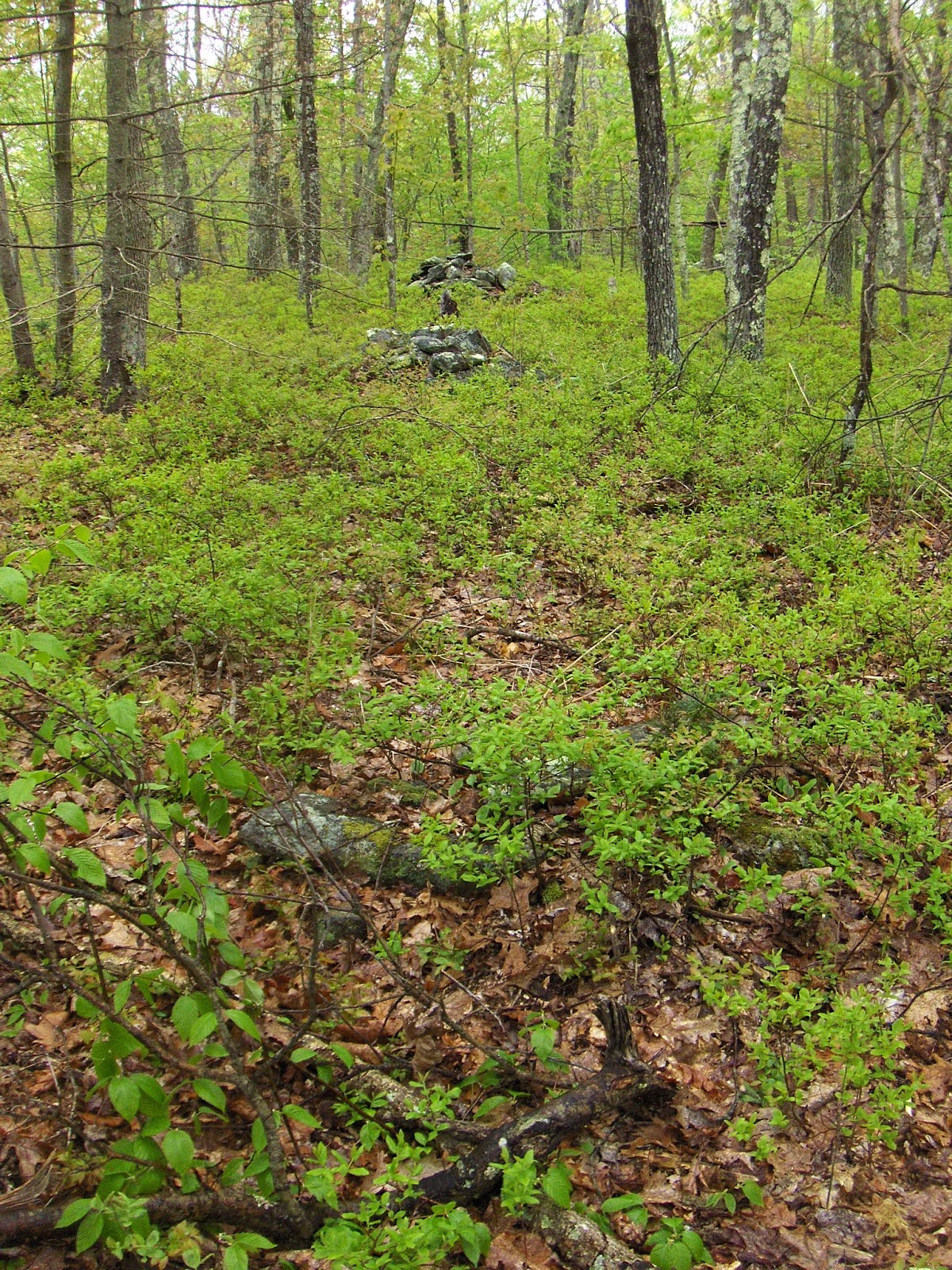
A possible calender site on the Uxbridge/Douglas border


On the hilltop was a magnificent sight.

A boulder with marker piles, marching along beside it...

… and extending to all the places where shadows from the boulder would be cast by a western sun or moon. Of course this is my fantasy construction for what is going on at this site. I do believe it is a type of sundial but it will take someone more systematic than me to go out and see where the shadows fall. Here are other views:


 A few other things on the northwest shoulder:


I doubt many will visit this site but it is highly recommended for students of astronomy, because it is a natural location with regular features, waiting to be measured.
Wednesday, May 22, 2019
Friday, May 17, 2019

Sunday, May 12, 2019
Variations in design of rectangular burial mounds
Variations
in design of rectangular mounds with hollows. Styles A-D may be tall and up to
40 feet across; styles E-H are usually low to the ground and less than ~15 feet
across. Style I is a crescent shape, usually ~20 feet across.


 Type C Hopping Brook:
 Type D Callahan State Park
 Type D Blood Rd
 Type E Ashby West


 Type G Falulah
 Type G Hobbs Brook, Lincoln
 Type I Nod Brook:
 Type I Scott Rd


This is a shape classification not a rock pile classification - because large or small examples of the same shape may be different types of rock pile.
Examples:
Examples:
Type A Blood Hill

Type A Franklin

Type A Northborough

Type B Hopping Brook


Type F Woodbridge Rd

Type F Apron Hill


A split in the Rock Pile community
I had an article rejected by NEARA journal editors. It was about the hypothesis that the larger mounds with central 'hollow' are burial mounds - a simple New England expression of a nationwide mound culture. The article included a typology that I find useful (see next post).
The reason NEARA editors gave for refusing to publish this hypothesis is that it is too sensitive a topic. The NEARA organization would not want to be an accomplice to vandalism or violations of the NAGPRA laws. In fact, this policy does protect the organization from an existential threat (i.e. burial mounds vandalized because of scientific reporting, here in New England) but there is a genuine scientific downside:
I heard something about climate change denial that seems to apply to rock piles: you cannot suppress the truth just because it is uncomfortable to you. Yet NEARA is implementing a policy of censorship. It is ironic, since many of the recent directions and priorities of organization derive from an open sharing of information, including from this blog. I think it is inappropriate for a "research" society to muzzle its researchers, especially for fear of condemnation.
And I would be glad to hear what readers think, both about the particulars of allowing mention of burial into discussions of rock piles; and about the more general topic of NEARA endorsing a politics of secrecy in its role as a research organization. At a minimum, the organization should stop pretending to be about public "education".
The reason NEARA editors gave for refusing to publish this hypothesis is that it is too sensitive a topic. The NEARA organization would not want to be an accomplice to vandalism or violations of the NAGPRA laws. In fact, this policy does protect the organization from an existential threat (i.e. burial mounds vandalized because of scientific reporting, here in New England) but there is a genuine scientific downside:
- It excludes comparison of New England stone mounds with earthen and stone mounds outside New England. For example, mounds in Ohio, central America, and Egypt are all thought of in terms of burial. To deny this role for New England stone mounds implies they are outside that spectrum.
- It obliges limited or superficial explanation of features: for example alignments and proximity to water. What is left after excluding basic assumptions, like death and the underworld, may not be worth much.
- Ultimately it leads to ignoring what may be the most important piles at a particular site. Lacking any coherent interpretation the burial mounds remain invisible, all the more likely to be abused by passersby.
In the end, I cannot see how burial mounds or sites that are funerary can possibly be protected without divulging their function. How can they be properly "protected" if the sites are lied about? Also how will it work if "secret" topics are to be discussed on field trips and in conferences but not in publication? How is that going to work?
I heard something about climate change denial that seems to apply to rock piles: you cannot suppress the truth just because it is uncomfortable to you. Yet NEARA is implementing a policy of censorship. It is ironic, since many of the recent directions and priorities of organization derive from an open sharing of information, including from this blog. I think it is inappropriate for a "research" society to muzzle its researchers, especially for fear of condemnation.
And I would be glad to hear what readers think, both about the particulars of allowing mention of burial into discussions of rock piles; and about the more general topic of NEARA endorsing a politics of secrecy in its role as a research organization. At a minimum, the organization should stop pretending to be about public "education".
Thursday, May 02, 2019

Wednesday, May 01, 2019
Ceremonial Stone Landscape Presentation (Orange MA)

Hosted by Sarah Kohler
Thursday, May 2nd @ 4:30PM
Stage on Main
17 South Main Street, Orange, MA 01364
Sarah Kohler will be giving a presentation to the New Salem Historical Commission (of which she is a member) of her ongoing research. This is a posted, open public meeting & anyone is welcome to attend.
The presentation will focus on the artistic, pragmatic, mathematical & astronomical components, contained within the precolonial stone constructs and stone landscapes that are extant in our region.
A series of large, framed photographs, showing details of her subject will be on view in the gallery during the presentation.

Subscribe to:
Posts
(
Atom
)
