Thursday, August 31, 2006
R.I.P.
Jim Mavor passed away on Tuesday. He was a great man and we are all in his debt. There will be a memorial service at the Woods Hole Town Hall on Saturday Sept. 2 at 2:00 PM.
 I chatted with Jim Mavor on July 4th. [Click here]
 I chatted with Jim Mavor on July 4th. [Click here]
Wednesday, August 30, 2006
From a project on The Gravelly Landscape of Montana
[Click here]
H. Site Type Summary
The following prehistoric site types have been identified on the forest in the Gravelly Landscape:
|
|
|
|
|
|
|
|
|
|
|
|
More about the Smoking Place, from "Indian Country Today"
[Click here]
...The tribe expressed outrage and disbelief at recent vandalism to rock cairns at The Smoking Place, a sacred site to the tribe. One rock cairn was dismantled and the rocks scattered. Two other cairns where altered and rebuilt. 'These cairns are extremely sacred to the Nez Perce people, they are spiritual to use,' said Samuel N. Penney, chairman of the tribal executive committee....
...The tribe expressed outrage and disbelief at recent vandalism to rock cairns at The Smoking Place, a sacred site to the tribe. One rock cairn was dismantled and the rocks scattered. Two other cairns where altered and rebuilt. 'These cairns are extremely sacred to the Nez Perce people, they are spiritual to use,' said Samuel N. Penney, chairman of the tribal executive committee....
From "Indian Country today"
[Click here]
...The tribe expressed outrage and disbelief at recent vandalism to rock cairns at The Smoking Place, a sacred site to the tribe. One rock cairn was dismantled and the rocks scattered. Two other cairns where altered and rebuilt. 'These cairns are extremely sacred to the Nez Perce people, they are spiritual to use,' said Samuel N. Penney, chairman of the tribal executive committee....
...The tribe expressed outrage and disbelief at recent vandalism to rock cairns at The Smoking Place, a sacred site to the tribe. One rock cairn was dismantled and the rocks scattered. Two other cairns where altered and rebuilt. 'These cairns are extremely sacred to the Nez Perce people, they are spiritual to use,' said Samuel N. Penney, chairman of the tribal executive committee....
Idaho Statutes
TITLE 27CEMETERIES AND CREMATORIUMS
CHAPTER 5
PROTECTION OF GRAVES
27-501. DEFINITIONS. For the purposes of sections 27-501
through 27-504, Idaho Code:
(1) "Cairn" means a heap of stones or other material
piled up as a memorial or monument to the dead.
(2) "Grave" means an excavation for burial of a human
body.
(3) "Indian tribe" means any Idaho Indian tribe
recognized by the Secretary of the Interior.
(4) "Professional archaeologist" means a person who has
extensive formal training and experience in systematic,
scientific archaeology.
27-503.  PERMITTED ACTS -- NOTICE. (1) If action is
necessary to protect the burial site from forseeable
[foreseeable] destruction and upon prior notification
to the director of the state historical society and
to the appropriate Indian tribe in the vicinity of
the intended action if the cairn or grave contains
remains of an Indian, a professional archaeologist may
excavate a cairn or grave and remove material objects
and human remains for subsequent reinterment
following scientific study. Reinterment shall be under
the supervision of the appropriate Indian tribe if the
cairn or grave contained remains of an Indian.
(2)  Except as provided in subsection (1) of this
section, any proposed excavation by a professional
archaeologist of a native Indian cairn or grave shall
be initiated only after prior written notification to
the director of the state historical society and with
prior written consent of the appropriate Indian tribe
in the vicinity of the intended action. Failure of a
tribe to respond to a request for permission within
sixty (60) days of its mailing by certified mail,
return receipt requested, shall be deemed consent.
All material objects and human remains removed during
such an excavation shall, following scientific study, be
reinterred at the archaeologist's expense under the
supervision of the Indian tribe.
(3)  In order to determine the appropriate Indian
tribe under this section and section 27-502, Idaho Code,
a professional archaeologist or other person shall consult
with the director of the state historical society who shall
designate the appropriate tribe.
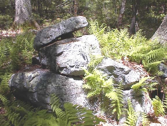
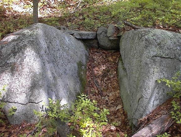
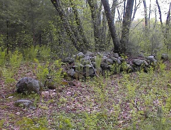
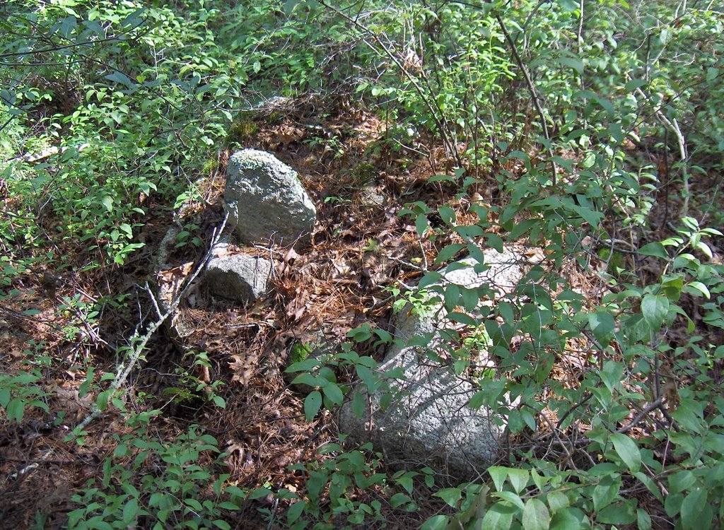
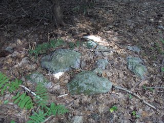
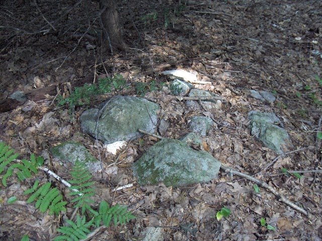
Two small sites in Bedford, MA (from Journals)
It is hard to imagine someone going to the bother of locating this place on foot simply to destroy the two piles there. So I might as well give some directions. It might be worth it just to know that -yes- there are a couple of rock pile sites in Bedford. I wrote:
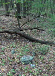
... a place in Bedford I have been meaning to try to get to - a woodland east of Spring Street. Driving south off of Rt 4 is a turn onto Spring Steet and, continuing, you pass Middlesex Community College and continue along and pass a lake on your right and then there is a "Campus Parking Lot" just before the first brick building of the VA (is it?). Parking in that lot I went east into the woods along a yellow spot trail and then a blue spot trail, down across two brooks and into a low lying area where I explored a bit looking for rock piles. The first brook had a beautiful little waterfall and some baby trout - a surprise in Bedford. So down in this low area, and not someplace I can describe the location of exactly, was one split-wedged rock and one sort of turtle effigy: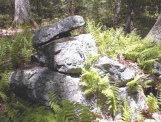
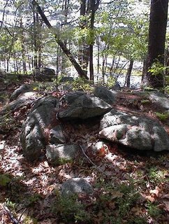
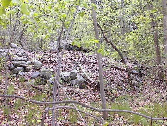
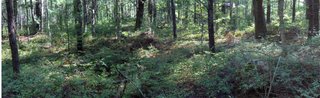
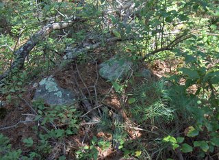
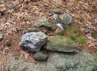
 Look carefully you'll notice a second rock on the back of the "turtle". But of course no self respecting turtle would appear without something on its back. That was all I found and I headed uphill to come out at XXX. Just near the path, I stumbled on some subtle piles which, as I examined them, I decided might be graves. Here is one:
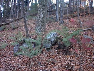
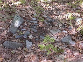 Can't remember what this is a picture of but it is from the same vicininty.
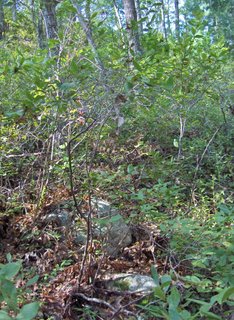
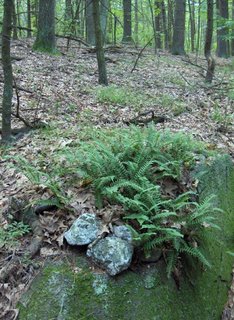
... a place in Bedford I have been meaning to try to get to - a woodland east of Spring Street. Driving south off of Rt 4 is a turn onto Spring Steet and, continuing, you pass Middlesex Community College and continue along and pass a lake on your right and then there is a "Campus Parking Lot" just before the first brick building of the VA (is it?). Parking in that lot I went east into the woods along a yellow spot trail and then a blue spot trail, down across two brooks and into a low lying area where I explored a bit looking for rock piles. The first brook had a beautiful little waterfall and some baby trout - a surprise in Bedford. So down in this low area, and not someplace I can describe the location of exactly, was one split-wedged rock and one sort of turtle effigy:
 Look carefully you'll notice a second rock on the back of the "turtle". But of course no self respecting turtle would appear without something on its back. That was all I found and I headed uphill to come out at XXX. Just near the path, I stumbled on some subtle piles which, as I examined them, I decided might be graves. Here is one:
 Can't remember what this is a picture of but it is from the same vicininty.
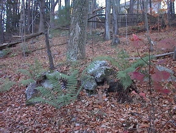
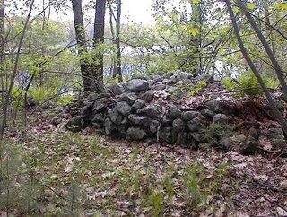
Prayer Seats by Rt 3 in Billerica, MA
From Journals:
I had occasion to drive up Rt 3 to go to a job interview yesterday and I saw, to my dismay, that there are still a couple of stretches of woods along there where I have not been. In particular south of Treble Cove Rd on the east side of Rt 3 there is a thin stretch of woods. Well there was not much along there but there was a little: these knobs of outcrop by the highway had a couple maybe four little prayer seats which I could still make out. Also there was one place where the outcrop had obviously been quarried and piles of broken rock around the spot indicated someone had cleaned up a bit afterwards. And someone made a little outline from some of the fragments. Since this was just next to one of the "seats" I am thinking at the time after the quarrying, this place was still in use for ceremonies.
 Here are a couple of seats. The third (and maybe even fourth) were more decrepit and are not illustrated. I did notice that each of them faced in opposite directions - sort of North, South, East, and West. This was just an impression. One interesting thing was comparing the coloring of the quarried rock with the ones in these pictures. These here were all uniformly gray, but sitting near some quarried rock which was still brown. The same brown color shows up a little further south in the stone walls and arrangements which appear to be a kind-of 19th century waste water treatement plant ruin, just north of the current waste water treatment facilities. So here is a place where a little color-based date ordering is possible.
By the way, if you drive north on Rt 3, look at the cut through the rocks on the right just before Treble Cove Rd. It is nice to know that there are prayer seats up there, remnants of what was there before.
I had occasion to drive up Rt 3 to go to a job interview yesterday and I saw, to my dismay, that there are still a couple of stretches of woods along there where I have not been. In particular south of Treble Cove Rd on the east side of Rt 3 there is a thin stretch of woods. Well there was not much along there but there was a little: these knobs of outcrop by the highway had a couple maybe four little prayer seats which I could still make out. Also there was one place where the outcrop had obviously been quarried and piles of broken rock around the spot indicated someone had cleaned up a bit afterwards. And someone made a little outline from some of the fragments. Since this was just next to one of the "seats" I am thinking at the time after the quarrying, this place was still in use for ceremonies.

 Here are a couple of seats. The third (and maybe even fourth) were more decrepit and are not illustrated. I did notice that each of them faced in opposite directions - sort of North, South, East, and West. This was just an impression. One interesting thing was comparing the coloring of the quarried rock with the ones in these pictures. These here were all uniformly gray, but sitting near some quarried rock which was still brown. The same brown color shows up a little further south in the stone walls and arrangements which appear to be a kind-of 19th century waste water treatement plant ruin, just north of the current waste water treatment facilities. So here is a place where a little color-based date ordering is possible.
By the way, if you drive north on Rt 3, look at the cut through the rocks on the right just before Treble Cove Rd. It is nice to know that there are prayer seats up there, remnants of what was there before.
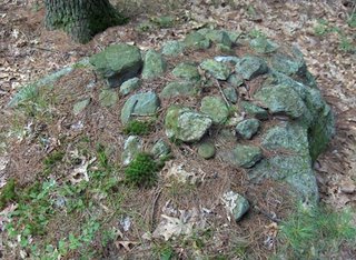
Tuesday, August 29, 2006

Pond in Carlisle
Thanks to Jim P for calling attention to the diagonal courses of rocks (from lower left to upper right) in his recent pictures from Miner Farm. Now we can see the same construction principle in other piles. These ones are from the eastern bank of an artificial pond in southern Carlisle, and seem very similar to the one Jim P was discussing.
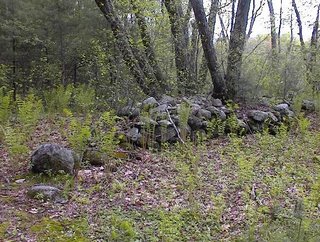 [Not sure what that larger rock in the foreground is for.]
 In Journals from 2005 I wrote:
I have always thought these types of piles could well be from careful field clearing. TF disagrees completely. We argued about how these could have been made. The last one, for example, which is built up around an outcrop has no ramp up it. But a key point here is that these piles contain the material I expect was extracted from a field - the full distribution of sizes is present and the argument seems to be about whether anyone would have bothered to make a tidy pile when all that was needed was to clear a field. I do not find either alternative compelling. It is worth noticing that there is a prominent pointed rock out in the middle of the pond there and that, from this last pile, the direction from pile to rock was that of the summer solstice sunset. This kind of potentially ceremonial relationship argues against field clearing. But a field was cleared to make the pile. Another point worth making is that there are plenty of awfully well built stone walls. Why did they bother with that?
Flat Stones In Three Miner Piles
by JimP
In this post I want to compare the construction of three piles from Bob Miner's farm. The first is a Larry Harrop photo of the platform cairn. The second is a new photo from Bob Miner of his large pile. The third is Larry's photo of the turtle cairn.
I've highlighted several of the flat stones in each pile that all appear to serve a supporting function. The idea here is to perhaps get some idea of the methodology that may have gone into their construction. I'm really not trying to prove any points. Consider this nothing more than an exercise that I did for myself that I thought I'd share with all of you.
Beneath each image I've included links to the photos without the highlights for comparison purposes.
 http://www.menotomyjournal.com/flat/orig1.jpg
 http://www.menotomyjournal.com/flat/orig3.jpg
 http://www.menotomyjournal.com/flat/orig2.jpg
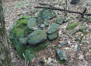
Monday, August 28, 2006
Miner Pile -- A Closer Look (Plus Split-Wedge)
by JimP
Bob Miner sent me the following photo that gives us a closer look at the huge pile.
Bob Miner sent me the following photo that gives us a closer look at the huge pile.


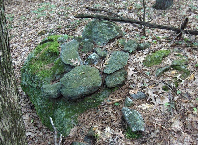
Field Clearing? This one is from Carlisle, MA
 Compare this to the one shown below in Jim P's most recent post.
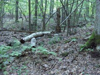
The last kettle holes of summer - off Firetower Rd. Falmouoth, MA
Last weekend was my last chance to go out exploring in Falmouth, so I decided to explore more carefully around Firetower Rd. The firetower itself is located on the highest hilltop in Falmouth and, in the past, I have found sites in a number of the kettle holes around the hill.
First I went into a hollow directly northeast of the tower and found one pile at the foot of the southern slope. This is consistent with the pattern of pile placement I described earlier in "Anatomy of a Kettle Hole". At this site the pattern was reduced to just one pile. Here is the canonical picture:
 In a saddle between this hole and other low places, there was one rock-on-rock. Both it and the first pile were quite deeply buried and nearly invisible. That was all I found northeast of the tower, and the patch of woods there is not as big as I thought. I soon found myself up against the backs of houses.
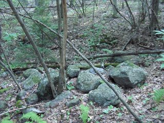
I climbed back uphill to where I parked on Firetower Rd. and proceded north a little ways until there were two trail openings leading west and downhill. I took one and it led back into some of the kettle hole sites I found before. So I headed out in a direction I had not been from there and got over into a slightly different part of the woods, when I spotted a rock pile across a shallow valley, almost a small kettle hole.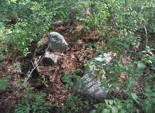 This pile was built up on a boulder sitting on the northeast side of the hollow. There were several other boulder piles there. Like this one:
 The view is to the west across the hollow. Notice the quartz vein in the support boulder. And there was another one, looking out over the hollow:
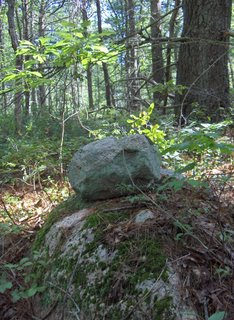 These piles looking out to the west and southwest over the hollow, each supported on a boulder, and each having one larger rock with smaller ones in support, these characteristics are not part of the standard kettle hole pattern. So perhaps this is a different kind of site. The presence of one large rock with smaller ones, all on a boulder is reminiscent of effigies, although there were no well defined symmetries. The piles are like a number of animals (perhaps turtles) looking out west and southwest over the hollow.
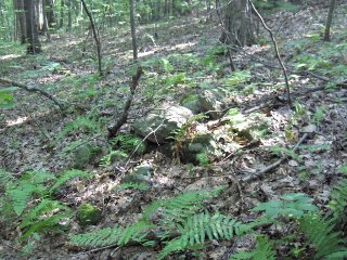
But then down in the bottom of the hole, at the southern edge of the hole was one larger domed ground pile - not on a support boulder:
 The view here is to the northeast back towards the piles just shown. The larger ground pile is in the foreground on the right. This pile is more the standard pattern, of a ground pile on the southern side of the bottom.
As I explored around the hole I found other piles on the eastern side of the hole, and a couple up on the rim of the western side. This one, for example, is right next to the conservation land trail (a "White Spot Trail") but I missed it when I walked by the first time.
 So here the piles surround the hollow. Most are supported on boulders. One ground pile appears at the southern end of the bottom of the hole.
In one way this is a standard kettle hole site: the (only) pile at the bottom is a ground pile but all the piles up on the slopes or at the rim of the hollow are piles built on support boulders.
First I went into a hollow directly northeast of the tower and found one pile at the foot of the southern slope. This is consistent with the pattern of pile placement I described earlier in "Anatomy of a Kettle Hole". At this site the pattern was reduced to just one pile. Here is the canonical picture:
 In a saddle between this hole and other low places, there was one rock-on-rock. Both it and the first pile were quite deeply buried and nearly invisible. That was all I found northeast of the tower, and the patch of woods there is not as big as I thought. I soon found myself up against the backs of houses.
I climbed back uphill to where I parked on Firetower Rd. and proceded north a little ways until there were two trail openings leading west and downhill. I took one and it led back into some of the kettle hole sites I found before. So I headed out in a direction I had not been from there and got over into a slightly different part of the woods, when I spotted a rock pile across a shallow valley, almost a small kettle hole.
 This pile was built up on a boulder sitting on the northeast side of the hollow. There were several other boulder piles there. Like this one:
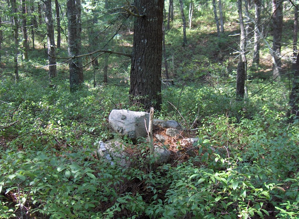 The view is to the west across the hollow. Notice the quartz vein in the support boulder. And there was another one, looking out over the hollow:
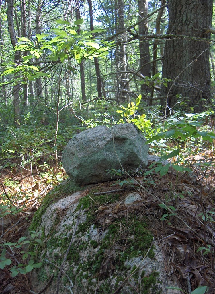 These piles looking out to the west and southwest over the hollow, each supported on a boulder, and each having one larger rock with smaller ones in support, these characteristics are not part of the standard kettle hole pattern. So perhaps this is a different kind of site. The presence of one large rock with smaller ones, all on a boulder is reminiscent of effigies, although there were no well defined symmetries. The piles are like a number of animals (perhaps turtles) looking out west and southwest over the hollow.
But then down in the bottom of the hole, at the southern edge of the hole was one larger domed ground pile - not on a support boulder:
 The view here is to the northeast back towards the piles just shown. The larger ground pile is in the foreground on the right. This pile is more the standard pattern, of a ground pile on the southern side of the bottom.
As I explored around the hole I found other piles on the eastern side of the hole, and a couple up on the rim of the western side. This one, for example, is right next to the conservation land trail (a "White Spot Trail") but I missed it when I walked by the first time.
 So here the piles surround the hollow. Most are supported on boulders. One ground pile appears at the southern end of the bottom of the hole.
In one way this is a standard kettle hole site: the (only) pile at the bottom is a ground pile but all the piles up on the slopes or at the rim of the hollow are piles built on support boulders.
Saturday, August 26, 2006
New Photo From Bob Miner
by JimP Another photo from Bob Miner's farm. This pile almost definitely got this large from field clearing. Note that it was built in the corner of a field. However, the less-than-haphazard construction leads me to believe that it might have started its life as a ceremonial cairn, much like others found on Bob's property. I would guess Bob's grandfather and the farmers before him likely added to an already existing pile. What do you think?
 Another photo from Bob Miner's farm. This pile almost definitely got this large from field clearing. Note that it was built in the corner of a field. However, the less-than-haphazard construction leads me to believe that it might have started its life as a ceremonial cairn, much like others found on Bob's property. I would guess Bob's grandfather and the farmers before him likely added to an already existing pile. What do you think?
Thursday, August 24, 2006
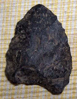
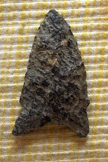
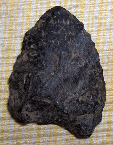
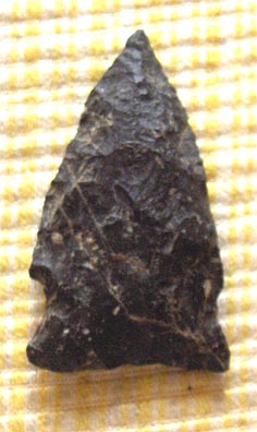
Some Arrowheads from Concord, MA
Except the two late paleo Indian points below, all of these are from within a few hundred yards of the historical marker of previous posts.
Fluted Paleo Indian Points:
A large thick heavy blade, probably not projectile. Has the concave base and flaking style of the earliest artifacts. ~2"
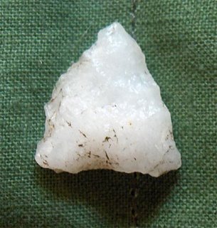
 A classic but tiny fluted point. Made from an unusual chert, ~1/2". Characteristic of late Paleo Indians.
 A small quartz late Paleo Indian point. Almost no flute but the beginning of "ears" or "tangs" at the lower two corners of the triangle. ~1/2". Found near the above. This is called a "Hardaway Dalton" point.
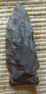
Eared "Brewerton" Points:
A typical eared Brewerton, probably re-sharpened. ~1".
 A "side notched" Brewerton. ~1.3".
A small Brewerton of some other variety. ~0.8".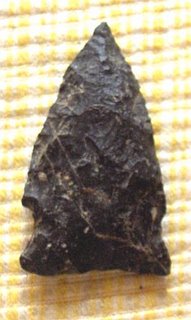 Stemmed "Merrimac" Points:
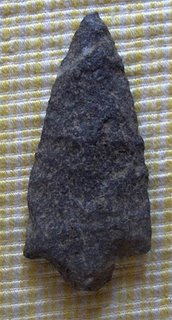
A large classic Stark Point. Made from reasonably soft material. ~2".
Another classic Stark point, but probably not a projectile. Made of Cambridge Blue Argillite. ~2".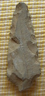
A small Merrimac Point. ~0.8".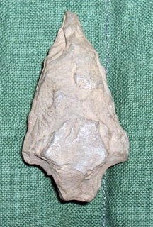
An unusual small stemmed point. ~0.5".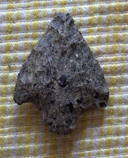
Fluted Paleo Indian Points:
A large thick heavy blade, probably not projectile. Has the concave base and flaking style of the earliest artifacts. ~2"
 A classic but tiny fluted point. Made from an unusual chert, ~1/2". Characteristic of late Paleo Indians.
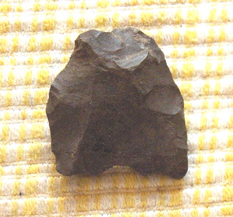 A small quartz late Paleo Indian point. Almost no flute but the beginning of "ears" or "tangs" at the lower two corners of the triangle. ~1/2". Found near the above. This is called a "Hardaway Dalton" point.
Eared "Brewerton" Points:
A typical eared Brewerton, probably re-sharpened. ~1".
 A "side notched" Brewerton. ~1.3".
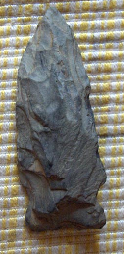
A small Brewerton of some other variety. ~0.8".
 Stemmed "Merrimac" Points:
A large classic Stark Point. Made from reasonably soft material. ~2".

Another classic Stark point, but probably not a projectile. Made of Cambridge Blue Argillite. ~2".

A small Merrimac Point. ~0.8".

An unusual small stemmed point. ~0.5".

More about the cemetery historical marker
I might as well say it here as well as anywhere else that the reason there are these two arrowhead shapes on the stone is because there were two different people who came and left their arrowheads in this spot. Some made their stemmed arrowheads out of materials from east of Concord: back in Cambridge and Saugus and Marblehead and points north along the Atlantic coast. While the others made eared points of materials from the west: Westford, NY and points inland. It appears that the eared points are the descendents of ancestral fluted points of the Clovis and other paleo Indians. I took an early date for a stemmed point (6,000 BC) and a later date for the eared point (3,000 BC) in order to point out the contrast between the paleo Indian story of great game hunters using fluted points and coming over the land versus the story of the stemmed point people who came from the sea. I think Ted Timrek would call them the "Red Paint People" and they were in Concord along with, and over the same time frame, as the descendents of Clovis.
What is interesting and what is, I think, one of the only stories that comes down to us from this pre-history is that these two different peoples - from the sea or from inland - both lived in Concord over many thousands of years where the two different arrowhead styles persisted. The stemmed points got smaller over time and the fluted points became "eared" and then "tanged" and then "notched" but still these basic shapes remained and remained different. In other words these two cultures just did not intermingle. There was no cultural merging over a period of at least 3K years. So that is the story, the two peoples did not get along.
Those are the shapes of the arrowheads from Concord, MA. I guess I could illustrate this, let me go see what I've got. [See following post]
Cairn on Glastonbury Mountain in VT
Norman Muller sent this in as being similar to the one on Sugarloaf Mtn. below.

Searching through "flikr" photo sharing website
Someone puzzles over a recent "cairn" [Click here]
Trailside on Sugarloaf Mountain [Click here]
The way field clearing piles should look [Click here]
Ohlone Trail Rock Pile [Click here]
Don't Build Rock Piles! [Click here]
Arctic Graveyard [Click here]
"Safford Grids" - structures in the desert [Click here]
What's the story here? [Click here]
Trailside on Sugarloaf Mountain [Click here]
The way field clearing piles should look [Click here]
Ohlone Trail Rock Pile [Click here]
Don't Build Rock Piles! [Click here]
Arctic Graveyard [Click here]
"Safford Grids" - structures in the desert [Click here]
What's the story here? [Click here]
Wednesday, August 23, 2006
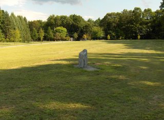
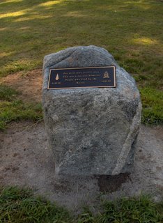
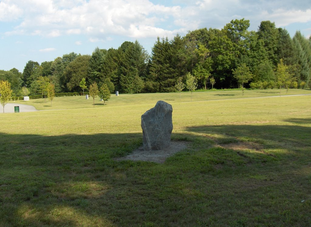
Continuing story of the cemetery marker, bronze plaque, memorial stone
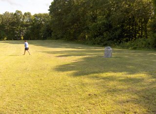
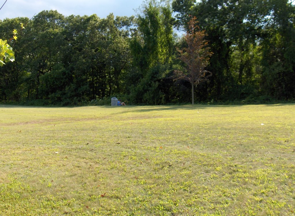
Went out to get some pictures to show you and the story continues: there was someone sitting leaning against the stone as we drove up. As they realized we had driven up nearby they scooted around behind the stone to stay hidden and then, when I approached loudly apologizing for interrupting, a young teenage girl with a bunny rabbit got up and walked away.
 Sorry about that.
 And then as I am getting closer to the rock, I see a small place at the base of the rock where the stone dust has been wetted down and it appears that a dog (or other canine) must have come bye and peed - leaving a message for the other dogs. This is a compliment and not an insult.
 So things already are beginning to live at my rock.
The bronze plaque is placed so you look southwest to read:
"For more than 10,000 years
This was a favorite home to
People who lived by the
Rivers"
On the left is a sketch of stemmed Merrimac point with the caption "6,000 BC" and on the right is one of an eared Brewerton point with the caption "3,000 BC".
 Many arrowheads were found at this location including ones like these and others - fluted points, small points, etc. Everybody came through here.
 As they realized we had driven up nearby they scooted around behind the stone to stay hidden and then, when I approached loudly apologizing for interrupting, a young teenage girl with a bunny rabbit got up and walked away.
 Sorry about that.
 And then as I am getting closer to the rock, I see a small place at the base of the rock where the stone dust has been wetted down and it appears that a dog (or other canine) must have come bye and peed - leaving a message for the other dogs. This is a compliment and not an insult.
 So things already are beginning to live at my rock.
The bronze plaque is placed so you look southwest to read:
This was a favorite home to
People who lived by the
Rivers"
 Many arrowheads were found at this location including ones like these and others - fluted points, small points, etc. Everybody came through here.
Tuesday, August 22, 2006
A little help, please
Just glancing at the topo map of Bolton I am sure most of those little patches of green have rock piles in them. So far, with a couple of exceptions, all the ones I have checked out there do. However there are still a lot more of these green patches and I am thinking I still have a lot of work to do checking each one. Perhaps some reader lives out near Bolton - could you please help? It is so much fun locating sites. You start in on the rest of Bolton and I can get going on the other side of the Nashua River Valley.
Speaking of armchairs and rock piles
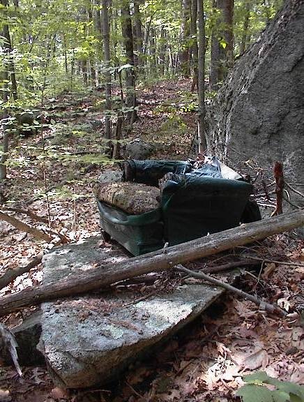 This is not the one I saw in Bolton but is the same sort of thing, from Milford, MA. It is an armchair near a rock pile site. I think it is clear that someone went to a bit of bother to get an armchair out in the woods. Maybe a grandpa wanting to be comfortable got his teenage grandsons to help carry the chair out there. Also it hints that this is a place to sit even if you do not have an armchair.
Gully sites
So the next posts are about two sites found the weekend before going on vacation. Both sites were within 20 yards of where I parked. But these remind me of Snake Meadow Hill (in Westford?) where there was a different gully side site. Of course the Moosehorn site I found with Bruce M. is the ultimate gully-side site. There is a lot of variety but I think these places can be distinguished from marker pile sites: marker pile sites are not gully sites.
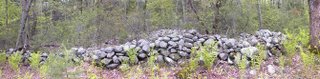
(Second of) Two Gullies in Bolton, MA
[This is from the same morning as the previous gully site in Bolton, to which I am comparing this new site]
...Then I headed over to the XXXX area and tried exploring in from the west side, off one of the small development roads:
 At this second spot I was a few steps into the woods wondering if I should continue. There was no trail where I thought there should be one and the houses were quite nearby. But one step further and I spotted a rock pile at my feet. These piles were all large-rock piles. The piles were clumped together in a very small area of higher ground between two fingers of brook at the very top where the brook began to dive down hill.
 Here is a bit of a view back towards where I first noticed the piles:
 And a couple more examples:
 I do not think these are anything to do with "memorials to fallen warriors". In fact they do not even seem to pertain to the same culture [as for the previous gully site]. These piles are obviously placed at the head of a brook, almost within the brook. The large stones suggest a very different kind of pile and there total dis-shevellement hints at their being quite a lot older. I do not suppose anyone will ever go check out this place?
First of Two Gullies in Bolton
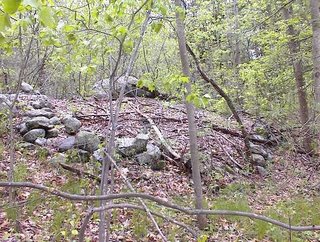
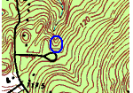
[This is from the last weekend of July]
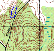
 I planned to walk on the main hill shown in this map fragment but when I parked I thought I should just quickly check downhill on the other side of the road. When I went in there I soon saw a few traces of things and followed them along.
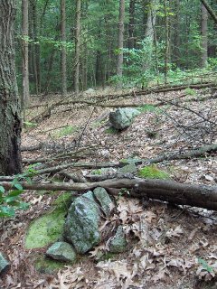 And there was a bonafide pile seeming to incorporate quartz as well as burnt rocks. As I explored further there were other piles like that, with quartz and burnt rocks and I thought "hmm blazed piles...memorials to the dead?".
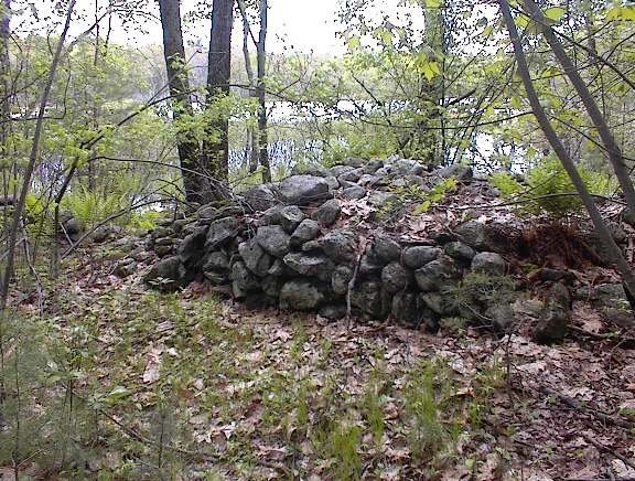
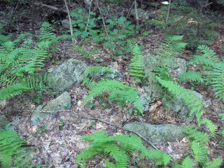
 And I noticed that these piles really used more quartz than I am used to seing in piles. And there was one row of piles where the quartz was quite noticeable, even at a distance. Here are three in a row:
 Here is one of those three:
 Here is another, a pile like no other I have seen:
 Really beautiful! These piles face west over the beginning of a waterway, which here is just a dry gully starting to form in the woods and draining towards the northwest.
Below these quartz piles was a boulder and next to it was a stuffed armchair - fallen over and deteriorating.
 I planned to walk on the main hill shown in this map fragment but when I parked I thought I should just quickly check downhill on the other side of the road. When I went in there I soon saw a few traces of things and followed them along.
 And there was a bonafide pile seeming to incorporate quartz as well as burnt rocks. As I explored further there were other piles like that, with quartz and burnt rocks and I thought "hmm blazed piles...memorials to the dead?".
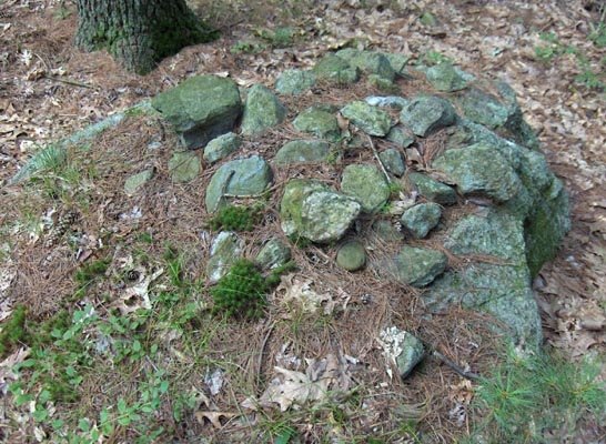
 And I noticed that these piles really used more quartz than I am used to seing in piles. And there was one row of piles where the quartz was quite noticeable, even at a distance. Here are three in a row:
 Here is one of those three:
 Here is another, a pile like no other I have seen:
 Really beautiful! These piles face west over the beginning of a waterway, which here is just a dry gully starting to form in the woods and draining towards the northwest.
Below these quartz piles was a boulder and next to it was a stuffed armchair - fallen over and deteriorating.
Subscribe to:
Posts
(
Atom
)
