
Saturday, June 30, 2018
A mound in the "distance"
Ames Long Pond (eastern side) - Stoughton Memorial Conservation Land

Friday, June 29, 2018
First find in a long time
From the Concord corn fields:
 This is a fine material, called hornfels, or "hornstone". I never found a complete item made from it before. Some other shots.


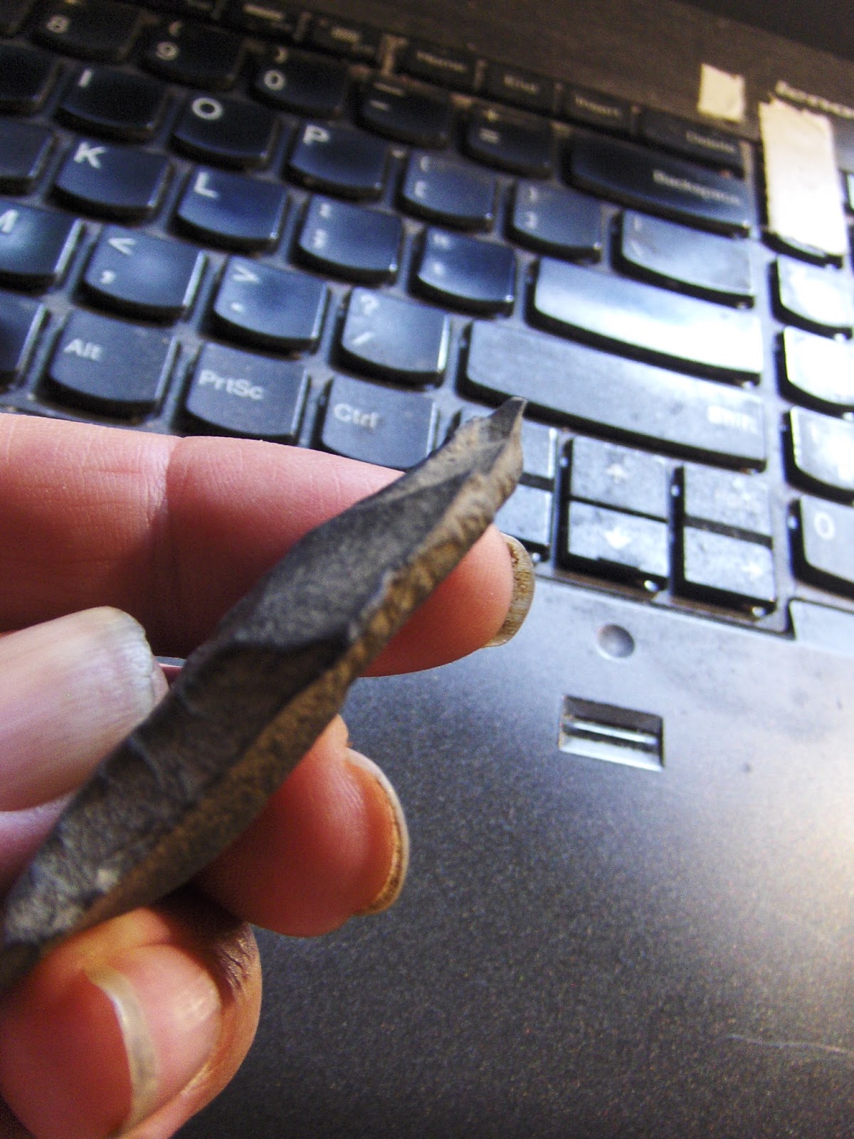

I believe it is a little knife. An unusual shape but undamaged.
SCOTLAND’S LONGEST NEOLITHIC CAIRN
Destroyed by Fowl Watchers

A photograph of the conceal construction erected at Carn Glas cairn. (Picture: NOSAS)
Read more at: https://epeak.info/2018/06/27/scotlands-longest-neolithic-cairn-destroyed-by-fowl-watchers/Wednesday, June 27, 2018

Tuesday, June 26, 2018

Thursday, June 21, 2018
Doug Harris leads a field trip to the Upton Chamber - July 14
(via Peter Anick)
Greetings,
Thanks to all who came to hear Doug Harris speak about indigenous ceremonial stone landscapes of New England during his recent Massachusetts tour. We at the Narragansett Indian Tribal Historic Preservation Trust (NITHPT) are excited to connect with anyone interested in learning to recognize, appreciate, and protect ceremonial stone landscapes.
To that end, starting in June and continuing through October of this year, we will be leading monthly field trips in Upton to show people the Upton Chamber and companion features on top of Pratt Hill in Upton. The trips will be on the second Saturday of each month. The next field trip is slated for July 14th.
Although there is no charge for the field trip, NITHPT is a not-for-profit 501C(3), and charitable donations are welcome to support our mission to protect and preserve ceremonial stone landscapes.
*****************************************************************************************************
What: Field trip to the Upton Chamber and associated ceremonial stone landscape features atop nearby Pratt Hill
When: Saturday July 14th from 1PM to 4PM
Where: Meet at the American Legion parking lot at 15 Milford St, Upton, MA 01568
· From there we will carpool to the Upton Chamber at Heritage Park, and then to the base of Pratt Hill
· We will park at the base of Pratt Hill and walk to the NITHPT land at the top of the hill to see the stone features there
· For elders and handicapped we will can transportation you up the hill if given advanced notice
RSVP: Please send email to nithpt.csl@gmail.com (we can accommodate up to 20 people)
Thursday, June 14, 2018
YouTube "Ancient Civilization" search
Cliff dwelling In Arkansas:
https://www.youtube.com/watch?v=AahCCSqtOl4
Not sure where:
https://www.youtube.com/watch?v=-z7cjaL5_Mo
Added:
https://www.youtube.com/watch?v=xqJQ_AuZ5xE
https://www.youtube.com/watch?v=AahCCSqtOl4
Not sure where:
https://www.youtube.com/watch?v=-z7cjaL5_Mo
Added:
https://www.youtube.com/watch?v=xqJQ_AuZ5xE
Tuesday, June 12, 2018
Monday, June 11, 2018
Headwaters of Canoe River - northernmost Foxborough
This the landform west of King Philips Rock, between Little Canoe River and Canoe River:
 You can get there from East Str, where there is a brook croosing just below the dam of that pond in the middle of the map fragment.
At first I went more or less directly east and found a few low ground pile (upper blue outline):


At first I went more or less directly east and found a few low ground pile (upper blue outline):


Kind of a dull, dark, flat place under yearling pines.
I continued north and east, wanting to get up to whatever high points were available. Somewhere back in those hinterlands (and back down low near the water, that maybe now is "east" Canoe River) was a small site with three or four items:

Otherwise it was dull in there.
My main intention was to explore along the Canoe River and I am sorry I did not stick to that plan and explore along the river to the north.
I eventually circled back to the lower end of the pond and went south along the edge of the high ground following a stone wall. This was a familiar configuration (I was reminded of Howard Rd in Shirley) of wall on bluff over brook - so I continued along southward, trying to keep an eye out for structures on either side of the wall. Not at all surprised to come to a mound. Some views:


At the end of the ridge was a collection of satellite piles that were more or less evenly spaced. A configuration of marker piles next to mound is familiar. Here we are looking back towards the mound which is to the not quite visible to the left in the background:

A little further downstream was another mound.


This one had only one satellite.

Oley Hills - Twenty Years After
(From Norman Muller):
I retured to the Oley Hills site nearly twenty years have left it. It is owned by a new family, and the terrain around the bottom of the hill has changed. Attached is a photo of one of the cairns, how in an open field; before it was in a low growth of shrubs. It is built on a low, flat boulder and must be close to six feet high.


I retured to the Oley Hills site nearly twenty years have left it. It is owned by a new family, and the terrain around the bottom of the hill has changed. Attached is a photo of one of the cairns, how in an open field; before it was in a low growth of shrubs. It is built on a low, flat boulder and must be close to six feet high.
The other photo is of a donation cairn on the ridge top in view of the large platform cairn. Sorry the slide is so dark. Attached is a photo of the platform cairn taken years ago. I wasn't that aware of the connection until today, approaching it from a different direction.


Subscribe to:
Posts
(
Atom
)
