Wednesday, May 31, 2006

More from Larry Harrop - split filled boulders

Larry writes in:

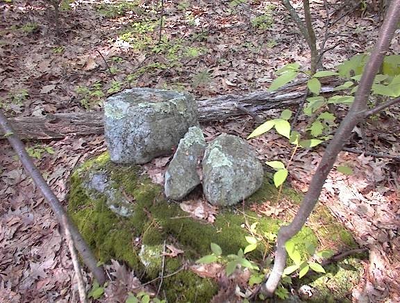
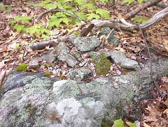
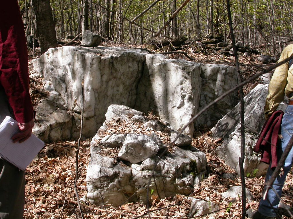
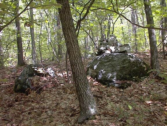
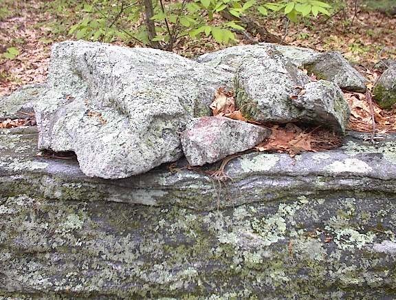
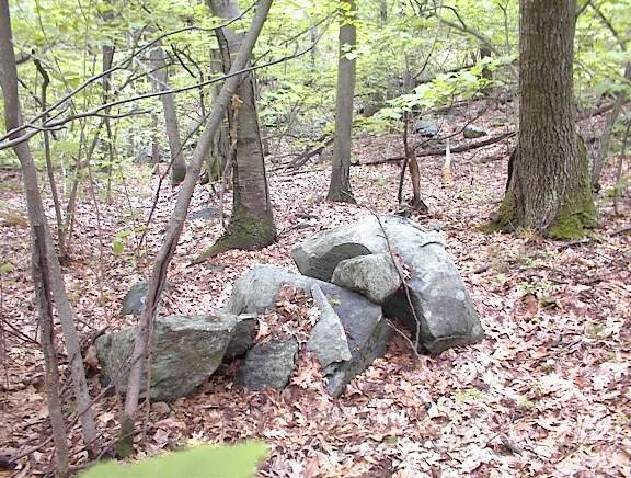
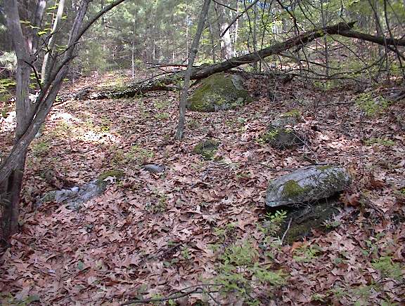
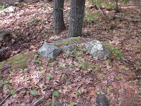
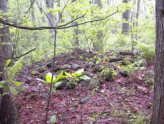
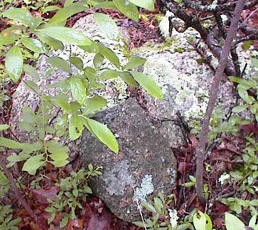
These pictures are from the colonial farm site gallery. The first picture shows 3 boulders with a pile of small stones filled in between them. That vein in the boulder in front is quartz.
http://larryharrop.com/main.php?g2_itemId=1783

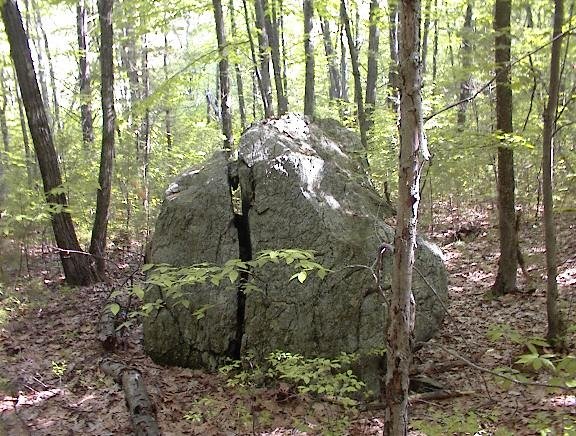
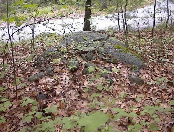
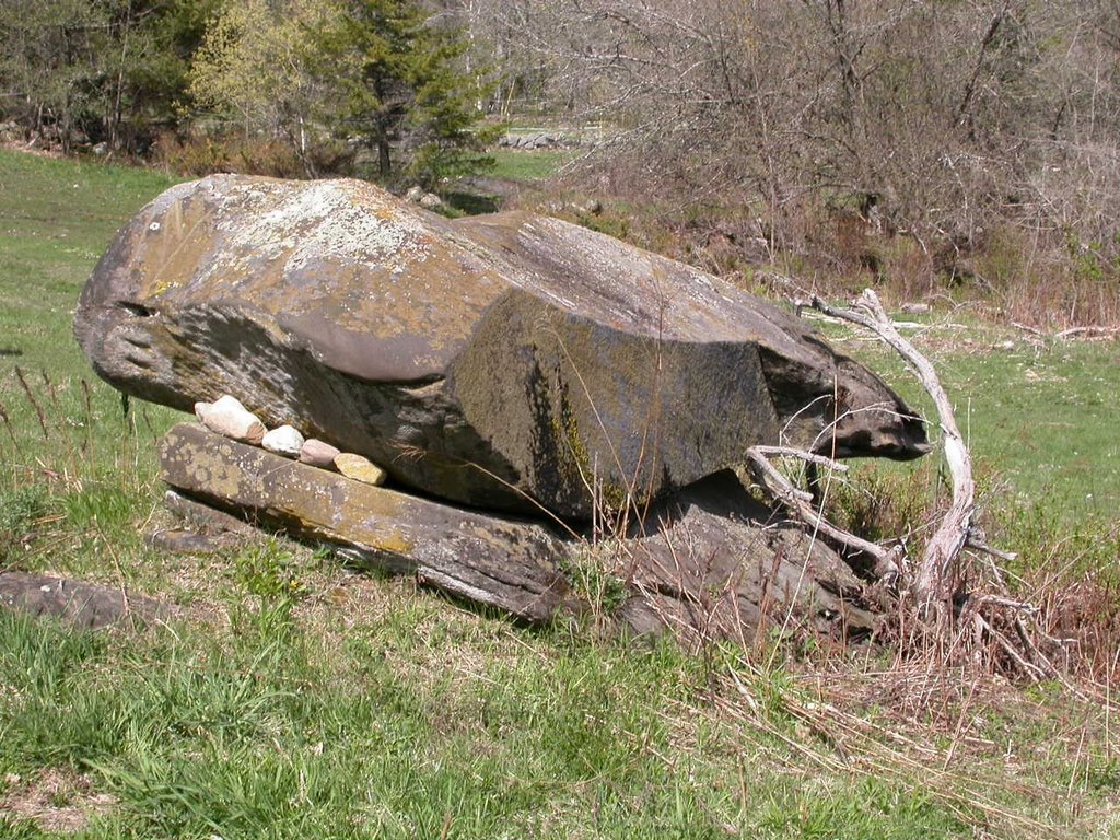
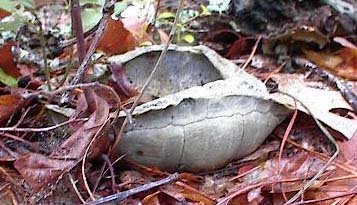
If you look behind and to the left, you'll see a small downed tree leaning on a boulder. That's a split boulder that has been filled.
http://larryharrop.com/main.php?g2_itemId=1780

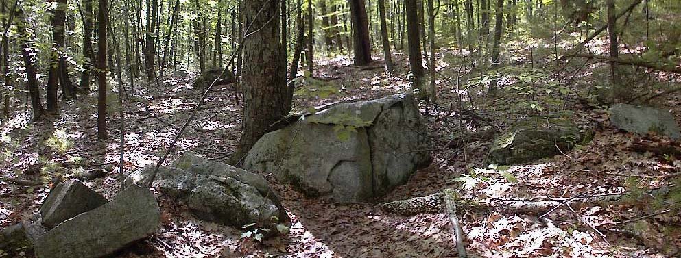
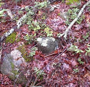
Right in front of the boulder with the quartz vein, there is another split and filled boulder.
http://larryharrop.com/main.php?g2_itemId=1753

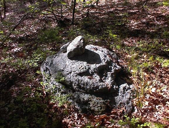
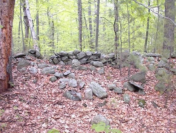
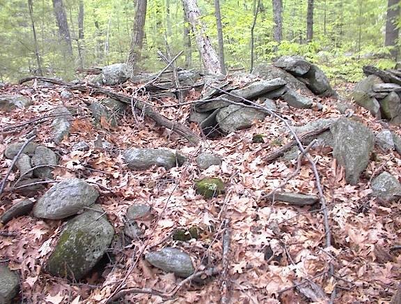
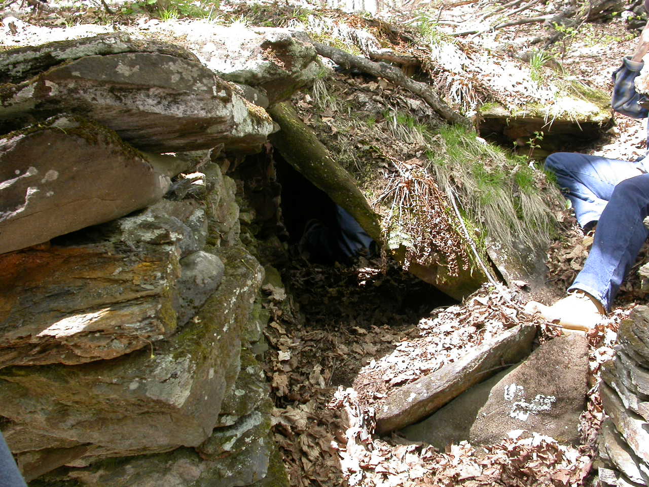
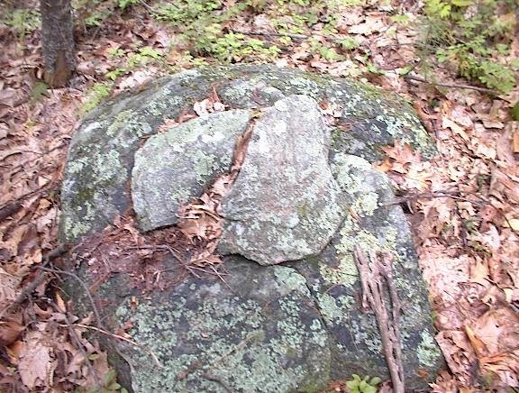
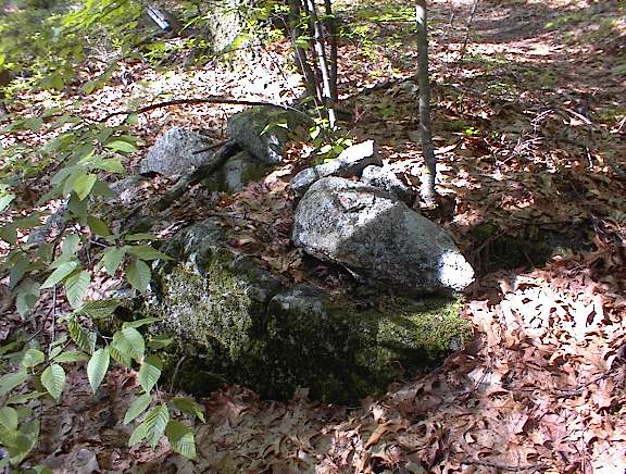
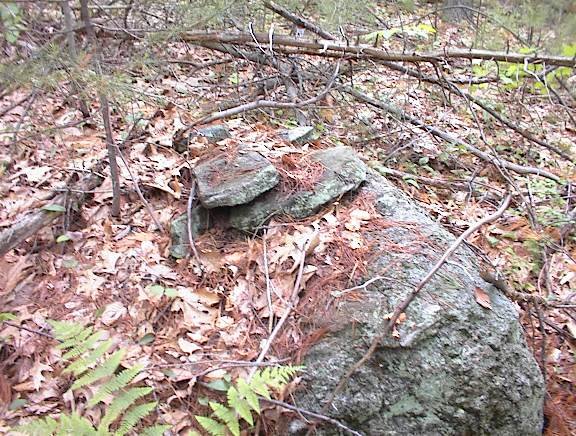
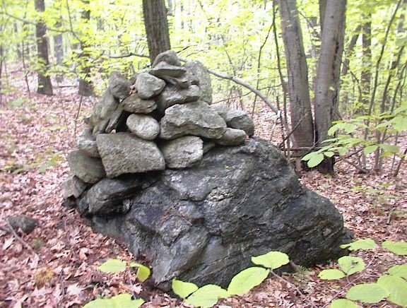
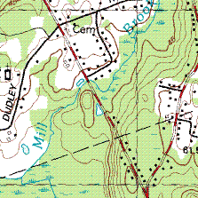
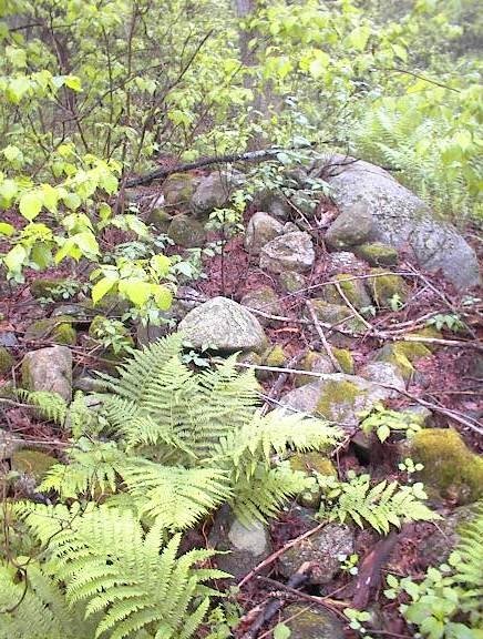
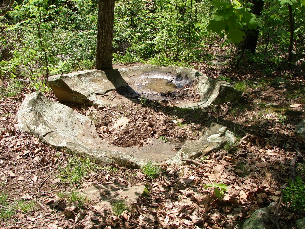
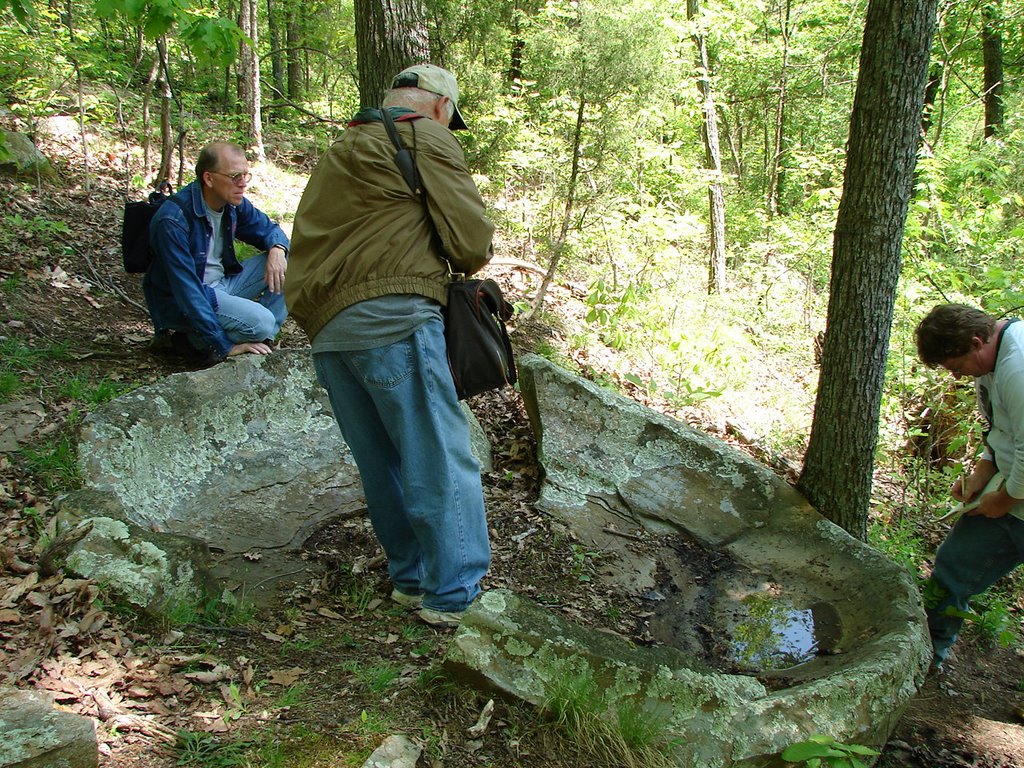
This site was confusing. You have the obvious colonial cellar hole and field walls. Then peppered throughout the site are features like these. This is one of many interesting features at this site.

More of the Bolton Conservation Land

Friend from Carlisle (FFC) convinced me to go back to the site of the gurgling brook in Bolton to look for my cellphone. I already mentioned that. After finding the phone and re-visiting the nice site, FFC headed uphill in a more southerly direction. Right before hitting suburbia there was another cluster of rock piles on a dry knoll. The piles were mostly on the ground or supported, perhaps a bit like the nearby hilltop site from the previous day.
Here is one more from up there.
The large leaves in the foreground are from an American Chestnut. They grow up from roots which are still there and then are blighted by the time they get to around 20 feet tall, preventing them from getting to the point of flowering.

Here is a the view back downhill towards the wetland:
In this view we are facing roughly northeast, the gurgling brook site is downhill and to the left.

Walking downhill, as we get towards the bottom and the edge of the wetland, FFC says: ooh! I have a good feeling about this place. Then he got excited at what turned out to be a major split-wedged rock, pretty much at the swamp edge:
In the foreground of the next picture, note the pile of burnt broken rocks in a ground pile.
I read that sweat lodges were built close to water and that the heated rocks would be left behind in a pile. So we keep our eyes open for that possibility. Perhaps this pile in the foreground represents a sweat lodge. Here we are at the edge of the swamp. The gurgling brook is perhaps 30 yards beyond this large split-wedged rock.

There were a number of things right along the edge of the swamp here:

After this we returned to the place of the gurgling brook which is only a few yards northwest along the edge of the swamp. Here it is from the south:
After that we went back up and around the hill and down the other side to the car. The town line cuts across these hills. Starting with the seat and the nice lady and the lost arrow, we were in the conservation land demarcated by this stone wall - by this town line. Back near the car at the entrance of the conservation land, you can see this standing stone, with a "B" on one side for Bolton and and "S" on the other for Stow.
If you look carefully you can see a bit of FFC behind this stone.

Tuesday, May 30, 2006

More amazing photos from Larry Harrop of a site from Jim Porter

[Click here]
Wonderful, and genuinely weird in some cases. This is the "colonial site" portion of a large site mentioned here first by Jim Porter. As usual, the photo's are great.

Googling "Cairns" + (various locations)

[Click here]
What the...? Cairns in the desert.

[Click here]
Some pictures from Rhode Island - wait for it.

[Click here and scroll down]
Labrador

[Click here]
California. This picture is from a website about sacred water [Click here]. Hard to imagine not sharing some interests with these folks.

Hilltop site in Bolton

by pwax
Continuing the description of sites in the Bolton Conservation Lands at the edge of Stow:

After finding the site with the gurgling brook, I continued uphill, with the thought that I would get to one of the summits. When I got up there I headed southwest. There was a site on the southwest part of the summit, just like on many of the other hills nearby. As I first approached there was a damaged place in the stone wall and what looked like a rock pile on a support beyond that:
Although I thought it was clear that the wall was damaged, some of the tumbled rocks fell far from the wall and almost appeared to be deliberate structure. This begins a pattern that was repeated at this site - of a wall re-used for other purposes. In this case, stepping through the break in the wall led to a small area of low ground piles and low-to-the-ground supported piles.
[Digression about alignment chasing and why it is not much better than the donation pile "myth": because it suppresses curiosity about the topography and it supresses cursiousity about the site characteristics and single pile characteristics - all under one oversimplifying umbrella: the only characteristic is to be at this spot along the line. Alignment chasing suppresses study of the details.]

There were perhaps twenty piles. Here is one my feet found where my eyes could barely see it.

There was a suburban neighborhood on this hilltop, and I could hear the kids playing nearby. I was thinking all through the trip here - through South Acton, through Stow, into Bolton, that people are quite oblivious of this history of the land they now occupy. And it made me think about my own goals and why I am looking at rock piles, and why am I getting so nearly fanatical about it. My answer is that my goal is to make the American Indian re-appear. We have heard about how the Indian "vanished" - and given the general obliviousness this is a good word. But in reality how could they, who lived here for 10 thousand years, not leave some traces or anything that would not be erased by a mere 300 years of our European occupation? One goal is to make the American Indian "un-vanish".

A stone wall runs along the eastern side of the site. It looked as if an original wall was built and then someone, more hastily, piled loose rocks along one side of it. Later still, someone came along and made a couple of "nests" in the lose rocks along the wall:
These two were right next to each other. I should have tried for a panorama shot but there was a tree in the way.

The Vermont Blanchard Stone - from Tim Fohl

The Blanchard Stone is described ([Click here]) as an example of Celtic Oggam (Ogham) in Vermont. Tim Fohl sent in some photos he took on a NEARA fieldtrip to see it. There was also a stone chamber nearby.

Here are views of the Blanchard Stone:

This is a very large quartz outcrop with some signs of human work:
This is the "backdoor" of a stone chamber by a spring downhill
from the
Quartz. It is located next to a wall running EW. Notably
there are no
stones nearby:

Here is the "front door":

Summary of a good weekend of exploring

One of the goals of this blog is to make the point that sites are quite common and are located everywhere. This weekend I had the good luck to be exploring more in a rock pile "region" - a place where every available patch of woods has piles in it. Anyway, this is a bit of bragging, but also part of the basic message:

Saturday Morning
Single platform pile in Billerica
Saturday Afternoon
Gurgling Brook site in Bolton Cons. Land
Hilltop site in Bolton Cons. Land
Sunday Morning
Expanded/new sites in Bolton Cons. Land
Monday Afternoon
Visit to large pile at Whipple Hill, Lexington
New "burial ground" site at other location on Whipple Hill, Lexington

Count them however you like, that is a lot of places.

Note: I already reported on the first two from this list. Descriptions for the others will be coming during the week. That site in Lexington is the closest to Boston of any site I have found. It is startling to find a perfectly good site, right there effectively in the city.

Monday, May 29, 2006

Another view of the gurgling brook site in Bolton

Losing a cellphone - it is fun to be superstitious

by pwax
Warning, personal, not rock-pile related:


When I found that gurgling brook hollow with the most excellent large pile, my impulse was to call Friend From Carlisle (FFC) and brag about it, so I fiddled in my pocket to find my cell phone - but it was gone. I had had a spill earlier which must have been when I lost it. It is funny, as I approached a little outcrop that seemed like a ceremonial spot, I tripped and fell to my knees and the thought came to me that the gods wanted me to be humble and approach properly - on my knees. I remember laughing at the thought because it is fun to be superstitious. Apparently they wanted to strip me of my modern technology as well, and I guessed this was where the phone dropped out of my shirt pocket. Losing my cellphone was upsettng. It was only when I got back to my car and was sure I had not left the phone there, that I knew it was lost. But I was tired from the long walk, thirsty, and did not think I would be able to find it anyway.

Later when I called FFC, he insisted we go back out and look for it. So the next day I took him to see the hollow with the gurgling brook, and tried very hard to retrace my step in getting there. I had figured out over night that it was when I took the spill that I was most likely to have lost the phone but there were several very similar outcrops and I was not confident of finding the correct one in a woods which is largely un-differentiated sloping ground with views blocked by pine saplings in all directions. Anyway he and I walked along until we got to one possible outcrop, so I said: go ahead and phone my number. Sure enough my lost cellphone rang right at my feet. Even so, it was invisible underneath a dead leaf and took a few minutes and another phone call before I located it.

Bolton Conservation Land - a site with a gurgling brook

by pwax
I think I am going to pubicize this site: it is at the northwest corner of the wetland shown on the map fragment under the "CO" of WORCESTER CO. At this spot a brook comes out after a brief passage underground and empties into the wetland. There is one large rock pile and a number of smaller ones all in a little hollow of the landscape, where you can hear the gurgling sound of the brook.When I first approached the site, I could see several rock piles and could sense something larger looming back in the shadows under the leaves. Here is a closer view of the pile in the background:Note in the detail view that the small rock at the edge is red colored as if it was burnt.

I could not contain my curiousity about the larger pile I sensed under the trees. Here it is:
It was only as I walked down to get a look at this that I realized how quiet it was in this place, with no traffic noises and only the sound of the brook. Next to this pile was a rock with a noticeable exposed vein of quartz:
I tried to frame this photo with the quartz visible in the foreground and at least the base of the larger pile in the background.

Here is another pile closer to the water:
You can see the hollow and, in the background, the place where the brook comes out from underground. I went over to verify the sound was coming from the brook. The brook comes from above, goes underneath the rocks for about 10 yards, and then comes back out above ground here. There must be a little cavity where the water falls and makes the pleasant sound and it had rained hard the night before. The sound would not always be here but I take it that this is the reason for the site being placed here. Another example suggesting that sound could be important.

I was thinking the large pile was a real "cairn". If rock pile hunting was to be c
ompared with big game hunting then this pile is the equivalent of a buffalo. "The family will not go hungry tonight", I thought. Not seeing any more piles, I was heading off thinking about buffalo, but then decided to turn back and look harder for more piles here. After all, this was a very peaceful spot, why be in a hurry to leave? There were a couple more minor piles which I managed to get blurry pictures of.
This is a good examples of "Twins": a pair of boat rudder shaped rocks. In my observations, this pattern often occurs at the edge of a site and, according to my theory, it might mean "No Tresspassing".

When I did finally leave, I headed off towards a hilltop I had planned to explore. I did find another site up there. But if I had headed off around the wetland that this gurgling brook site was at the edge of, I would have found a continuation of this site in that direction. I'll leave the continuation for another day.

Sunday, May 28, 2006

Another pile from Bolton Conservation Land

by pwax
It was a beautiful day to be out walking.

Rock Spirits of the Hotcâgara

by JimP:
I came across the following web page that discusses the rock spirits of Hotcâk (Winnebago) mythology written by Richard L. Dieterle. Here is an excerpt:

"Rocks are of many kinds, and each variety has its own spirit chief. Relatively small rocks, which in English are termed "stones," are all manifestations of a single spirit, sometimes simply called "the Female Spirit." When the earth was newly formed, it spun and rocked uncontrollably, so Earthmaker tried to weight it down, but it only came to perfect rest when he scattered the Female Spirit over the face of the earth. In the Medicine Rite it is said that Earthmaker made her from flesh that he extracted from the right side of his body. Having formed her, he cast her down to earth where she split in two. When she landed, she shattered into many pieces, forming the rocks and stones of the earth."

Click here for full article

Bolton Appetizer 2

by pwaxA perfect split-wedged rock at the edge of the swamp.

Miscellaneous structures from the Bolton Conservation Land

I went back this weekend to the same hills on the Stow-Bolton line that I visited last week with Friend From Carlisle (FFC). There were some nice sites which I'll report in due course. There were also a number of structures at the edges of or between these sites, and they might be worth at least recording.

Here for example is a rock-on-rock, part of a loosely defined curve of rocks. Right next to it, or just above it on the slope, here is a small pile with a clear symmetry. I wish to call piles with symmetries "effigies".
Here is another small structure from the same spot.
These pictures from today are from one of the shoulders off the side of the hill. Here are some other miscellaneous things from yesterday but found in the same general area.

This rock face of quartz seems to have gone through chemical and heat treatment. Looks like there were fires built against the face of the rock.Also note the two small rocks wedged against the foot of the boulder.

Indian "Bars"

Jim P writes:
It's just a quote I ran into while doing research. It's from William Wood's New England's Prospect, 1634. He's talking about the deer in New England and how hard they are to catch with dogs.

"In summer it is hard catching of them with the best greyhounds that may be procured because they be swift of foot. Some credible persons have affirmed that they have seen a deer leap threescore feet at little or no forcement; besides, there be so many old trees, rotten stumps, and Indian bars, that a dog cannot well run without being shoulder-shot."

I wonder what the, "Indian bars," are that Woods is talking about? A look in the dictionary shows that, "bars," can mean:
"something that impedes or prevents action or progress. synonym - obstacle"
What's more, Woods is also saying that, "Indian bars," are quite numerous.

Saturday, May 27, 2006

Bolton Appetizer

The weekend is for collecting and the week is for describing. So far, end of Saturday with three sites found, the weekend is holding up its end of the bargain.

Solitary platform near Mill Brook, Billerica MA

Because I commute by here, I became aware of a stretch of woods I had not explored - in the triangle between these roads in Billerica. The woods faces northwest towards a brook called Mill Brook. Access is blocked from almost every direction by private property but I found a way in and discovered the whole area is a wet skunk cabbage swamp, so it was rough going after a night of heavy rain. Anyway it is lucky I went in the way I did - because I found one solitary platform pile next to a small rivulet that feeds into the swamp from the east. If I had gone in a different way I would have missed it (and perhaps have seen something else). Anyway I was out and back home in 1/2 hour; making this the shortest site hunt ever.
The pile itself was roughly rectangular and composed of rocks mostly of the same size, built up against a larger boulder on the downhill side. It was perhaps 3 yards from the rivulet.

Friday, May 26, 2006

Kettles of Fleming County Kentucky

(via Larry Harrop)
Pam writes to Larry:
I stumbled across your site while preparing an article on the Kettles of Fleming County. These are a series of bowl-like structures (including one or two "lids") found along a ridge in Northern Kentucky, about 10-15 miles south of the Ohio River. I'm attached a couple of pictures of these kettles. A local observer says there are 7 such structures.
While we were on an expedition to these structures, we came across a stone lined in-ground structure about 12 feet X 7 feet (a colleague has more exact measurements). The local assumption has been that this was a root cellar by the only family known to reside on the site during historic times. It's one heck-of-a climb up to the summit, so its a safe assumption. The thing is is that the house of these inhabitants was at least 100-300 meters away --not even in sight given the heavy growth and terrain. When I looked closely at the site, it reminded me
of structures I had read described in New England.
Have you heard of any thing like this down here? I haven't been able to find good images on line of the New England structures, can you direct me further?

Parowan Gap - Archeoastronomy in Utah

[Click here]
"...the five alignment double redundant cairn system...is an observational calendar system? "

[Click here] to see some of the petroglyphs in question.

[Click here] or here for the researcher's web page

[Click here]
This is a little deeper in the same website. Shows a stone wall arrangement being used as part of a calendar system.

Thursday, May 25, 2006

Surprise at the invisibility of rock piles - from Sept 2004

"You have to admit that with sites like this right there in Lincoln and sites like the other day near Boxboro center, that there is an overwhelming number of these rock piles sites around here. It is not just an impression, it is true there are rock pile sites in every single woods you look in. Could it possibly be that they are so inconspicuous nobody has noticed them anywhere and that, in fact, they exist in overwhelmingly large numbers everywhere -say- along the eastern seabord? I can't believe that. Over time I have gotten much better at ferreting out these sites. Apparently last time here, I only saw a very small fraction of what was there. So it is probably difficult for most people to notice these sites at all."

Update: sorry about the arrogance.

Off Brick Kiln Rd Falmouth, MA - from July 2004

by pwax
Got the official "Morraine Trail" map from the Falmouth 300 committee, and tried to explore in more detail along the Waste Water Treatment Service Road off of Brick Kiln Road. First I went up to the right hand bend where it turns into Blacksmith Rd. Right after the turn there is another road to the left which continues north in the same direction as the service road before the bend. I parked right at the intersection and explored the gully between this further road and Rt 28. Directly on the slope there I came on a rock-on-rock underfoot. Then a couple more very humble rock piles:
Along with this group there was also a small pile with several rocks. In the detail picture you can see there is an old turtle shell bone on the pile. Looks like a box turtle shell. These piles are pretty inconspicuous, low in the brush as they are. This small cluster of rock pile and rock-on-rock faces westward, right towards Rt 28, across the wet place at the bottom of the gully. So I continued on a way but came up to an open area with buildings and desisted in exploring in that direction.

Wednesday, May 24, 2006

Stone Cairn on Tundra

I turns out this photo from the U.S. Fish and Wildlife Digital Library is in the public domain. What a view.
Note the slot down the middle - a bit like an aperture, a bit like a pile-gap-pile.