Jim Egan, a great guy:
Saturday, April 23, 2022
Friday, April 22, 2022
Delong-Cooke Map of ceremonial sites
Zoom meeting from the Roaring Brook Lake Garden Club and Tompkins Corner Cultural Center, March 21, 2021

The reference to the Delong-Cooke map, leads to here:
Well worth a look at the bottom.
Tuesday, April 19, 2022
Monday, April 18, 2022
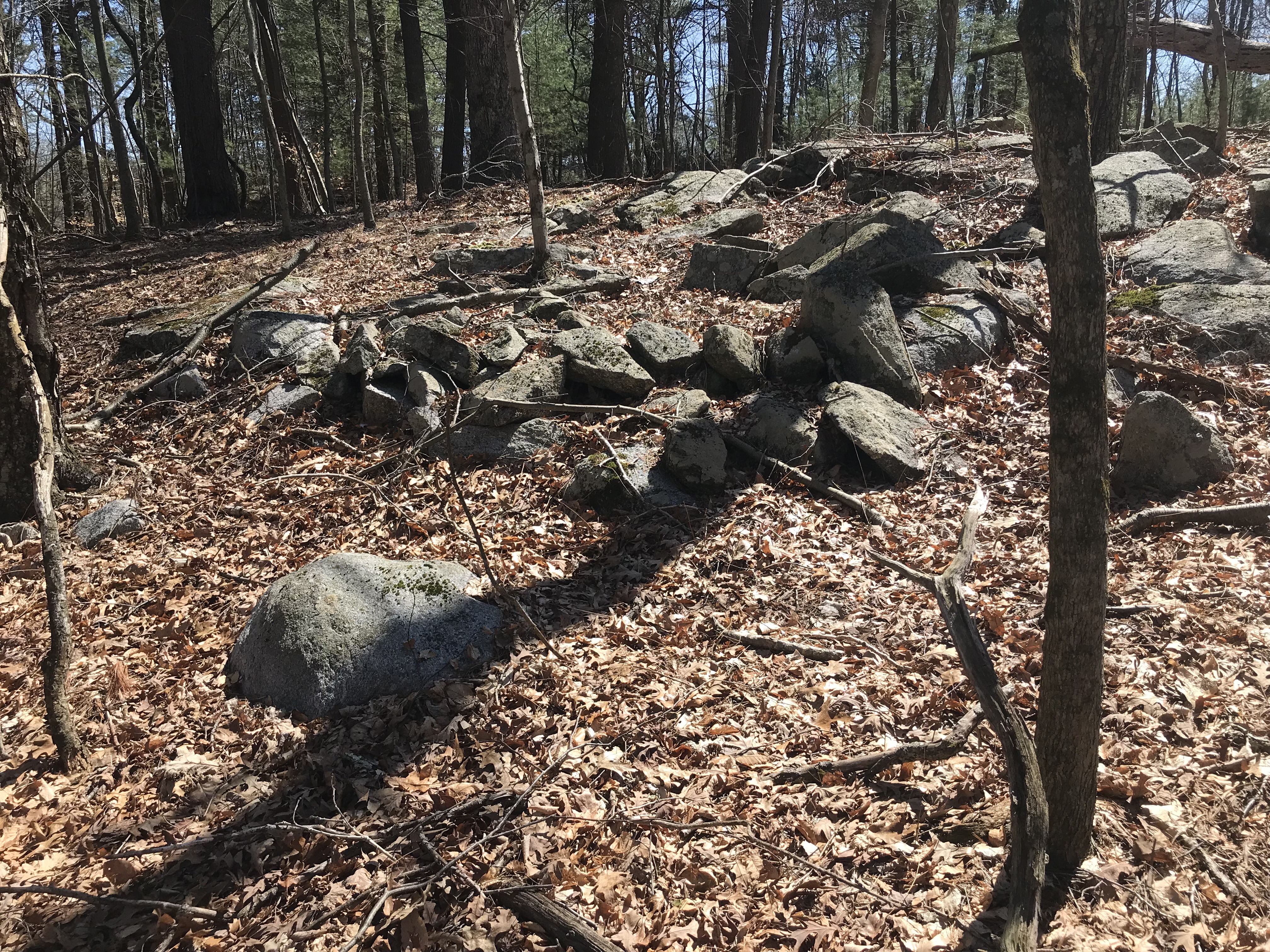
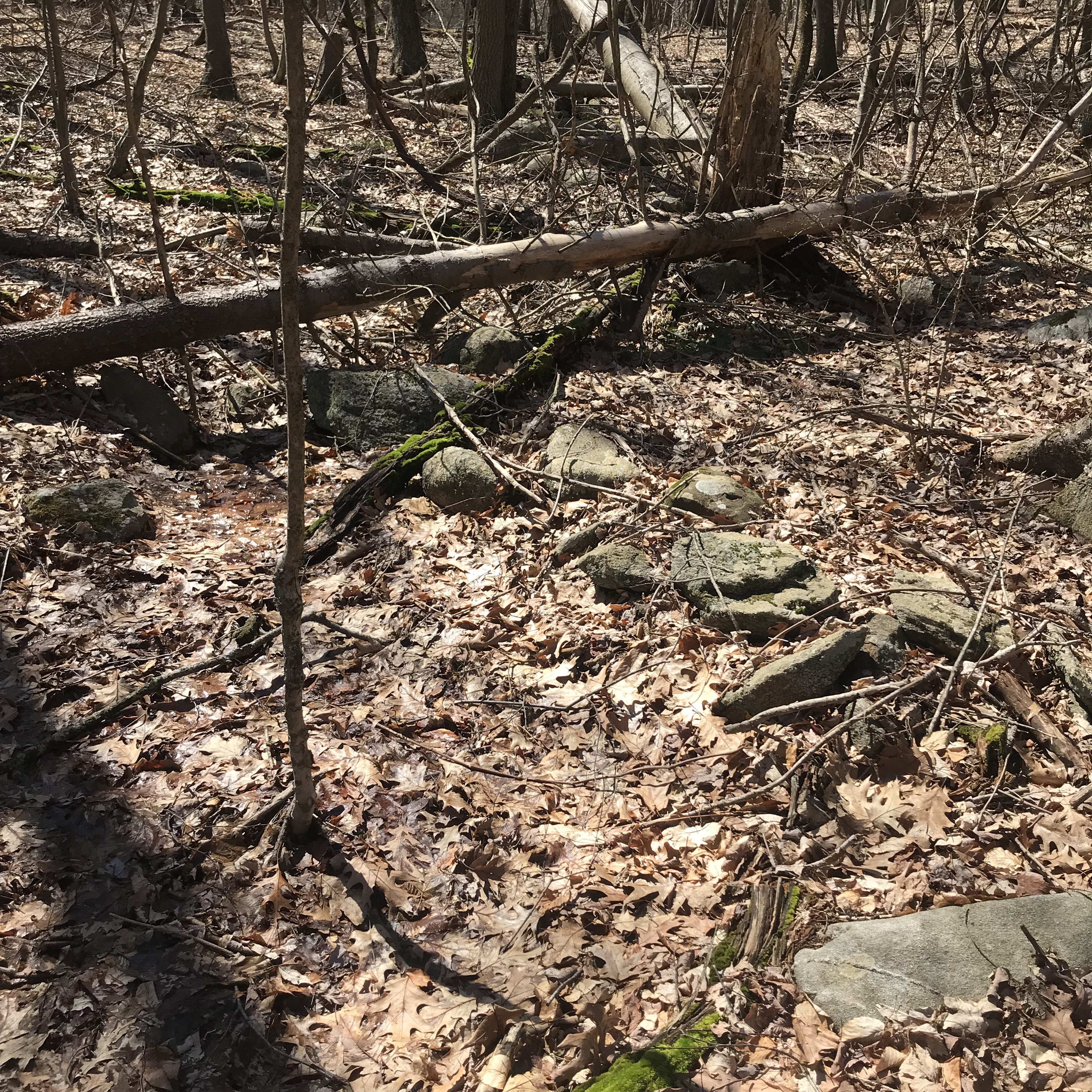
Atherton Brook - Quabbin and also a site near Cooleyville.
Atherton Brook, crosses Rt 202 in Shutesbury and feeds into Quabbin to the East. I picked this as a place we could walk upstream - having fantasies of how I would scramble up the hills. As mentioned, I am in poor shape after 3 years of stay-at-home from the pandemic.

When we got down to the brook and headed downstream we came to a flat bench next to the brook, with rock piles - low and almost completely buried - you had to be looking for them to notice: Would most people notice this next one? And the chunk of quartz?
 Looking at my pictures, I am surprised to see what looks like an effigy:
 Is it a fish? A coincidence?


At this point my wife forgot about bear worries, and starting noticing the beautiful surroundings. I'll tell ya, these are very old: No idea how old or how big these really are:
 So we found rock piles. Not the huge mounds like the Moosehorn/Harris Hill mounds. Older, more basic: ground piles with quartz or white feldspar:
 This is a common form of pile. Not in a grid, not a structured site. Ground piles with quartz, mixed with effigies.


***
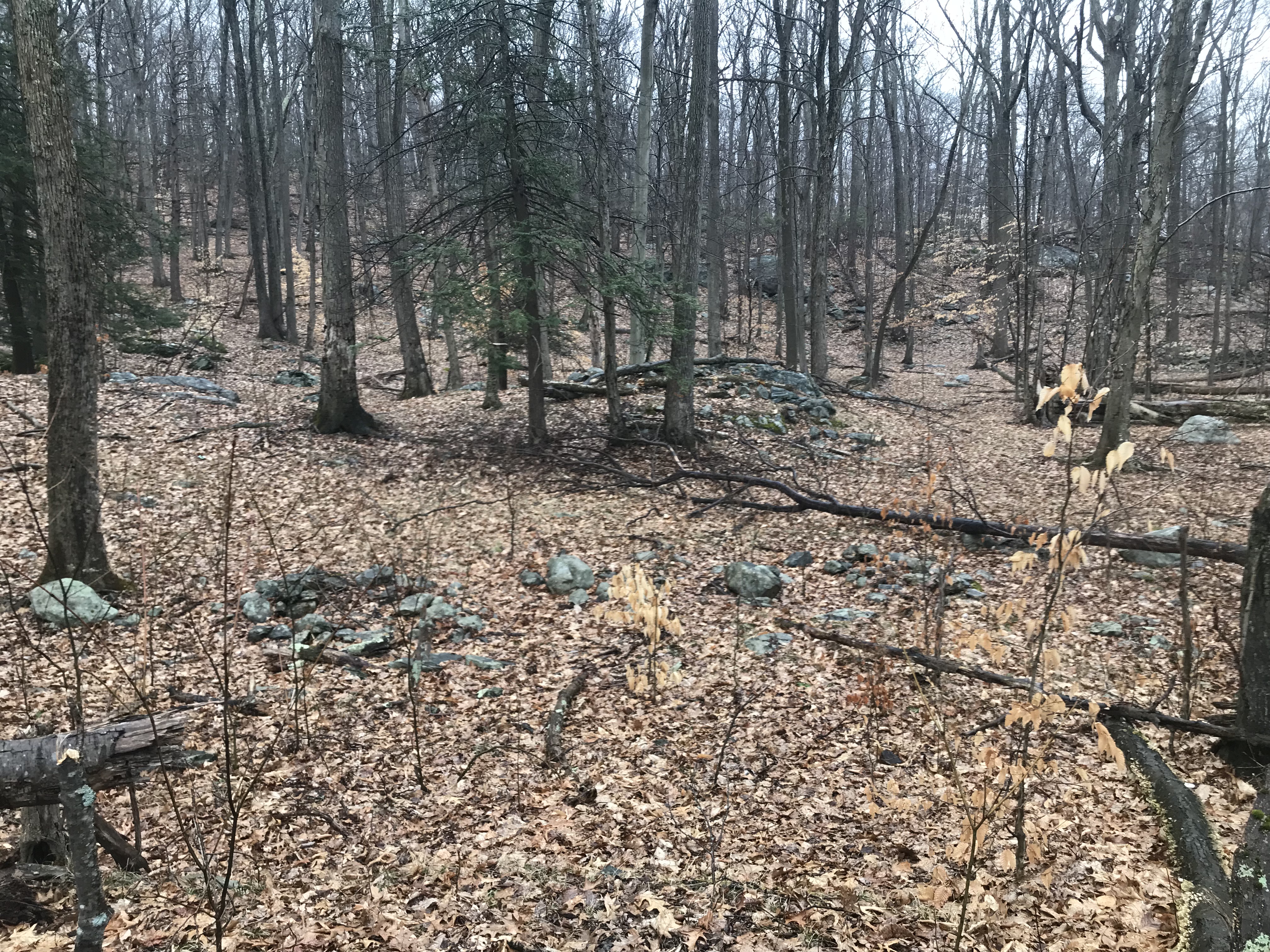
Somewhere between Atherton Brook and Harris Hill, on Rt 202, there was some tree cutting going on, giving a view into the woods full of rock piles. I took a quick set of photos and, afterwards decided some of them were effigies. Looked like this: The next looks like an effigy using colored rocks:
 And this looks like the "fish" from Atherton Brook:
 There is enough symmetry and sense of a "head" that this might also be an effigy:
 So this site seems similar in age and intent to what was along Atherton Brook.


Last word about my 5 day trip: you get so you notice there are rock piles everywhere. Pick another brook along Rt 202; or go look more carefully along the road edge near Harris Hill. In fact our land is blanketed with old ceremonial structures that no one can see. What an irony!
Sunday, April 17, 2022
Rt 202 near Moosehorn Rd in New Salem, MA
Bruce MacAleer and I saw these several years ago - adjacent to Harris Hill on Rt 202 in New Salem. Went back, as part of visiting this area. So, here are a couple Barb videos:
AndWish I was not rushed, parked insecurely along Rt 202 at a little pull-out.Three ovals
I made a previous post about this oval of rocks from the top of Boehmler Rd in Cahoonzie, NY.

An oval from Peck Hill, Woodbridge:
Here was one from Fahnestock, NY:
Barrel Cairns - I saw some in Cahoonzie, NY
By "barrel cairn" I mean a solid, vertical, cylinder of stacked rocks.
Having seen a video with "barrel cairns" from this place, I thought it a worthwhile destination. So we were driving around Cahoonzie (named after a Lenape chief who was 7 feet tall) and could not get into the woods. I saw some from the car on the way up Boehmler Street. Took some photos:


Friday, April 15, 2022
King's Chamber
Hard to describe the wonder of this moment. Let's start.
It is April 3 with a light rain. We start at the end of Waywayando Rd (at 'A').


Somewhere, there is a false trail off to the right (as we are headed towards 'F', from 'C') and then a bit down from 'F' a fork in the old road we are on. We go left and then, the path is flooded again. We cross and get off the road and onto a narrower footpath. This takes us around a couple outcrops and over to the chamber (at 'E'). As we are heading in that direction, I cannot help but admire the opposite slope - a steep hill, laced with walls - and the occasional mound (at 'D'):
If I was twenty pounds lighter, I could imagine running over there to have a quick look. By the time we got to the chamber, the slope over there was quite rocky. In fact you could probably hear the cascade from a small waterfall, across from the chamber: (The waterfall is the spot of white, near the center of the photo). I was facing in this direction, when Barb started exclaiming about what was behind me:
 Here is Barb's video:I cannot put into words my feelings about how this amazing structure, high in the barren hills, could be called a "root cellar". Too stupid for words! Meanwhile, someone - possibly "New Agers" decided to add a standing stone in the "portico". Here is the reverse photo:
From the side:
So that gives you a brief glimpse of this place. I cannot recommend it enough. The chamber is magnificent and the surroundings even more so. About an hour north of NYC.

If I was twenty pounds lighter, I could imagine running over there to have a quick look. By the time we got to the chamber, the slope over there was quite rocky. In fact you could probably hear the cascade from a small waterfall, across from the chamber:


From the side:
So that gives you a brief glimpse of this place. I cannot recommend it enough. The chamber is magnificent and the surroundings even more so. About an hour north of NYC.
I should mention, that as we were heading towards 'C', there was a
box canyon that seemed peculiar, and somehow parallel to the chamber. Here is another Barb video:
box canyon that seemed peculiar, and somehow parallel to the chamber. Here is another Barb video:
Third day of a five day trip. Almost ready to blog the remainder. Nothing compared to this place.
Fahnestock: O...M...G
Well we drove from Woods Hole, MA to East Fishkill, NY and the hills got steeper and steeper. So more and more of the woods was visible from the road - especially in early morning light. I spotted rock piles occasionally, then as we are leaving Connecticut, they were visible on nearly every hill we passed. It got more and more intense, till we are on the final approaches to the "King's Chamber" hike. There, it got more and more and more rugged, with nearly every rock having piles. The hike in and out from the chamber were pretty intense. So much so that, I kept seeing valleys to the side and wishing I had the energy to explore them, with rock piles off in the distance as far as the eye could see. More later about that.
You exit the Taconic State Parkway and head east on Pudding Str. Then you turn off onto a dirt road Waywayando Rd. But before then, on Pudding Str, on the border of Kent, NY, I spotted some big things, and had to pull over and grab a few photos. Like many roadside stops we made, I am insecure about parking and always am a bit rushed. There is a body of water in the background here, it is a reservoir called Waywayando Lake and circling the lake would be a grand adventure. Here I am, a few feet from the car being astounded. When I call this a "minor site", it is a bit tongue in cheek. (Also it is Kent NY not CT)
Some photos. I did not feel like I could get far from the car. I was visible from the house across the street. This is the first glimpse:


Wednesday, April 13, 2022
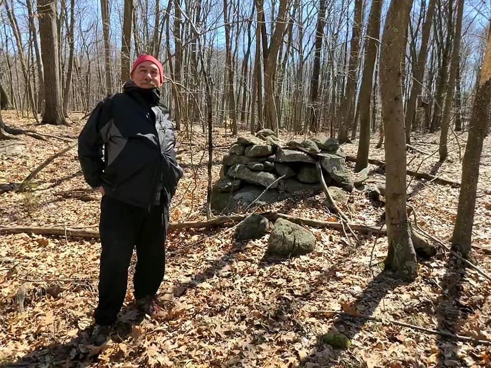
Tim and Peter at Peck Hill
Tim MacSweeney

Cupules:
https://drive.google.com/file/d/1iGYflKBrgt-9vScc18EdmHfwkEWN8CF4/view?usp=sharing
Now that I watch the video, I guess I shouldn't have been climbing on it.
Peter and Tim:
#1 https://drive.google.com/file/d/1q12Igq-EPILIVwq9O5Ier8RlhxsIoDHC/view?usp=sharing
#2 https://drive.google.com/file/d/1JuMjqsY-fvTNOyTjzUC34C6XU86SRbNE/view?usp=sharing
#3 https://drive.google.com/file/d/1E-jGbUoxsuj-t3nurL4Yn_geggCMYRn3/view?usp=sharing
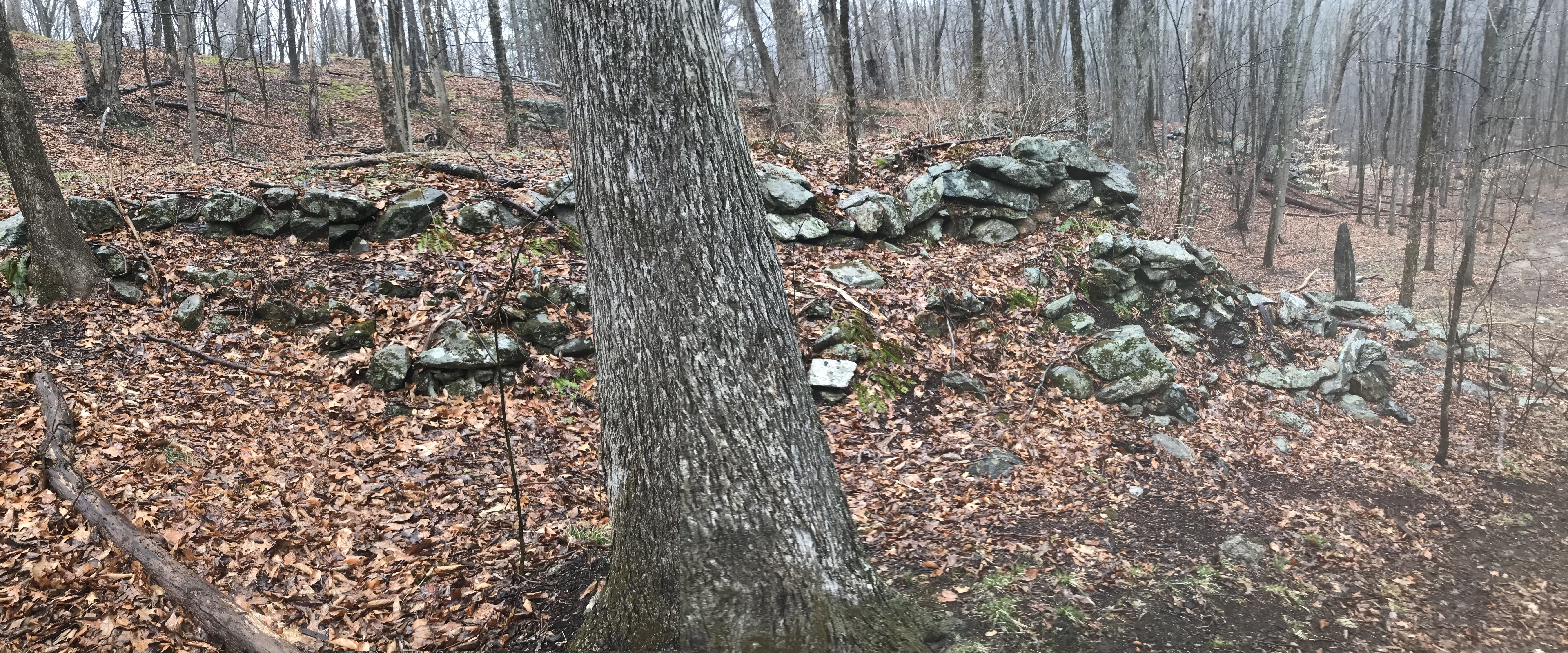
Woodbridge 4 - Things I saw that were unusual
While walking around the Elderslie Preserve in Woodbridge, CT. I saw several things I am not used to seeing. I thought I would mention them explicitly. These are some of the ways that Woodbridge is "out of step" with the typical sites I see. This might be because of the Paugusett who lived there, or for other reasons. I might not have noticed these things, except that Tim MacSweeney pointed out some of them. Here are some unusual things:
Stone circles, by a foresight:


Wall dips:
I showed one yesterday from Bladen's River, CT Saw another at King's Chamber in Fahnenstock, NY. What looks like part of the wall, at the low point of the 'dip', is actually a rock pile beyond the wall. Look closely at the different focuses. There is a pointy rock in the wall on the right side of the dip. I imagine it's shadow hitting the pile behind the wall, perhaps going through the hole? That might even be a piece of white feldspar built into the dip, like the dip had quartz in CT.

Zig-zag "snake" in a spring
(Tim MacSweeney's photo, me and my wife in the background) While Tim was taking that photo, I was taking this one:
 Hard to make out. Tim pointed out how the brook was forming to the side of the zig-zag:


Manitou stone at a wall end:

Cupules
These little divots in the rocks were completely unusual. For one, these holes are not symmetric and many are too small to serve as mortars. For another they are not always on a horizontal surface. For another they seem to form patterns on the surface:
 [Here, Tim warned me about climbing on the thing. I took a chance to get a better photo. When I watched Barb's video, later, I noticed some helpful little stepping stones to help someone get on top of the rock. So I do not feel so bad.]


To call these "mortars" would be a failure of observation.


Note the vertical surface:

What are these?
Tuesday, April 12, 2022
Woodbridge 3 - "Crescent Cairn" at Elderslie Preserve
The main Woodbridge experience is within the "Elderslie Preserve". Check out the nice Woodbridge Trail maps. They indicate this feature and I was expecting a wide old crescent remnant of a mound with hollow. But no, this was more like an oven:
Here are some photos:


I would say this is a unique structure but I have seen something very similar before, behind the main school building at Barlow School in Amenia, New York. The school is gone but I suppose the rock pile is still there:

This example in Woodbridge, off Orchard Rd, seemed blackened on the inside - which is why I suggest it is some kind of oven. But I do not know. I was struck, in Woodbridge, by how much soil had eroded from around the base of the structure.
Subscribe to:
Posts
(
Atom
)
