A non-invasive procedure allows obtaining archaeological information without excavating (phys.org)
Monday, May 31, 2021
Wednesday, May 19, 2021
Land Protectors Win One for Nayyag - Ancient Native Site Rescued
Nohham Cachat-Schilling writes:
W8li Nogdgisg8adt8onk Nitompaog (Good-Meeting My Friends)
W8li Acim8, Wunne Achimu, Good News: MassDOT has cancelled its plans for a roundabout that would have destroyed the legacy of an ancient ancestral Indigenous village with unique artifacts.
Thank You Land Protectors and Equal Preservationists, Your strong opposition is cited as a basis for this change.
Those of us who were bad-mouthed for standing up are now honored by the legacy of our Ancestors. This is a great first step in equal historic preservation for Massachusetts. We can now being to real plan for equal historic preservation in Massachusetts.
"NORTHAMPTON — The state has cancelled its plans to build a traffic roundabout at North King and Hatfield streets on what’s also the site of a 10,000-year-old 'undisturbed ancient village.'"
Early on, we were attacked for standing up and criticized for calling the site a village, but obviously, this interpretation is now accepted and our stand is validated. They said "no Native Americans are concerned, " but we showed that Natives and diverse Americans care very much. Thanks to the Skibiski family, River Valley Co-Op, Aquinnah Wampanoag Cultural Resources Office, Nolumbeka, Mark, Rochelle, Anthony, Tyler, Don, Peter, Rob, Mary Lou, Gia, Christopher, Jose, Leah, Kenneth, Eric, Eileen, Amy, Adele, Alex, Sarah, Wayne, Martin, Chris, all 55,000+ people who signed the petition on behalf of justice in historic preservation, and everyone who supported.
“MassDOT has determined that the best next step is to terminate the current construction contract and undertake a re-evaluation of the project design. The re-evaluation option is responsive to the nature of the public comments received, which asked MassDOT to consider alternatives that avoided the location of the archaeological site,” the notice said. “This re-evaluation will take public opposition into account as a key evaluation criterion for all design alternatives considered.”
We can now offer the pedestrian overpass alternative, a chance for a cultural space, and neighborhood improvement. Several people suggested a pedestrian overpass and traffic control light alternative at the DOT comment meeting.
w8liw8sse nitompaog (good work my friends),
Friday, May 14, 2021
Whaddya Think?
Found on an island, wrong material but this looks like the base of a Merrimack (Stark) point:


Wednesday, May 05, 2021
Oley Hill site dates to 2500 years ago
I asked Norman Muller about his dating result for the Oley Hills. They used OSL (Optically Stimulated Luminescence) to arrive at a date of 2500 BP, for one of the terraces at Oley Hills. He wrote:
Yes, the Oley site is much older than Cahokia. I am of the opinion that the large platform stone mounds in the Northeast were inspired by the earthen mounds in the Midwest. Or maybe the influence went in the other direction! You are aware, of course, of that large geometric earthen mound in western MA (see LiDAR attachment; the mound is about 50 feet high and 200 feet long at the base; the top is precisely oriented to the cardinal directions. I visited the site with Timreck and Lisa Gannon).

Sunday, May 02, 2021
Ontario Mounds
Reader Joanne writes:
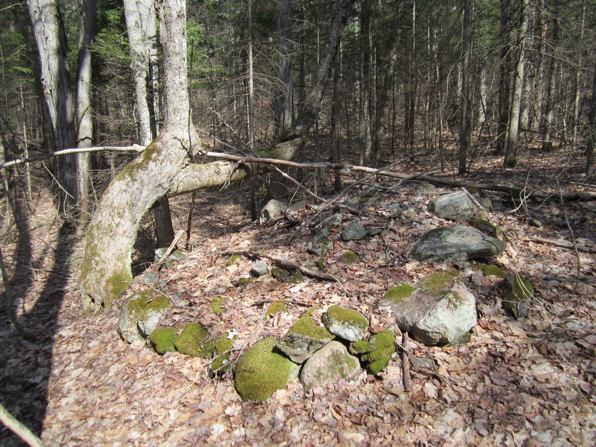
We found these unusual stacked rock piles deep in the woods. The one is quite large, almost an igloo shape, maybe 10 feet across and 4 feet high with a depression in the centre. It is made up of carefully placed stones. About 65 feet away from it is a flat circular mound about 6 feet across, under a very distinctive bent tree.
Further on in the woods we found another stacked pile up against a rock out cropping but I don't have a clear photo of it. These piles are well back in the woods and not near any homesteads or farms, or even roads.
Any thoughts on their origin? Thanks for taking a look at them.
[Added later:] This site is west of Algonquin park in Ontario. In the park itself there are 41 smaller rock cairns but none as large as this one.


Mike Martin's Cave
A reader writes:
Rock Piles contributors, especially Jimp:
I have a challenge for you:
I'm researching "Captain Lightfoot," the "last of the New England highwaymen" who was hanged in 1821 for a robbery near Medford, MA.
The attached article (first column) from an 1885 edition of the Boston Globe describes a cave alleged to have been used by Lightfoot, i.e.Michael Martin.

The location is Arlington, MA--now much developed.But the streets mentioned (Highland Ave, Spring Road (Old Spring Street?), place this very near Menotomy Rocks.
Is the cave in this article the one found by Jimp in Menotomy Rocks Park?
Jerry Kuntz
Warwick, New York
Subscribe to:
Posts
(
Atom
)
