Wednesday, August 31, 2022

Why you should not trust population genetics or DNA geneology results

Study reveals flaws in popular genetic method (phys.org)

They talk about "PCA" or Principal Component Analysis. This is the method that assumes your data lies in an oval (or an ellipsoid in higher dimensions), assuming the data has "components" that match the axes of the ellipsoid. It is complete nonsense when the data does not happen to lie within an ellipsoid. I had no idea it was used in genetic comparisons but that explains why they keep concluding such absurdities as the "Clovis First" or the uniform populations of South America.

For example:

"Techniques that offer such flexibility encourage bad science and are particularly dangerous in a world where there is intense pressure to publish. If a researcher runs PCA several times, the temptation will always be to select the output that makes the best story," adds Prof. William Amos, from the Univesity of Cambridge, who was not involved in the study.

Monday, August 29, 2022

Beaver Brook State Park, Windham CT

Thought it would be worth exploring the valley south of Beaver Hill and, for some dumb reason, I thought my wife and I would have the easiest walk in from the north. We followed that dotted line down from the top of the map fragment:

I did not realize we were trespassing most of the way. Up top, there was a solitary niche, which I took to be ceremonial:
[The colors are so much brighter on a sunny day.] We proceeded south, into an area of stone walls and an old house foundation. A beautiful and remote place in the hills of eastern CT. 

Sadly, we were slogging through thick undergrowth when the old road (the dotted line) disappeared into black birch saplings. Then we were slogging through knee deep blueberries. Then we were slogging through waist deep cinnamon ferns. Fresh out of a pandemic we were not in shape for it. In fact, the purpose of taking a drive and trying some more ambitious hikes was partially in order to get back in shape. The ferns were wet and my wife started getting a blister. So, although I had hoped to descend into what looked like a great rock pile hunting spot, we thought it was wiser to give up and go back the way we came. I was worried that, if we missed the top of the old road, we would have to slog through even denser growth to get back to the car, so I retraced our steps very carefully and it worked out.

Fall is upon us, at least since there has been such a severe drought.

Back as we crossed the hilltop, these two standing stones were a few feet apart and seemed related:

Otherwise we saw no evidence of ceremonial stone work. Enough to be puzzling. [Some of the larger boulders looked like they had been moved a bit.]

We had spent the night at "The Inn" in Mansfield and, just before leaving the room, I noticed a Bible in a drawer next to the bed. Thinking it would be fun, I opened to a random spot and read a verse - you know "Sortes Biblicae"-kind of idea. The verse was about the Israelites casting down all the works of the Nephrim (or Asherim or some such earlier religious people). It mentioned at some length that the Israelites were systematic and destroyed all the things they could find: temples, statues, etc. As with most things in the Bible, the stories are generic enough to apply to almost anything. But as we are walking through the woods, seeing nothing but an old house foundation and walls, and I am wondering what happened to the stonework that I expected to find up there, the biblical story came to mind. The systematic erasing of all the "devils work" is a traditional activity. So maybe that is what happened here. It would be fun to find that verse again (I tried and failed, back at home) because it is an idea that might  explain some of the empty woods in areas that should have rock piles.

Saturday, August 27, 2022

A brief moment in Natchaug State Forest

In Natchaug State Forest in northeastern CT, my wife had developed blisters, so we were touring by car. As we turned from Kingsbury Str. onto Old Griffin Rd, I spotted something in the bushes near the road- northeast of the corner. This was the only "mound with hollow" I saw in the course of several days walking and driving about.

Some other views:


If you look closely you can see the mound is built up against a large split rock.
I saw the same thing a couple days ago in Tiverton - a mound built against a large split rock. Hopefully you do not need me to explain the symbolism.

I should mention that I found a small site, a few hundred yards uphill from Fayette Rd, over at the southeastern end of the Hampton Reservoir. Not worth showing pictures, I suspect that the actual structures were too broken down to see clearly.

Parker Woodland (the videos)

My wife took some videos featuring, predominantly, me. Here I am again lumbering around. I lost some weight since the last time.


Short Walks in Parker Woodland (part II - the south)

The "cairns" are clearly marked on various trail maps, so we followed directions and got to a site, perched on a completely rocky slope, far from any possible plowing or field. Trying to call these things farm-related seems the height of absurdity. Well you can believe the Native Americans left no traces or you can believe you lying eyes.

As we approached along the blue trail, I commented to my wife that we were coming up to a bit of a spring. And then there was first rock pile, followed by more and grander piles. They have obviously been rebuilt at least once, maybe several times.

Video:

https://youtu.be/aJ2bXoZCTQw

And:

Video:
I would guess these are marker piles, just like many of the ones in the north part of the park.


And now, before leaving this place and answering my wife's question ["why look at more?"] let me mention what seemed to be a crime. In one spot, there was collection of quartz chunks. Recall that quartz if not that common around here and that one of the rock piles had a chunk of quartz on top (see first video, above). 

You notice a plastic Tupperware container. This was an orienteering "letter box". I wonder if some orienteering fool, decided to collect all those nice pieces of quartz so as to make the letter box more visible and findable by the next orienteering participant. It is not often that vandals leave their identity there to be found. And, I think someone who cares about Parker Woodland, should think about locating the organization responsible for this. I would think it gives orienteering a big black eye.

Back to my wife's original question: Why look at more of these? 
I could not pretend the answer involves seeing new things because they were not really new. Another answer might be: because it is interesting studying regional variations. But that is not really true either because they are pretty much the same as what I find elsewhere. For example triangular marker piles, from Fitchburg and other places. Or tall piles with a blaze of quartz [now mostly destroyed at Parker Woodland]. Being told about a site is far less interesting than discovering it yourself. What is definitely a true answer is that I remain curious about why are sites located exactly were they are.

In the case of southern Parker Woodland, the answer is obvious if you look at a map, or go their in person: it is a flat bench between springs, facing south; easily accessible from a brook below.

As for the sites at the northern end of the park, they were clustered around the house foundations and all were on high points amidst the surrounding woods. Their calendrical appearance suggests each household had its own needs. But that is surely an oversimplification. In any case, the question of location remains interesting - even after becoming jaded to the appearance of the particular sites.

My wife also wanted to know what we were "seeing". She wanted an overview. My explanation was that it is obvious not only that Indians lived here for a long time and that they seemed to still be around - judging from the careful reconstructions. If you look at these piles, you see many with the upper rocks having no lichen.

Short walks in Parker Woodland (part I, the north)

Having seen pictures of crowded "cairn fields" from Parker Woodland, it seemed like a place worth visiting. Armed with Norman Muller's advice that the northern part of the woodland was more interesting than the southern part, we started into the park from the north end. 

I should mention that neither I nor my wife are in good physical condition. In fact, post pandemic, the priorities are losing weight and getting back into shape. But this was the first such exercise - it is hard getting off Cape - and the walks we took were pretty short. 

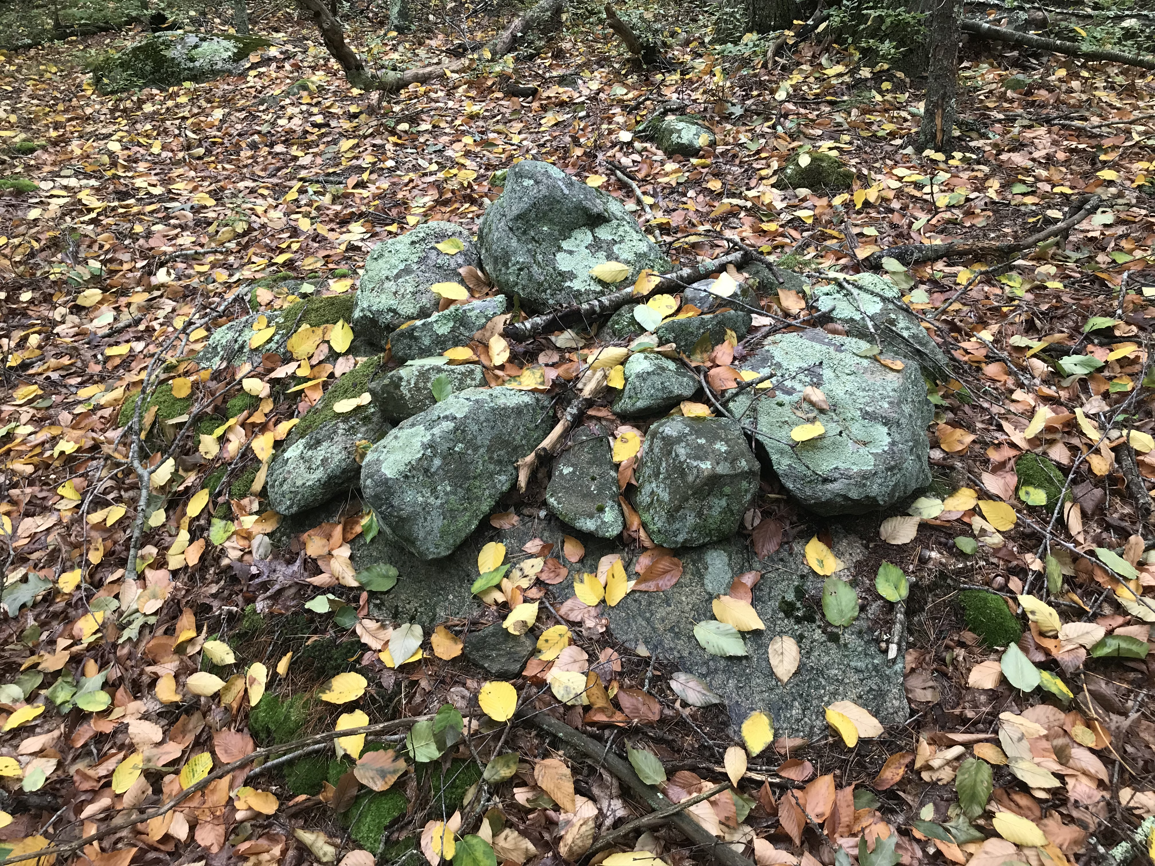
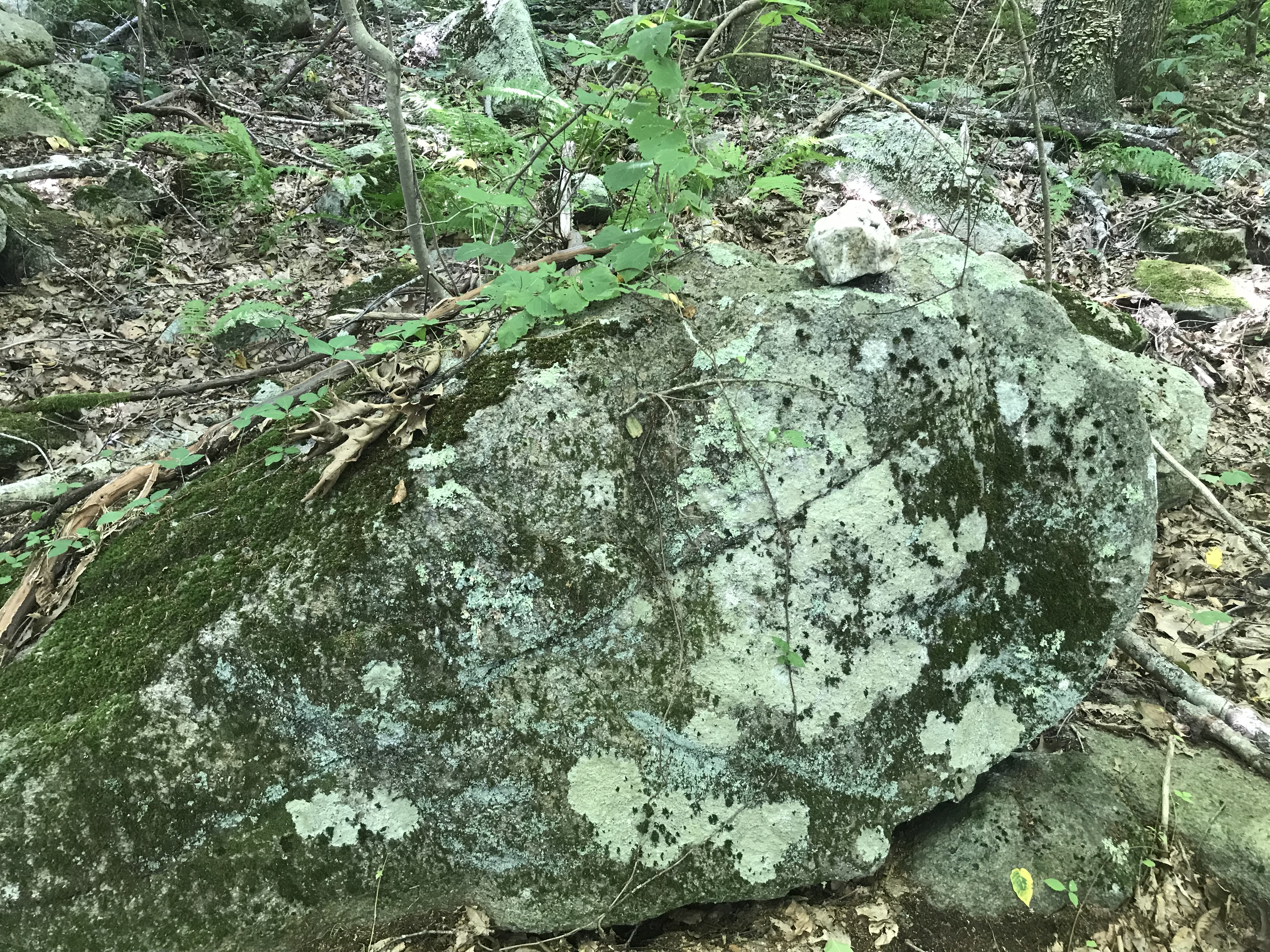
We started south along the dirt road extension of Thomas Parker Rd. Already before parking I had to stop and photo some of the large piles next to the road:

The property owner is a lucky guy:

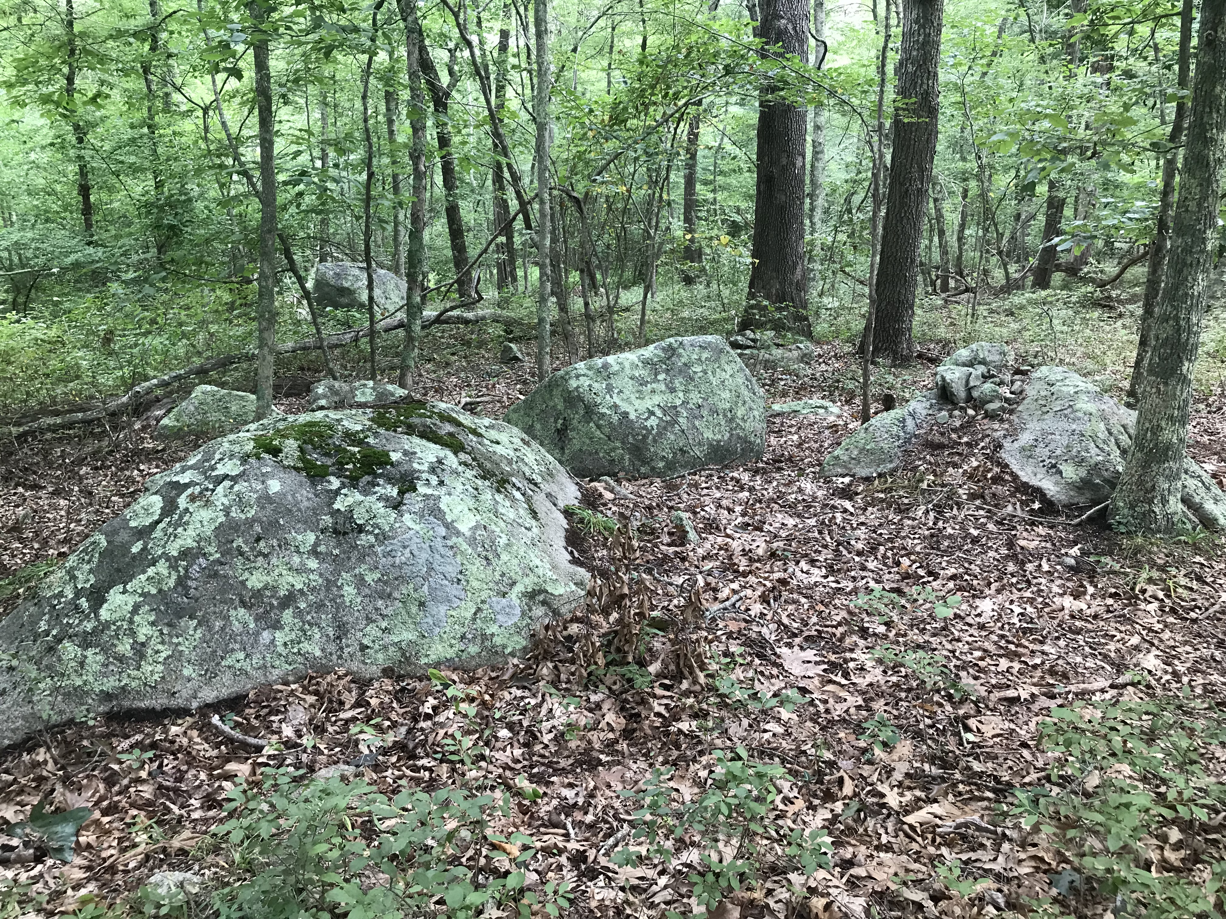
Then, as you walk down the dirt road, clusters of rock piles appear on either side:

My wife asked a tough question: "OK so these are very nice and it is fun taking as walk, but what is the point of looking at more rock piles?" I was giving this some thought as we proceeded.

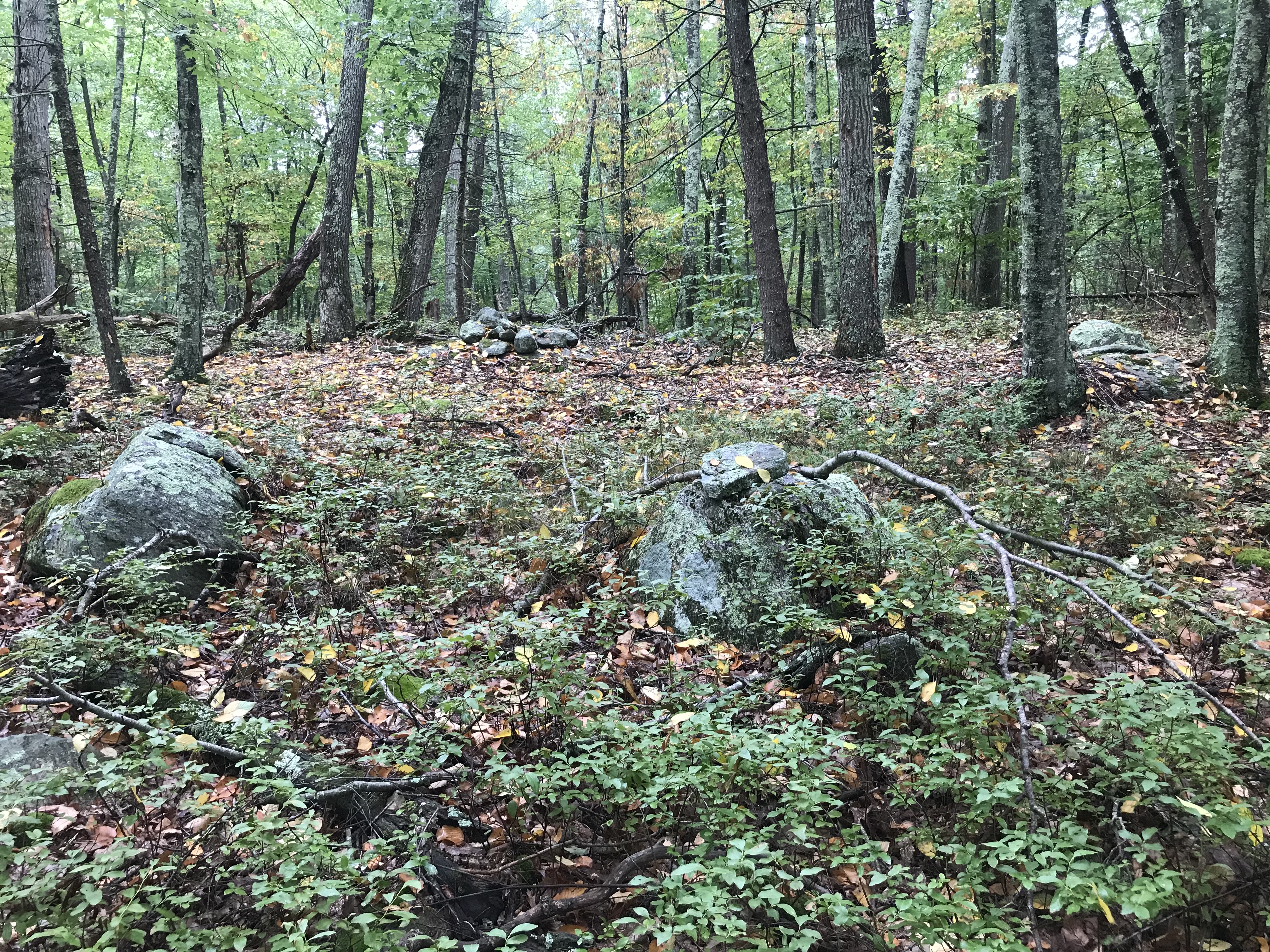
There was a trail cutting perpendicularly across the road and we followed the right hand (western) side trail, down through the woods, past a cluster of old house foundation. The rock piles were everywhere but, to me, seemed most clustered around the old foundations. This does not mean they piles were biproducts of colonial, agrarian, life but that these colonial farms were owned by Indians. The ongoing presence of modern Indians in the area was clarified later, during the second walk at the southern end of the park. 

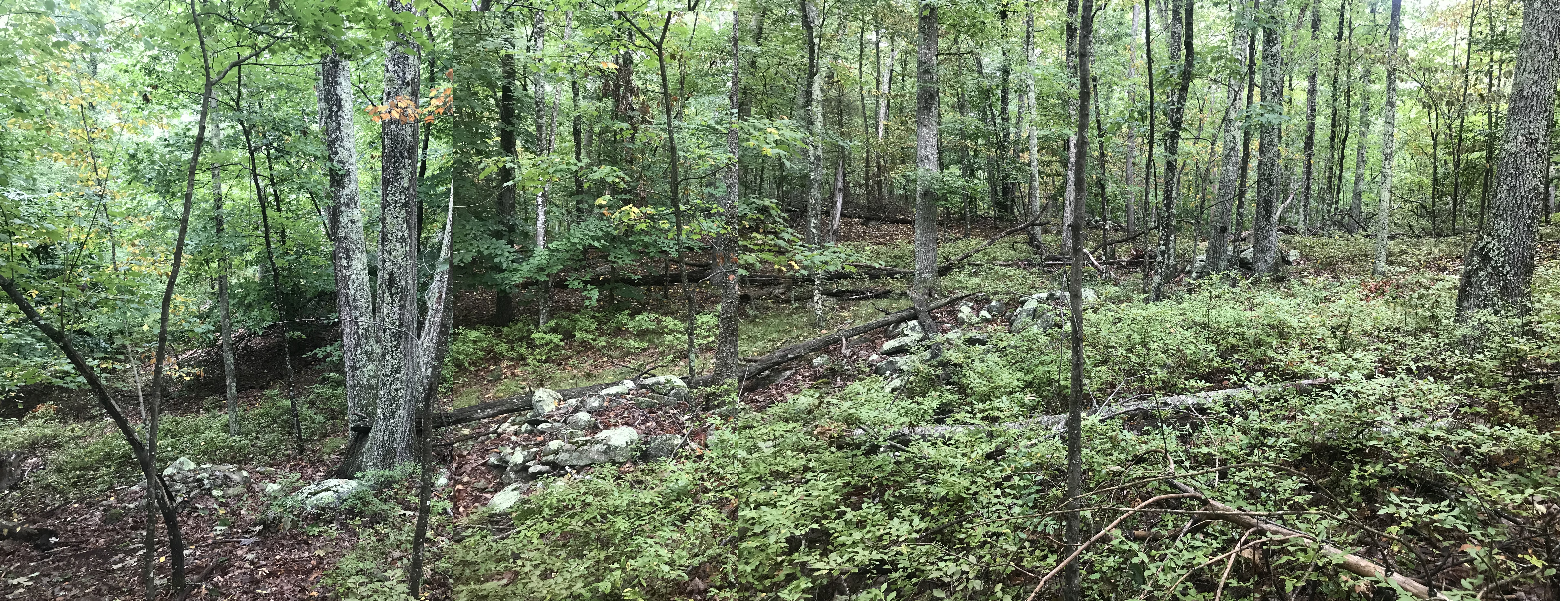
This is such well-trodden territory that it was not hard to find newspaper articles describing the "mysterious" cairns of Parker Woodland. They all reference the groups of rock piles we saw later and do not mention the material at the north end of the park. As suggested by Norman's comment, the woods to the north are much more "full" - with one cluster of rock piles after another, non-stop wherever we walked. But being out of shape we did not walk far and I regret not having the time or energy to explore places between north and south. It is a big patch of woods. My wife was starting to go more slowly.

I wonder if the brainiacs who could not decide whether the crowded cairns on a rocky hillside (see below) were farming biproducts, even noticed these other rock piles in the northern end of the park? The nicest structure I saw was this one (to the rear of previous):

I consider this to be "rectangular", although it was wider at one end than the other. Next to it, was a gully with a stepped sequence of piles:

A lot of what I would call "marker piles":
Some, triangular from above:


There was very little quartz to be seen.
A marvelous place:
But we have not yet answered my wife's question. 

We continued west and down, till we got to the edge of a steeper drop-off and, lacking the will to go down and then back up, we reversed direction and went back towards the T. Parker Rd.

We followed the eastern trail a bit before getting too tired out (I know this is pathetic...having driven so far to get here and then being so physically limited) and heading back for the car. The sites thinned out quickly and we ran out of rock piles to see. On the way, a couple of noteworthy things:

Here, at least, was a piece of quartz:

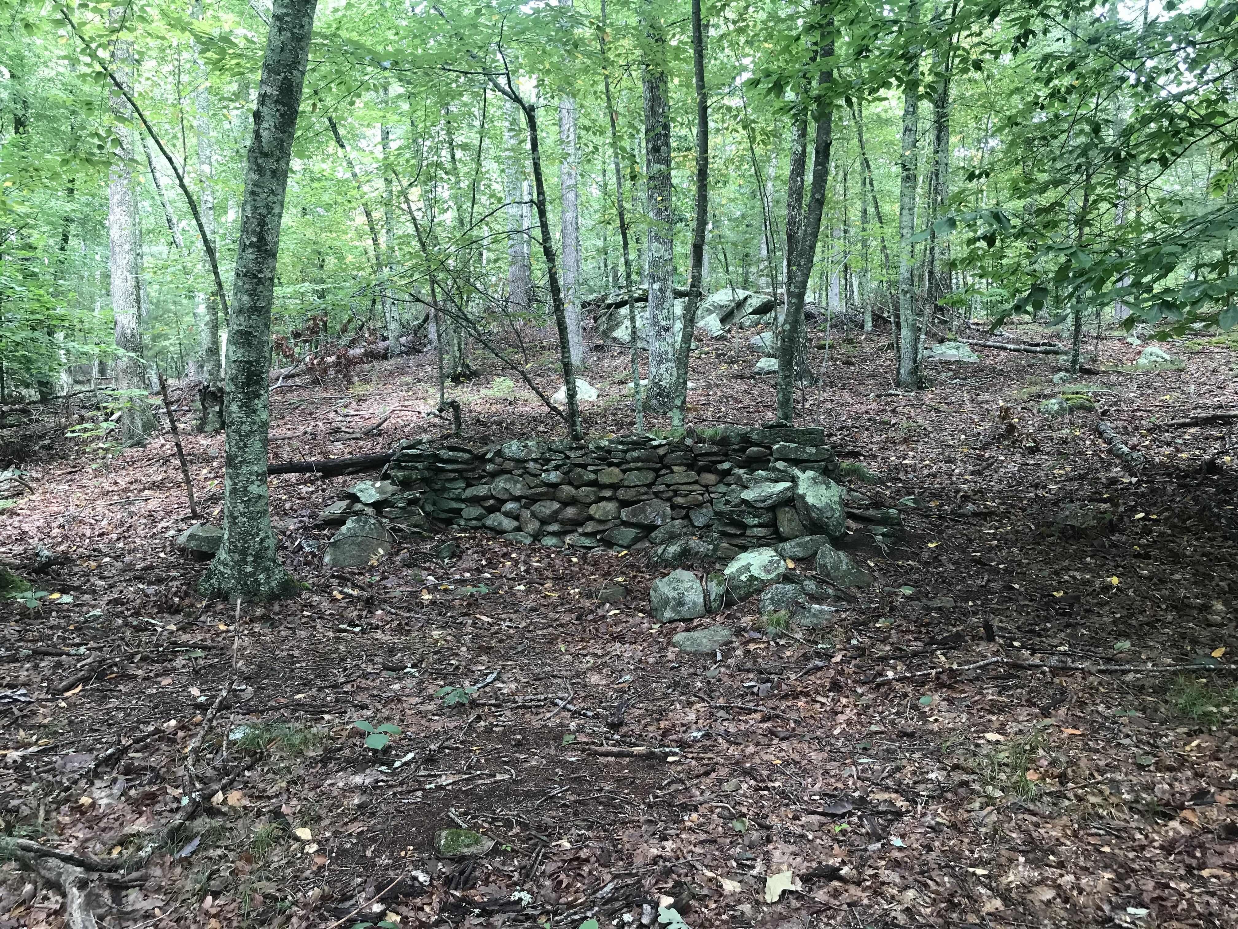
Here was something larger:
And something a bit "box"-like.
Anyway, not much to comment on, the question of "why look at more" still bothering me. 

We trudged back to the car, then drove around to the southern end and "Parking Lot #2".

Tuesday, August 23, 2022

Anomalous Structure in the Hampton Reservoir

I am spending time looking at the topo map trying to decide where to hike. This is southeastern Natchaug State Forest. What the heck do we have here?

At the lower left corner of the reservoir we see something strange. Don't tell me that is natural. Maybe it got flooded when they filled the reservoir.

Any ideas?

Appetizer


Monday, August 22, 2022

The curious number of cemeteries around Parker Woodland

Has anyone commented on this? The roads around Parker Woodland in Rhode Island are dotted with many more cemeteries than is normal:

Hoping to go there tomorrow, perhaps I'll take a look.

Friday, August 19, 2022

Last time in Tiverton (for now)

Having struck out at Wildcat Hill, I thought I would go back to the Pocasett Highlands nearby. It was even worse there - blueberries and empty swamps. Lots of rocks and.. nothing. Kinda strange.

Rather than throwing good hours after bad, I cut my losses after an hour, got back to the car, and drove back over to the Longplex area (per previous) because I thought I missed some of the area. At first I went down through the woods following the same path as before. Before coming to the place where I saw the mound(s) earlier, I noticed another one; very much hidden in the bushes, maybe fifty yards from the previous find.

Here is a rearview:
As I commented, there is internal structure if you look at it for a while.

It was interesting that this mound was built against a large split rock. It reminded me of two other "gap" related structures I noticed here the first time: the mound next to the wall (here) and this wall end (here).

Tuesday, August 16, 2022

Tiverton #2

Continued to visit Tiverton, RI with a walk around Wildcat Rock. Felt like I spent a lot of time in the lowland bushes. Although these are pretty woods, they were astoundingly empty of signs of ceremonial activity. I expected more. 

What I did find were examples of quartz rock-on-rock. This is an unusual feature in the parts of MA I have explored but they are common here in Tiverton for some reason.

Here is one:

other direction
another
another
further away
another
The woods were pretty empty of other features. Why? Had they been destroyed? These woods have seen a lot of activity. Or were they never here? Perhaps Tiverton was a no-man's land of some sort.

Sunday, August 14, 2022

A walk in Tiverton RI

I parked on Progress Way, behind the Longplex Family Sport Center and dove into the woods, heading south. 

Rt 24 cuts across the upper left of the map fragment and I think I was following the dotted line, indicating an old road, that starts in the middle of where Rt 24 bends to the northeast. There were magnificent walls, mostly cast down and varying greatly in height. [Something wrong with my writing today...sorry].
I was confident that this was good hunting territory and, sure enough, that looked like a mound - not a wall - over behind there:

You see:
From the other direction:
And a closeup:
You can see this as two parallel ridges with a lower place in between - in the spectrum of "rectangular"; possibly with a "hollow".  Another angle:

Continuing my walk, here was a little gateway:

And here was a little knoll, crossed by a wall, and I thought I should climb and look beyond that wall:
Ah! A small site with groupings of piles-on-support:


Some of the piles and boulders seemed to define small spaces:

And then one of the most interesting things was some spurs coming out from the stone wall that also defined spaces (but this might be a different kind of "space"):
I have not seen too many of these but this is my first foray into Rhode Island . It is an hour's drive from Falmouth but I think it is worth it. There are lots of other woods in Tiverton to explore.