Monday, October 29, 2018

Another Wrentham Pavement - Sheldonville example

Leaving Birchwold, driving back towards the highway on 121 I glanced left and saw this under the phone lines [at the cross hair on map]:
I parked hastily and went to look. To the left of it was a smaller pile:
And to the right and downhill of it there were some other features. But first:
I note that these "pavements" are neither rectangular, nor do they have much in the way of hollows. Here we are downhill from it:
Looks like a small circle in the background.

It is interesting to find this example of a pavement. Compared with the ones down the road at Birchwold it is in much better shape and some auxiliary piles are visible, suggesting related functions.

Back at Birchwold, Wrentham

Thought I would continue my walk from the other day, went back to Birchwold an passed the nice "Wrentham Pavement" I photo'd in different light:

Again I admired the red Wamsutta rock:
Here is an example of its use as a wedge in a split:

Here was another pavement:

Saturday, October 27, 2018

Where bedrock gives way to sandy lowlands, north of Providence RI - a prediction

If you look at a topo map of where MA meets the corner of RI, you will see "uplands" developing to the north of brooks and rivers leading down into Woonsocket, Pawtucket, and Providence. You can see a shadow across the middle of the map where the "hills" are colored differently - inside the blue outline. I mean in places like Cumblerland RI, Plaineville, Wrentham, and Foxborough.

Having seen what I am calling "Wrentham Pavements" in Wrentham, I predict that the same will be found in all of these towns. It is easy to imagine people living by these waters, heading as far uphill as possible to make mounds - and there the mounds are today.

Tuesday, October 23, 2018

Wrentham begins to reveal itself - Birchwold Farm and the Wrentham "Pavement"

I drove a bit further from the highway to a place on Rt 121 in southwestern Wrentham called "Birchwold Farm". Previously, in this direction, I got to Red Brush Hill and was disappointed. This time, I went a little further to this place, stepped into the woods and found rock piles. That's always nice.
This first rock pile combined some interesting "geologies" seen in other places. The tourmaline granite, familiar from Sterling:
And the red rock of the Wamsutta formation, familiar from Randolph:
I think the red rock is bedrock here. I stepped over towards the parking lot (having parked south of it on 121) and noticed a loose "pavement" mound:
 This is 15 yards from the parking lot. Another view.
It was tempting to rush off south into the conservation land but I was having such success, I turned back to look along the bluff that overlooks the open field there and found other beaten down mounds. No need to look further, they are right there in the bushes. In fact the whole 'bluff' had loose mounds forming a pavement and overlooking the lower wetter areas to the southwest:


The "gem" of these, from above:
And from below:
And from a distance, easy to see from the field below:
Aww....Wrentham.

The observation is that loose mounds along a bluff, overlooking a wetland, are the same type of mound that I saw last time in Wrentham, just north of here over by the store outlets. I compare these to what I called "Ravine Culture" from up north, closer to New Hampshire. Loose "pavement" along bluffs occur throughout Massachusetts - from Webster woods in Falmouth to East Wachusett Brook in Princeton and Blood Hill in Ashburnham. I think they are harder to see when there are newer rock piles around to distract one's attention. But down here in Wrentham, they are a pure expression - the only game in town. And so you notice them. 

To be honest, there were fields nearby and not a very strong argument against "field clearing". To do what I can to argue the case (1) argue from similar architecture nearby; (2) argue the quantities of local bedrock in the mound; (3) argue from the mounds being uphill from the field; (4) argue that field clearing creates mounds, not pavements; (5) argue that field clearing produces rocks of different sizes and that these mounds are composed of rocks that are all about the same size - so the wrong size distribution of component rocks. At the end of the day, these arguments contain useful observations but also keep the "field clearing" hypothesis alive.

I walked around for a bit longer, it was late in the day, and I did not get as far south as I hoped. There is plenty more exploring to be done along that brook, which is one of the brooks leading down to Diamond Hill Reservoir, and further waterways leading down into Pawtucket, Rhode Island. From the looks of it, Pawtucket and Fitchburg are similar in being the meeting place of many brooks and rivers. I will try to hunt out those headwaters.

I had a pleasant hypothesis confirmation when I went a little eastward into a north-south valley [right hand side of the map fragment] and looked to the left along the slope I was coming down, seeing nothing, then looked across the valley to the far slope and a little uphill - just to be scanning the flanks of the headwater valley - and seeing another tumble of rocks spilling over a bluff.
Closer:
Since it seems to be a well defined type of mound, common in Wrentham, let's give a name like Wrentham Pavement. Other suggestions?

Sunday, October 21, 2018

Friday, October 19, 2018

Poconos Rock Piles

From reader Mike:
To whom it may concern,

I've found a sizeable amount of cairns and rock formations when I lived in the Poconos. I can provide coordinates. At the time I lived there, there appeared to be no interest in these formations. The area is infested with Black Bears, so please be careful if you do visit the location. If you would like these coordinates, please let me know. I can tell you how to access the area and where you'll find them. Please reply if interested.

[I can forward an email address if you are interested in the details - PWAX]

NEARA fall events

From Peter Anick:
Hi. Just wanted to alert you to a few things of interest:

We are in archaeology month in Massachusetts.  Lots of interesting events still coming up.  Here are a few:

International Archaeology Day at Dighton Rock State Park

Date & Time: Saturday, October 20, 10am-2pm
Location: Dighton Rock State Park, 3rd Avenue
Information: 617-626-1377, ellen.berkland@state.ma.us
Sponsor: Department of Conservation and Recreation, the Massachusetts Archaeological Society – Southeast Chapter, and the Friends of Dighton Rock   
Admission: Free
Be an archaeologist for the day!  Learn how to think like an archaeologist…excavate a test unit, screen for and identify artifacts, and document and record soil levels. Other activities focus on the extensive and rich peopling of the area dating back thousands of years. Find out why this place was and is so special to the First People of Massachusetts. Learn how to use a bow-drill, grind corn with a mortar and pestle, weave a fishing net, make a ground stone-tool fishing weight, make a ceramic pot in the traditional indigenous way, play the game of Hubhub, or even try your hand (arm) at throwing an atlatl! Visitors are welcome to bring an artifact for the experts to identify and to tour the most studied artifact in the U.S.‑Dighton Rock‑ carved by indigenous people thousands of years ago. The event is free and there is plenty of parking. Bring water (and work gloves if excavating and screening).


Adult Archaeology Walk

Date & Time: Saturday, October 20. 10am (Rain Date October 27, please call to confirm)
Location: Meet at the parking lot at the end of Wheeler Lane, off of Route 27, Acton
Information: 978-929-6655
Sponsor: Friends of Pine Hawk, Acton Memorial Library
Admission: Free
This year's archaeology walk will again be led by Linda McElroy, Trail Through Time site specialist.  During the walk, we will visit the Nashoba Brook stone chamber, view its interesting interior, and learn about its history and that of its associated square foundation. Time permitting, we will also visit the industrial era site of the Acton Pencil Factory.  Visitors are advised to wear hiking boots, and bring buy spray and a flashlight for the walk. The walk is expected to take 1.5 to 2 hours and cover a distance of 1.5 miles round trip. Please confirm the event date and time in the library's online calendar.

More events listed here: https://www.sec.state.ma.us/mhc/mhcarch/arch_month/archidx.htm


Hope you can make it to the Fall NEARA meeting in Nashua.  Reserve before Oct. 31 to take advantage of lower prices and guarantee banquet seats/hotel reservations.  As usual, we will try reserving some tables at Saturday lunch for Massachusetts chapter folks to meet and discuss what's new (or old, for that matter).  If you have a site you would like to see, or if you are willing to lead a field trip, let me know and we can discuss at the meeting.

The leaves are hanging on tight this season, so we'll shoot for a November date for the Montague field trip, which is best seen without foliage. Tentatively thinking about the weekend of Nov. 24, so we can walk off our Thanksgiving dinners.  Mark that in your calendars, to be confirmed.

Finally: At the moment, I am the custodian of the NEARA library's small collection of books on rock art.  If you are interested in borrowing a book for your research or interest, let me know your interest and we'll figure out a way to lend it to you (e.g. I could bring it to the fall meeting).  You can check out the full library in Nashua during the meeting as well.

Best regards,
Peter
Massachusetts state coordinator

Monday, October 15, 2018

Manitou Hassannash Preserve (Hopkinton RI)

Nevada Drone Archaeology


Drone Archaeology in Nevada, California, and Arizona

"All videos are accompanied by ambient (background) Native American music. If you don't like the music just turn off your volume."
A collection of videos here:
https://www.youtube.com/channel/UCBilc4sbuo1bmi3_Wr_uMsQ


Saturday, October 13, 2018

There's that shape again (from Exploring Moche Murals):
That one actually does look like it has been vandalized.

Tempers Flare in Shutesbury: "Solar foes claiming Indian burial mounds raise ruckus at Shutesbury meeting"

See: https://www.masslive.com/news/index.ssf/2016/08/solar_foes_claiming_indian_bur.html

Archaeology versus Archeology

Both spellings are acceptable. I don't like the extra 'a' in "archaeology" because it doesn't feel like an English spelling. Weird how I have to insert it, in some places, to be consistent with people's expectations.

NEARA FALL CONFERENCE, NAHSUA NH NOV 9-11

See here for full conference schedule.

Friday, October 12, 2018

Employers of professional archaeologist don't want sites found

(Via Norman Muller)

I received the frank comments below from a fellow I know, who was once a contact archaeologist and is no longer employed in that profession.

"I think many archaeologist's don't want to, or want to create the time, to investigate these fascinating sites, & want to keep 'their jobs' by staying within the parameters of general archaeology, & not venture outside the 'mainstream' of conventional archaeological thought. Sadly, in my own limited experience of working in archaeology, we were very limited in what was investigated & actual artifact finds; in fact, on one site we had a limited investigation of, along the Musconetcong River, we found a small concentration of black chert worked flakes, evidence of Indians having been at this site, we called over the crew-chief to check out the artifacts we found & he threw them into the woods! We had a 'knee-jerk reaction' at this - we said: "What the hell are you doing?!" He responded: "You want a pay-check this week?" "Yes, of course", we responded, "If we report that there was evidence found here, we ( the archaeological company I was working for at the time - CRCG, now defunct) will have to apply for a permit, to archaeologically investigate this site, & we, (CRCG) cannot afford, the time, money, & crew to investigate this site"; "So you found "nothing", understood?" And this is what happens, over & over again, in archaeology, this is why many archaeologists never 'stick their necks out' to investigate such interesting sites as in your articles, you've written about."

Friday, October 05, 2018

Reflections - from Norman Muller


Twenty Years Studying Native American Stonework

Peter Waksman’s fascinating recent essay on his blog Rock Piles (October 1, 2018), reflecting on his decades-long experience studying Native American stonework near his home in Concord, MA, made me think of my own experiences on the same topic, and so I decided to write some of them down.

I came to this serious pastime from a background in classical archaeology and geology as an undergraduate at Boston University in the late 1950s-early 60s, and then in graduate school in the mid=1960s, focusing on the scientific examination of art, and art conservation, which became my life’s work for the next fifty years.

While employed at the Worcester Art Museum in Massachusetts in the mid-1970s, I came to meet Malcolm Pearson, the photographer and former owner of the Upton Chamber and Mystery Hill in NH.  We lived near one another.  Malcolm was an active member of the Early Sites Research Society, and a close associate of Jim Whittall; he took me to the Morrill Point Mound in Newbury, MA, where Whittall was excavating, and also to the kiva-like underground chamber in Putney, VT, another of Whittall’s projects.  I also attended a couple of meetings of the ESRS, but never really embraced the organization, one reason being that I was skeptical of some of the so-called artifacts I was shown at the Putney site.

Moving to Princeton, NJ in 1981 and to a job at the Princeton University Art Museum, I left the ESRS and Native American stonework behind me for the next sixteen years. Then, around 1995, I was contacted by Steve Ells, a Thoreau scholar and resident of Lincoln, MA, who wanted me to show him a log structure I had seen in Estabrook Woods in Concord when I lived in MA for a year in 1969.  So, one spring day in 1995 I drove to Concord, met Steve, and the two of us hiked through Estabrook Woods to where I remembered the log structure having been located.  Now, twenty-five years later, it was pretty much dilapidated.  At one point after seeing the log structure, Steve asked me if I’d be interested in seeing an above-ground stone chamber.  Always intrigued by new discoveries of this sort, I enthusiastically agreed, and so the two of hiked to the base of Hubbard Hill, where, along a colonial stone wall, we came upon this fascinating stone structure.  Steve told me that Mark Strohmeyer had studied it and had written a report on it for Harvard University, which owned the property.  I obtained Mark’s phone number from Steve, and once I got back to Princeton, I called him.

I never met Mark, but we had some long and intense talks by phone on Indian stonework, about which I knew very little at the time; Mark did most of the talking.  At one point during our first telephone call, Mark told me to buy a copy of Manitou and read it.  And once I had read it, I should call him back, which I did.  During this second call, he told me to contact a high school friend of his in Pennsylvania, Fred Werkheiser.  Fred was a shoe store owner in Nazareth, and in 1996 he kindly showed me several interesting sites near the Delaware Water Gap. The following year, in November, he took me to the Oley Hills site in Berks County, a day after an early November ice storm had covered everything with about a half inch of ice.  The effect on the remarkable stonework was beautiful and spellbinding, and from that point on, I was determined to learn as much about the site as I could, and try to determine whether the stonework (which consisted of large platform cairns, a Terrace, and stone walls) was Colonial or Native American.  The former landowner claimed the stonework was Celtic, but Fred said it was Native American.  I sent photos of some of the cairns to the state archaeologist, who wrote back saying the features looked “Industrial.”. With that, I knew that trying to determine who built the stonework and when would prove a daunting task.  For the next several years I made many trips to the Oley Hills site, and to Reading and Harrisburg, studying deeds and collecting information.  All of this resulted in an article published in British Archaeological Reports (BAR) in 2008, which is available on the NEARA website.

Beginning in the late 1990s, Manitou was my main source to the mysteries of American Indian stone constructions, the information in it often supporting what I had seen on my own in the woods.  But as I became more familiar with the stonework scattered in the woods of the Northeast, I also became more critical of what Mavor and Dix had written.  For example, their emphasis on archaeoastronomy and alignments, particularly in reference to the Upton Chamber, which was one of the main focus points early in their book, I found unconvincing. While archaeoastronomy is certainly a valid field of study, particularly for those areas of the country that are more plains-like or arid than the Northeast, this discipline must be applied carefully, and the evidence checked repeatedly, before results can be accepted.  With regard to the Upton Chamber, I still have some basic questions about the chamber having been used as a sighting platform that have not been answered satisfactorily, in my estimation.  The first one is, what was the main or primary purpose of using the chamber as a sighting platform?  And why build a massive beehive-shaped chamber simply to view some stars setting over a hill a mile away?  Couldn’t an outdoor spot on the ground, perhaps marked by some stones, have sufficed?   The chamber as a viewing location doesn’t make practical sense.  So what if certain stars set over Pratt Hill in 710? What practical purpose did this have?   Is it possible, using only one’s eyes, to actually see the stone mounds on Pratt Hill from deep inside the chamber on a moonless dark night?  And does one have the visual acuity to perceive certain stars setting over Pratt Hill a mile away?  What about trees getting in the way, plus the problem of cloud cover in the Northeast, which amounts to about half the days of the year?  So, until someone can answer these simple questions, I will remain skeptical of the actual function of the Upton Chamber.

In Lucianne Lavin’s excellent book, Connecticut’s Indigenous Peoples, New Haven & London, 2013, she discusses archaeoastronomy briefly on page 283, focusing in part on King Philip’s Cave and King Philips Rocks in Sharon, Massachusetts.  With regard to these sites, she writes the following: “Some have used astronomical theory, coupled with the use of global positioning and geographic information systems, in attempts to make the case that such rock clusters and caves form sight lines in the direction of important solar events, such as summer and winter solstices, usually around June 21 and December 21, marking the longest and shortest days of the year… In contrast Onkwe Tasi, a Native American and longtime resident of Dracut, Massachusetts, reported that ‘indigenous New Englanders did not construct stone structures to calculate celestial , solar or lunar change.’  Instead they relied upon the variety of predictive faunal, floral, and climatic cues, marking transitions between seasons.  Tasi claimed his ancestors had no need for elaborate stone calendars, and that he knew of no contemporary Native groups using sites with stone piles, stone walls, outcrops, or boulders for ceremonial purposes.  Trudie Lamb Richmond has echoed Tasi’s comments regarding local indigenous use of natural phenomena rather than stone calendars.  The Agawam calendar supports this claim, and many professional researchers agree.  Still, this does not negate the fact that some stone formations reflect the spirituality and ideology of local First Nations.  And there is always the possibility that in the distant (and now forgotten) past some indigenous peoples did use stone sight lines to mark important celestial events.  Patrician Rubertone refers to these cultural stone monuments as ‘memory keeping places,’ mnemonic devices that link tribal members to their ancestral history and to each other.”

Wednesday, October 03, 2018

Stone Percussion Instruments (CO)


Stone artifacts could be Colorado's oldest percussion instruments
     Author: Erica Tinsley - September 4, 2018

They were a mystery in Colorado for decades. Large, rounded stones found throughout the San Luis Valley and at the Great Sand Dunes National Park. Now local archaeologists believe they may be Colorado's oldest instruments...

Story and Video:
https://www.9news.com/article/news/local/stone-artifacts-could-be-colorados-oldest-percussion-instruments/73-590995639

Monday, October 01, 2018

Indigenous Landscape - creating a new mythology

When I got started looking at rock piles there had been thirty or so years of research by individuals connected (or not) with something called the "Early Sites Research" (ESR) society. It included James Whittal, and some of the other individuals whose names are familiar - I am not sure who was in that organization but people like Goodwin (of Mystery Hill fame), Pearson (the photographer), Sincerbeaux (the lady from Vermont). I am sorry if I am missing names here - it was before my time. That organization gave rise to NEARA and I believe early NEARA people included Ted Ballard, Ros Strong, Sue Carlson. Barry Fell the controversial Harvard script decipher-er was an influence in ESR but I am not aware of him being involved with NEARA.

In the transition from ESR to NEARA we also have people like Mavor and Dix who, in my opinion, were the first to publish a believable and coherent picture about ceremonial stonework in New England. We also have Ted Timrek, a Smithsonian videographer, who made beautiful films and contributed some intellectual continuity with the old Smithsonian days of Squier and Davis - a past where Native American mounds were a well known, comfortable fact. In personal communication with me, Ted claimed he was at the Calendar I dig (see 
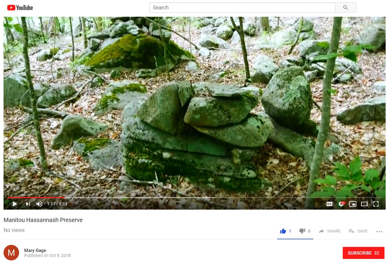
Manitou by Mavor and Dix) and brought up the possibility that the subject matter was not from European visitors but rather from Native Americans. I asked Mavor about this specifically and he said that Ted was there and was part of a general conversation they were having.

This time frame - maybe ~1970 [???], also included the energetic talent of Mark Strohmeyer, who had been exploring up and down in the towns of my home territory, and who had tried to tell the local historical societies about the stone work in those towns. Later I located sites which, it turned out, Strohmeyer had visited but located incorrectly on the map. (I am talking about the Acton "grid" which is off Spring Hill Rd, not Log Hill Rd in Carlisle.) At the same time, Byron Dix, like Strohmeyer, had spent a good deal of time poking around the woods of Boxborough, Harvard, and the valley of Beaver/Elizabeth Brooks (now Rt 495). In my thinking Strohmeyer and Dix were the first to really go out exploring, but the ladies of Vermont had also done a good deal of exploring- I just don't know about it.

Mavor told me he got interested in applying Alexander Thom's archaeo-astronomical techniques, that had been applied to megalithic monuments in Europe,  to something in the U.S. Mavor was surprised when it turned out that stone walls had astronomical alignments. And his interests and thinking shifted gradually from European archaeo-astronomy to Native American archaeo-astronomy. The thread of archaeo-astronomy was a major new idea in the analysis of stone sites. Previously there was not much to study - except some inscriptions found in stone chambers. A lot of early research [much like the research I have been doing] was in the category of "Ooh! look at that! isn't it curious?" Mavor turned the study into a subject where you apply genuine measurement techniques and provide quantitative approaches. In my opinion (and this is very relevant to the story) the quantitative emphasis went a bit too far, and in some cases stunted the growth of people observing the stone constructions. I watched a lot of sloppy work with a magnetic compass, passed off as "research", by people who could easily grasp the presence of an alignment but who never thought much about its significance.

By coincidence, I live in the Concord area in the winter and visit Woods Hole, Mavor's home town, in the summer. My father went to a "seniors group" talk by Mavor and come home with a copy of "Manitou" and the thought: "I just heard something strange about the woods...let's go check". We were in Woods Hole and went out to a couple of the sites Mavor reported. Sure enough the alignments described by Mavor were real. I was into arrowhead hunting at the time but I went and introduced myself to him, challenging his statement that stone tools were not found near ceremonial sites (they actually are found, just not 8K years old arrowheads). He ended up recruiting me into NEARA. Because I was already blogging about arrowheads, the NEARA board of directors asked my to do a web page for the organization - so I started their home page for them and started looking around for something I could contribute to the subject. I was, and am, in awe of Mavor and Dix for having discovered this amazing phenomenon in our woods. Actually it was not just them.

So when I started, I wanted to contribute something and noticed quite a few rock piles in Acton. What was critical for me was seeing well-built piles about 1/2 mile away from some field clearing piles and thinking "whoa! this is not the same thing...how do I prove it?" So I started trying to document and understand rock piles. It seemed they were an under-studied aspect of the subject. Everyone else in NEARA was interested in stone chambers, European inscriptions, and alignments. At around the same time I started writing about rock piles, Norman Muller was taking an interest in rock piles and he was writing about them. The site at Oley Hills is certainly one of the most fantastic collection of mounds anywhere. I want to dwell on the point that Norman has been focused on large sites with amazing large mounds. There are few such monumental sites near my home in Concord and so, by default, I ended up examining smaller less dramatic examples. I think this was a good thing. By far the majority of sites are not "monumental" and it would be easy to miss their significance.

Back then, around ~2003, I thought sites were rare and ventured, timidly, out from Concord looking for sites in nearby towns. They were everywhere I looked; leading me to think, at times, that I had uncovered some magic formula for locating sites. At one point it was "southeast facing, next to brooks". Whatever the theory that got me out looking, it always seemed successful. I now understand this as the result of sites being everywhere but, over time, real correlations were noticed and my hunting techniques became more efficient. I ventured to speculate about things and then tested ideas against the realities of the sites I was finding. I did an experiment which I think is definitive: pick a random place on the map (say in far off Leominster) and circle the locations most likely to contain rock piles. Then go out and look. I found rock piles in the snow that way and, believe me, you don't find them in the snow very easily. This convinced me there was a relation between topography (mostly the relation to water) and site locations. But by "site" I mean the humble collections of near-invisible piles. I do not know what the correlations would be with large monumental sites of the sort studied by Norman. I did other "experiments" related to collecting and analyzing typology statistics from many sites. Probably my important contribution is the discovery and mapping of more than 800 sites.

I should also mention this Rock Piles blog. When I got too much material to publish, I thought it not appropriate to use the NEARA webpage for my photos, so I showed Dan Boudillion how to do manage the web page and transferred my energies to Rock Piles. With the help of guest authors like Tim MacSweeny and Chris Pittman, the blog has been able to keep going 12 years since 2006 eight years, since 2010. During that time we added so many standard search terms to the articles that were posted, that this blog became the target of most Google searching involving ceremonial stone work. Ironically it is not always true and many stories about "mysterious rock piles" continue to come from people who should know better and been able to find information online, had they looked for it. But in any case, the blog answered the search questions about rock piles, at a rate of perhaps 100 new people a day, for long enough that academic rejection of Native American stonework never took place. Online, the notion of ceremonial rock piles in the eastern U.S. is the norm.

At around 2003, while I was discovering sites in Carlisle, Linda MacElroy from NEARA told me about a fellow named Jic Davis, who lived near the corner of Acton/ Carlisle/ Concord, and who had a "jade mine". Jic turned out to be a forester and landscape designer who loved geology and the beauty of his own back yard. As it turned out, his "jade mine" was right beyond a rock pile site I had explored the previous week with my son Joe. When I met Jic and visited the "mine" we passed through the rock pile site on the way back and I commented that a certain table rock there sure seemed unusual. He briefly argued that it was from colonial stone work, and then gave up and became very enthusiastic about Native American stone work. Jic was mostly interested in his own views and his impressions of rock piles were formed from a limited data set. The idea of celestial alignments is easy to understand and a fun idea and got latched onto immediately. In later years, I would call Jic up and say: "lets go out" and occasionally he would take walks with me and add the insight of his observant (I claim un-filtered) perceptions. Those insight came from inside his head and (still later) when he would ask Doug Harris about something, Doug would get annoyed that Jic was projecting so much into the subject and asking questions Doug could not answer. I want to say that it was deeply significant to Jic, on a spiritual level, that there were visible traces of the Indians left in the woods of his childhood. When we were suburban kids, Indians were a favorite subject and, as adults, it only slowly dawned on us that there were Native objects in plain site. A thrill!

But there was another thread of significance to Jic, namely the possibility that the Native Americans could help him protect his land from the estate lawyers. It also turned out that Jic's land was on loan from a land owner and that the estate for the fellow (who was said to be senile) were getting ready to threaten Jic's use of the property. Not something I could have done, Jic put himself out there time after time calling the Indians. Eventually they appeared, they saw, and they adopted. Now if you care to understand my relation with Jic, consider that although I taught him about the subject, and schemed with him [I actually wrote the formal invitation to the Indians], somehow the Narragansett Indian Elders came to Carlisle, without my hearing about it until long after. Somehow their acceptance of the invitation, scheduling, and actual visit took place without a word of it being mentioned to me...even though Jic and I were talking on the phone at least once a week throughout that time.

The personal downside is somewhat irrelevant. But the real downside is that the Indians were introduced to the rock piles by people who knew very little about them; leading to a present in which the Indians may not have gotten a complete picture, and maybe never will. Everybody is focused on alignments! After the initial visit by the Elders, they sent out a deputy Tribal Historic Preservation Officer, Doug Harris, to do further surveying and coordination with local land owners about site protection. They were looking at the sites I showed them. I showed them to another local land owner Tim Fohl, who quickly adopted an interest in"alignments" but had no experience with the topic. Out of this time frame came the "Indian Rock Defense" that got written about in the Carlisle "Mosquito" as a new way to fight against land development. It is very gratifying to see local towns rolling out education programs to teach people about Ceremonial Landscape.

Also in this time frame, I started showing sites to Doug Harris, ultimately leading to me giving him a list of 8 towns where I knew about rock piles. Doug Harris got it, or thought he did. I remember showing him a site and he asked: "Why would there be a site there?" and I answered "How could there not be...look at it." I showed him the relation to water. At the time I was very curious about whether the Indians already knew about ceremonial stone work. I think they did not; and will explain why. They did have a story about a "medicine man circuit" that passed through the towns I listed but I asked questions and analyzed what Doug Harris was saying. I was very puzzled by the use of quartz in rock piles and tried to pass various speculations by Doug to see what he would say. He informed me that quartz, as a white material, was more an amplifier than something with its own properties. And that is the only useful information I got from him. Later he made an elementary mistake emphasizing how corners are to be avoided in "harmonious" constructions. But that was because he stopped listening to me before learning about rectangular mounds with hollows. Also his wife, Winona, showed some puzzlement when I first showed her a rock pile - wondering if it wasn't from field clearing and dismissing similar structures from her back yard. I really wanted to know if there was any cultural continuity between today's Native Americans and yesterday's rock piles. I conclude that the memories are there but vague and featureless and mostly forgotten. Until it became a tool in land development - and suddenly the Indians had real leverage.

When Doug first started to get the idea, he was excited and went to the USET congress (an official meeting of united, south, and eastern, tribes) and they issued a "resolution" that named the 8 towns (the ones I had identified) and that was the start of an official story about rock piles. I listened with great intent when, at a subsequent NEARA meeting, they had the chairman of USET speak these words: "We did not know about these things....you showed us the way." That nails if for me. Before these events, ceremonial landscape was NOT part of Indian thinking in the eastern U.S. I should mention in passing that the USET chairman's voice was transmitted to the audience during a NEARA "expert panel discussion" about rock piles that was organized by Doug Harris and included Tim Fohl, Ted Ballard, and tribal officers from Mashpee and Aquinna. I was not asked to be on that panel.

Doug Harris accepted rides to events from Tim Fohl - who had joined the discussion as a local landowner. Tim liked the idea of alignments and never seemed to evolve past that; and he seems to have passed on that focus to Doug Harris. This tends to "bake in" the concept of alignment as the primary "spiritual" end-in-itself. But it is wrong and only part of the picture. I tried to explain it to Doug but, by then, he was traveling around the country giving talks. He picks up the phone when I call - usually to alert the tribes to a threatened site - but has not had any more time to go look at sites. Unfortunately, I did not know about burial mounds at that time and it was only later that I tried and failed to communicate that to Doug. The alignments are part of a calendrical system that is a critical component of burial rituals - not an end itself. I don't think Doug Harris understands that. Let me then stipulate that today's Indians did not have direct knowledge of ceremonial stone structures. As a result the education programs being rolled out in individual towns are not quite right, emphasizing astronomy when they should be emphasizing the role of astronomy in mortuary and other rituals. I do not know what might be being said about water, if anything.

I would not mention it except for being slightly hurt to have been written out of the story. So I listen to a YouTube of Doug Harris ( Doug Harris Let The Landscape Speak Part 2) and find him emphasizing how it was this "crazy guy" from Carlisle (Jic Davis) who got the Indians to come out and who showed them the rock piles. That is not entirely true. I think it is much easier to accept that "spirit" is speaking to modern Indians via a crazy guy from Carlisle, than via a western scientific type (my PhD is in Math) who is simply trying to observe carefully, given a lead from Mavor and Dix. Note that Mavor was a PhD ship designer. Also a shout out to people like Fred Martin and Ken Leonard, who retired from academics and used their skills to study stone structures. The truth is that the knowledge of ceremonial structures arises, out of the ashes, not through the spiritual insights of a "crazy guy" but through systematic, disciplined observation by a number of people, many with scientific backgrounds. As far as that goes, "spirit" uses the tools available. I like to think Doug cannot write me and other early contributors out of the story, because we are all part of it.