Monday, June 15, 2015
Why you shouldn't climb on rock piles
It is a bit superstitious and a bit scientific to believe that climbing all over a rock pile is tasteless. After all, it might be someone's grave. It is certainly fragile. So keeping off of it is a good way to be respectful.


Solstice Viewing in Boxborough
via Peter Anick at NEARA:
This Sunday morning, June 21, NEARA member George Krusen will host a summer solstice sunrise meeting at a location in Boxboro hypothesized by Byron Dix as a sunrise alignment. (There is also a winter solstice sunrise alignment here.) Information here from Sudbury Valley Trustees site: http://www.sudburyvalleytrustees.org/events-calendar/summer-solstice-sunrise-weather-alert
If you know of other sites to visit for observing possible alignments, send me a message with directions and I will post to the group. Take photos and videos to test your hypotheses. As most of you know, the sun will rise/set at roughly the same horizon location throughout the week before and after the actual solstice, so you can check the weather and pick your day(s) to optimize viewing.
In past years, some of us have gone to Upton Chamber for the sunset (between 7:30 and 8:30pm). There is foliage but the glint of the sun setting over Pratt Hill can usually be made out from inside the chamber. You can watch from outside, but if you want to go inside, bring boots in case there is water.
This Sunday morning, June 21, NEARA member George Krusen will host a summer solstice sunrise meeting at a location in Boxboro hypothesized by Byron Dix as a sunrise alignment. (There is also a winter solstice sunrise alignment here.) Information here from Sudbury Valley Trustees site: http://www.sudburyvalleytrustees.org/events-calendar/summer-solstice-sunrise-weather-alert
If you know of other sites to visit for observing possible alignments, send me a message with directions and I will post to the group. Take photos and videos to test your hypotheses. As most of you know, the sun will rise/set at roughly the same horizon location throughout the week before and after the actual solstice, so you can check the weather and pick your day(s) to optimize viewing.
In past years, some of us have gone to Upton Chamber for the sunset (between 7:30 and 8:30pm). There is foliage but the glint of the sun setting over Pratt Hill can usually be made out from inside the chamber. You can watch from outside, but if you want to go inside, bring boots in case there is water.
A Few things about Indigenous Clam Gardens
"demonstrating a sophisticated understanding of
stonework engineering”

Photo and Image: Amy Groesbeck.
http://wakinguponturtleisland.blogspot.com/2015/06/clam-gardens-june-2015.htmlSaturday, June 13, 2015
Boulders in Smithfield RI

https://trailsandwalksri.wordpress.com/category/mercer-lookout/
(By some power lines, if you look here: http://www.exploreri.org/trailmaps/wolf_hill_map.pdf
or here: http://binged.it/1Qv7fN2)


Also at Wolf Hill Forest Preserve - Smithfield, RI, I find someone relates that "Stone walls (are) everywhere..."

This, "Quartz rock at Nipsachuck, showing repeated use in artifact making," comes from:
Friday, June 12, 2015

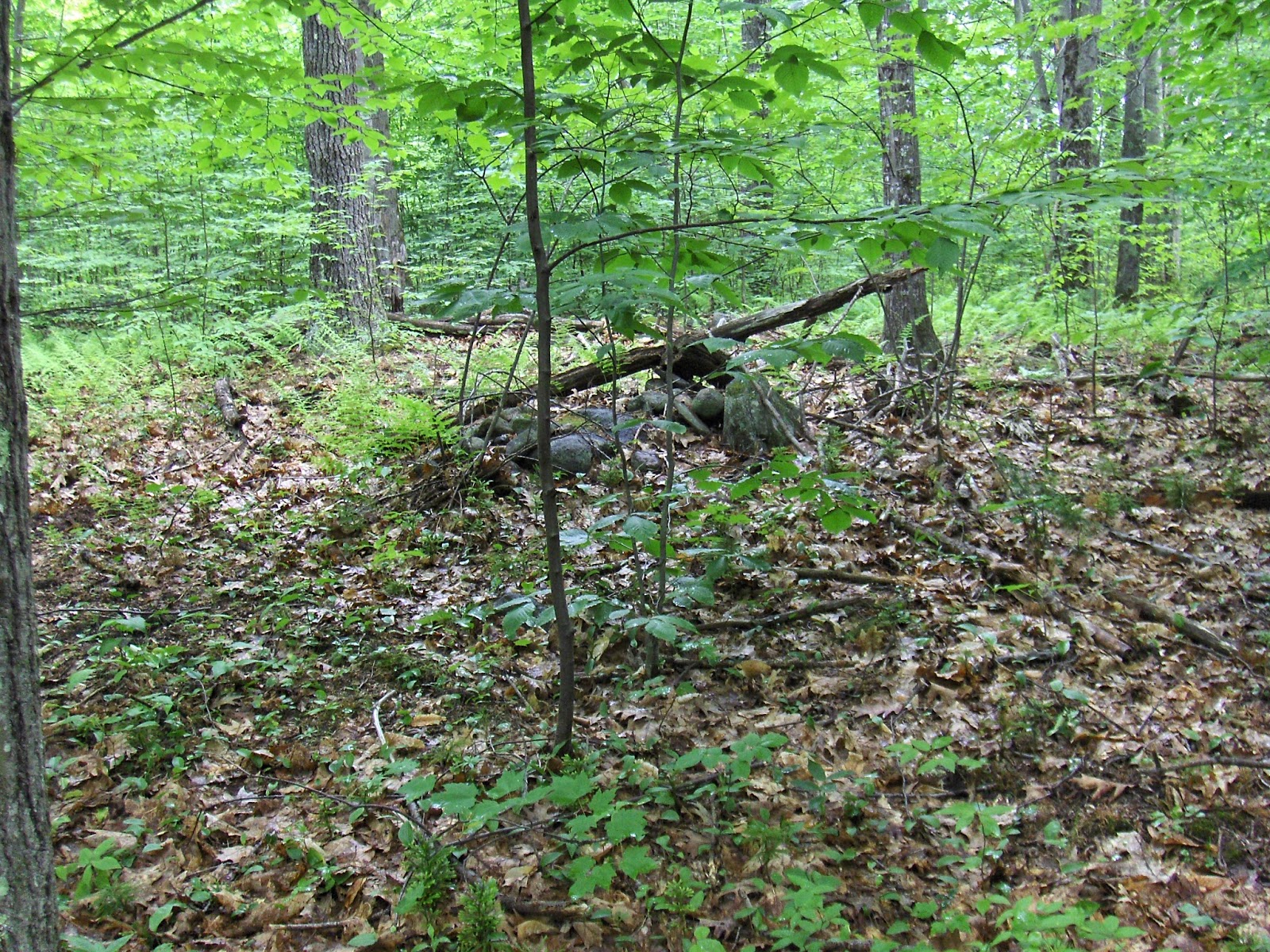


Modern rock pile

Living in the Past
Landowners often loot or destroy archaeological sites. Is
this new subdivision a solution?

By Nick Romeo
“When he was a boy in the 1930's, (Archie) Hanson loved
collecting beads, fishhooks, arrowheads, shells, and any other tangible relics
of the Native American tribes that once inhabited the California coast where he
lived near Long Beach. Throughout a prosperous career as a California land
developer, he continued amassing an amateur collection, flying a helicopter
along his private stretch of coast and landing to grab artifacts. In the late
1980s, he and Mary became interested in the archaeology of Southwest Colorado
after taking a river rafting trip guided by three archaeologists associated
with the Crow Canyon Archaeological Center, a nonprofit institute located next
to ICR that is dedicated to research and public education. Mary loved picking
up beads and arrowheads as much as Archie did, but on this rafting trip someone
was always admonishing her to put them back down. “Finally I said to Archie,
‘Let’s get 10 acres so I can do what I want,’ ” Mary told me. “Here they believe
in property rights,” Archie added. “You can dig up skulls and throw ’em over
your shoulder.”
“I really respected archaeology,” Archie told me, “but I was
doing a development here. So how do you treat ground that contains ruins
respectfully?”
More:
Ai'nt got nothing like that 'round here!!
Only sort of Rock Pile related, but...
http://wakinguponturtleisland.blogspot.com/2015/06/aint-got-nothing-like-that-round-here.html
http://wakinguponturtleisland.blogspot.com/2015/06/aint-got-nothing-like-that-round-here.html
Thursday, June 11, 2015
Native American Mounds (GA)

"Permanently disabled, Zimmerman began looking for a rustic
hideaway and ended up buying 74 acres in Richland Township, Berks County, not
far from Crystal Cave. He began exploring his property in an off-road vehicle —
and made what he says is a startling discovery. The steep terrain was full of earth mounds, carefully
constructed rock piles and other evidence of life among previous residents that
he believes could date back to pre-Columbian times. Excited, he began seeking
confirmation.
Unfortunately, his claims haven't generated much interest. He's
looking for someone with expertise in this area to see his discoveries
firsthand. "I know what I have here," he insists..."
Bill White writes, referring to the story above: "My column today mentions a Georgia author who responded to
my recent story about a Berks County man who believes mounds and cairns on his
remote property date back to ancient Native Americans.
In preparing that
earlier column, I ran photos past a couple of experts who were unimpressed. But
as I wrote today, Rick Zimmerman of Richmond Township received a lot of support
in emails I received and sent on to him.
Modern-day explorer rediscovers rock Quinnipiac Indians worshiped, celebrated (video)
Via the NEARA Bulleting Board [click here]
Wednesday, June 10, 2015
More artifacts from the Kentucky Stone Wall/Mound Site
More photos from Yanaba L, who writes:
I found this arrowhead a few miles away from the rock pile location on a Creek bed..my friend has also found quite a few arrowheads at this creek..
Also, I found this fish shaped rock in the area of the rock piles..found quite a few of them but this is the only one I kept...


I found this arrowhead a few miles away from the rock pile location on a Creek bed..my friend has also found quite a few arrowheads at this creek..
Also, I found this fish shaped rock in the area of the rock piles..found quite a few of them but this is the only one I kept...


Tuesday, June 09, 2015
Up by Some Power Lines in CT


(Above an enhancement of "before" and below a photo of "after:")

http://wakinguponturtleisland.blogspot.com/2015/06/older-photos-from-under-power-lines.html
Monday, June 08, 2015
Lovell Reservoir Continued
Continuing from here. Essentially my walk took me along the side of a valley, up to its origin, and then back up the side to a plateau, after a brief rest.
 Let me tell you that after my brief rest (under the letter 'v' of "Lovell") that slope to the northwest looked inviting. Open, sunny, not too much underbrush but patches of fern and, as it turned out, patches of exposed rock that looked more and more like deliberate rock piles. At the brow of the hill was a wall with a conspicuous wall bulge. It caught my attention because of the collapse at the center against the wall:
 This was also "suspicious" because there was an auxiliary small pile (to the left) and because of some quartz details:
 (Lower right, there is a small piece of quartz, then another above it near the green leaf and, finally, I am pointing slightly to the left of a third piece.) Also, I could see another pile from there and was more confident - for the first time during the walk - that yes, these piles are the real thing:
 But never mind the little stuff, I turned and saw this with its feet in a vernal pond (there is water seeping out of the ground in several places on this plateau):
 I took quite a few pictures. You can see there was a bit of structure (wall in back and hole in front), now fallen down:

I did not realize there were two larger ones out of sight off to the side. Here is one:
 Let me call attention to the cream beige quartzite left of center:
 About 15 feet down the left side of the pile was a second piece of quartz:
 And here is a view from that end:
 You can glimpse the quartz on the right behind the sapling. As with the first mound, there is obvious structure here - now collapsed.
The last, and biggest:
 And again there is a hint of collapsed structure:
 Goodbye, I'll probably not see you again:
 On the way back to the car, there were a few smaller mounds, a house foundation, then a further small cluster of piles around a seep. I have no reason to think the house foundation is from a different age than the piles. As is often true in northern Fitchburg, it looks like the farmers were continuing some older traditions. One comment about the style of piles: these are not your typical rectangles with hollows - they are more like messy, multilevel, with internal walls. Quite like others from this same specific area, as shown here and especially here.
The whole slope is a graveyard. Does it matter? Perhaps the town needs to know about it, so they can avoid bulldozing and logging. But otherwise it is a remote area and reasonably likely to remain undisturbed.


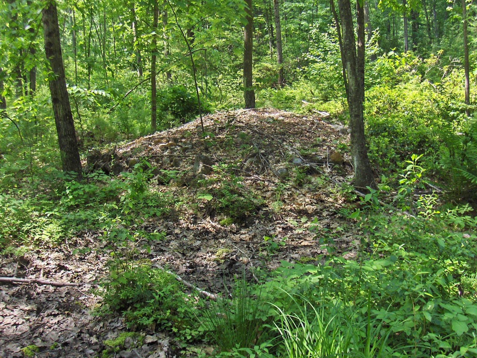

I did not realize there were two larger ones out of sight off to the side. Here is one:

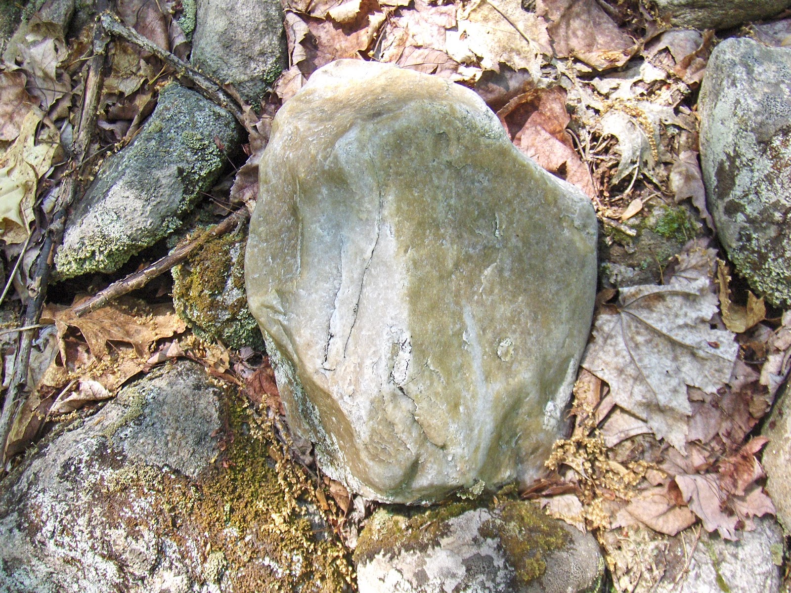


The last, and biggest:


The whole slope is a graveyard. Does it matter? Perhaps the town needs to know about it, so they can avoid bulldozing and logging. But otherwise it is a remote area and reasonably likely to remain undisturbed.
Sunday, June 07, 2015


Friday, June 05, 2015
A site in Phippsburg ME
Via reader Patrick S.:
Here is an interesting site in Phippsburg
https://www.facebook.com/
https://www.facebook.com/
https://www.facebook.com/
https://www.facebook.com/
https://www.facebook.com/
https://www.facebook.com/
https://www.facebook.com/
https://www.facebook.com/
https://www.facebook.com/
https://www.facebook.com/
https://www.facebook.com/
https://www.facebook.com/
https://www.facebook.com/
https://www.facebook.com/
https://www.facebook.com/
https://www.facebook.com/
https://www.facebook.com/
Here is an interesting site in Phippsburg
https://www.facebook.com/
https://www.facebook.com/
https://www.facebook.com/
https://www.facebook.com/
https://www.facebook.com/
https://www.facebook.com/
https://www.facebook.com/
https://www.facebook.com/
https://www.facebook.com/
https://www.facebook.com/
https://www.facebook.com/
https://www.facebook.com/
https://www.facebook.com/
https://www.facebook.com/
https://www.facebook.com/
https://www.facebook.com/
https://www.facebook.com/
Thursday, June 04, 2015
From Bear Sign to Mound Group

Here were some unfamiliar flowers:

As I followed the west side northward, I tried to keep an eye on the eastern side - which looked dull. I kept coming across piles of rock that were ambiguous. Were they natural? Were they part of nearby system of walls? A first of several wall bulges:


I fell into the poison ivy at one point and rushed down to what was left of the brook to wash my hands in the mud. From the head of the ravine I continued northeast to a lookout over the reservoir then headed back northwest into the remnants of the valley. I was not sure where to go from there but the slope to the northwest was inviting - with large sunny patches of hay-scented ferns and more rock piles that seemed somewhat natural and hard to make out on the slope. I saw more:


More on the Hensler Site
Via Norman Muller:
For
those interested in the Hensler site in WI and the petroglyphs found
there, here is a link to an article on the site by Jack Steinbring:
***
Update:
Update:
This
link will take you to the page with the Steinbring article on the
Hensler site. It is the third article down under “Research”, p. 27-45.
Tim’s link is to an abstract of the longer article.
Hensler Paleo-Indian Point Petroglyph (Wisconsin)
A video by Todd Rongstad, part of the Sacred Ground Documentary Series, that features Dr. Jack
Steinbring, David Weier, Ritchie Brown, and DS Cook.
Click here for the other videos: https://www.youtube.com/channel/UC1uQDrP2EIsgP8dNtiSbm_w
Click here for the other videos: https://www.youtube.com/channel/UC1uQDrP2EIsgP8dNtiSbm_w
Wednesday, June 03, 2015
Stone Mounds (Morris/Litchfield CT)

The first may be just a "modern" creation, stones piled to make some wide modern pathways, the rows of stones looking scant, slim and sloppy as if they had possibly been "harvested" in the last couple hundred years maybe:


I'd been by this one before and I didn't stay long to look, continued on along fairly level ground. I got off the path when I saw some sizable stones visible sticking up above the ferns, just before the drop down to a very large swamp:


Subscribe to:
Posts
(
Atom
)
