This is about rock piles and stone mound sites in New England. A balance is needed between keeping them secret and making them public. Also arrowheads, stone tools and other surface archaeology.
Friday, May 27, 2022
A trip to Canonchet
Went for a drive with my middle son, David, to southwestern RI and Canonchet. Having heard about Canonchet for many years, I thought it would be worth a visit. As it turned out, we barely scratched the surface. Among other things, I am pretty badly out of shape after 3 years of staying at home to avoid disease.
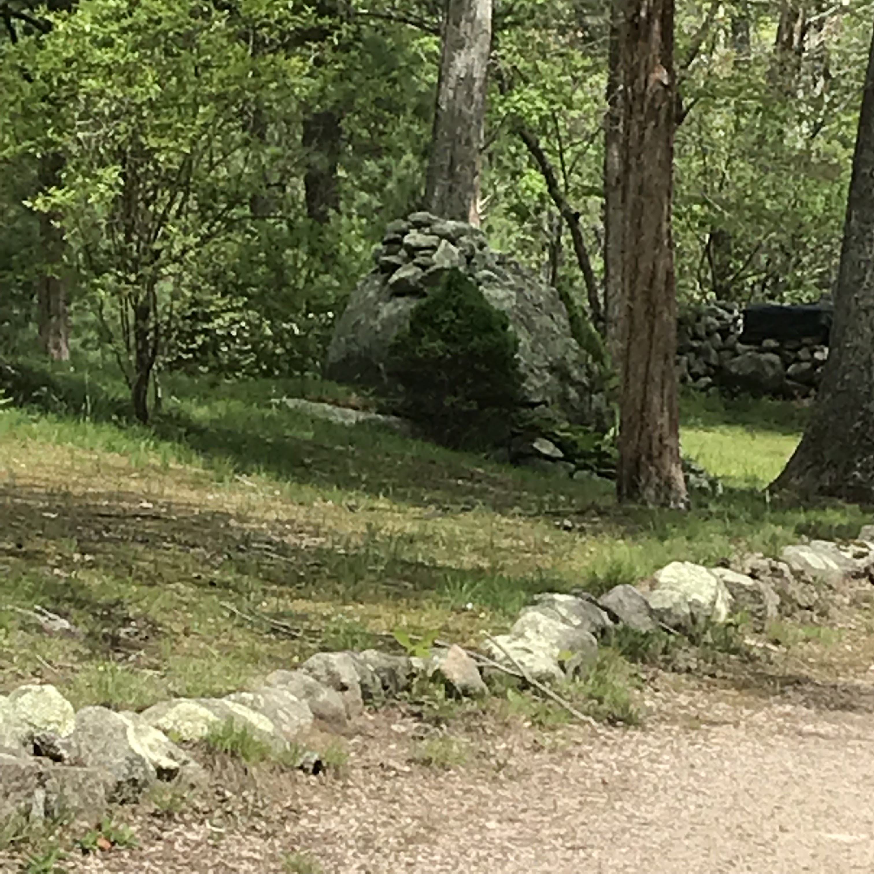
I put blue outlines where we saw rock piles but you might as well put a blue outline around the entire map. In any case, we had a successful short hike. Starting at the parking lot (lower right corner of map) we walked west until I got tired of walking in the flatlands and sensed a hill off to my right. Along that flat trail, I noticed one rock pile that looked like an effigy.
Later, my son said the underlying boulder looked like a frog.
As soon as we got over to the "hill" - a small outcrop - we started seeing rock piles. I liked the bit of stone wall we saw. Tim M. might call this is a "snake". I was struck by the pointed standing stones at each end (small in front, large in back). I was particularly struck by the third rock from the front - made of quartz. It reminds me of the pearl on Unktena's forehead.
[Parenthetically, I just Googled "Unktena" and it is all over the Internet that it is a "Cherokee Myth". But that is nonsense. The Cherokee were not in Massachusetts, naming the islands and brooks.]
Anyway, we continued uphill, through the site. This is David Waksman:
The piles got bigger and fresher looking, right up into someone's backyard.
Quite an intense place. I rarely see piles so close together. Also, since these are quite cleanly vertical sided, I suspect them of being a kind of marker pile.
It was around here I started noticing something that did not 'click' until I got home and thought about it. There are some things wrong with these piles. They are in perfect shape and they do not have any forest debris on top of them. In other words: they are new. Or, more likely, they have been restored in the not-too distant past. Given they are in someone's backyard, I guess this makes sense - especially if the people living there happen to be Narragansetts [the local tribe here].
There is a sense that the vertical sided piles were all lined up toward the same direction (note the angle of the tree shadows in these 3 pictures):
Then we got out to the Lawton Foster Rd. Here was another fine rock pile across the street in someone else's backyard:
We trudged uphill, admiring rock piles on either side of the road. Apparently the locals are OK with honoring these things. Here is someone's driveway.
Then we came to another collection of larger piles, on the north side of the road. Note how some of these are older, not reconstructed and covered with leaves, moss, and downed branches.
But this one? I think it might have been reconstructed:
In the middle of all these glorious marker piles, something different and less conspicuous:
Yep, that's a rectangle with a niche at the lower right. Let's go around to the other side and have a look:
(I got the name of the road wrong, it is not Richardson Rd but Lawton Foster). Another error, is that while filming, I did not notice there was another rectangle to the side - it is right at the end of the video. Also at around 0.14 minutes from the start.
If you watch the video, there is something wrong about the "hollow". I would say that it partakes of the same "newness" as do the reconstructed piles. Except, this looks more like recent destruction than recent construction.
I wanted to go on walking but we sort of got stuck on the road because of not knowing which way to go, and ending up circling back to the parking lot. Sorry I was in such a rush, I really have to slow down and learn how to study places rather than focusing on how to get there and back.
Update: I think Jim P photo'd the same piles long ago:
This is outside of the Preserve? Historic Survey and Inventory of Stone Features Located Within the Manitou Hassannash Preserve, Hopkinton, Rhode Island by Alexandra Martin, Eva Gibavic, Kenneth Leonard (Ceremonial Landscapes Research), and Richard Prescott (Hopkinton Historical Association and Hopkinton Historic District Commission) Photos by Paul Ziobro (Ceremonial Landscapes Research) https://drive.google.com/file/d/1wsqdN1CmmWOP1Z4sWcK4cBj_MBmBrIUB/view Photos: https://drive.google.com/drive/folders/1ki7S2pZKa8t0nPzmfoW2MF3gwotUSIY0
This appears to be well within the preserve - these sites have been well documented by Steve DiMarzo and published by the Gages in "Land of 1,000 Cairns". As you said, you are just scrqtching the surface here!


3 comments :
This is outside of the Preserve?
Historic Survey and Inventory of Stone Features Located Within the Manitou Hassannash Preserve, Hopkinton, Rhode Island by Alexandra Martin, Eva Gibavic, Kenneth Leonard (Ceremonial Landscapes Research), and Richard Prescott (Hopkinton Historical Association and Hopkinton Historic District Commission) Photos by Paul Ziobro (Ceremonial Landscapes Research) https://drive.google.com/file/d/1wsqdN1CmmWOP1Z4sWcK4cBj_MBmBrIUB/view
Photos: https://drive.google.com/drive/folders/1ki7S2pZKa8t0nPzmfoW2MF3gwotUSIY0
This appears to be well within the preserve - these sites have been well documented by Steve DiMarzo and published by the Gages in "Land of 1,000 Cairns". As you said, you are just scrqtching the surface here!
The sites (plural) are probably both in and out of the preserve. There is an island of private land along Lawton Foster Rd.
Post a Comment