Monday, November 20, 2006

Bayberry Hill (site 1)

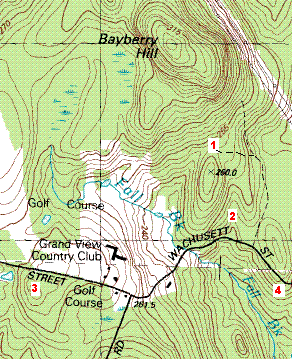
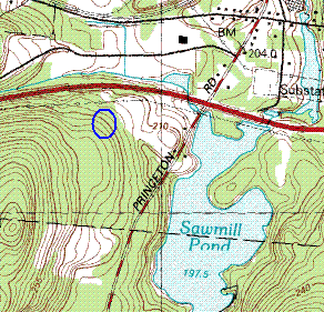
*********[Continued from the previous post, see map]*******************

At the first place, we walked in along a dirt road which forked (not shown on the original map) allowing us to go up towards the col between the smaller hill to the south and the main Bayberry Hill. This col was one of the places I had thought would be worth exploring, and as we walked along I spotted a rock-on-rock off to the right.
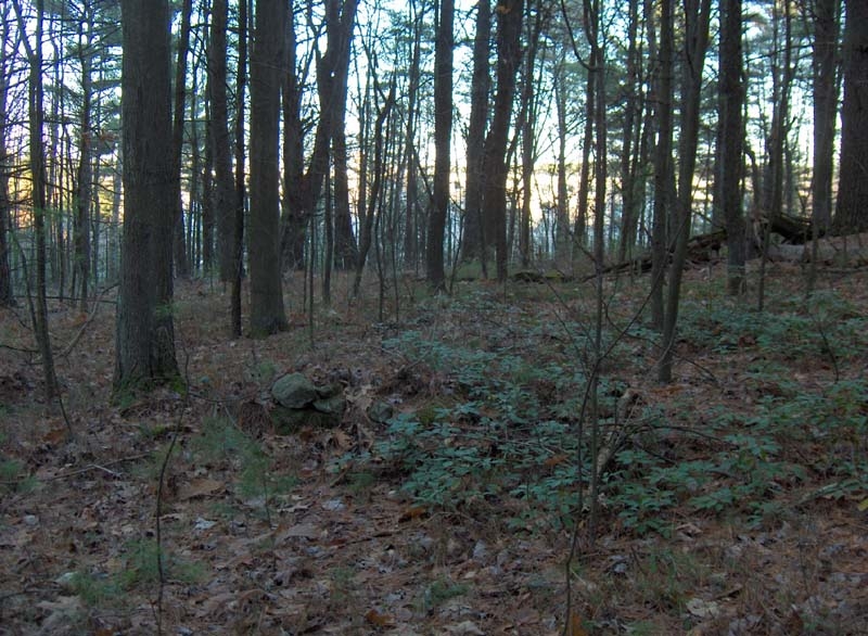
As soon as we got off the road, Bruce noticed one ground pile and then another. As we continued over a little outcrop dividing northeast from southwest, we came to an area of little puddles and rocks and a view northeast.

[It was at about this time that I discovered my digital camera was not working. I was able to borrow Bruce's but was upset to have my camera busted and also to have to go back and take photos again. All these photos here are screen shots from Bruce's Kodak gallery.]

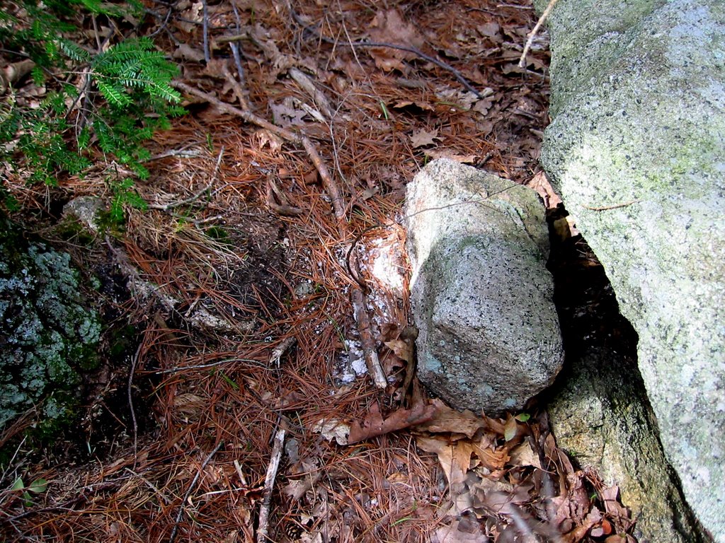
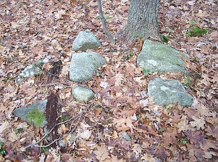
Here are some of the piles.
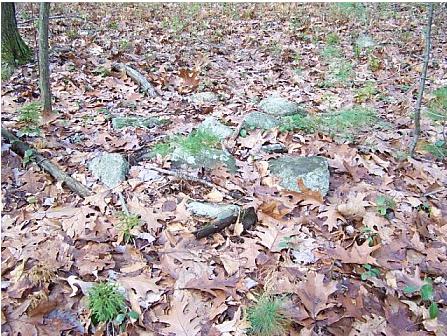
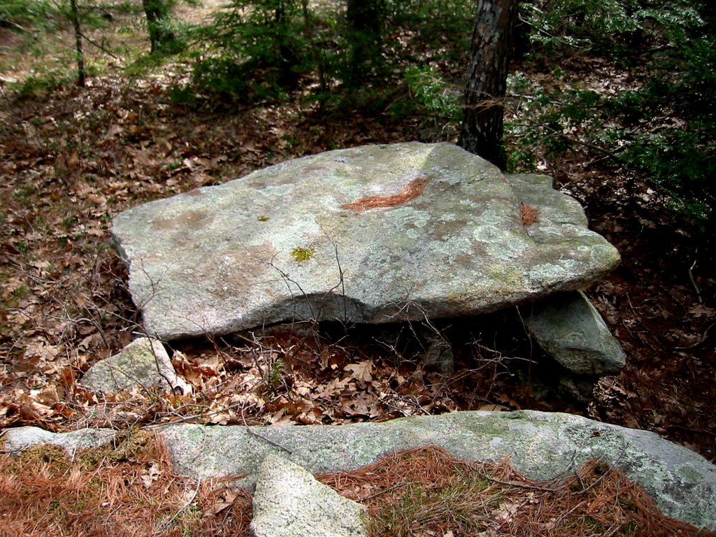
This is a very typical Masachusetts woods and the view to the northeast looks so familiar but with these rock piles in the foreground.

I particularly like this sort of thing:
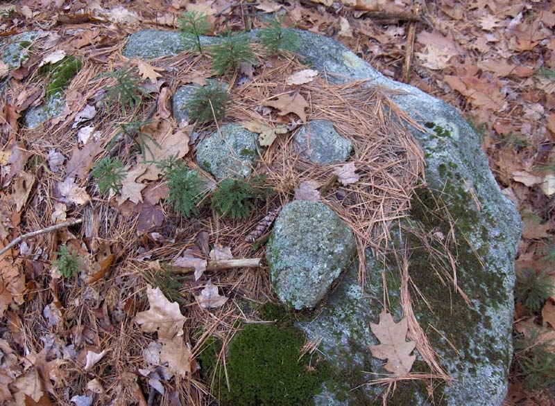
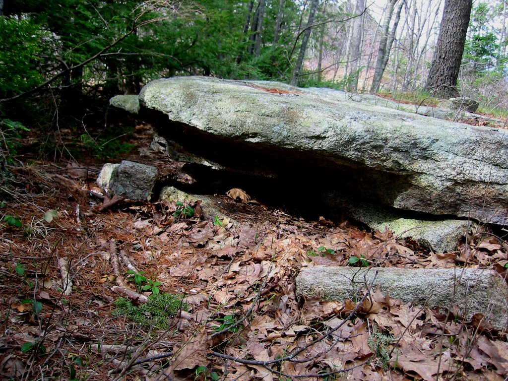
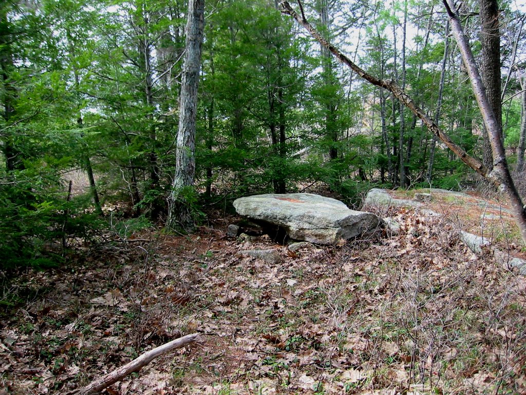
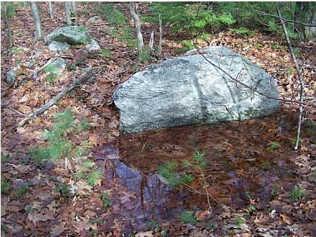
Maybe someone quarried a boulder here but I still think it is a small ceremony including the reflective surface of the upright piece of boulder, the little puddle, and the rock pile.
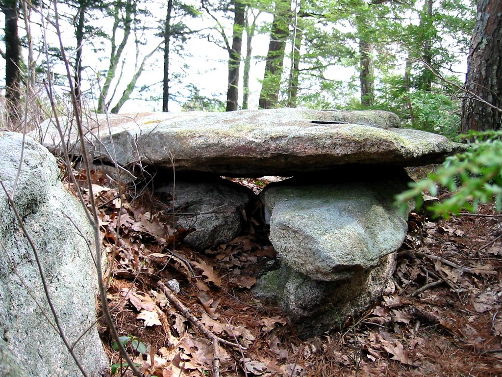
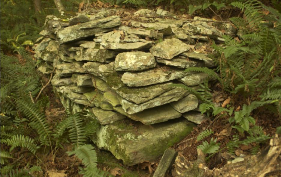
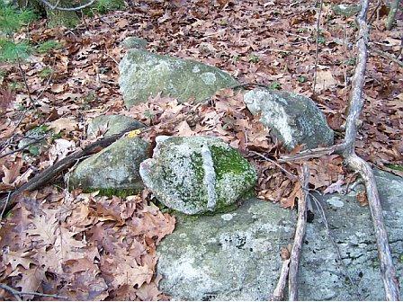
There were rock piles on both sides of the dirt road at the col. Here is a side view of the first rock-on-rock I spotted. Notice the additional rock to the right, I was reminded of pile-gap-pile and am half-convinced this is a deliberate gap structure.
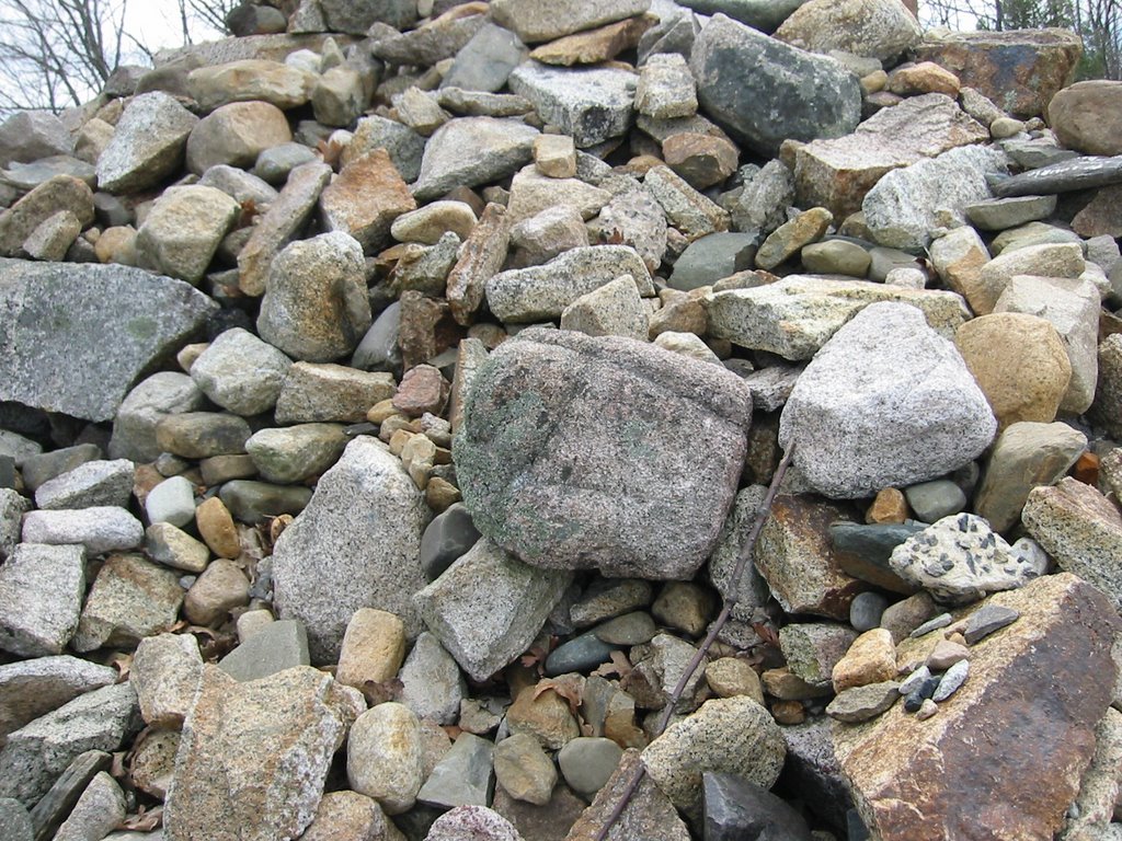
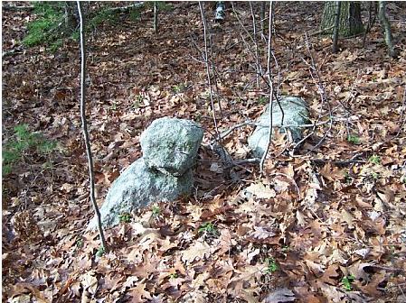
After this we got to the top of Bayberry Hill and saw little or nothing. Some signs of quarrying. In the end we circled around, revisited the col site, then made our way down and back out to the car.
*********[Continued in the next post]*******************

Sites along Wachusett Str. and on Bayberry Hill, Leominster MA

Bruce and I went out exploring Saturday with an eye to the intriguing looking wetlands west of Bayberry Hill. This is an area we had been planning to explore since mid-summer and so, Saturday, off we went. By the end of the day we had found four sites, and only scratched the surface of the woods along Wachusett Street, shown on the map fragment above. In the next few days I'll post photos and descriptions of these four sites and you can judge for yourself if they are similar to each other or reminiscent of other sites we have considered before. For my money the only site which seemed quite different from what I am used to was the one marked 3 in the above. I should also mention that we never did get to explore those intriguing wetlands, for the usual reason that mountain laurel prevented the possibility.

Since I already wrote these sites up for my Journal, I'll cut-and-paste from there. For starters, here are some introductory paragraphs:

Sometime last summer, while we were looking at a map of Leominster State Forest, Bruce pointed out one the hills in Leominster, called Bayberry Hill, and he pointed out the nice swampy area west of the hill, and proposed going to check it out. All summer I explored to the north and to the south of Bayberry Hill, but I saved it for when we could go out together. Yesterday we did, and climbed the hill from the south via the dirt road shown as a dashed line on the map. As usual, movement was pretty restricted because of the mountain laurel but we found a small site (labeled with a 1 on the map fragment) at the col between the main hill and the smaller hill to the south. This was a place with water coming out of the ground in little puddles and with low ground piles and supported piles scattered about. There were perhaps 30 features. Also a nice view to the northeast and the southwest. After summiting the main hill, we did what we could to explore downhill to the west towards the verge of the wetlands but ended up not seeing anything and heading back to the car.

We decided to do a bit of driving west along Wachusett Street to watch for rock piles from the car - sort of like window shopping - and we had only gone a few yards when I thought I saw a rock-on-rock in the wetland to the right (labeled 2 on the map). We stopped and explored a bit and found a small site with pile right in the brook, leading uphill to a place which I judge to have been an old mill. After that we continued west and thought the tpography south of the road looked interesting, so we stopped and parked across from where the "Country Club" opening ended on the right, and walked south down into the woods (labeled 3 on the map). Here there was a slightly unusual site with deeply buried piles and what looked like small standing stones
deliberate marking a direction in relation to the piles. After that, I was getting hungry and urged Bruce to head the car back in the direction we came from. We only just passed the first place we had parked when glancing downhill on the right, we both spotted some rock piles (at 4 on the map).
********************[continued in the next post]***********************

Petroform article

[Click here]
via Nancy Wisser's links.

Sunday, November 19, 2006

Prospect Hill - Waltham, MA

by JimP
After nearly two weeks of fighting briars and climbing hills, I needed a bit of a break. So we decided to head over to Prospect Hill in Waltham for the foliage. The, "prospect," of being able to drive to the top was attractive, and the views definitely didn't disappoint.But as I drove up the access road I spotted what looked like a possible balanced glacial erratic. I decided to stop and check it out on the way back down the hill.Although the erratic wasn't truly balanced, it was an impressive sight nonetheless as more than half its girth was suspended off the end of an outcropping. I decided to quickly look around -- but didn't find any rock piles.

However, on the opposite side of the access road across from the erratic, at a place called Dinosaur Rock, I spotted a very large split boulder.It was a remarkable boulder, but the question remained -- was it wedged? Sure enough, as I brushed aside the leaf litter down inside the split, there it was -- a small rock.I tried moving the rock but it wouldn't budge. It was definitely wedged in there and seemed as though the weight of the top portion of the split was resting on it.

Could there be more features on Prospect Hill? Perhaps in some remote part of the park maybe -- but I was happy just to find this split-wedge near that impressive glacial erratic.

[Click here] for more information on Prospect Hill.

Appetizer

Patience....more to come during the week.
Can you see the little wedge in there?

Sites....good. Camera.....bad

Bruce and I went to Bayberry Hill, Leominster Conservation Land. We found 4 sites and I would have gotten lots of pictures except my new @#$!! camera went on the blink. Luckily Bruce let me use his. But getting the photos out of his gallery software and into my PC, then moving them online, is going to be a bit of a hassle. Today, if it doesn't rain on the way to the Upton Chamber, I'll use my old camera.

Saturday, November 18, 2006

Panther Orchard Farm - Part Four

by JimP
In this final installment of our look at Panther Orchard Farm we'll see a collection of just some of the many rock piles found all over the property. First is this large depression pile (survey ribbon in foreground - this area is slated for development):Next is one of the many, many single rocks on boulders:Then we have these two small rocks on a boulder:Here are two small piles:And finally a look at three of the many piles built on boulders:

Minor features from Leominster State Forest

I did go out last Sunday but did not see much. I like the colors in these photos.

Rock-on-rock:Split-wedged rock "Spirit Door":
Notice the edge of the upper piece of the split rock, it looks like pieces of the edge were removed. Maybe this rock was split manually without metal tools.

Friday, November 17, 2006

The weekend plan

Before signing off for the weekend, here is the weekend plan: Saturday: To a hill in Leominster State Forest which Bruce spotted on the map. We have been planning a trip since mid-summer. Then Sunday: out to the Upton Chamber by invitation of Cathy Taylor of the Upton Historical Society. As for the Leominster trip, I expect to be frustrated by the mountain laurel. As for the Upton trip, I hope to get lots of good pictures. Also I have to read up on what M&D say about that chamber and about the rock piles which are visible from there on Pratt Hill.

Thursday, November 16, 2006

A small site behind the Best Western in Fitchburg

This is probably the last post on the subject of the NEARA conference. This conference location may have the unique distinction of having a rock pile site within strolling distance of the backdoor, easily within 100 yards of the place.

Here is a map fragment showing Rt 2 crossing Rt31, where the Best Western Hotel is located. The rock pile site is roughly where the blue outline is.
And here is a view back downhill towards the hotel. Note the foreground.
FFC, in his usual inimitable way, took a stroll and noticed some split-wedged rocks and rock piles back here. I went out to take a quick look and got some photos. It was genuinely fun to see these at the NEARA conference. We should do a conference in the same place sometime and use this site for a little seminar. When FFC and I went back there and started uphill (go to the far northwestern corner of the parking lot behind the hotel and stroll into the woods) I angled off to the right. Here is a first pile.
And here is a magnificent split-wedged rock:
And there were a number of low piles that seemed supported and having some symmetry or structure:
These are what I call effigy piles.

As we headed back down towards the hotel we crossed paths with a couple of young men from the ESAF conference. We made sure to show them that wedged rock, just so they could have something to notice and think about. We didn't stick around to talk with them.

Wednesday, November 15, 2006

Mt Agamenticus, York Maine - from Nan Millett

Nan Millett is one of the Acton Land Stewards. She writes in:

Here are the photos I took when Hart and I visited Mt. Agamenticus in York, Maine last April. I have done some poking around to find out more about what we found there but so far it is only about colonial period. I sent an e-mail to Ros Strong and she said there wasn’t much on native there. . All the info on the area seems to leave off any mention of natives using the spot. It is a high lookout type of Mt. and overlooks the ocean as well the rivers, etc .To the N/W, Mt. Washington is in view. It is a very commanding area. There is a road to the top with a parking lot and lodge.

Pics # 2062--68 are of the boulder on the S/W off the trail by about 12 '. It is a fairly open area on top of the Mt. Boulder is on ledge. A lot of this area is exposed ledge.

#2072 and 73 is of an particular (shaped appearing) stone that was on a pile by the parking area. The pile was mostly of plain vanilla rocks and bits of rubble, brick and cement. This stone caught my eye. It was different and I took these two photos.
One week later we were on the Mt. again and I went to take another look at the "special stone". I couldn't find it on the pile where it had been the week before. I finally discovered it, lying by itself, on the grass. It was about 10', uphill from the pile. I took #2114 at that time.

Stone Piers - possible colonial features (from James Egan)

I wanted to write a short note and show some pictures Jim Egan had in his talk at the NEARA conference. The talk focused on a colonial era house foundation which he believes was an early trading post in Connecticut. The house was high above a cliff/steep hill in a difficult to reach spot and this might have been in order to defend the location. A few feet below the house on the slope were two rock piles - rectangular and with deliberately level surfaces. What were they for? Possibly for trade goods, possibly as cannon placements, possibly as foundation support for out-buildings. There were several possibilities and all made a certain amount of sense outside of the context of ceremonial rock piles - which I tend to emphasize on this blog. So for the record, here are some stone "piers" which may well have had a colonial practical purpose. These are probably not ceremonial.
[Photos by James Egan]

Tuesday, November 14, 2006

NEARA conference - selections from the Schedule

So let me make a few adulatory comments and a few snyde ones. Some of the sessions were pretty exciting and I had a hard time going to sleep Friday night with my head spinning over the social and informational aspects of the day. Let's read through parts of the program schedule:

Friday 8:30-12:00 Session 1 - New England State Archeologists (Chair Brona Simon)
I did not go to any of these sessions. Brona Simon is the public official who, single handedly, is responsible for more archeological destruction than anyone else on record in Massachusetts. I sure wasn't going to go listen to her and I was a bit afraid I would have to be on the same stage with her. I have spoken with the lady by phone just once and have been plotting her overthrow. I also noticed Giovanna Peebles on the schedule, as Vermont State archeologist. She also has a pretty bad reputation among Mavor fans and, when he was near death's door, her calumny was still high on his personal list of topics and grievances. By contrast the Rhode Island State Archeologist was not on the program (I forget his name). I have heard him talk in praise of the efforts of NEARA members and he is well liked in that community. Anyway this session was in conflict with Bruce and Suzanne's talk in the other session.

Friday 8:30-12:00 Session 2 Contributed Papers (Chair Jack Hranicky)
I took one look at the title of the early morning talks and found no reason to go before Suzanne Wall and Bruce McAleer's talk. For example: "Mid-Atlantic Super-Long distance Obsidian Exchange". This sounds like a big load of nothing. I have found Minnesota Catlinite ("pipestone") on the ground here in Concord, and shell beads from California show up just about everywhere in the US. Wake me when you want to report on some Islandic obsidian. OR maybe you would want to hear about "GIS-based distance decay Modeling of the Cultural Distribution of Shriver and Loyalhanna Chert".....nope, I don't think so. Then at 10:30 I listened with interest to Suzanne and Bruce's talk "Steatite Quarrying and Utilization of Altered Metamorphic Rocks in Eastern New England". This was of interest not just because it was friends presenting but also because I knew there would be discussion of altered above ground rocks - a topic of general interest. Suzanne demonstrated that pecked grooves are very common in our woods and she did a good job making the audience aware of these altered rocks. I found her and Bruce's unwillingness to speculate about the purpose of those grooves detracted from the point they were making. Nontheless, an interesting topic. Then, since I was already in the room, I listened to the next talk: "A Pipeline to the Past, or Six Archaic Sites Narrowly Considered". I can summarize this talk in one sentence "We did salvage archeology along the path of a planned pipeline and found flakes and arrowheads". I am not sure what the content of such a talk is supposed to be. I love looking at arrowhead pictures (in lieu of looking at the real thing) and they showed a pretty nice "pre-form" made of Braintree Argillite. Not to put too fine a point on it but talks like this or like others from later sessions like "Indigenous Subsistence and Settlement Practices in Northern New England During the Woodland Period: the enduring contributions of James B. Peterson" hold little interest for me [no offense to Mr. Peterson]. In fact this is a good example of the kind of thing Curt Hoffman was speaking about when he diss'ed conventional archeology and the preoccupation with food. I took one glance at that program and started thinking about how to write a harangue on the subject of how bankrupt and in need of new ideas New England Archeology has become. Maybe it always was that way. My personal complaint: these people refuse to speculate about anything of interest and, a simple enumeration of dull facts does not a narrative make. Without narrative you have nothing.

1:00 - 3:00 PM Session 3 James Peterson Memorial Session (Chair Mark McConaghy)
[I skipped]

1:00-3:00 PM Session 4 New England Antiquities Research Association (Chair Dan Lorraine)
Here is where I gave my talk. First up was Colgate Gilbert talking about Burnt Hill "Standing Stones, Observatories, Hill Farms, and Indian Agroforestry: a look at the Sweetser and Thayer Site in Franklin County Mass". It is too long a story to tell you how he fell out of favor with NEARA, hogged the Burnt Hill site, failed to ever report anything, and generally interfered with other people wanting to research the place. After years of silence here he was, reporting on facts about the place that were observed by other people long before he got there (with no credit given to those people) followed by a complicated attempt to date the site based on someone else's estimate of forest succession and burn off. Fech! Then came me with "The Distribution of Rock Pile in Middlesex County, MA". Then came James Egan with "What's a Rhode Island Stone-Ender doing in Connecticut?", and then Tim Fohl with "Similarities of Ceremonial Structures in New England and Mesoamerica" - a discussion of why alignments related to sunrise on August 13, seem to show up frequently around here while the most significant aspect of that date is that the sun is directly overhead, on that date, at major ceremonial sites in Mesoamerica.

After this there was a break and a digression involving a short walk outsite the conference hotel where FFC located some rock piles. When we got back I listened to part of Sue Carlson's talk "How Was it Built? The Construction of the Newport Tower". Then I went back to the hallway to chat with people and get ready for dinner.

Dinner was nice with Curt, Doug, Bruce, and a few others. We drove as fast as possible down into Leominster to eat Chinese and then were back before you knew it to watch another version of Ted Timreck's Film "Hidden Landscapes: A Northeastern Ceremonial Landscape". This included some wonderful footage of Mavor and Dix when they first discovered and then started excavating at Calendar I in Vermont. Poignant because of the loss of these wonderful men but also subtly capturing the mystery of the lichen covered stones. Opening shot: an old rock, propped up, camera pans up to show the foot of a tripod and a young man (Mavor) squinting through a transit and focussing then re-focussing. Totally intent. There was a lot of other footage in there and Ted made a valiant effort to bring the viewer into understanding stone features around here by giving them a context from the deep past and from across the Altantic Ocean. I am not sure this context worked for me but then a film has difficulty being all things to all people. After that...home for a bad night's sleep and then a return to the Saturday conference.

[Tiring now of going through this schedule item by item]. Saturday was about a panel discussion with open ended Q&A, with panelists: Cherly Maltais, Curt Hoffman, Doug Harris, and alternately Tim Fohl, Tom Paul, Doug Schwartz, and Fred Martin. This panel started with a short film interview of Alan Leveille, a contract arcehologist and bad guy who blesses rock pile destruction. In this intereview he is seen making his apologies and claiming a new willingness to work with the Indians and become an anthropologist as well as an archeologist. This is another long topic I cannot get into here, but rumor has it that he was told to stop interfering with protection of Indian Ceremonial structures or his company would never work again in Rhode Island. Fech again! Anyway, after that there was an extended discussion with, for example, Doug H. telling us to read the USET resolution to find answers; and Curt H. telling us his background in Biblical Archeology (see yesterday's post); and Cheryl lending moral support and talking about being grateful for NEARA keeping alive and fighting to protect these sites (or was it Doug who said this?). It was pretty interesting to me.

Anyway, I was exhausted after this, had lunch with Lisa Gannon (Vermont State Coordinator for NEARA), hung around a bit, then drove home. Each day I had hoped to leave early and do a little exploring in the surrounding woods (Leominster State Forest) and each day the main events were mid morning and early afternoon - leaving it too late each day to do more than veg out afterwards.

Monday, November 13, 2006

Tribal Ceremonial Areas In Pachaug State Forest

by JimP
There was an article today in the Norwich (CT) Bulletin concerning a proposed 75-acre development and its proximity to historic Narragansett Indian settlements and burial sites. Narragansett Tribal Historic Preservation Officer John Brown is requesting an inspection of the site, but developers are resisting.

Brown is quoted as saying, "tribal ceremonial areas lie along Pachaug Forest." I found that notable considering a [recent post] about Pachaug, as well as its proximity to sites we discuss here often -- such as Rockville in RI which borders Pachaug.

[Click here] to read the entire article.

People at the NEARA conference

I have nothing systematic to say about the conference. I went to a few talks but enjoyed schmoozing out in the hallway more. The titles of a lot of the talks left me un-inspired, so I just took it easy and only planned to go to a few things, particularly things by friends. On the whole, though, it was a very exciting conference to be at because, for the first time, archeologists, antiquarians, and Native Americans all participated. That was the plan anyway but the conference proceeded in two separate rooms and, just as I had little interest in what was going on in the "Eastern States Archeology" (ESAF) room, so apparently did most of the ESAF members have little interest in what was going on in the NEARA room. Maybe in a separate post I'll go through the part of the schedule I experienced. But how about some mention of the people? These are the ones I wanted to capture on camera (I missed on getting a decent photo of Linda McElroy).

Here is Cheryl Maltais:
Cheryl is the head of the Gay Head Wampanoag (the "Aquinna") and will be the next president of the United South and Eastern Tribes (USET). As a member of the Wampanoags Cheryl comes from one of the families charged with preserving "culture" and, so, she is in charge of the Tribal Historic Preservation Office. I got to eat lunch with her and although I wanted to ask how she ended up at this meeting, I held my peace and waited for the topic to come up. As it happens, she mentioned how some families were "fishing families" and how some were "cultural families" and, at that point, I asked if she was (yes) a member of a cultural family. But she also mentioned that many of the facts related to ceremony (...ya know...rock piles and such) were known to some limited number of families and were not shared with the others. [This is connected to a discussion of the density of rock pile sites. If the pattern she describes held true also for the people making rock piles in my neighborhood, it suggests this was an activity limited to a few individuals in the tribe. ] Cheryl also talked about the recent goal of her tribe to re-vitalize their language and their culture. She mentioned that the last of the grandfathers took most of their knowledge with them when they passed away. I asked if that was around in the 1960's and she agreed and it seemed for a moment that we were on the same wavelength. I must also add that I asked her if there were any rock piles on Martha's Vineyard and she said "lots" and proceded to talk about how there were som many places she played in when she was a child without understanding their significance. [To me this is an important clue about things.]

Here is a picture of Doug Harris on the right, and Jic Davis on the left. Jic was filming much of the proceedings. Doug is married to the daughter of the Narragansett Tribal Historian, he works for the Medicine Man, and is an Officer of the Narragansett Indian Tribal Historic Preservation Office (NITHPO). Doug is the man. He first visited the sites in Carlisle and was instrumental in the first acknowledgedment that ceremonial sites exist in Acton, etc... and were, indeed, important ceremonial places to the Indians. He is the author of the USET 2003:022 resolution [Click here].
During the meeting Doug was extremely clear that the question of "What are rock piles for" was answered by the resolution. (Read it again.) In the early years (i.e. prior to the USET resolution) I showed Doug around the sites locally and, I am proud to say, I had something to do with defining the list of towns included in that resolution. Doug has been and will be the ambassodor between the Narragansetts and the local towns. He is a charismatic speaker and a fine guy.

Here is a picture of Curtis Hoffman. Curtis is the only "official" archeologist who is actively studying rock pile sites and other related "above ground" stone features. Curtis is, I believe, past president of the Mass. Archeological Society (MAS), he is Chairman of the Anthropology Department at Bridgewater State, he is the author of "People of the Freshwater Lake" [?]. He organized this conference and Curtis is also "the man" in a number of ways. He has the respect of a number of different communities.
I also claim some role in bringing Curtis into contact with Doug H. and the people in Carlisle. [Curt first came to Carlisle to see my arrowhead collection and also a couple of pieces Tim Fohl had.] Curt's acceptance by Doug is a matter we can leave for later biographers to try to piece together. But at any rate, today, everybody gets along. Curt had a number of interesting things to say at the conference and the ones I took note of were these: his background was not in American Archeology which [he stated] has gotten off onto a bad path in its pre-occupation with what people eat - as opposed to what they believe or do. By contrast, Curt was trained as a Biblical archeologist to study the Jews [he is Jewish] in the Mid-East and so he was trained to think about how beliefs impact physical culture and, perhaps because of this, he is more ready than most to see that the above ground stones as worth studying. Curt is a joker, among friends, and was talking about "NEARA my heart to thee"...just to give you an idea of his character. I could tell you more about Curt and about my own interactions with him but let me mention that he and Doug came up with the idea of training Indians to protect ceremonial structures in towns - training in recognizing the ceremonial features, training in local laws and political interaction, training in certain traditions. Apparently USET made another resolution recently to support a program Curt proposed for Bridgewater State, that would conduct this training program as a variant of their program in Cultural Resource Management ("CRM").

Here is Bruce McAleer.
Bruce is my frequent companion on explorations. We went on a road trip last year, which he proposed, and which was very succcessful. Typically enough we go out exploring and find very little but Bruce has found some vast rock pile sites and he is the only person besides me who seems to have a passion for finding new places. Bruce has been working for some time with Suzanne Wall, a geologist, to identify and map locations where soapstone was quarried. Here is Suzanne Wall: She is quite a character - giving a scholarly, almost school-marmy, presentation at the meeting but, outside the meeting, seeming to have na in-the-field kind of character. She impressed me the first time we met, as the Jeep we were in barely escaped getting bogged down in the mud and exclaiming: "Holy saturated silt!" She is a trained geologist, actively out looking for interesting rocks. Those are my personal contacts and some of the "movers and shakers" at this meeting. Here are some people who make the NEARA organization function. This is Sue Carlson, an architect and expert on things Scandinavian. She has been involved with analyzing some of the Norse rune stones found here. And here is Ros Strong: Sue and Ros live together in Maine and between the two of them produce the NEARA Transit and the NEARA Journal. I think they do a fabulous job and I sympathize with their quarterly editor's puzzle: how to fill an entire issue with articles [I have the same problem here so if you have material then send it in!]. These are very nice ladies who have dedicated their lives to keeping the NEARA organization going. How they pay for things I cannot imagine but Ros is about the only person in NEARA who I am comfortable leaning my head on and going to sleep against, at the back of a darkened conference room.

Finally, here is Jim Egan from Rhode Island.
I am not sure how to introduce Jim. He has been presenting at NEARA meetings since I started going to them 8 or so years ago. He is usually talking about colonial era architecture, or about the Newport Tower, and always brings an attitude of precision and imagination to his observations. He spoke about the Benedict Arnold trading post in colonial Rhode Island [not the Benedict Arnold of later treasonous fame], and showed some rock piles which (to my shame) were pretty good examples of non-ceremonial piles that could have been mistaken for ceremonial piles. A good guy to know.

Sunday, November 12, 2006

More about the NEARA conference coming soon.

The NEARA conference was intense and I hope to catch up on some exploring plans today. There is a variety of interesting information from the conference, which I hope to tell you about later.

Saturday, November 11, 2006

At the NEARA conference

First day: saw lots of people I know and heard some good discussions. A friend went out to smoke, took a little stroll behind the hotel, and found a small site. I went to take a look. When we got back, it was fun sitting listening to Sue Carlson and finding a tick climbing up my shirt. I'll have some photos later and perhaps a bit of a report.

Some links from Larry Harrop

I did a search for "Manitou" at http://cdl.library.cornell.edu/moa/
Some interesting reading.
Some samples ;

From The North American review. / Volume 103, Issue 212 July 1866

http://cdl.library.cornell.edu/cgi-bin/moa/pageviewer?frames=1&cite=http%3A%2F%2Fcdl.library.cornell.edu%2Fcgi-bin%2Fmoa%2Fmoa-cgi%3Fnotisid%3DABQ7578-0103-3&coll=moa&root=%2Fmoa%2Fnora%2Fnora0103%2F&tif=00005.TIF&view=75


The North American review. / Volume 22, Issue 50 January 1826

http://cdl.library.cornell.edu/cgi-bin/moa/pageviewer?frames=1&cite=http%3A%2F%2Fcdl.library.cornell.edu%2Fcgi-bin%2Fmoa%2Fmoa-cgi%3Fnotisid%3DABQ7578-0022-7&coll=moa&root=%2Fmoa%2Fnora%2Fnora0022%2F&tif=00059.TIF&view=75

and

harper' monthly 1870
http://cdl.library.cornell.edu/cgi-bin/moa/pageviewer?frames=1&cite=http%3A%2F%2Fcdl.library.cornell.edu%2Fcgi-bin%2Fmoa%2Fmoa-cgi%3Fnotisid%3DABK4014-0040-106&coll=moa&root=%2Fmoa%2Fharp%2Fharp0040%2F&tif=00803.TIF&view=75