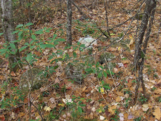
Looking down from above:
Here we are looking at the well made end of the "wall". Looking back towards the railroad bed above:
Some panoramas:
I was commenting that there is a lot of internal structure in this "wall".
Meaning: nooks, crannies and well built faces in the middle of the wall, not at the edges. For example:
closer:
Last look (the railroad bed is the higher ground behind):
I don't believe for a second that that is a colonial wall for any of the usual agrarian reasons.
Suspicious, we explored the vicinity carefully....oop! here is a small pile and then something bigger in the distance (about 40 yards from the "wall"):
This is a large trench in a pile, at the end of a regular wall:
I have seen trenches like that before, eg in Estabrook Woods and on Mt Elam. I interpret them as mass burials representing something quite different from the individual piles with hollows, seen up hill to the south (around "A").
Closeup of the trench:
A nearby pile with quartz:
And a low pile connecting the trench to the end of the regular wall:
All of which says this is not just a collection of walls.


No comments :
Post a Comment