Thursday, December 31, 2015

East Wachusett Brook - long mound with hollow

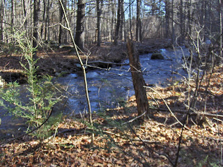
The "mound" archeology may be interesting but I was taken with the brook itself - wide and busy with earth on either bank so impacted by the passage of people that there is almost no undergrowth. I should have taken a more careful picture:
Walking north along a well defined path, I notice a lot of piled rock up on the left:
Is it natural or man made? I decided pretty quickly that it was man made:
This is a large berm made of cobbles. I notice a chunk of quartz, left of center (the observant reader will also notice a small enclosure between the camera and the quartz):
Bear with me....I want to point out that the "mound" continues to the right of this picture. I am standing in a hollow with more of the rock pile behind me. It is hard to see because of the bushes but here is a shot from the end of the mound:
 
This part of the mound has its own chunk of quartz and, in fact the overall shape is this:
The opening faces the brook, seen below:
The hollow, on the left edge of this picture, might also be a ramp down to the brook, but I ignore that interpretation, and assume this is simply the hollow of a different shaped burial mound. Hard to get a picture of the whole thing. From one end:
Goodbye from below. You can still see one of the chunks of quartz:
This is from East Wachusett Brook in Princeton MA, around where the small blue outline is on this map:
This is the Stillwater River watershed. It is the only example of a "long mound with hollow" from south of Rt 2. As I look at the map, the Stillwater River flows south into the Wachusett Reservoir in Clinton, and then into the Nashua. So actually this 'long mound with hollow' is, like all the other examples, a feature of the Nashua and Souhegan watersheds.
Stockbridge MA Indian Monument (1905)

Wednesday, December 30, 2015

Arrowhead finds- Fall 2015

One rainy day in the fall, I spent hours carefully scouring the ground in a spot that has been hit or miss for me in the past. On this day, I was having some luck- but after hours of looking I had found only broken and crude points. I looked at the area I had left to go, it was just a small strip. I thought to myself, well, this little last bit is as likely as anywhere else to yield something nice- and it did. I really like these quartz triangles with an incurvate base and slightly curved sides like this when they are well made and not broken.
Here it is with the rest of the day's finds. A good day.
That triangle, cleaned up. Squibnocket Triangle, I would say.
The stemmed points aren't terrible. Wading River or Squibnocket Stemmed type. I should get out to this spot again...
Dave and I hit another spot that had never yielded a whole point for me. In this place there is a little wash-out where, after heavy rains, flowing water gathers rocks together. I always always check places like this but had not found a point in such a feature- until this time. Look at this thing, you could have seen this from space. It was a sight for sore eyes, for sure. Found after 5 minutes of searching.
Here is a sort of side shot where you can see how this perfect and finely made triangle was perched on a little pedestal of soil, waiting to be picked up.
It is unusual to find points of this quality. It is very thin and still very sharp. I believe it could still be used.
Dave had some luck, too, with this little hornfels triangle.
I only have a couple of projectile points made of this pretty hornfels material. I like the stripe.
This spot is incredibly dense with artifacts. After a couple of hours I had a whole handful of broken tools and arrowhead fragments.
This one showed damage but was tantalizing when I spotted it.
Too bad about the corner ding, because the tip on this is sharp as a needle, and it is nicely flaked.
Dave and I returned to the same spot several days later after another good rain. I spotted this only a few feet away from the wash-out where I found that nice thin triangle.
It's a nice triangle with more basal thinning than I usually see on these. A good find for me. I believe the points from this site are Madison and Levanna triangles, from Woodland times.
Dave found a few interesting objects out there, as well.
This is probably the most productive spot I have ever found, but nearly everything is broken. Frustrating- but so much better than not finding anything!

Thoughts about a "Ravine Culture" and piles in the shape of a wrench

I think I finally saw enough examples of a type of feature that something clicked in my mind and it became a familiar pattern - something shaped like a "wrench". This is a elongated mound with a hollow at one end, opening downhill (towards flowing water). I just drew this picture as an example:
I found an example along East Wachusett Brook, in Princeton MA, and was seeing its similarity with other piles I mentioned as the characteristic feature of the "Ravine Culture" at Blood Hill, Ashby MA. In that post I also mentioned other similar examples: Falulah, Lovell Reservoir, etc. With a widened perspective I make other connections and also remember another pile at the foot of Whittemore Hill in New Ipswich NH. Searching through old posts about that hill, imagine my pleasure to find this picture, along with this post

Another place turns up in my search was along Trapfall Brook, here

Places where I have seen this feature:
- E. Wachesett Brook, Princeton MA
- Falulah Brook, Fitchburg/Ashby MA
- Lovell Reservoir, Fitchburg MA
- Blood Hill, Ashby MA
- Whittemore Hill, New Ipswich NH
- Trapfall Brook, Ashby MA
A case could also be made that this shows up in Shirley at Spruce Swamp Brook - the easternmost example. I'll post photos and location for E. Wachusett Brook next.
We need a name for this type of feature. 
The word wrench is not particularly attractive but it is a reasonable reminder of the shape.I am going to go with "Long mound with hollow".

Last site of the year?

East Wachusset Brook, coming up.

Tuesday, December 29, 2015

Signposts? Possible deliberate marking of the lower end of a pathway - from water up to burials

Working on the idea of a pathway up the hill from the water, it might make sense that the lower part of the pathway was marked in some way to indicate what was uphill from this spot. The idea of a "signpost", at the lower end of such a pathway, comes from a link Norman sent recently (click here) about finding water in the desert.
I found a burial mound in the saddle between summits at Jewell Hill. I guess I have been there before but, this time, I followed the path of least resistance back downhill to the north and found a beautiful pile at the lower end, with multiple pieces of quartz and a place where the quartz in the wall seemed to point the way up hill:
Here is a view of the nice pile from below:
 
 Here are some closeups:


This all suggests these features mark the lower end of the pathway, like signposts, like the petroglyphs of Norman's link.
 
And here is a video, trying to put things in perspective:

Split wedged rock - Jewell Hill, Ashburnham

 You gotta take a closer look:

Rattlesnake Hill - the other brook

When writing about Rattlesnake Hill, I recently commented that there was a 2nd brook cutting into the hill from the south (leading to Great Brook) which needed to be explored. Here then is the result of exploring a 2nd valley of the hill.
The larger blue outline is a typical "marker pile" site, built along outcrops:
This is a bit decrepit but good reason to equate it with the many other marker pile sites, found up and down this valley of Beaver Brook/Elizabeth Brook - the valley of Rt 495. Every hill nearby has these (multiple) types of sites.


But I look at this photo and see something else:
There is a distinct pathway running up the right-of-center of the picture. This may be a "pathway" site rather than a marker pile site - where the pile guide a person along the path.
***
Across the valley, about where indicated by the smaller blue outline on the map, was somthing quite a lot rarer: a substantial triangular pile. Seen from each corner:

I cannot escape the impression that there is a small superficial "hollow" in the center of the last picture, opening to the right. This pile, as well as the small one in the background (last photo) have chunks of quartz:

This shaped pile is not common and the other example I can think of (southern end of Hycrest pond in Sterling) is not similar enough to claim a relationship.
Again, a success finding piles by going to the top  of a brook connected to a navigable waterway.

The last pile at Blood Hill. About "hollows" in rock piles.

This is a most beautiful example of a rectangular mound with a hollow and a "tail" - a variation that involves a deep inner hole and a broad pavement, to one side, for a "tail". This pile was all by itself on the smooth northeastern slope of the hill, more or less directly north of the main valley I described earlier.
Lots of additional structure visible. First picture, a sort of "vestibule" faces the viewer. Second picture at the right rear, there is another little auxiliary divet. 
Let me repeat myself about piles with hollows. There are three hypotheses that have been voiced:
1: The hollow is from vandalism - people removing rocks from the pile.
2. The hollow is added to the pile later, or built in from the beginning. It is a place for a person to sit, as in a "vision quest pit" or "thunderbird nest".
3. The hollow is a built in architectural feature to hold something (a body or an offering) that is now gone. The hollow might have been open to the air, or the result of collapse of an inner chamber.

I have looked at hundreds of sites and many hundreds of examples and I can tell you: hypotheses #1 and #2 do not fit all the evidence.

Evidence against vandalism
- The hollows are usually symmetrically placed. Sometimes there are two adjacent hollows. 
- There are no scattered rocks around the edges of the pile, that could have been removed from the hole.
- A broad spectrum of variations in pile height from 6 foot tall walls to 1 inch of rock poking up through the dead leaves. All have the hollow. In other words, the hollow is there even when there is almost no rock pile to be seen. You have seen rectangular outlines on the ground. There is no evidence of vandalism and not much evidence for a pile. Like the Cheshire Cat: can there be vandalism without a rock pile?
 - It is inconceivable that the same shapes appear in piles from Nova Scotia to Georgia. Are we believing that "hardy Yankee" vandals did the exact same thing..coast to coast...at sites scattered from 'nearby' to 'vary inaccessible'? Consistency is evidence of design not of destructiveness. We give a "no" to Bakunin: the destructive act is NOT the creative act.
- A well built hole: sometimes the hollow is a vertical sided hole that is carefully made. It could not have resulted from vandalism.

Evidence against "Vision Quest Pits"
- A lack of any positive evidence: no one ever was observed using a rock pile as a "seat". There are no recorded instances. Several people include it in their speculations, notably an old indian who spoke (in a YouTube I watched) about the hollowed piles being made by "old ones...who went before". 
- It is inconsistent with actual variations in pile shape. There is a continuum of shapes from simple outlines to deep holes in large piles. Sometimes the hollow is too deep to see out of (which would pretty much be the case in the pile pictured above).
- Wrong sized hole: frequently enough the hole is 15 inches across. I joke that these are "cup holders". They could not perform any function involving a seated person.

In "Science" you take your hypotheses and test them...and test them again. I eliminated the "vandalism" hypothesis after seeing many examples with the same clean design and no scattered rocks. I eliminated the "Vision Quest Pit" hypothesis when observing small hollows, overly deep holes and the continuous spectrum of shapes only some of which could function as a place to sit.