We went to the museum as a follow up to visiting some of the "cairns". I wanted to see info about the geology of the area, maybe an arrowhead or two, and perhaps more info about the rock piles. I was well served.
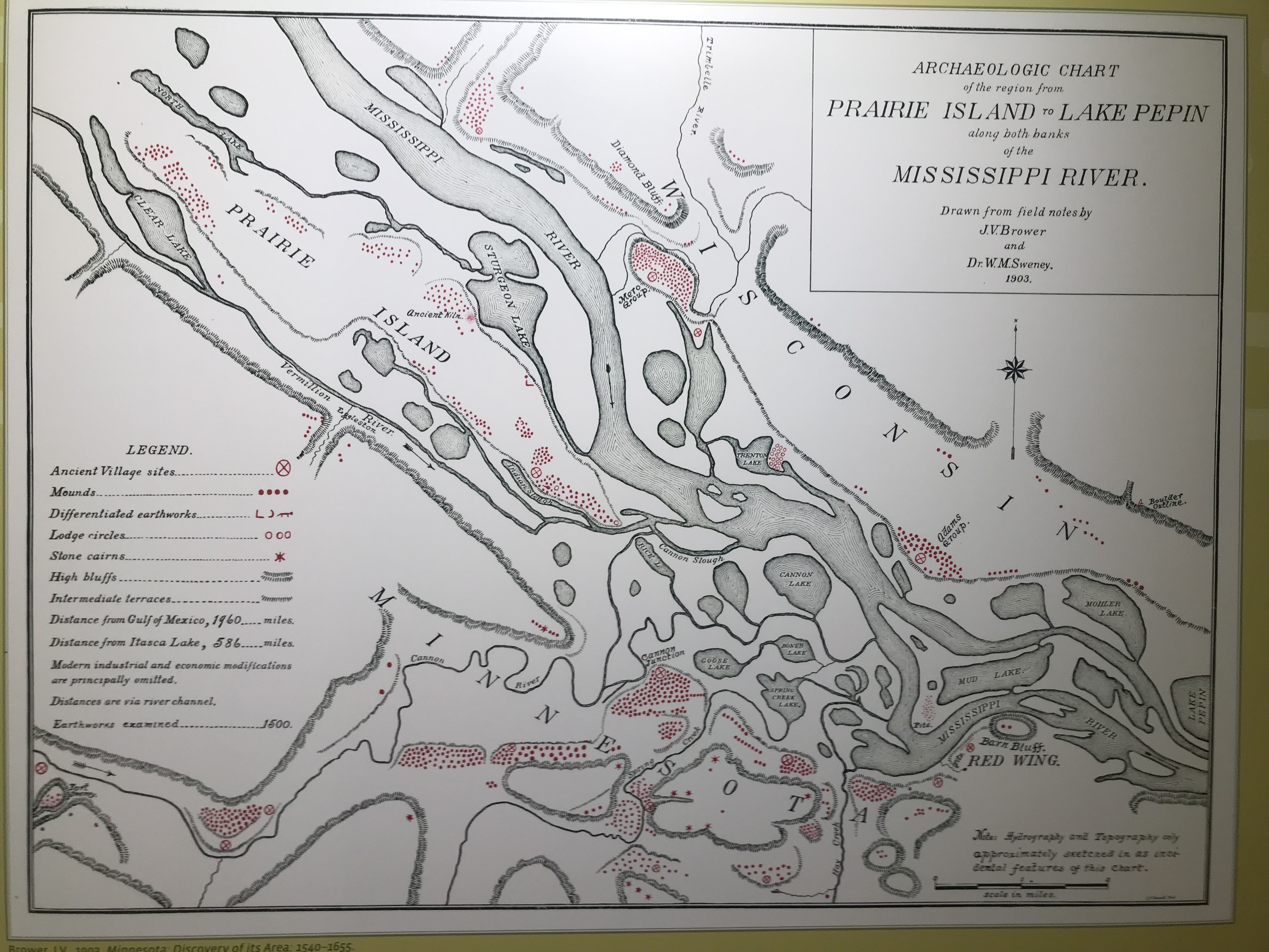
Apparently there were more mounds in Red Wing than anywhere else in the US. This map, although wrong, has some important details:

Another thing I would quibble with is the idea that these "cairns" are all the same. I found three distinct types of structures on that one hill (not counting the 'alignment'). None of them could have ever looked like that fat 'biscuit' that we see in the old black and white photo. Behold the entire poster: Two details:
 Wow, those earthen mounds must have really been something. Quoting the poster, quoting Edward Schmidt in 1939:
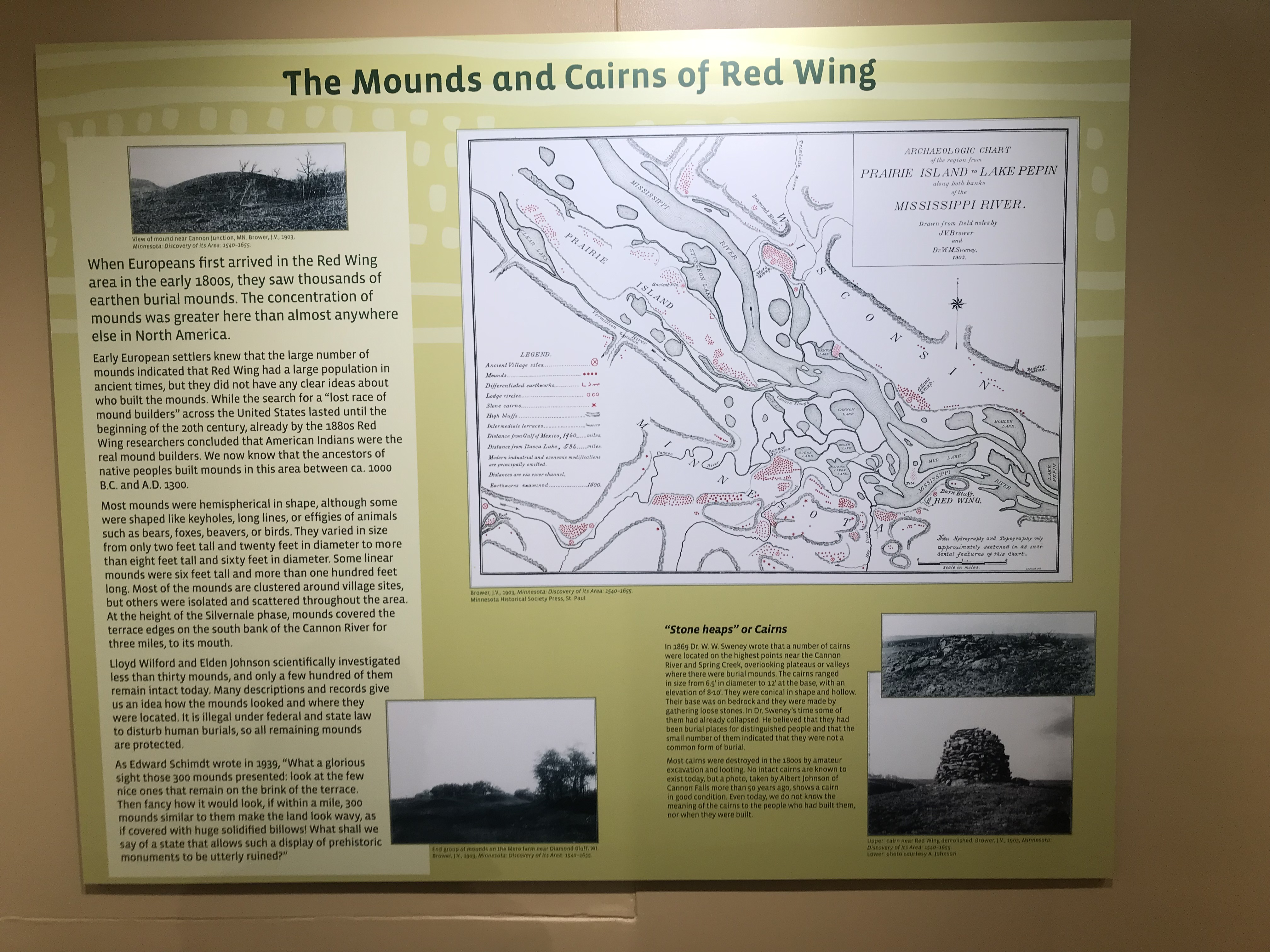


What shall we say of a state that allows such a display of prehistoric monuments to be utterly destroyed?
It might as well be Massachusetts, as far as that goes.
As for arrowheads, the display furthers the confusion about the variety of people from the past, with a photo of an old gentleman proudly holding his best paleo point. But they displayed the results of more recent digs.


What I am seeing is mostly side-notched points from the same style as mound builders and Mayans. Presumably these are the "Middle Mississippian" arrowheads. Ignoring the curious expertise that allows them to date rocks while ignoring the archaeological context they are found in, I can still say - why did they mung it all together? Adding, that the lighting was such that, if you bent over to look closely, you blocked the light and could not see anything.
In spite of my bitching, it was a gorgeous little exhibit, within a beautifully appointed County Museum. They had dollars to spare.
When I look carefully at the red dots and stars on the map, although it is hard locating the landform of the "Spring Creek Prairie" conservation land, I don't see any sign of 5 (or six) piles close to each other, nor any sign of the lone mound at the end of the ridge. In fact it is somewhat impossible to match the bluffs shown on the survey map with today's topographical map. But it sure does leave me wanting to go back and try to get some things right.

No comments :
Post a Comment