This is about rock piles and stone mound sites in New England. A balance is needed between keeping them secret and making them public. Also arrowheads, stone tools and other surface archaeology.
Friday, October 21, 2022
Visiting Red Wing MN - finding the cairns
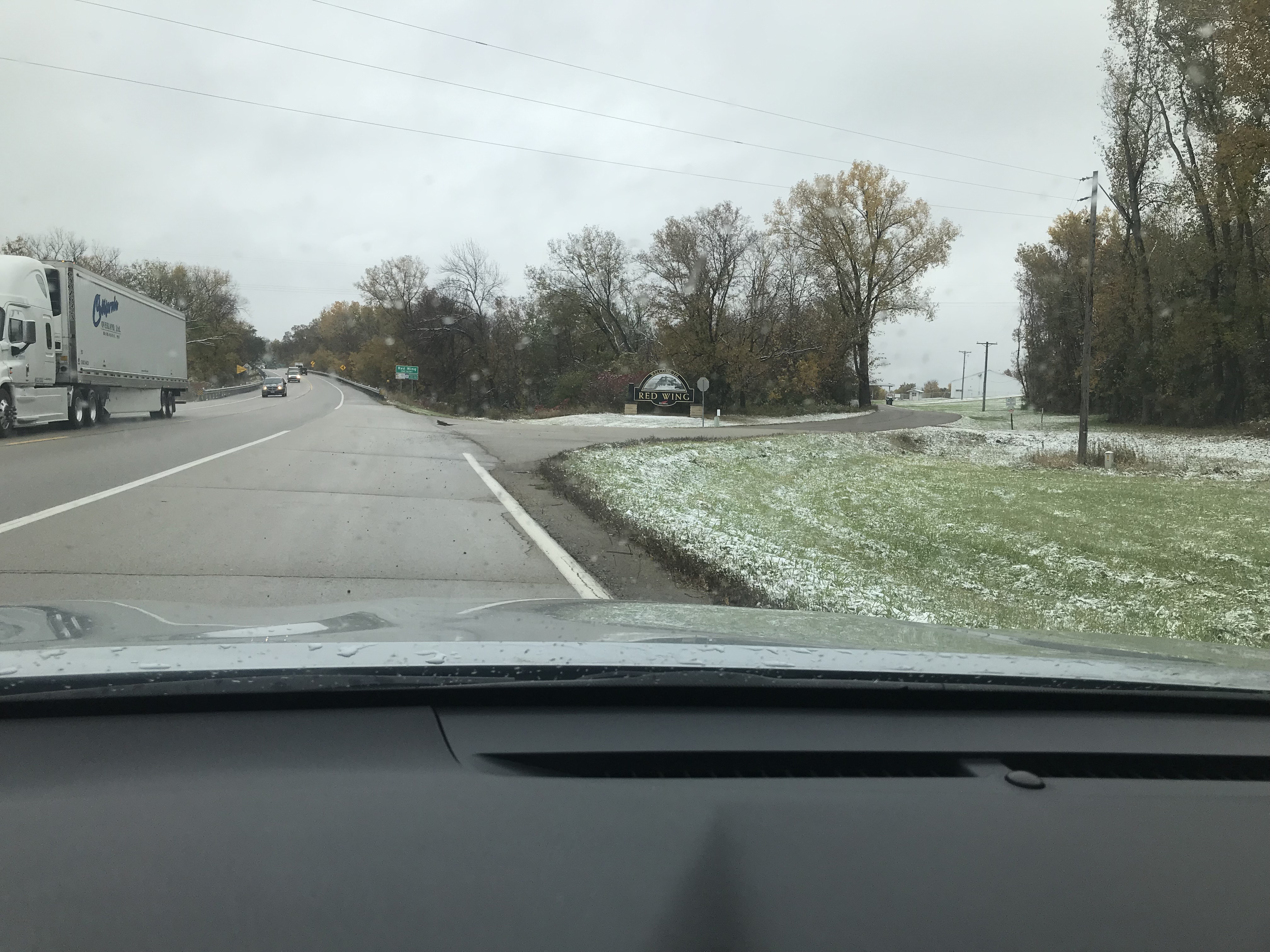
We woke up in Lake City, south of Red Wing, to a day with the first snowfall. Trying to decide whether to go walking outside, we had nothing to do except drive back to the Twin Cities for dinner. So we decided to forgo the hunt for Tundra swans that were said to be migrating through at the time.
What the heck - we decided to hike in spite of it raining and spitting snow. As it turns out my wife and I have good luck when out in the rain by ourselves.
There is some tourist info, and a couple of YouTubes, but the best info available for locating the famous "Red Wing Cairns" was something I linked to long ago, that came from Norman Muller:
With this in hand, and a local map showing a bona fide conservation land, we went to "Spring Creek Prairie". There was a road that took us up to the top of the bluffs [that is the geology of Red Wing, where the land along the Mississippi is several hundred feet lower than the surrounding country].
After a few steps down the main trail, I headed left into the woods to see what I was dealing with. I thought I would come to the edge of the bluff but the land slopes more gradually on the western side of these bluffs.
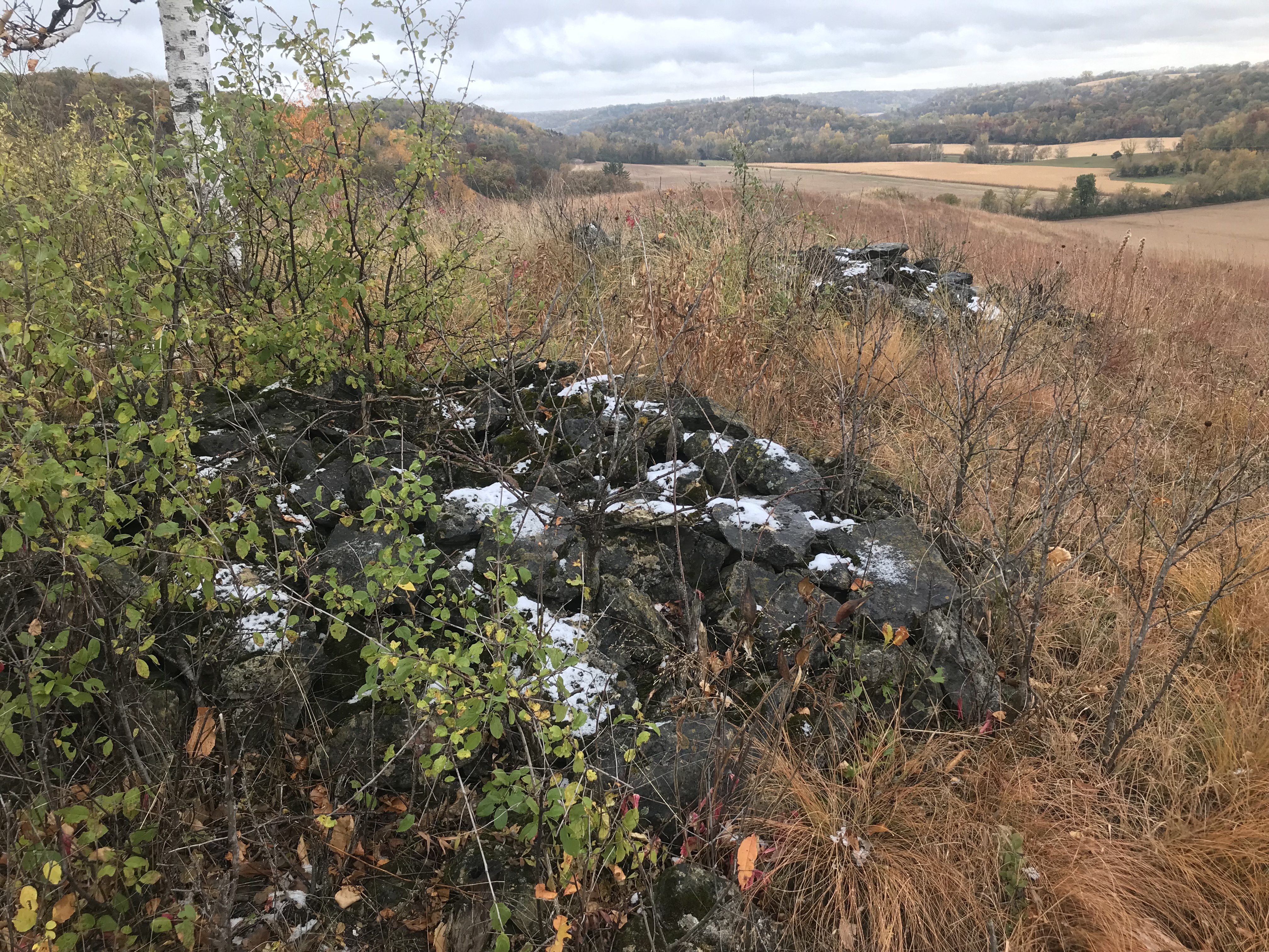
So I came to the first rock I saw on the surface since arriving in Minnesota. What do you know, it was part of an "alignment" - a curved course of evenly spaced rocks. Just like "marker piles", the basic layout is familiar to me. There was an old trail back in there which we followed until I got worried we were getting too far from the main trail. We got back to it and followed it down and over to a high hill. You kind-of knew you were getting to the place.
A beautiful side valley, not visible from the Mississippi. And there are the rock piles in the bushes:
I don't know if anyone cares about my observations but there seems to be quite a lot of misinformation out there - starting with the original surveys from 1903. One bit of misinformation is that these cairns are completely vandalized. I am not so sure because there is no sign of other rocks lying around the damaged cairns. What you'll see in these videos is five tightly grouped "cairns" around a central hole - that is dug into the bedrock - and a possible sixth pile that is completely gone. I always kick myself later for not paying attention to the exact details that I went there hoping to see. Ah well! With videos, at least we can take a better look around:
And
I will say that these "cairns" were faintly donut-like. Yet I do not want to believe these are burials. There is another possibility - that building a small rock piles, you do not need to fill the center as you build up a 'circle" of walls.
There was a distinctly astronomical feel to the place. I have never seen such closely spaced piles. AND I found another of those curved - "marker pile" - alignments, hiding in the grass there. Here is five "in a row", quite similar to what I found at the start of the walk:
According to (me), this only works to mark the passage of time if there is a shadow source that casts its shadow, more or less perpendicular to the 'alignment'. Only thing up there that would make such a shadow is the "cairns" at the top of the hill. So burials - maybe - or part of an astronomical arrangement.
In fact there were lots of other little rock piles around that have not been noted:
Let me call your attention to the sharp little "bump" at the end of the ridge on the left. On closer inspection, it was the largest "cairn" around. But old and covered with grass and flowers:
Sadly, I could not find this on the 1903 survey or on the more recent poster from Norman.
It is a totally beautiful spot. Rock piles at the edge of the prairie. The grass/flower combo is natural prairie. But all other places have been erased. This is just a little patch of what used to be everywhere.
Looking back, this is the hilltop with the "cairns":
Here, we have scrub oak in the foreground, other oaks in the background, and a tiny peek at the distant highpoint with the small birch tree.
What a place. A couple other pics:
Look at the "line" of ridge and pile, aiming away towards the southwest.
It is so tempting to go back and look for the other cairn sites. According to the poster, there are seven other places with rock piles. According to the 1903 survey (coming up next when we visit the local county museum) there are 10 cairns located around Red Wing.
My sense is that no-one has looked that closely for things. Except where it has been plowed [apparently nearly everywhere] there are very likely to be small piles on all the bluffs around here. The 1903 survey was busy looking for village sites and earthen mounds. They did a mediocre job with the "cairns". [To be continued.]


1 comment :
I should add that Bruce Koenen, who made the poster Norman sent, has done a good job ferreting out known, but lost, cairns.
Post a Comment