When I got started looking at rock piles there had been thirty or so years of research by individuals connected (or not) with something called the "Early Sites Research" (ESR) society. It included James Whittal, and some of the other individuals whose names are familiar - I am not sure who was in that organization but people like Goodwin (of Mystery Hill fame), Pearson (the photographer), Sincerbeaux (the lady from Vermont). I am sorry if I am missing names here - it was before my time. That organization gave rise to NEARA and I believe early NEARA people included Ted Ballard, Ros Strong, Sue Carlson. Barry Fell the controversial Harvard script decipher-er was an influence in ESR but I am not aware of him being involved with NEARA.
In the transition from ESR to NEARA we also have people like Mavor and Dix who, in my opinion, were the first to publish a believable and coherent picture about ceremonial stonework in New England. We also have Ted Timrek, a Smithsonian videographer, who made beautiful films and contributed some intellectual continuity with the old Smithsonian days of Squier and Davis - a past where Native American mounds were a well known, comfortable fact. In personal communication with me, Ted claimed he was at the Calendar I dig (see
Manitou by Mavor and Dix) and brought up the possibility that the subject matter was not from European visitors but rather from Native Americans. I asked Mavor about this specifically and he said that Ted
was there and was part of a general conversation they were having.
This time frame - maybe ~1970 [???], also included the energetic talent of Mark Strohmeyer, who had been exploring up and down in the towns of my home territory, and who had tried to tell the local historical societies about the stone work in those towns. Later I located sites which, it turned out, Strohmeyer had visited but located incorrectly on the map. (I am talking about the Acton "grid" which is off Spring Hill Rd, not Log Hill Rd in Carlisle.) At the same time, Byron Dix, like Strohmeyer, had spent a good deal of time poking around the woods of Boxborough, Harvard, and the valley of Beaver/Elizabeth Brooks (now Rt 495). In my thinking Strohmeyer and Dix were the first to really go out exploring, but the ladies of Vermont had also done a good deal of exploring- I just don't know about it.
Mavor told me he got interested in applying Alexander Thom's archaeo-astronomical techniques, that had been applied to megalithic monuments in Europe, to something in the U.S. Mavor was surprised when it turned out that stone walls had astronomical alignments. And his interests and thinking shifted gradually from European archaeo-astronomy to Native American archaeo-astronomy. The thread of archaeo-astronomy was a major new idea in the analysis of stone sites. Previously there was not much to study - except some inscriptions found in stone chambers. A lot of early research [much like the research I have been doing] was in the category of "Ooh! look at that! isn't it curious?" Mavor turned the study into a subject where you apply genuine measurement techniques and provide quantitative approaches. In my opinion (and this is very relevant to the story) the quantitative emphasis went a bit too far, and in some cases stunted the growth of people observing the stone constructions. I watched a lot of sloppy work with a magnetic compass, passed off as "research", by people who could easily grasp the presence of an alignment but who never thought much about its significance.
By coincidence, I live in the Concord area in the winter and visit Woods Hole, Mavor's home town, in the summer. My father went to a "seniors group" talk by Mavor and come home with a copy of "Manitou" and the thought: "I just heard something strange about the woods...let's go check". We were in Woods Hole and went out to a couple of the sites Mavor reported. Sure enough the alignments described by Mavor were real. I was into arrowhead hunting at the time but I went and introduced myself to him, challenging his statement that stone tools were not found near ceremonial sites (they actually are found, just not 8K years old arrowheads). He ended up recruiting me into NEARA. Because I was already blogging about arrowheads, the NEARA board of directors asked my to do a web page for the organization - so I started their home page for them and started looking around for something I could contribute to the subject. I was, and am, in awe of Mavor and Dix for having discovered this amazing phenomenon in our woods. Actually it was not just them.
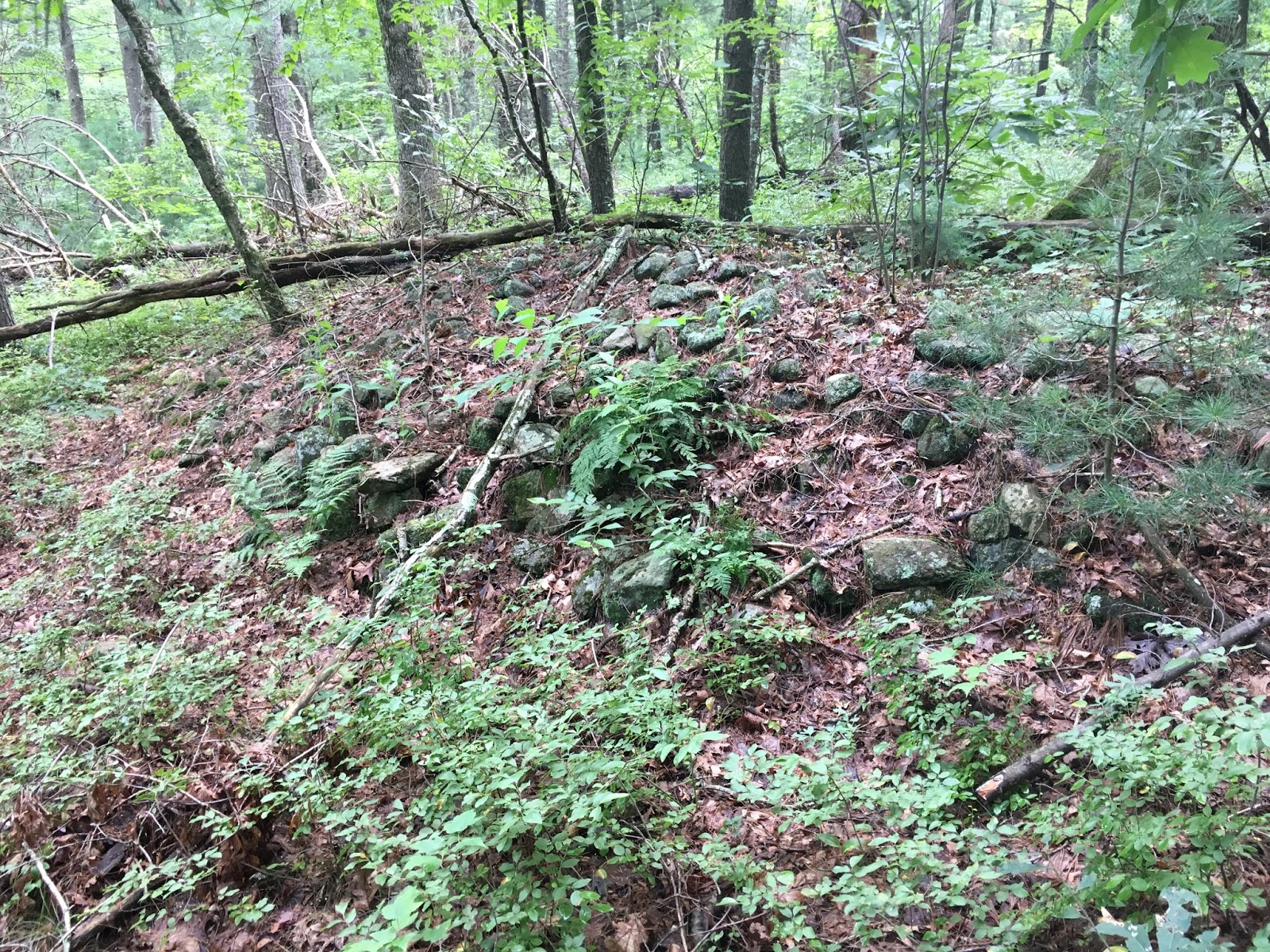
So when I started, I wanted to contribute something and noticed quite a few rock piles in Acton. What was critical for me was seeing well-built piles about 1/2 mile away from some field clearing piles and thinking "whoa! this is not the same thing...how do I prove it?" So I started trying to document and understand rock piles. It seemed they were an under-studied aspect of the subject. Everyone else in NEARA was interested in stone chambers, European inscriptions, and alignments. At around the same time I started writing about rock piles, Norman Muller was taking an interest in rock piles and he was writing about them. The site at Oley Hills is certainly one of the most fantastic collection of mounds anywhere. I want to dwell on the point that Norman has been focused on large sites with amazing large mounds. There are few such monumental sites near my home in Concord and so, by default, I ended up examining smaller less dramatic examples. I think this was a good thing. By far the majority of sites are not "monumental" and it would be easy to miss their significance.
Back then, around ~2003, I thought sites were rare and ventured, timidly, out from Concord looking for sites in nearby towns. They were everywhere I looked; leading me to think, at times, that I had uncovered some magic formula for locating sites. At one point it was "southeast facing, next to brooks". Whatever the theory that got me out looking, it always seemed successful. I now understand this as the result of sites being everywhere but, over time, real correlations were noticed and my hunting techniques became more efficient. I ventured to speculate about things and then tested ideas against the realities of the sites I was finding. I did an experiment which I think is definitive: pick a random place on the map (say in far off Leominster) and circle the locations most likely to contain rock piles. Then go out and look. I found rock piles in the snow that way and, believe me, you don't find them in the snow very easily. This convinced me there was a relation between topography (mostly the relation to water) and site locations. But by "site" I mean the humble collections of near-invisible piles. I do not know what the correlations would be with large monumental sites of the sort studied by Norman. I did other "experiments" related to collecting and analyzing typology statistics from many sites. Probably my important contribution is the discovery and mapping of more than 800 sites.
I should also mention this
Rock Piles blog. When I got too much material to publish, I thought it not appropriate to use the NEARA webpage for my photos, so I showed Dan Boudillion how to do manage the web page and transferred my energies to
Rock Piles. With the help of guest authors like Tim MacSweeny and Chris Pittman, the blog has been able to keep going 12 years since 2006
eight years, since 2010. During that time we added so many standard search terms to the articles that were posted, that this blog became the target of most Google searching involving ceremonial stone work. Ironically it is not always true and many stories about "mysterious rock piles" continue to come from people who should know better and been able to find information online, had they looked for it. But in any case, the blog answered the search questions about rock piles, at a rate of perhaps 100 new people a day, for long enough that academic rejection of Native American stonework never took place. Online, the notion of ceremonial rock piles in the eastern U.S. is the norm.
At around 2003, while I was discovering sites in Carlisle, Linda MacElroy from NEARA told me about a fellow named Jic Davis, who lived near the corner of Acton/ Carlisle/ Concord, and who had a "jade mine". Jic turned out to be a forester and landscape designer who loved geology and the beauty of his own back yard. As it turned out, his "jade mine" was right beyond a rock pile site I had explored the previous week with my son Joe. When I met Jic and visited the "mine" we passed through the rock pile site on the way back and I commented that a certain table rock there sure seemed unusual. He briefly argued that it was from colonial stone work, and then gave up and became very enthusiastic about Native American stone work. Jic was mostly interested in his own views and his impressions of rock piles were formed from a limited data set. The idea of celestial alignments is easy to understand and a fun idea and got latched onto immediately. In later years, I would call Jic up and say: "lets go out" and occasionally he would take walks with me and add the insight of his observant (I claim un-filtered) perceptions. Those insight came from inside his head and (still later) when he would ask Doug Harris about something, Doug would get annoyed that Jic was projecting so much into the subject and asking questions Doug could not answer. I want to say that it was deeply significant to Jic, on a spiritual level, that there were visible traces of the Indians left in the woods of his childhood. When we were suburban kids, Indians were a favorite subject and, as adults, it only slowly dawned on us that there were Native objects in plain site. A thrill!
But there was another thread of significance to Jic, namely the possibility that the Native Americans could help him protect his land from the estate lawyers. It also turned out that Jic's land was on loan from a land owner and that the estate for the fellow (who was said to be senile) were getting ready to threaten Jic's use of the property. Not something I could have done, Jic put himself out there time after time calling the Indians. Eventually they appeared, they saw, and they adopted. Now if you care to understand my relation with Jic, consider that although I taught him about the subject, and schemed with him [I actually wrote the formal invitation to the Indians], somehow the Narragansett Indian Elders came to Carlisle, without my hearing about it until long after. Somehow their acceptance of the invitation, scheduling, and actual visit took place without a word of it being mentioned to me...even though Jic and I were talking on the phone at least once a week throughout that time.
The personal downside is somewhat irrelevant. But the real downside is that the Indians were introduced to the rock piles by people who knew very little about them; leading to a present in which the Indians may not have gotten a complete picture, and maybe never will. Everybody is focused on alignments! After the initial visit by the Elders, they sent out a deputy Tribal Historic Preservation Officer, Doug Harris, to do further surveying and coordination with local land owners about site protection. They were looking at the sites I showed them. I showed them to another local land owner Tim Fohl, who quickly adopted an interest in"alignments" but had no experience with the topic. Out of this time frame came the "Indian Rock Defense" that got written about in the Carlisle "Mosquito" as a new way to fight against land development. It is very gratifying to see local towns rolling out education programs to teach people about Ceremonial Landscape.
Also in this time frame, I started showing sites to Doug Harris, ultimately leading to me giving him a list of 8 towns where I knew about rock piles. Doug Harris got it, or thought he did. I remember showing him a site and he asked: "Why would there be a site there?" and I answered "How could there not be...look at it." I showed him the relation to water. At the time I was very curious about whether the Indians already knew about ceremonial stone work. I think they did not; and will explain why. They did have a story about a "medicine man circuit" that passed through the towns I listed but I asked questions and analyzed what Doug Harris was saying. I was very puzzled by the use of quartz in rock piles and tried to pass various speculations by Doug to see what he would say. He informed me that quartz, as a white material, was more an amplifier than something with its own properties. And that is the only useful information I got from him. Later he made an elementary mistake emphasizing how corners are to be avoided in "harmonious" constructions. But that was because he stopped listening to me before learning about rectangular mounds with hollows. Also his wife, Winona, showed some puzzlement when I first showed her a rock pile - wondering if it wasn't from field clearing and dismissing similar structures from her back yard. I really wanted to know if there was any cultural continuity between today's Native Americans and yesterday's rock piles. I conclude that the memories are there but vague and featureless and mostly forgotten. Until it became a tool in land development - and suddenly the Indians had real leverage.
When Doug first started to get the idea, he was excited and went to the USET congress (an official meeting of united, south, and eastern, tribes) and they issued a "resolution" that named the 8 towns (the ones I had identified) and that was the start of an official story about rock piles. I listened with great intent when, at a subsequent NEARA meeting, they had the chairman of USET speak these words: "We did not know about these things....you showed us the way." That nails if for me. Before these events, ceremonial landscape was NOT part of Indian thinking in the eastern U.S. I should mention in passing that the USET chairman's voice was transmitted to the audience during a NEARA "expert panel discussion" about rock piles that was organized by Doug Harris and included Tim Fohl, Ted Ballard, and tribal officers from Mashpee and Aquinna. I was not asked to be on that panel.
Doug Harris accepted rides to events from Tim Fohl - who had joined the discussion as a local landowner. Tim liked the idea of alignments and never seemed to evolve past that; and he seems to have passed on that focus to Doug Harris. This tends to "bake in" the concept of alignment as the primary "spiritual" end-in-itself. But it is wrong and only part of the picture. I tried to explain it to Doug but, by then, he was traveling around the country giving talks. He picks up the phone when I call - usually to alert the tribes to a threatened site - but has not had any more time to go look at sites. Unfortunately, I did not know about burial mounds at that time and it was only later that I tried and failed to communicate that to Doug. The alignments are part of a calendrical system that is a critical component of burial rituals - not an end itself. I don't think Doug Harris understands that. Let me then stipulate that today's Indians did not have direct knowledge of ceremonial stone structures. As a result the education programs being rolled out in individual towns are not quite right, emphasizing astronomy when they should be emphasizing the role of astronomy in mortuary and other rituals. I do not know what might be being said about water, if anything.
I would not mention it except for being slightly hurt to have been written out of the story. So I listen to a YouTube of Doug Harris (
Doug Harris Let The Landscape Speak Part 2) and find him emphasizing how it was this "crazy guy" from Carlisle (Jic Davis) who got the Indians to come out and who showed them the rock piles. That is not entirely true. I think it is much easier to accept that "spirit" is speaking to modern Indians via a crazy guy from Carlisle, than via a western scientific type (my PhD is in Math) who is simply trying to observe carefully, given a lead from Mavor and Dix. Note that Mavor was a PhD ship designer. Also a shout out to people like Fred Martin and Ken Leonard, who retired from academics and used their skills to study stone structures. The truth is that the knowledge of ceremonial structures arises, out of the ashes, not through the spiritual insights of a "crazy guy" but through systematic, disciplined observation by a number of people, many with scientific backgrounds. As far as that goes, "spirit" uses the tools available. I like to think Doug cannot write me and other early contributors out of the story, because we are all part of it.