I was browsing through my photos and came across some images that I had not shown to anyone yet, so I thought I'd post them.
Tuesday, August 22, 2006
"Lost" Photos
by JimP
I was browsing through my photos and came across some images that I had not shown to anyone yet, so I thought I'd post them.
The rockpile above is on the Miner Farm at Tomaquag.
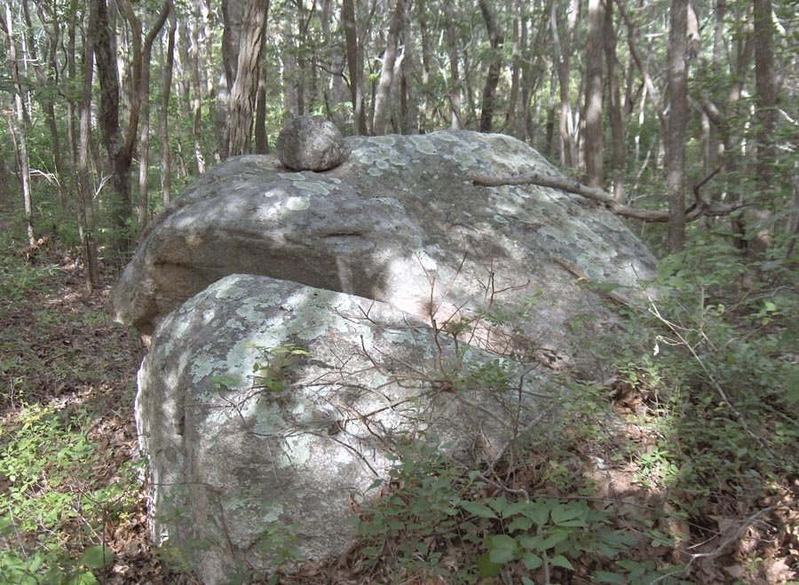
Above is another image from the Miner Farm, this time it's a rock-on-rock. The shape certainly reminds me of some kind of animal head.
Piles of stones make up the above row at the Miner Farm. The arm and leg belong to Bob Miner.
The rockpile above was found on a site near Rte. 3 in Hopkinton, RI. It sits near the lone boulder you see pictured below.
I was browsing through my photos and came across some images that I had not shown to anyone yet, so I thought I'd post them.
Monday, August 21, 2006
Bronze Plaque Marker for Cemetery is In!
At last. This has been a multi-year effort. Now all I have to do is take some pictures and have a dedication ceremony.
Sunday, August 20, 2006
Rock on a split-wedged boulder
Pictures from Upstate NY
Reader Meghan writes in asking for information about the many rock piles on her land.
Here are some photos, showing a substantial cairn field:
http://s49.photobucket.com/albums/f278/megdagooch/Camp/Stone%20Walls/ ?
Here are some photos, showing a substantial cairn field:
http://s49.photobucket.com
Saturday, August 19, 2006
More slow blogging weekends
Back to the Cape for weekends through the end of August - with slow dialup connection and fewer new rock pile sites to report.
For the record, I was on Rt 495 going south about 1/4-1/2 mile north of the Wareham border, stuck in stop-and-go traffic, and admiring the scenery to my left in the highway median strip, and thought I spotted a rock pile. Love it. I don't suppose there are any readers in the Wareham area who could go check?
Friday, August 18, 2006
Rock Piles in Monroe State Forest, MA
This is from reader Nick Holland, responding to my question about where he saw many rock piles in the State Forest:
"I saw them throughout the forest, but particularly remember them along the Spruce Hill Trail off of Raycroft Road. There is a spur trail off of Spruce Hill that heads north off the State Forest with many stone piles. Feel free to publish information on these, as this is public land. I was in the DAR State Forest yesterday and saw two really nice, organized 'piles' just off of the NewEngland Mountain Bike trail, fairly near the junction with the main park road."
Anyone else want to go out there and have a look?
"I saw them throughout the forest, but particularly remember them along the Spruce Hill Trail off of Raycroft Road. There is a spur trail off of Spruce Hill that heads north off the State Forest with many stone piles. Feel free to publish information on these, as this is public land. I was in the DAR State Forest yesterday and saw two really nice, organized 'piles' just off of the NewEngland Mountain Bike trail, fairly near the junction with the main park road."
Anyone else want to go out there and have a look?
Photos From Bob Miner
by JimP
Here are more amazing photos from the Miner Farm at Tomaquag taken by Bob himself.
Above is a u-shaped structure. Some people might call it a prayer seat.
A rock pile sits by a fallen tree above.
Two rocks-on-rock in above photo. I could be wrong, but Peter might call these, "twins." The surrounding area has been kept clear and park-like by Bob's grazing livestock.
Above we see another pile on the ground.
An amazing structured rockpile built into a wall is pictured above.
Above is a stunning boulder with two parallel quartz veins and a triangular rock-on-rock. In the foreground sits an almost rectangular rock with concave surface on top.
For more photos of Bob Miner's amazing property -- some from Bob, some from Larry Harrop -- [click here] to visit Larry Harrop's Miner Farm gallery.
Here are more amazing photos from the Miner Farm at Tomaquag taken by Bob himself.
For more photos of Bob Miner's amazing property -- some from Bob, some from Larry Harrop -- [click here] to visit Larry Harrop's Miner Farm gallery.
Thursday, August 17, 2006
Tim MacSweeney poem
[This is elevated from comments to my previous post about the surprisingly low number of sites.]
Great Mystery (another way to translate Manitou).
And the piles of stones, the outcrops – everything
Meant something, recalled a memory,
Was perhaps an eternal prayer.
Stones on a turtle’s back,
You and I and everyone and everything
Are just stones on the turtle’s back…
To some people they don’t mean a thing,
Those monuments, those collections;
French soldiers firing at the Great Sphinx
Conquistadors destroying temples
Priests burning pagan books
Just a few years ago
During the looting of an ancient city
In the Cradle of Civilization
A man came on TV and made this plea:“Don’t destroy oil wells.”
And sent soldiers to guard the oil fields
As antiquities disappeared…
So those woodcuts of burial mounds we posted
Were robbed for grave goods
That went into somebody’s curio-cabinet,
And the stones went into a fence or a foundation.
For every story like that there’s a thousand that quietly went away:
Somebody rolled the big stone down the hill
Somebody bulldozed them for a highway or a driveway
Somebody was building something
My Great Grandfather worked building stone walls,
Probably took apart hundreds of mounds,
In a different part of town
Walling in a rich man’s property
For next to nothing in pay…
Just stones to some;
To others, stones on the turtle’s back…
- August 17, 2006
Great Mystery (another way to translate Manitou).
And the piles of stones, the outcrops – everything
Meant something, recalled a memory,
Was perhaps an eternal prayer.
Stones on a turtle’s back,
You and I and everyone and everything
Are just stones on the turtle’s back…
To some people they don’t mean a thing,
Those monuments, those collections;
French soldiers firing at the Great Sphinx
Conquistadors destroying temples
Priests burning pagan books
Just a few years ago
During the looting of an ancient city
In the Cradle of Civilization
A man came on TV and made this plea:“Don’t destroy oil wells.”
And sent soldiers to guard the oil fields
As antiquities disappeared…
So those woodcuts of burial mounds we posted
Were robbed for grave goods
That went into somebody’s curio-cabinet,
And the stones went into a fence or a foundation.
For every story like that there’s a thousand that quietly went away:
Somebody rolled the big stone down the hill
Somebody bulldozed them for a highway or a driveway
Somebody was building something
My Great Grandfather worked building stone walls,
Probably took apart hundreds of mounds,
In a different part of town
Walling in a rich man’s property
For next to nothing in pay…
Just stones to some;
To others, stones on the turtle’s back…
- August 17, 2006
Wednesday, August 16, 2006
Curiousity about the number of rock pile sites
I have a reasonably good idea of how many rock pile sites (sites per square mile and piles per site) can be found around here in Middlesex County Mass. There are lots and lots of sites but I find myself wondering: how come there are not more? Were rock pile sites made by a small number of people over a longer period of time or a large number of people over a short period of time? Based on what I see, it appears more like what would be the result of a small number of people over a small period of time. I would say every site I have seen could be accounted for by about 100 people building a rock pile once a year for one lifetime, or a smaller number of people making more, or a larger number of people making fewer. But it does not really add up to as much activity as I would expect from pre-history. Add to this that in the only documented information about this (at Bannock Point in Ontario) the modern day Native Americans deny having built the rock piles.
It also is part of my thinking that rock piles are ephemeral - they last for a few years and then are destroyed by natural random processes. You can see this happening at almost every site: piles bashed by falling trees, rocks around the base of a boulder which still has a few rock on top, etc. Also, as evidenced by the second excavation discussed in Manitou (the one about the "Dairy Hill Monolith"), there are other rock piles buried under ground where you cannot see them. So maybe there are lots more piles there than we realize.
Another possibility is that a rock pile ceremony might have required destroying an old rock pile before building a new one. In that case the numbers are consistent with a small group of people (perhaps the "shamans") making the piles. Or perhaps youths seeking visions would build a number of piles but these would then get destroyed, intentionally or randomly, at a rate that matched the rate at which new ones were built.
Actually the data is kind of different down in Holliston and Hopkinton at the sites Bruce McAleer located. Those sites go on for miles with thousands of rock piles. So it almost seems like a different story. There, I suspect the piles are being renewed by local Indians or were until recently. Maybe that is the explanation: so much development and destruction up here leaves a very patchy record that it is mis-leading.
All these things are confusing and worth thinking about occasionally.
It also is part of my thinking that rock piles are ephemeral - they last for a few years and then are destroyed by natural random processes. You can see this happening at almost every site: piles bashed by falling trees, rocks around the base of a boulder which still has a few rock on top, etc. Also, as evidenced by the second excavation discussed in Manitou (the one about the "Dairy Hill Monolith"), there are other rock piles buried under ground where you cannot see them. So maybe there are lots more piles there than we realize.
Another possibility is that a rock pile ceremony might have required destroying an old rock pile before building a new one. In that case the numbers are consistent with a small group of people (perhaps the "shamans") making the piles. Or perhaps youths seeking visions would build a number of piles but these would then get destroyed, intentionally or randomly, at a rate that matched the rate at which new ones were built.
Actually the data is kind of different down in Holliston and Hopkinton at the sites Bruce McAleer located. Those sites go on for miles with thousands of rock piles. So it almost seems like a different story. There, I suspect the piles are being renewed by local Indians or were until recently. Maybe that is the explanation: so much development and destruction up here leaves a very patchy record that it is mis-leading.
All these things are confusing and worth thinking about occasionally.
Owyhee Hills in Oregon
[Click here]
"The larger of the two is described thus; "The mesa top which covers an area of c. 40 x 40 meters is totally enclosed by a wall c. 1/2 meter high. The wall has a series of openings. Within the walled area are cairns, circular, semicircular and rectangular alignments".
New issue of "Stonewatch" from the Gungywump Society
[Click here]
I find particularly interesting the illustration part way down of the "angular fluctuation" of the sunrise. The curves shown remind me of the curves of rock piles I mentioned for kettle hole sites.
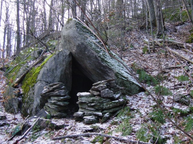
Visit to a Vermont Stone Chamber
[Click here]
Note there is page "2" and a page "3" but no page "1".
The parent website has some other interesting photos from Hawaii [Click here]
Note there is page "2" and a page "3" but no page "1".
The parent website has some other interesting photos from Hawaii [Click here]
Tuesday, August 15, 2006
Book Review: America's Stonehenge Deciphered
by JimP
I received my copy of Mary Gage's new book America's Stonehenge Deciphered last week. I had eagerly anticipated its arrival and I must say it did not disappoint. I felt compelled to write this review for the blog.
Mary seamlessly combines historical, archaeological, and other physical records with Native American oral traditions to piece together a 3,000 year ceremonial history of the Mystery Hill complex in North Salem, NH. It not only becomes evident that Mary has pain-stakingly inspected all the structures at the complex known as America's Stonehenge, but that she also has extensive knowledge of all the reports from archaeologists and researchers who have studied the site over the last several decades. She puts it all together into a cohesive timeline that not only makes logical sense, but brings the general public new insights into the spirituality of New England's First Nations.
The value of Mary's book goes far beyond Mystery Hill. It also helps us to better understand ancient lithic sites all over New England. From her meticulous documentation of each structure and feature, we gain knowledge of similar structures that likely served similar purposes at sites all over the Eastern Woodlands. We learn new ways of viewing stonework and rock piles. We find features that we might have otherwise overlooked.
The hundreds of terrific photos by Mary's son James and all the expertly-drawn illustrations do a wonderful job of placing you right there at each feature as Mary describes their uses. It becomes easy to imagine the Native People practicing their rituals and continuing their traditions over scores of centuries on the beautiful sacred hilltop site. It transports you back in time and allows you to envision the ceremonies in a way you likely never have before.
Although those people lucky enough to have visited Mystery Hill often and who have intimate knowledge of its many features will gain the most value from Mary's book, it is so jam-packed with information that there is literally something in it for everyone. This book should sit on the shelf right next to your copy of Manitou by Mavor and Dix. I feel it is both that important and that ground-breaking.
America's Stonehenge Deciphered is a bargain at just $16 plus shipping. It's available through Amazon.com and Powwow River Books.
[Click Here] to order your copy today!
Note: I am in no way affiliated with Powwow River Books or with America's Stonehenge Deciphered in any way. I posted this review because I honestly received that much value from Mary's book -- and I think everyone should own a copy. This is very much an unsolicited endorsement.
Mary seamlessly combines historical, archaeological, and other physical records with Native American oral traditions to piece together a 3,000 year ceremonial history of the Mystery Hill complex in North Salem, NH. It not only becomes evident that Mary has pain-stakingly inspected all the structures at the complex known as America's Stonehenge, but that she also has extensive knowledge of all the reports from archaeologists and researchers who have studied the site over the last several decades. She puts it all together into a cohesive timeline that not only makes logical sense, but brings the general public new insights into the spirituality of New England's First Nations.
The value of Mary's book goes far beyond Mystery Hill. It also helps us to better understand ancient lithic sites all over New England. From her meticulous documentation of each structure and feature, we gain knowledge of similar structures that likely served similar purposes at sites all over the Eastern Woodlands. We learn new ways of viewing stonework and rock piles. We find features that we might have otherwise overlooked.
The hundreds of terrific photos by Mary's son James and all the expertly-drawn illustrations do a wonderful job of placing you right there at each feature as Mary describes their uses. It becomes easy to imagine the Native People practicing their rituals and continuing their traditions over scores of centuries on the beautiful sacred hilltop site. It transports you back in time and allows you to envision the ceremonies in a way you likely never have before.
Although those people lucky enough to have visited Mystery Hill often and who have intimate knowledge of its many features will gain the most value from Mary's book, it is so jam-packed with information that there is literally something in it for everyone. This book should sit on the shelf right next to your copy of Manitou by Mavor and Dix. I feel it is both that important and that ground-breaking.
America's Stonehenge Deciphered is a bargain at just $16 plus shipping. It's available through Amazon.com and Powwow River Books.
[Click Here] to order your copy today!
Note: I am in no way affiliated with Powwow River Books or with America's Stonehenge Deciphered in any way. I posted this review because I honestly received that much value from Mary's book -- and I think everyone should own a copy. This is very much an unsolicited endorsement.
Blog search function is broken
The feature at the top of the blog with "Search this Blog" seems to have stopped working. This is too bad because it was an easy way to get cross-reference information. You can still search the blog but you have to go out, for example to Google or to Technorati in order to perform the same search function - and using them you get a lot of non-blog-specific results.
If anyone knows how to fix this or understand the problem, please leave a comment.
A kettle hole site
I only found one significant site this summer, during two weeks of exploration. It is possible I have exhausted all the obvious places in Falmouth and, in the future, I will need to get lucky to ferret out a few more sites in what is actually a rather limited land area. This day out I was planning on looking for one more Mavor site which he mapped and which I had not yet explored. But looking at the map I saw there was at least one more deep kettle hole nearby which, by my strategy, I thought I really should explore first. [Later, when I found a site in there I was thinking snyde thoughts about why the heck didn't Mavor explore the next kettle hole over...well his alignment theory prevented it, since it was in the wrong direction.] But as I came up to the lip of this new kettle hole and saw the steep slope several hundred feet down into it, I was dreading the climb back out through the blueberries. Walking through blueberry bushes is hard work and this was the hottest time of the summer. I said to myself: well you've got it to do. [Here is what I wrote]:
I did, in fact, find a nice rock pile site down in there, as indicated by the northernmost outline on the map fragment. This surprised me because I would expect Mavor to have explored every similar location (i.e. kettle hole) near where they had already found rock piles. But they must not have checked that kettle hole. Why not? My thought is that their theory got in the way. They were too busy chasing alignments and I think a better strategy is to look in all kettle holes. On the other hand there may be something to what they were doing because the layout of this new site is along a rough diagonal from lowest point at the bottom of the steepest part of the sloping sides of the bowl up across that steepest slope in a more or less southeastern direction.
I think there is a good chance to figure out this site and it is hard to imagine it has nothing to do with the sky. What else could possibly dictate that kind of shape for a site? In more detail, I drove up along a road running with the kettle hole to the northeast, I parked and started in and seeing how steep the sides were, thought: well you are going to have to work for it this time, and how easy it is to go downhill. I went down the southern slope into the hole. A few feet up from the bottom I saw a first rock pile, then a rock-on-rock and started thinking: ah, a real site. Down at the bottom there was a group of rock on rocks, and one boulder pile with more than five rocks. I found the additional piles in a diagonal from the first one and so also explored outward along that same diagonal and found a few more distant piles up higher on the slope to the southeast. Circling back around there was one more isolated pile near the true lowest point. A few odds and ends of rocks around the other sides of the hole could well be additional structure to the site, which I am not sophisticated enough to pick up on.
Here is the first pile and rock-on-rock:

I was happy enough to see two genuine piles in the right sort of place. Here is another rock-on-rock and a view back up the southern slope:

I was tracking along a diagonal and came to a small group at the bottom:
Here is another view from the bottom, again to the south:
The "main" pile is in the background of the first picture behind the foreground pile. In the second picture this same "main" pile is to the right. And here it is in all it's glory:
Maybe a little "turtle" action there. Maybe it is too badly damaged to tell. I like how my camera is doing. But I was playing with the settings and got some good and some bad pictures without learning much about the best settings. Anyway, I explored outward and found things along the same diagonal but back to the southeast and higher up the slope. Two outliers:
[The second one is much like the first].
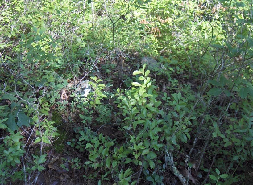
Then I circled down in and back to the group of piles at the bottom. I saw one ground pile at the lowest point and then another ground pile, close to the original group. These were thoroughly buried:

This would be an extremely good reasearch site. The piles are well differentiated from each other. All the ones I spotted on the slopes were boulder piles but at the real bottom there were a couple of ground piles. So there is different form and possibly different function. All in all a well articulated and integrated site.
I did, in fact, find a nice rock pile site down in there, as indicated by the northernmost outline on the map fragment. This surprised me because I would expect Mavor to have explored every similar location (i.e. kettle hole) near where they had already found rock piles. But they must not have checked that kettle hole. Why not? My thought is that their theory got in the way. They were too busy chasing alignments and I think a better strategy is to look in all kettle holes. On the other hand there may be something to what they were doing because the layout of this new site is along a rough diagonal from lowest point at the bottom of the steepest part of the sloping sides of the bowl up across that steepest slope in a more or less southeastern direction.
I think there is a good chance to figure out this site and it is hard to imagine it has nothing to do with the sky. What else could possibly dictate that kind of shape for a site? In more detail, I drove up along a road running with the kettle hole to the northeast, I parked and started in and seeing how steep the sides were, thought: well you are going to have to work for it this time, and how easy it is to go downhill. I went down the southern slope into the hole. A few feet up from the bottom I saw a first rock pile, then a rock-on-rock and started thinking: ah, a real site. Down at the bottom there was a group of rock on rocks, and one boulder pile with more than five rocks. I found the additional piles in a diagonal from the first one and so also explored outward along that same diagonal and found a few more distant piles up higher on the slope to the southeast. Circling back around there was one more isolated pile near the true lowest point. A few odds and ends of rocks around the other sides of the hole could well be additional structure to the site, which I am not sophisticated enough to pick up on.Here is the first pile and rock-on-rock:

I was happy enough to see two genuine piles in the right sort of place. Here is another rock-on-rock and a view back up the southern slope:
I was tracking along a diagonal and came to a small group at the bottom:
Here is another view from the bottom, again to the south:
The "main" pile is in the background of the first picture behind the foreground pile. In the second picture this same "main" pile is to the right. And here it is in all it's glory:
Maybe a little "turtle" action there. Maybe it is too badly damaged to tell. I like how my camera is doing. But I was playing with the settings and got some good and some bad pictures without learning much about the best settings. Anyway, I explored outward and found things along the same diagonal but back to the southeast and higher up the slope. Two outliers:
[The second one is much like the first].Then I circled down in and back to the group of piles at the bottom. I saw one ground pile at the lowest point and then another ground pile, close to the original group. These were thoroughly buried:

This would be an extremely good reasearch site. The piles are well differentiated from each other. All the ones I spotted on the slopes were boulder piles but at the real bottom there were a couple of ground piles. So there is different form and possibly different function. All in all a well articulated and integrated site.
Subscribe to:
Posts
(
Atom
)