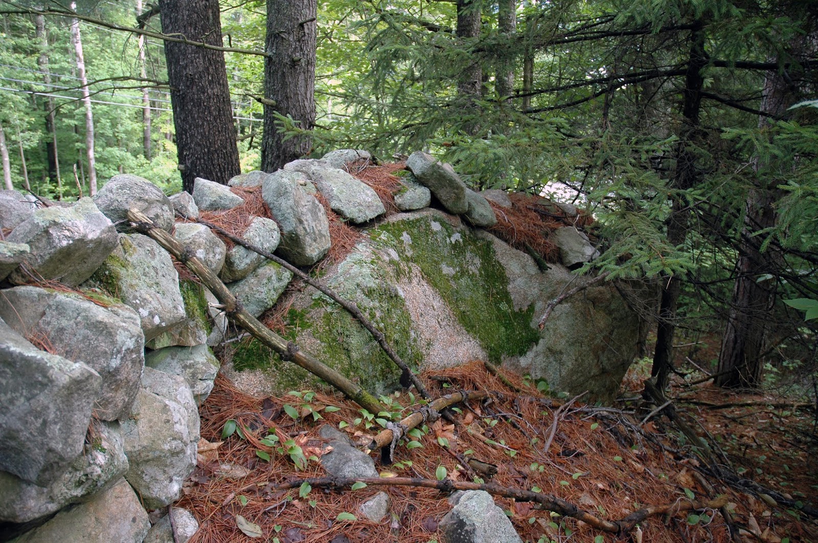
I just posted a comment about a short wall segment in NH that is unrecorded by LiDAR. Below are two photos: one of the split boulder and another of a portion of the wall. Both features are immediately next to Route 16 in Ossipee, NH.

This is about rock piles and stone mound sites in New England. A balance is needed between keeping them secret and making them public. Also arrowheads, stone tools and other surface archaeology.

13 comments :
The top picture where the wall flows over the boulder has been termed a "wave" by Tim MacSweeney.
Dave C. in DE.
Norman -
Can you send me coordinates or a more specific location? Though my book will be out in less than a month, I am still collecting data!
Has anyone had any success viewing lidar data of Massachusetts?
I'm technically savvy and have tried everything so far with no luck!
Norman photos show some portions of stone wall and, I believe, he is making the point that this wall does not show up on the LIDAR discussed by Tim in a previous post.
I have to ask Curt: why does this deserve to be listed in your catalogue?
Peter: it is on the up-side of an old well-known Indian Path - and when I last drove this stretch of road recently, the rows of stones had that "look."
If every stone wall suspected of being Indian is listed on the survey, then it dilutes other information that is more specific.
In what way is a "stone wall" not a stone structure?
I think we all believe the walls are a combination of old and new. A map of *all* walls would be of interest but should not be considered a map of ceremonial structures. I am talking about avoiding data dilution.
I don't know of any aboriginal wall sites in NH. If I did, I'd like to see if the LiDAR program would reveal them, particularly if they do not conform to the idea we have of colonial walls, which are those joining at right angles.
This is a "stone wall site" in NH, good example of a Snake Effigy, the "wall" it's body (along with the other features): https://wakinguponturtleisland.blogspot.com/2018/02/not-guatemala-no-lidar-no.html
Isn't the starting point of mapping out Ceremonial Stone Landscape features, that includes the "Snake Rows of Stones," the stone fish weirs, the terrace walls, the stoneworked springs and causeways etc., the entire data set of what most people call "stone walls." The next step is diagnostically assessing them, as best we can, by field observation, eliminating the most modern and working backwards toward a picture of how and why the structures fit into an Indigenous Landscape - like removing layers of paint or digging down through the strata, inch by inch (or centimeter by centimeter) to get down to the lowest layer?
Thorson's assumption is that the majority of stonework happened around here after 1620 seems to be based on repeated folklore rather than actual scientific investigation or careful enough observation of repeated patterns that resemble native American Iconography found in other media.
"What if the stone wall begins with a Snake's head?" seems like a good question to me.
A person could craft this into "If the stone wall/row of stones begins with the representation of a big snake head, then which culture is more likely to have created it - colonists or Indigenous People?"
"...(t)he original fishing WEIRS had been made of stone walls in the form of a "W"and stretched across the entire width of the channel. The bottom two points of the "W" pointed towards Paugus Bay and were utilized during the late summer Shad down-river migration, while the middle point of the "W" pointed toward the Lake and was utilized during the spring up-river Shad migration. The points of the "W" were "...left open a few feet for the water and fish to pass through. A short distance below the opening another wall was built in a half-circle, and into the spaces was placed wicker-work, made of small saplings, through which the water could easily flow, but fine enough to entrap fish of any considerable size."
The stone walls, sturdy enough to last hundreds of years, were only partially destroyed by the several miller's dams that were built in the Weirs Channel from 1766-1829 and an 1833 dredging project. They were still in evidence until the dredging of the Weirs Channel in the early 1950's...)
http://www.weirsbeach.com/topten/reason9frame.html
Dave: I did once relate that my friend in CA called it a "wave." I tend to think of it now as a "crawl" - like a smaller snake crawling over the head of a bigger snake, over it's head, in this case. A "Slither??"
Post a Comment