Monday, April 30, 2012

Lichen it (or Not)

"Lichen growth is an unreliable indicator of time."
Walk down my driveway with me and I'll show you what I mean...
Click here:
http://wakinguponturtleisland.blogspot.com/2012/04/lichen-it-or-not.html

Sunday, April 29, 2012

Levanna

I found this yesterday after hours of searching.
Based on the size, shape, and material, I believe this is what is called a Levanna point. These appeared around 700 A.D. and were used until the Contact period. This is made of what I believe is red felsite, my first find in this lovely material which is said to originate in Attleboro MA. This arrowhead has been rather extensively resharpened/reworked, probably it was originally an equilateral triangle and it either broke or simply became worn and was resharpened into this stubby shape. Good toolmaking materials in this area were scarce and the people who made this were very thrifty with good material, sharpening and reworking tools until they were used up. The tip and blade edges of this are worn, it was actually used like this, probably as a knife. I might guess that this had gotten too small to be resharpened further at this stage and it was discarded. I am very pleased with this find, the fine material and unique shape add variety to my collection of mostly broken quartz triangles. The area where I found this was very dry and dusty and this point was covered with dust, I almost stepped over it and only spotted it as a flat rock with a triangular shape. I didn't recognize it until I picked it up and wiped the dust away to reveal the flaking. I did also find my usual assortment of broken quartz tools and fragments.
The large triangle in the center is a "heartbreaker," it would have been a really great point if not for the missing corner. The crude triangle at bottom center is thick and it is flat on one side and convex on the other with steep edges, probably it was used as a scraper rather than as a projectile point. All the pieces in the bottom row (projectile point or blade midsection, scraper, Lamoka-type stem fragment) are from a new place for me, a coastal site in Rhode Island.

Ancient Graves found near Paulatuk

From cbc.com, rock piles in the North West Territory [click here]

Saturday, April 28, 2012

Desert Blogs

[Not rock pile related]. An interesting collection of blogs, includes pictographs and other desert fun. [Click here]. Link also added to the right.

Friday, April 27, 2012

Rock shaped like a mountain

This is a picture of Mt Wachusett from the top of Buck Hill in Fitchburg. 

Would you please take a closer look at this picture? Imagine yourself standing slightly to the right of where the camera was. The rock in the foreground has a high point, a shoulder to the right, and a shoulder to the left. Just like the mountain, the left shoulder is lower than the right shoulder. The idea of a rock shaped like a distant peak has appeared in a couple of places, something earlier about Mt. Shasta and also something I saw on a show about Machu Picchu. It is tempting to imagine this as another example.

My example is at least as good as this one [click hereThis one is sort of a joke. Gosh, here it is again and it is the Machu Picchu example.

Here  (last picture; my interpretation) is the Shasta one, from "Waking Up on Turtle Island".

Wednesday, April 25, 2012

nth stage rock pile

It is bigger than it looks.

Good links

There is some good blogging going on over there to the right.

Buck Hill, from the south

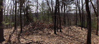
As I climbed and got higher up on this hill in northern Fitchburg, I started seeing a particular geology of flat rocks (we are one hill over from "Flat Rock Hill") stacked up in outcrops that I was mistaking for rock piles. I wish I took a picture because I dismissed them and dismissed them until they became real rock piles near the (southern) summit.
Some panoramas:
 An interesting space and interesting shaped piles:
There was another cluster of a few more piles, further up the hill:
There was another cluster over on the east side, at about the same elevation on the hill as the other clusters. But first....the summit. TA DAH!
As my friend from Carlisle says: looks like a good place for dancing:
Mt Wachusett in the background. It's shape is somewhat imitated by the rock in the foreground. 

Then, over east, at about the same elevation were some other piles like the first, integrated into the outcrops:
And that was about it. I was looking for the usual mounds but did not find them. Nor are these piles obviously marker piles. Still, I have a hard time not seeing them as part of what is going on at so many of the other hills around here. No reason why Buck Hill would be different. It does have a fine view. There was another rock pile site, at the northern foot of the hill.

Scene on Buck Hill

Tuesday, April 24, 2012

April showers bring... arrowheads

     Sunday night I lay in bed listening to the drumming of the pounding rain on the roof of my house. After a long spell of very dry weather, finally a good rainstorm. I imagined the heavy rains churning up the earth, creating washouts and gullies and exposing tools buried for thousands of years. I had been waiting for a rain like this. I was so thrilled by the storm that I found it hard to fall asleep despite the soothing sound of the rain and the cool breeze coming through the window.
     Monday I drove to work and watched the raindrops splashing in the puddles with great interest. My anticipation grew all day and after it stopped raining it became almost unbearable. After work I raced to a place where I could walk. The conditions were great, lots of rocks clearly visible, freshly exposed, washed clean by the rain and standing in sharp contrast to the soaked earth. Perfect. I carefully examined every broken rock, every color and shape. I was pleased to see this lying totally exposed:
     I believe this is what is called a "small stemmed" or "Squibnocket stemmed" point, made of argillite. Most points of this shape were made of quartz. This one is damaged, missing the tip. For me this is a good find because I like this shape and also the material, despite the fact that this material appears soft and results in rather crude tools for the most part.
     I looked at many more rocks in this spot but didn't find any other tools. I walked to another area with fewer rocks visible and saw a very exciting shape about 10 feet away, big, totally exposed and looking far too good to be true. Could it be? I couldn't believe my eyes...
     This is one of the best things I have ever found, it is perfect, thin, slightly serrated, the workmanship is incredible. And it certainly was not hard to spot. I was very lucky to be in the right place at the right time, to be the one to find this gem after all these years.
On the way back to the car as the sun was setting I reached down to pick up a piece of quartz that was just barely peeking out of the ground. I wiped the mud off and was very surprised when this emerged:
     This is chunky and thick, steeply beveled on one side, probably reworked down from a larger blade and perhaps used as a knife. I was very, very lucky yesterday. I spend so many hours looking and coming home with nothing but a stiff neck and aching back and it is easy to get discouraged but a day like yesterday makes it all worth it. Here are the finds for the day after I cleaned them up.

Monday, April 23, 2012

Coming up

An interesting summit.

"Walking in Woods"

In my car, I have a little sign I put on the dashboard, visible through the windshield saying "Walking in Woods". I use it when I leave my car somewhere where there is no good reason to park a car. Like on a back road next to someone's property - just to answer the question. So this weekend I was forced to pick such a place in order to get into a particular woods on Buck Hill in Fitchburg, which is partially private property. When I got back to my car there was a little note under the windshield wiper:
I couldn't decide if this was a threat. More likely a busybody expressing annoyance. In the end, though, it is true. Time to stop trespassing in northern Fitchburg. But I should add, in a sour grapes sort of way, that there is no particular reason to go back to Buck Hill. 
 

Shasta; Stone Rows as Bones of the Ancient Cultural Landscape

The Three Zones of Shasta; Photogravure after painting by Thomas Hill

Seeing recent photos from around Mt. Shasta, I look at all those stone rows as the "Bones of the Sacred Ancient Cultural Landscape." Images like these fuel my imagination, to fill in the blanks, just as much as any study or ethnology from Northern California does, including the highlights from "American Indian cultural models for sustaining biodiversity," written from a Native American perspective. You can read more here: http://wakinguponturtleisland.blogspot.com/2012/04/shasta-stone-rows-bones-of-ancient.html
Henry Larcom Abbot . Report of Lieut. Henry L. Abbot...In: Pacific Survey Reports, Vol. VI, Washington, D.C., 1857.Courtesy College of the Siskiyous Library Mount Shasta Collection
Images, and there are lots more, from: Mount Shasta; Chapter 10 of Picturesque California, 1888, as well as text written by (Someone's Uncle) John Muir: http://www.siskiyous.edu/shasta/lit/mui/jmuir14.htm

Flint knife in Chile proves the Alaskan Ice Bridges were too rough for travel

[not rock pile related] I could not resist quoting this worse than usual nonsense from the Santiago Times:

Research confirmed that these settlers crossed the Bering Strait from Asia into the Americas rather than traveling south via Alaska. Passing over the ice bridges into Alaska would have delayed their settlement so far in the Southern Hemisphere several thousand years.

Sunday, April 22, 2012

Western ecological sciences and traditional environmental knowledge

“People who lived in a place for generations—tens to hundreds of thousands of years—needed to have their act together in order to survive. They needed to know how to use the land, and how to use the land sustainably. This is not a function of just one population in any one generation.”
Dennis Martinez
Takelma Inter-Tribal Project
Restoration Consultant
More:

Saturday, April 21, 2012

Trillium, Fitchburg, Spring

Familiar Face in Cairns from Maine

Cairn #3 [ http://rockpiles.blogspot.com/2012/04/cairns-from-maine.html ]has a feature that I've seen before, a repeated pattern, a cultural motif, and, more than just randomly piling stones and cobbles, a choice in how to stack stones in an artistic manner. I have seen it around here, down in Woodbridge and I think in more than one or two posts here on this blog...

Friday, April 20, 2012

Cairns from Maine

NEARA coordinator for ME , Ros Strong wites:
Here are some rock piles from Maine. This is a very interesting site with a variety of features. It is on private land and we have the owner’s permission, in fact he got in touch with me. The first cairn we noticed, #1 is a fairly typical oval cairn, in nice undisturbed condition. 
Cairn #3 is not far away and is the biggest and most unusual that I have ever seen. It is about 25’ in diameter, not quite round, with two sides slightly flattened that may align to cairn # 2 that is partially destroyed, no good photo.
The big cairn is unique with the well built wall of big rocks is about 5’ high and filled with smaller rocks. There are a number of other cairns and walls that may have marked old boundaries.
The stone seat  appears to be a naturally shaped stone with another rock placed on the “seat”.
 
The land is fairly level and has been logged at various times over the years but shows no evidence of agricultural use or buildings of any size.We have surveyed the area which is not very large and I have done deed research  with some professional help, but even with an 1809 map, we have no clue as to any possible purpose.

Thursday, April 19, 2012

Oak Hill - between Rt 2 and Old Schoolhouse Rd

Oak Hill, on the eastern side of Harvard and southern Littleton, is the major land form in this valley of Beaver Brook, Elizabeth Brook, and the Boxborough esker made famous by Mavor and Dix.

I have explored around Black Pond several times and there are nice rock pile sites in the lower lands at the foot of the main hill. I thought I would go again and, with a new understanding of a "Wachusett" culture, look more in the uplands, and see what was to be seen. The sites lower down do not have large rectangular mounds with hollows (that I could see). Are they related? So I parked at A, in the usual place, and walked diagonally uphill over to B which was the first location where I could access the road that runs along the ridge (Old Littleton Rd). From there I walked down the road to its junction with Old Schoolhouse Rd and managed to sneak back into the woods near C. It was one of those walks where I spent more time thinking about trespassing than about the rocks and woods. Anyway, at C I found a nice Wachusett Mound just at the brow of the hill looking eastward:
At first I doubted this was more than just a field clearing pile. There were some larger boulders strewn around carelessly nearby and I was arguing with myself that the component rocks of the pile (eg in the last picture above) were too regular sized for field clearing. But then I looked over the edge. The pile is built on top of an outcrop and I could see some little pieces of construction at the foot of the outcrop:
I could see the main pile from below and tried to get it into the picture. When I got home and looked at this carefully, I conclude there is another rock pile here, between the outcrop and a separate boulder. There are also little bits of stone wall and a damaged enclosure of larger slabs, something a bit like this:
You can see much of this in the two pictures. In the end, I don't think this is field clearing. Also there were some little details:
Like the small pile in the foreground. 
So far, I see no obvious connection between this and the small piles at the sites below. I have found another large mound situated in exactly the same way on Oak Hill but a quarter mile south of here.

Tuesday, April 17, 2012

Scott Rd/ Flat Rock Hill - a last blink of the eye but you need 3D glasses

I went back up hill from d, past the lowest road and the middle road. Then I found rock piles again. This collection consisted of a only a single little eyebrow of a pile with a weird standing stone:I failed to take a picture of the relation of this "pointer" to the first rock pile. It is behind us.

See how this rock comes out of the screen! You need 3D glasses. Somewhat more seriously, I imagine both the rock pile and this pointer (and perhaps the third rock) being involved together in obtaining useful shadows.

So that is it. This hill has many sites on it, probably several I did not see.