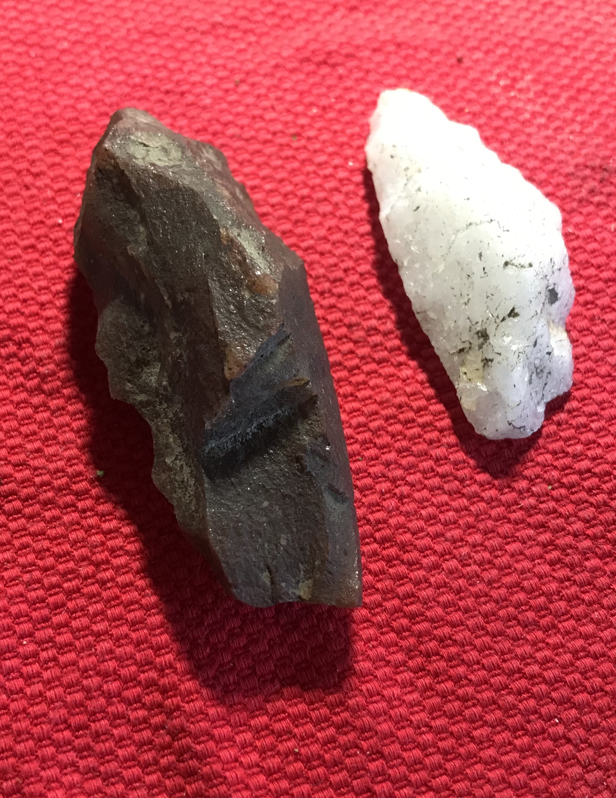
Awfully primitive:

I do not want to ignore it but do not want to collect it.

From the caprock east of upper Arrow Canyon, NV [see here]
Awfully primitive:
Still processing the items I brought back from Nevada. They must have made these things all over the world. :

According to this website (and others)
"He was able to identify the curious piece as a “Great Basin crescent.” Joe told me they were extremely rare and are found only where the water level of ancient Lake Lahontan was between 7,000 and 9,000 years ago."
I find this nicely expressed [from here] :
Most researchers on hominid evolution, looking back into deep time, ask what function or use an object would have served archaic communities in their struggle to survive. However, as previously noted, this utilitarian assumption is questionable. An alternative assumption is that the deep past may not have been like the present, dominated by the overtly utilitarian values that have always existed but have become dominant in modern Western civilization. I suggest that early humans possessed a sense of the sacred; that they were soulful people with hearts and minds who loved—and also presumably feared—the Earth on which their lives depended, and within which their lives were deeply embedded. These are essential attributes and qualities that make us human yet remain beyond the grasp of science where the question of “soul” and “the sacred” was driven out ...
Attracted by the name, I have tried a couple times to get into Arrow Canyon. This time I was careful to find the correct dirt road, taking me down into the canyon. Google street view of NV168 was helpful, cuz those dirt roads all look similar at their beginnings. I drove till it got too muddy, parked, and then started edging along the sides of the canyon, as I got deeper into it. There was an old stone house - no roof - near the beginning of the canyon, then some wild gourds or melons ...

... , then gravel slopes tumbling off the caprock, then some Ogham scratched in the Canyon wall, then a stone chamber, then a solid dam across the canyon. My guess is this dam was to prevent flash flooding downstream. Anyway, the dam was a barrier. There was a helpful rope for people to climb but that is not my idea of fun. It was getting late, so I turned back at the dam.
Here is a view of the dam and the, still unseen, deeper valley:
So, I am walking down the left (east) edge of the valley. At the first talus slope, spilling into the valley from the left, I see an opportunity to get up to the cap rock (about 100 feet up) and I scrambled up there, one slow step at a time. Getting up to the cap rock, I walked out to a little peninsula, then started getting dizzy and had to back off. But one notices this little line of rocks and rock piles:


Let me tell you my story about going to Nevada. It is not rock pile related although, in truth, there were rock piles on top of each of the only three prominences I got to. No, I went to find arrowheads. I didn't find any but I did see an awful lot of thought provoking archeology. I am sure the place I visited is not particularly special and there must be many, many places like this. But in some ways it was special and, at the end of this story, I will show why I believe this may be one of the more densely occupied sites in the valley. It is called "Hidden Valley" and is just north of Las Vegas on I15, on NV93.
For the last three or more years of the Covid pandemic, I have been sitting at home dreaming about visiting the southwest desert. And looking at maps and pictures. For a long time I was looking at cheap real estate pictures from near Saint Johns, AZ but no one in my family seemed very warm to the idea of buying land there. Then, more recently, I became crazed about finding arrowheads. So I was watching YouTube's about people finding long stemmed points around glacial lakes in the Great Basin - and I thought maybe I could give it a try.
One video was about excavating Haskett points in Great Salt Lake and it said that the best place to look for archeology was where fresh water entered the lake, when the climate was beginning to dry out after the ice age. It also gave clues as to what the old water courses would have looked like in satellite images. So I am looking at satellite images and topo maps and locating the glacial lakes near Las Vegas. One problem that suggested itself, is that many of the lakeshores from the late ice age appear to be completely buried under a deep outwash from the adjacent hills (called the "bajada", according to my friend Dave). It occurred to me that small hills at the edge of the lakeshore, even if surrounded by the bajada, might retain original surface and not be covered with silt. So I spotted something on the topo map that looked just right: near Las Vegas, edge of glacial lake, small hill within the lake AND not in a National Park where it could be illegal to pick up even "just a rock" items. I thought I was being quite clever to spot this place and plan to visit:


Saharan 'carpet of tools' is earliest known man-made landscape (phys.org)
These lucky fellows got the chance to count stone tool debitage and found an average of 75 modified fragments per square meter. I think that quantity could be matched pretty easily in some places in Nevada.
This lucky guy (me) didn't count flakes but each little piece of black rock here is a bit of chert from the nearby small hill:

This was from the same small hill I started with on Saturday. Of the several items I picked up, this one was as nicely flaked as that blade I posted a few days ago.

I find this flaking just gorgeous.
The following is slightly tongue-in-cheek:
Unfortunately, I am posting in reverse order. So I have already been writing about this place. Here is a one little "instructional video".

I was actually looking for stone tools (see previous post) but found rock piles anyway. I thought this hill would be a good place for early people to be looking out over a glacial lake to the south. Half the hill was some kind of "obsidian" and more on that later. This may be a place with very deep history and no single timeframe in which to interpret everything. I believe the term is "multi-component" - which is a snarky way of saying the archeological categories are meaningful in a place that has seen continuous occupation because of desirable properties. As if the people who lived there either fit into the categories or were 'transitional' between them. It would be simpler just to talk about the place.
[Update: After visiting the hill and doing a lot of examining of the stone tools, I admit that the above is wrong. There can be very distinct phases of people, clearly culturally different from each other. There can be a great depth of time over which "component" differences are quite meaningful. In other words: no, it was not necessarily a continuum of cultures. In that case, teasing apart some of the technology differences can be quite fun.]
As I climbed this hill, I noticed it had a lower 'bump' to the south and a higher 'bump' to the north. At the top of the lower bump I noticed this little 'U' structure [we are facing west]:

Continuing up the hill to the higher bump, I noticed this rock pile [we are facing northeast]:


Indigenous Causeway to a Wetland Garden??
Mysterious Mountains Nov
4, 2022

“A buried stone pathway ends at a boggy mountain bowl with a possible turtle effigy.”


There's a whole lot more here that I will soon be watching:
This is a sort of "shot across the bows" for the future of this blog. Repeat readers will have noticed a general slowing down of postings, an increased number of non-rock pile related and non-original articles. I am no longer living in Middlesex and there are not that many opportunities, being on a glacial outwash landscape. There is no mistaking that one of us (me or this blog) is getting old.
I am going to go on posting what I can but it would be nice if readers kicked in a bit of content from their end. I know you are out walking in the woods. Send some photos, so we can share your journeys, as my journeys get fewer and farther in between.
I like this sort of article:
Rock pile enthusiasts may enjoy something in the second from last photo. I am thinking the researchers did not notice it.
Seen next to Faye Rd, Woods Hole, an isolated rock pile:


Found some nice little argillite points:


Found in Rhode Island, these are quite similar: