The Wall on Dick's Ridge, Summerville, GA
Over two summers in the mid-1950s, Philip Smith, a graduate student in anthropology at Harvard University, embarked on a study of supposedly American Indian stone walls in northern Georgia for Arthur R. Kelly, a legendary Georgia archaeologist and founder of the Department of Anthropology at the University of Georgia. Kelly had long been interested in Indian stonework, and in Smith he not only found a fellow Ivy Leaguer, but also a bright student willing to undertake the daunting task of studying and surveying the walls that were often located on high ridges and in difficult terrain.
Smith's research over those two summers resulted in an article titled "Aboriginal Stone Constructions in the Southern Piedmont," which was published in the University of Georgia Laboratory of Archaeology Series, Report No. 4, March 1962. It is a fascinating report, the first of its kind, and in his conclusions he made the following observation about the seven or eight walls he studied: "...one of the most striking features is he apparently deliberate purposefulness by which large boulders and outcrops were tied in with the walls." This was a significant and insightful observation, and it conforms to my own views of certain walls I have seen in New England and beyond. Moreover, it applied to Dick's Ridge wall in Summerville, GA, which was discovered long after Smith's article appeared.
The following map is a copy of one that Tommy Hudson, a Georgia native and rock art researcher made, and it helps to explain the features that will be discussed in this brief essay.
On March 29, 2009, Tommy Hudson guided a group of members of the Eastern States Rock Art Research Association to he wall on Dick's Ridge, which is situated in the northwest corner of Georgia. Interestingly, this ridge is part of the same geologic formation that is found on Lookout Mountain in Chattanooga, TN, just to the north, and Little Sand Mt. and Rocky Face Mt. to the south, all three of which have Indian walls that Smith described in his report.
It was a steep climb to the top of the ridge, but once we got there, the terrain from the summit northward was fairly flat. Approaching the wall from the south end of the ridge, we first encountered some vertical fins of sandstone.
As we continued north along the ridge, we came to the beginning of the wall which extended west across the ridge for perhaps thirty or forty feet before making a sharp 90 degree turn to the north.
For the next 300 feet or so, the wall traced he west edge of the ridge, encountering vertical fins of sandstone along the way that became an integral part of the overall design. From a distance, the stone fins looked like walls.
Note the wall beginning in the lower left
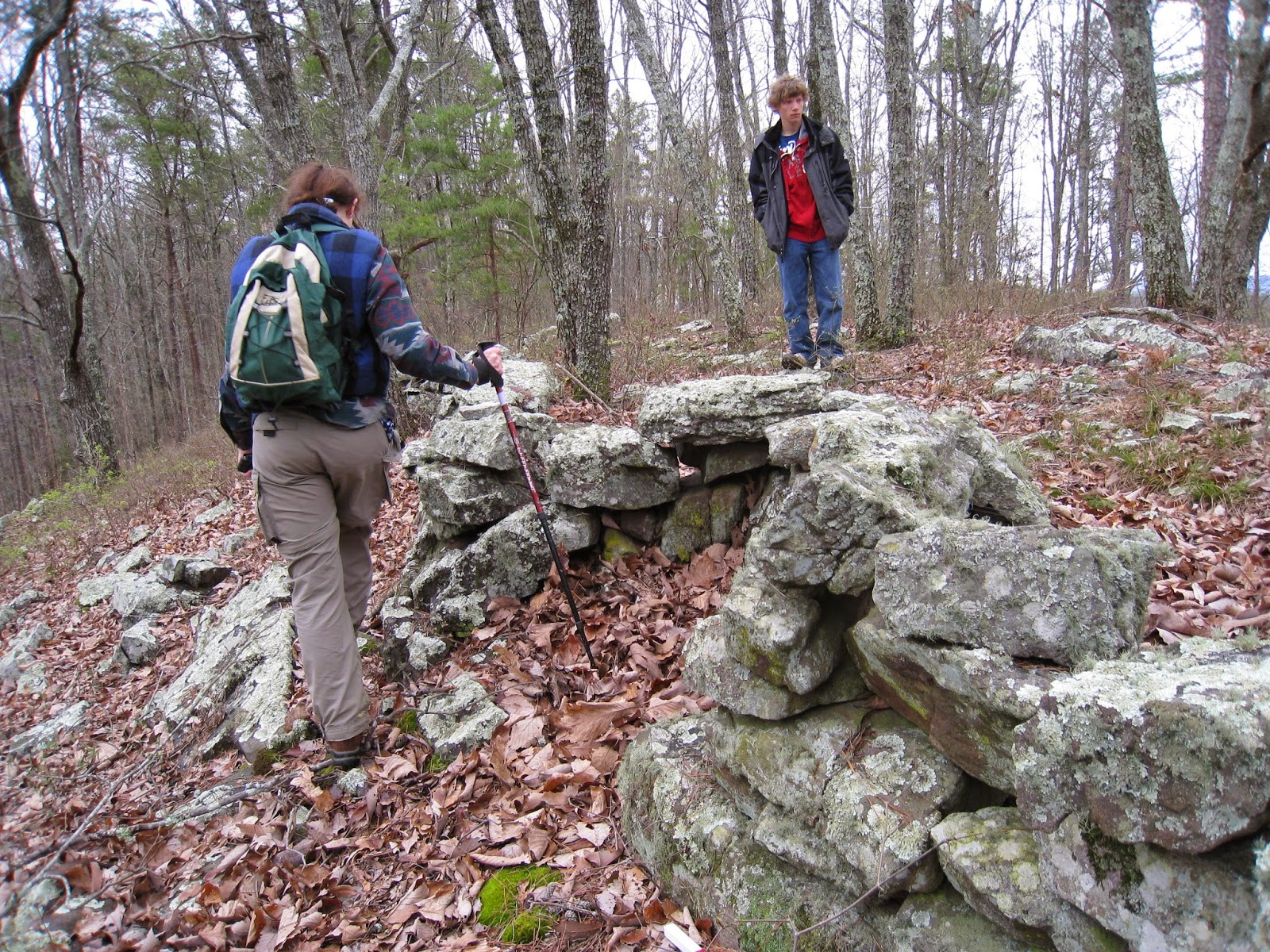
As we followed along the wall, I was struck by how large slabs of stone, some probably weighing a couple hundred pounds, were supported by small, fist-size stones, mimicking unusual construction techniques I had observed for pedestaled boulders, which are large erratics fully supported by three or four small stones.
Note the sandstone fin to the left of the wall
At some places where the vertical fins were exposed, a few rocks were placed on top to serve as a visual reminder that the fins were part of the wall.
At one point I saw a very large boulder at the base of the wall that was more than a meter long, fairly thick, and probably weighed close to 1500 pounds. It must have required three or four men to move it into place.
Further on we encountered a west-facing, U-shaped dip in the wall, what some of us call an embrasure.
These unusual looking features have sometimes been interpreted as deliberate turns to avoid large trees, but the rocky character of the terrain at this spot does not support this interpretation. We concluded that this indentation probably functioned as a prayer seat; a similar feature was found in a wall in Charlestown, RI:
The U-shaped structure on Dick's Ridge faced west, toward the setting sun and in the direction that the souls took on their voyage from the Middle World to the Milky Way. When we were shown an apparent rifled stone mound grave site beyond where the walls ended, which may have been of a significant person, it seemed logical that the prayer seat had some connection to it.
Rifled grave site
Among the piles of stone, Tommy Hudson discerned what he concluded was a stone cist grave.


2 comments :
I agree about grave. I call that a "lazy 9" and do not believe it was necessarily vandalized.
Norman, Thanks so much for cleaning up my drawing; I like it! Over the years I have honed my skills as an artist to compete with most third graders. Also, I would like to mention that the site is on the Eastern Continental Divide, which I consider to be a significant fact, one that is too detailed to delve into at this time, but I have addressed in other publications, including this one. On the NW side of the ridge is the Tennessee River basin, and on the SE side you are looking at the Coosawattee River basin. They are literally within 100' of each other. Interesting.
Post a Comment