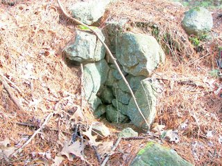
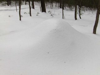
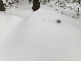
Saturday, March 31, 2007
Thursday, March 29, 2007
Redemption Rock - Princeton, MA
Dear reader from Holliston
Do you have any idea how many rock piles are in your town? It is well filled with them. If you know of some special places, drop me a line at rockpilesmail @ gmail.com [without the spaces]
Wednesday, March 28, 2007
A video clip of the small Dunstable site in next post
Just to give a slightly different perspective:
Out in Dunstable - a small rock pile site on the sides of a valley
I had promised myself not to go back to Dunstable because it is so sandy, but I selected a hill far enough to the west that I thought it might be worth exploring and went out last Sunday. I did not see much but in one little valley I came across a suggestive rock-on-rock and then two rock piles looking out over the valley and, in particular over two short stretches of stone wall at the bottom - one perpendicular to the brook there, the other parallel.

 Here are the piles:

 The two piles were 15 feet apart and I took all photos from near this second pile.
I have a feeling there may be more to this place than I notice in a casual passing. Perhaps without the snow more things would be visible, and perhaps the far side of the little valley would also be worth exploring.

 Here are the piles:
 The two piles were 15 feet apart and I took all photos from near this second pile.
I have a feeling there may be more to this place than I notice in a casual passing. Perhaps without the snow more things would be visible, and perhaps the far side of the little valley would also be worth exploring.
Tuesday, March 27, 2007
Just another of those little things
There are hills lying along the north of the Assabet River where Rt 495 meets Rt 290. I realized these might be worth exploring as I passed on my way to Northborough and, since I did not have such a succesful exploration of there, I stopped on my way back, parked behind a company and went up one hill looking over the river to the south and to Rt 495 to the east. Here we are on a southward facing shoulder:
 It is easy to guess this is a fire ring and a comfortable little place to sit in front of a fire. But up on the shoulder of a hill like this? I don't see any charring on the inner surface of the rocks in the circle. One of these days I am going to have to take a picture of a fire ring so we can compare with something like this - just one of those suspicious little things you find out in the woods.
Imagine for a moment that this is not a fire place. Then what is the bench for?
Monday, March 26, 2007
Behind a shack in Northborough
Driving along I saw some rock piles right in the backyard of a broken down shack. After looking around and deciding probably nobody would mind, I parked and went behind to take some quick pictures.
 Here are some of the piles:


 In these panorama pictures the piles appear to be part of the terracing:

 But don't think for a minute that this is "agrarian". Here is the backyard trash shading off into ceremony:
 And standing here at this split wedged rock, here is a view of the back of the cabin:
 I wonder who lived there?
 Here are some of the piles:


 In these panorama pictures the piles appear to be part of the terracing:
 But don't think for a minute that this is "agrarian". Here is the backyard trash shading off into ceremony:
 And standing here at this split wedged rock, here is a view of the back of the cabin:
 I wonder who lived there?
More about Rock Piles Threatened by Development in North Smithfield, RI
This is from the Woonsockett "Call" [Click here] Thanks to Heidi and Keith for the link.
I have spoken with a few other experts in the subject of rock piles, people who have read most of what has been written on the subject and who have spent years in the field studying rock piles. The consensus is that there is no reason to think the piles in North Smithfield are burial mounds. On a personal note, I think it is irresponsible for non-Natives to be talking about burials. Most rock pile sites are not related to burials and painting with such a broad a brush threatens rock piles in general.
I have spoken with a few other experts in the subject of rock piles, people who have read most of what has been written on the subject and who have spent years in the field studying rock piles. The consensus is that there is no reason to think the piles in North Smithfield are burial mounds. On a personal note, I think it is irresponsible for non-Natives to be talking about burials. Most rock pile sites are not related to burials and painting with such a broad a brush threatens rock piles in general.
Saturday, March 24, 2007
New Photos From Bob Miner
by JimP
Bob Miner has posted a number of stunning new photographs from around the Tomaquag Valley. Here's a flat pedestal boulder: Here's a perched boulder:
 And here's a tilted roof niche supported by a small manitou stone:
 [Click Here] to see the rest of Bob's album.
Bob Miner has posted a number of stunning new photographs from around the Tomaquag Valley. Here's a flat pedestal boulder:
 Here's a perched boulder:
 And here's a tilted roof niche supported by a small manitou stone:
 [Click Here] to see the rest of Bob's album.
Friday, March 23, 2007
Wikipedia entry for "cairn"
[Click here]
Anyone have the energy to go in there and create an entry for "rock pile", create the synonym lists: "cairn, stone pile, rock heap, stone mound, rock stack, ..."? Don't look at me, I like Dan Bouldillion's glossary.
Anyone have the energy to go in there and create an entry for "rock pile", create the synonym lists: "cairn, stone pile, rock heap, stone mound, rock stack, ..."? Don't look at me, I like Dan Bouldillion's glossary.
Thursday, March 22, 2007
Bay Path Stone Chair
by JimP This is a photograph of a stone chair from a book titled The Bay Path And Along The Way by Levi Badger Chase printed in 1919. The area where the stone chair was found was called Chicopee Hill near Monson, MA.
The Bay Path was a major Indian trade route that cut across Massachusetts. [Click Here] to read more from Chase's book.
 This is a photograph of a stone chair from a book titled The Bay Path And Along The Way by Levi Badger Chase printed in 1919. The area where the stone chair was found was called Chicopee Hill near Monson, MA.
The Bay Path was a major Indian trade route that cut across Massachusetts. [Click Here] to read more from Chase's book.
Double stone structures from Weston, MA
Wednesday, March 21, 2007
Killingworth CT Rock Piles and Cairns
Wow. I was just reminded of this. Talk about fine cairns. [Click here]
A typical water "break out zone" on a hill
Tuesday, March 20, 2007
European Animals in the New World
Interesting link via Tim MacSweeney at "Waking up on Turtle Island"
http://www.mariner.org/exploration/index.php?type=webpage&id=46
http://www.mariner.org/exploration/index.php?type=webpage&id=46
Monday, March 19, 2007
Sunday, March 18, 2007
The Acton Rock Pile Grid - Fred Martin's Survey, FFC's "Stupid Sheet", and testing the radial line hypothesis for marker piles
I went out with FFC in the snow to look at the high point overlooking the rock piles at the Spring Hill Conservation land in Acton, MA. I wanted to see if all the piles were visible from this high point and whether they would line up with this as a viewing position. Although I could not really see much on the ground, something exciting happened when we got back to FFC's house and looked at the survey Fred Martin made from data we helped him collect at Spring Hill. This is where the use of alignment information together with careful surveying leads to an interaction between the work people are doing on alignments with what I have been noticing about marker pile sites and how they are organized around lines radiating from an elevated viewing location. [Click here for the discussion of marker pile site organization]. [Also click here for the Ashland sites that brought up the idea of radial organization.] So here is a video where the rock pile alignments are tested for being defined relative a high point and, at the same time, the alignments are tested for being astronomically significant:
I think this is best possible result. Marker pile sites are common and make up, I would say, the majority of rock pile sites, so having this confirmation of their being organized radially is an important step towards understanding them.
I think this is best possible result. Marker pile sites are common and make up, I would say, the majority of rock pile sites, so having this confirmation of their being organized radially is an important step towards understanding them.
Saturday, March 17, 2007
More snow no rock piles
I am afraid so. But maybe I'll get out tomorrow to a site I know to check something.
Thursday, March 15, 2007
A few other nice pics from Ashland
Here is a nice pile with a quartz marked rock in the middle.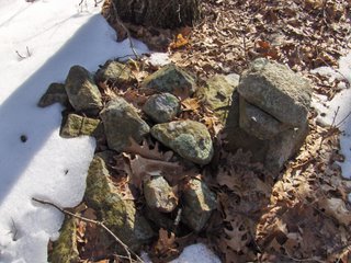
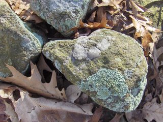 By the way, why would quartz cobbles, "blazes", be present in marker piles? I think the (purely speculative) theory is that quartz focuses and transmits spiritual energy. So if the lines of rock piles radiating from a central viewing position contain fragments of quartz, then the connection between the viewer and what is viewed is strengthened - creating a stronger flow. Here is another nice little scene.
 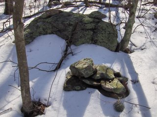 Here is another nice one:
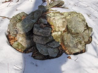

 By the way, why would quartz cobbles, "blazes", be present in marker piles? I think the (purely speculative) theory is that quartz focuses and transmits spiritual energy. So if the lines of rock piles radiating from a central viewing position contain fragments of quartz, then the connection between the viewer and what is viewed is strengthened - creating a stronger flow. Here is another nice little scene.
  Here is another nice one:
Wednesday, March 14, 2007
A knoll marker pile site - Ashland MA
If you have been following the narrative since last weekend, you'll recall I found a site on a knoll where I could view all the rock piles from one high point at the center of the site [click here]. This contributed to the thought that some marker pile sites might be organized with piles located on lines radiating out from a viewing position above the piles [click here]. The day after finding that site I found another site further uphill in the same part of Ashland. Here is how the hypothesis came into play:
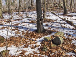 I was walking up a long slope and coming to a more level shoulder with a small knoll or outcrop when I saw a solitary rock pile (shown above). Since isolated rock piles are rare, I thought maybe this one was meant to be viewed from above on the nearby knoll and that, if I went up there I might see some other rock piles - assuming this was organized as a collection of rock piles visible from a high point. Here is a closeup of the outcrop. Note the little bit of stone wall up there.
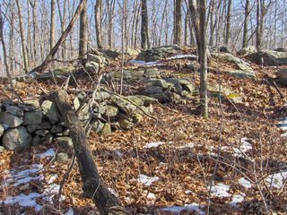 As I climbed to the top, I was already scanning the slope beyond it and thought I saw one pile and maybe a second one. When I went down to look there were actually lots of piles (~10) hiding in the dead leaves. Here are two examples:
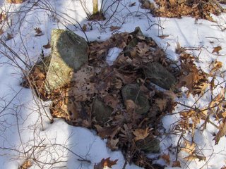
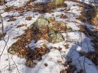 Note the larger pointed rock in the same relative position in the pile in each of these pictures. I call this type of pile "marker piles with a pointer" - the idea being that perhaps the pointed rock marks a location more precisely than the entire pile; and also that the entire pile may serve the purpose of creating a platform for the pointer. [Click here for previous discussion]
As I circled out further and further from the knoll, whenever I found another rock pile I would glance back to see if the knoll was still visible; and it was. In turn, the pile would be visible from the knoll. Then I came to a line of three piles (the picture is high res if you click on it):
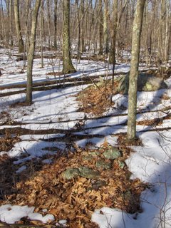 Sure enough when I looked back to the top of the outcrop, it was exactly in line with these piles. Note also the pointer in the middle one.
I continued circling outward. Here is a view back towards the knoll:
 There were walls emanating from the outcrop but not lined up - not that I could see. Rather than enclosing the area of the rock piles, one wall seemed to run down the side of the site and then stop, as if the wall end itself was a feature to be seen from the knoll. I should also mention that this wall along the side of the site was interrupted by a a store ring, possibly a fireplace:
 All and all I would not expect a normal fire circle in a place like this. I am not sure I saw any signs of charring, but I did not look too hard.
Further down hill, beyond the wall end, the features continued. But rather than being normal rock piles they were made of larger fragments and were overall larger. I kept looking back about 100 yards to see the knoll and thinking "of course the piles are getting bigger - they need to still be visible this much farther away"
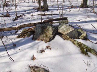 I continued outward a bit further and then circled around to the west a bit and over towards another little highpoint - a second knoll. It was getting so every rock that pocked above the snow was getting a suspicious look from me. And as I came up to this other little high point, I saw a rock-on-rock, then a pile or two and then larger piles over on the downslope a few feet beyond (see video which remains to be posted).
 These are even more substantial piles than before. They are downslope from another small knoll but I was not sure if they were still visible from the first knoll or rather part of a new organization around the second knoll. One advantage of the "radiating line" hypothesis is that it accommodates the possibility of multiple viewing locations with a second or even more groups of piles on lines radiating outward from other viewing positions. Let's have a look at a couple of these larger piles:
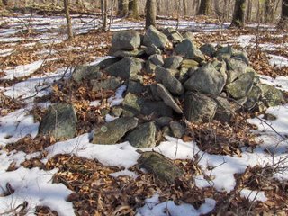
 Please note that this last picture shows a pile with a flat face towards the camera. I find it very interesting that this flat part is facing away from both the near and the far knolls. Either it is to be viewed from somewhere else or this tells us a first clue about these flat faced piles (click here for earlier discussion of flat faced piles).
So I'll leave it at that for now. We had a slight confirmation of the hypothesis of radiating lines from a viewing position above the piles. In this case I was expecting the rock piles before I saw them because I found one pile near a knoll and I supposed this might be a site with radiating lines. It is also very interesting that the majority of piles were to one side of the knoll. It is also very interesting that an example of a flat faced pile appeared to be facing away from the viewing positions. So now we have a couple of research questions to pursue:
 I was walking up a long slope and coming to a more level shoulder with a small knoll or outcrop when I saw a solitary rock pile (shown above). Since isolated rock piles are rare, I thought maybe this one was meant to be viewed from above on the nearby knoll and that, if I went up there I might see some other rock piles - assuming this was organized as a collection of rock piles visible from a high point. Here is a closeup of the outcrop. Note the little bit of stone wall up there.
 As I climbed to the top, I was already scanning the slope beyond it and thought I saw one pile and maybe a second one. When I went down to look there were actually lots of piles (~10) hiding in the dead leaves. Here are two examples:
 Note the larger pointed rock in the same relative position in the pile in each of these pictures. I call this type of pile "marker piles with a pointer" - the idea being that perhaps the pointed rock marks a location more precisely than the entire pile; and also that the entire pile may serve the purpose of creating a platform for the pointer. [Click here for previous discussion]
As I circled out further and further from the knoll, whenever I found another rock pile I would glance back to see if the knoll was still visible; and it was. In turn, the pile would be visible from the knoll. Then I came to a line of three piles (the picture is high res if you click on it):
 Sure enough when I looked back to the top of the outcrop, it was exactly in line with these piles. Note also the pointer in the middle one.
I continued circling outward. Here is a view back towards the knoll:
 There were walls emanating from the outcrop but not lined up - not that I could see. Rather than enclosing the area of the rock piles, one wall seemed to run down the side of the site and then stop, as if the wall end itself was a feature to be seen from the knoll. I should also mention that this wall along the side of the site was interrupted by a a store ring, possibly a fireplace:
 All and all I would not expect a normal fire circle in a place like this. I am not sure I saw any signs of charring, but I did not look too hard.
Further down hill, beyond the wall end, the features continued. But rather than being normal rock piles they were made of larger fragments and were overall larger. I kept looking back about 100 yards to see the knoll and thinking "of course the piles are getting bigger - they need to still be visible this much farther away"
 I continued outward a bit further and then circled around to the west a bit and over towards another little highpoint - a second knoll. It was getting so every rock that pocked above the snow was getting a suspicious look from me. And as I came up to this other little high point, I saw a rock-on-rock, then a pile or two and then larger piles over on the downslope a few feet beyond (see video which remains to be posted).
 These are even more substantial piles than before. They are downslope from another small knoll but I was not sure if they were still visible from the first knoll or rather part of a new organization around the second knoll. One advantage of the "radiating line" hypothesis is that it accommodates the possibility of multiple viewing locations with a second or even more groups of piles on lines radiating outward from other viewing positions. Let's have a look at a couple of these larger piles:
 Please note that this last picture shows a pile with a flat face towards the camera. I find it very interesting that this flat part is facing away from both the near and the far knolls. Either it is to be viewed from somewhere else or this tells us a first clue about these flat faced piles (click here for earlier discussion of flat faced piles).
So I'll leave it at that for now. We had a slight confirmation of the hypothesis of radiating lines from a viewing position above the piles. In this case I was expecting the rock piles before I saw them because I found one pile near a knoll and I supposed this might be a site with radiating lines. It is also very interesting that the majority of piles were to one side of the knoll. It is also very interesting that an example of a flat faced pile appeared to be facing away from the viewing positions. So now we have a couple of research questions to pursue:
- Can a central viewing position be located at some of the other sites I call "marker pile sites"?
- In what directions are the lines radiating? Is there any commonality between different such sites as to the directions used? If so, what is the meaning of that direction?
- If we determine a high point viewing position at some of the other sites with flat faced piles, how are the flat faces oriented with respect to the viewing location?
Subscribe to:
Comments
(
Atom
)


