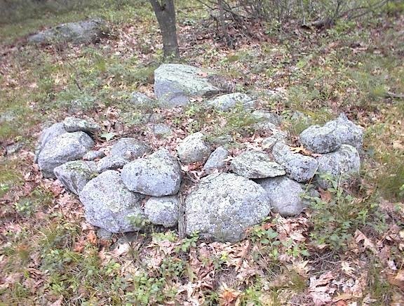
As before, I headed in from the north on the same forest road as before but where I turned left, this time I headed straight, up and over onto the southwestern slope of the hill. At first I passed the two "stone mounds" I photo'd previously, and then I continued. I started seeing faint traces of a rock pile site: some rock-on-rocks and some out of place boulders on the ledges.
 [Parenthetically, this is same old camera I have been using, and I held it very steady as I took pictures on this rainy day. I think the camera did well.]
As I continued along the western slope, I tried to keep an eye on the more level summit area to my left but also to check the slope to my right. I suspected I was getting close to rock piles and saw a first one: with a bit of retaining wall and a nice chunk of quartz:
 Here is a detail of the quartz:
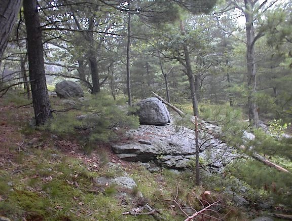
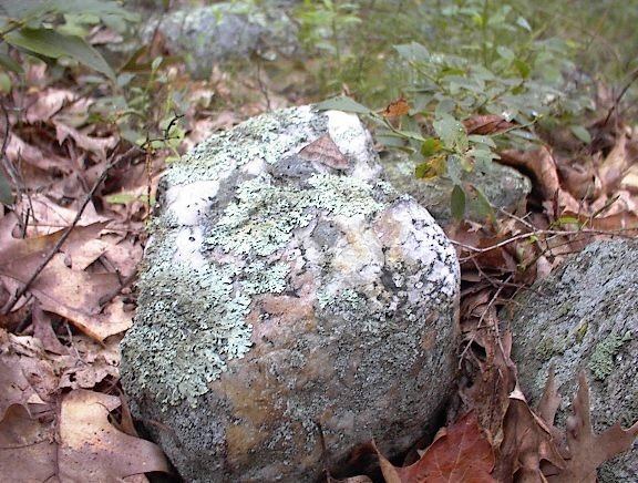 I think of this as being very "grave-like". But as I continued I started seeing other piles, built with uniformly large rocks and with "pointers" sticking out of them. The piles appeared to be lined up and evenly spaced. These, taken together, are exactly what I have been calling the characteristics of marker piles, which are not graves. In fact this site is a classic example of a marker pile site on a somewhat steep southwestern facing slope. In my first real look at the place, here is what I saw:
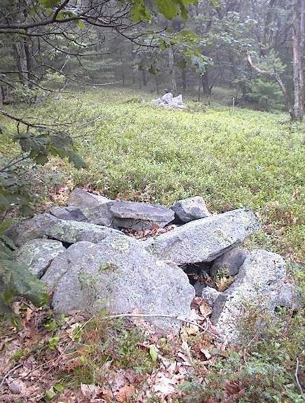 This picture shows three piles in a line. The third, furthest back, is hard to see. Here is a closeup of the second pile.
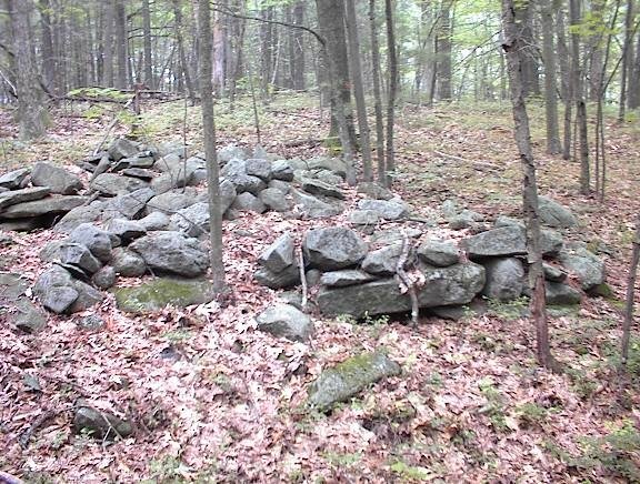
 Going along the slope, the piles seemed to grow larger and more substantial, more rectangular and suggestive of more internal structure. Here are four in a row, along a low ridge.
 They were so close together I was worried I was looking not at piles but at stone wall. In fact I was worried the whole time that I might be looking at field clearing piles. But here are some reasons that convinced me otherwise:
- there were no small rocks which are always the majority of what is cleared from a field
- all the rocks were uniformly sized
- the piles were once well made and had clear rectangular structure, still visible in the bits of remaining retaining wall that occured around the edges of the piles
- the piles were carefully lined up
- there were larger and smaller piles mixed together at the site
- the piles continued all across the southwestern slope of the hill, from just below the level summit (which could have been a field) down to the foot of the hill and then on into the swamp below. In a true field clearing the piles would all be dumped at the edge of the field not way off at the foot of the hill.

 I felt like I was walking around among the traces of a lost civilization. But it has all been damaged. I see significant and systematic vandalism here. That is why the site should be publicized - because it has already been destroyed. Every one of these larger piles, and most the smaller ones too, have been thrown down. What were they looking for? Why all the bother? There was one smaller pile that was torn up in the last two or three years. You could tell because of the dirt still stuck to the up-rooted rocks. What is it that makes destroying rock piles so appealing? Before I leave the topic of internal structure, let me mention again the "stone mounds" from the previous weekend. The suggestion was that these mounds enclosed and inner stone-lined room, digging down to which might have been the goal of the vandalism. The same pattern seems to be repeated here.
Anyway the site is still there and I think one of its most important aspects is the placement of the piles and the directions indicated by the lines of piles. The pile locations have not changed and I hope there is still a lot of information to be found here. The piles were destroyed but the site is still good.
After this I continued down to the foot of the hill where there were some other things at the edge of the wetland. And I continued my walk over to other hills in the area, until I got tired and too wet and headed out and home.

4 comments :
What you are looking at is remnants of NoTown. I believe it was a small farm town in the late 1700's to early 1800's. There's not alot of info out there about it. According to a local historian, the land was donated by the government to veterans of the french and indian war? It's was abandoned in the 1830's and has been a literal grey area on the map ever since. Pretty spooky place actually. There was a wave of sasquatch sightings there in the 1950's and 60's and footprints cast just last year in 2012. I've personally seen a full grown bull moose close to where those photos were taken. Hope that sheds some light on it for you- very interesting place! Careful of the local wildlife
I strongly suspect Notown was a place for poor people including and, in particular, Native Americans during the historical time frame.
I saw a moose too.
I was shown this area back in the mid 60's by a good friend who was shown by his father and uncle. They seemed to know all about the history of which you stated previously. Thanks for posting pictures and histoy. It brought back memories of over 50yrs ago.
Post a Comment