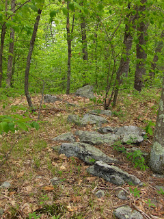
 were several short stretches of wall that started on top of the ridge and went 20 yards or so downhill towards the pond. These all more or less lined up in the same direction and I suspect were deliberately aligned in one particular direction.
Here is a first one:
 Another view of the same short stretch, from below:
 A few hundred yards away was a different short stretch:
 Another view of the same, facing down towards the pond:
 And yet again a bit further along the ridge, here is what looks like a more primitive/decrepit and smaller version of the same type of thing:
 Next to it, the only rock pile I saw in this part of the conservation land:
 There were a few other traces of things on the exposed bedrock on top. Like this propped slab:
 In the end, although I thought the wildflower pictures were all that made the walk worthwhile, actually, there were quite a few remaining traces of ceremonialism.
No comments :
Post a Comment